Dumaguete City, Negros Oriental — September 28, 2026. A cloudy, rain-soaked Monday is in store for communities across Negros Oriental, with the Philippine Atmospheric, Geophysical and Astronomical Services Administration (PAGASA) placing the entire Visayas region under a forecast of rainshowers and thunderstorms for the day. From coastal fishing villages in Bayawan to upland farms in Guihulngan, residents are being urged to prepare for a wet and potentially disruptive day.
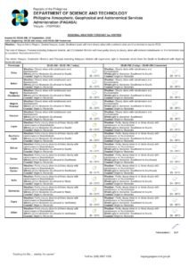
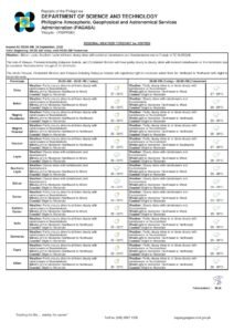
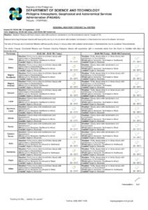
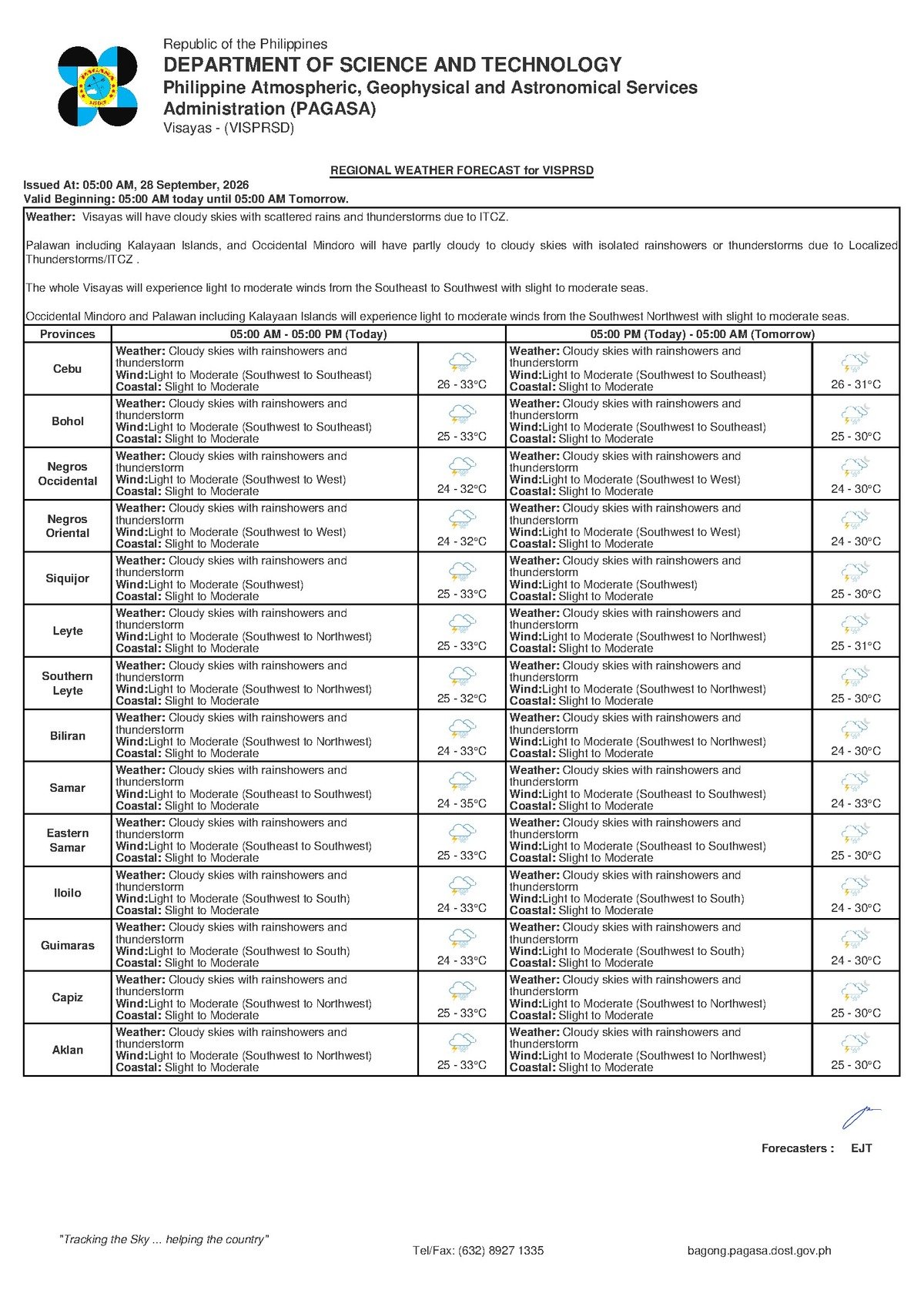
PAGASA released its regional weather bulletin for the Visayas at 5:00 AM on September 28, 2026, projecting overcast skies with intermittent to widespread rain accompanied by thunderstorm activity. The agency reported that winds would blow from the southwest to southeast at light to moderate speeds, with coastal sea conditions ranging from slight to moderate.
By the Numbers
- Forecast bulletin issued at 5:00 AM, September 28, 2026
- Temperature range: 26°C (low) to 33°C (high)
- “Slight” wave heights: 0.5 to 1.25 meters
- “Moderate” wave heights: 1.25 to 2.5 meters
- Extended outlook issued at 9:00 AM, September 27, 2026
What Is Behind Monday’s Weather
According to PAGASA, the prevailing wind flow from the southwest to southeast is consistent with the closing phase of the habagat, or southwest monsoon season, as the Visayas slowly transitions toward the cooler amihan months driven by the northeast monsoon. While the PAGASA bulletin does not name a specific weather disturbance as the driver of today’s conditions, the agency notes that moisture-laden air carried by these winds is feeding cloud formation, rainfall, and thunderstorm development across the region.
PAGASA emphasizes that thunderstorms are more than just heavy rain — they bring with them lightning strikes, sudden and powerful wind gusts, and concentrated downpours that can trigger localized flooding in low-lying areas and flash floods along slopes and riverbeds. Communities situated in coastal barangays or near river systems — including those in Tayasan, Jimalalud, and La Libertad — should keep a close watch on conditions throughout the day.
Area-by-Area Breakdown Across Negros Oriental
The PAGASA forecast covers the entire Visayas region, and Negros Oriental falls well within the affected zone. Here is how the weather is expected to play out across different parts of the province:
Dumaguete City: A grey, wet morning is expected, with thunderstorm activity most likely to develop during the warmer afternoon hours — a typical pattern when daytime heating intensifies moisture-driven convection. Anyone heading to the city centre, the public market, or government offices should carry an umbrella and waterproof gear.
Bayawan City and Zamboanguita: Communities along the southwestern coast can expect rain to come and go throughout the day. PAGASA’s thunderstorm warning means that fisherfolk working offshore should be on alert for sudden squalls that can form rapidly with little advance notice.
Bais City and Tanjay: Coastal and inland communities along the province’s eastern flank should also prepare for cloudy and rainy conditions. While coastal sea states are not extreme, the agency notes that small vessel operators in nearby waters should remain vigilant.
Guihulngan City and the Northern Corridor: Towns including Guihulngan, Vallehermoso, and Canlaon are covered under the same Visayas-wide forecast. According to PAGASA, lightning during thunderstorms poses a significant hazard for agricultural workers in open or elevated terrain.
Siquijor: The island province, accessible from Dumaguete via inter-island ferry, falls under the same regional forecast. PAGASA’s advisory on coastal conditions means that travellers planning to cross between Siquijor and Negros Oriental should confirm vessel schedules in advance, as ferry operators may adjust departure times based on real-time sea states.
Cebu and the Broader Visayas Network: The same forecast of overcast skies with rain and thunderstorms applies to the wider Central Visayas inter-island network, affecting routes that connect Negros Oriental to Cebu, Bohol, and the surrounding islands.
Reading the PAGASA Forecast: What the Language Means
PAGASA uses standardized language in its bulletins, and understanding what each phrase means can help residents make safer decisions:
“Cloudy skies with rainshowers and thunderstorms” — This is not merely a probability statement. The agency is signalling that rain is expected, and that thunderstorm cells may develop even in areas that appear only overcast. Lightning can strike before heavy rainfall begins; residents should not wait for a downpour before seeking shelter.
“Light to moderate winds from the southwest to southeast” — Under normal conditions, these wind speeds are not dangerous on their own. However, PAGASA notes that gusts during a thunderstorm can temporarily exceed the prevailing wind forecast by a significant margin. Outdoor workers and those on elevated ground should factor this in.
“Slight to moderate coastal conditions” — The agency defines “slight” wave heights as 0.5 to 1.25 meters, and “moderate” as 1.25 to 2.5 meters. Large passenger vessels operated by carriers such as OceanJet, SuperCat, and 2Go on routes connecting Dumaguete, Tagbilaran, and Cebu can typically handle these sea states. However, PAGASA’s warning is particularly relevant for small motorized bancas and outriggers used by fisherfolk and community-level inter-island travellers — these vessels face real hazard when moderate wave heights coincide with thunderstorm-driven gusts.
Sector-Specific Guidance
Commuters and the General Public
Waterproof gear is non-negotiable today for anyone travelling within Dumaguete, Bais, Bayawan, or any other municipality in the province. Low-lying roads and drainage-adjacent areas can flood rapidly during intense thunderstorm rainfall. Motorists are advised to drive slowly and avoid crossing flooded roads, where water depth is often far greater than it appears on the surface.
Fisherfolk and Small-Boat Operators
PAGASA’s combined advisory of slight-to-moderate coastal conditions and potential thunderstorms represents a meaningful risk for operators of small vessels. While today’s forecast does not constitute an outright prohibition on fishing, the agency’s guidance strongly implies that bancas and small outriggers should stay close to shore, monitor sky conditions continuously, and return to port well before any approaching storm system makes landfall over their area of operation.
Farmers and Agricultural Workers
Rain on a Monday can be welcome for rice and sugarcane farms across the interior flatlands — particularly in Manjuyod, Bindoy, and Ayungon — but PAGASA’s thunderstorm advisory introduces a serious safety concern. Lightning is among the leading weather-related causes of occupational fatalities in agricultural communities. Workers should move to a solid, enclosed structure at the very first indication of thunder or visible lightning, and should avoid taking shelter under tall trees, inside open sheds, or on high ground.
Students, Parents, and School Administrators
As of the time of the PAGASA bulletin, no school suspension orders have been issued under today’s forecast, since the conditions — while rainy — do not reach the threshold of a typhoon signal or extreme rainfall warning. Parents should ensure children leave home equipped with appropriate rain gear. School administrators, however, should continue monitoring conditions through the afternoon hours, when thunderstorm activity in the Visayas typically peaks due to daytime heating.
Outdoor Events and Construction Workers
PAGASA’s thunderstorm forecast is a clear signal for organizers of outdoor activities — including community fiestas, sporting events, and construction operations — to have contingency plans ready. Electrical equipment set up outdoors should be properly covered or secured, and event coordinators should be prepared to either relocate activities indoors or call them off entirely if lightning is observed in the vicinity.
Extended Outlook: The Days That Follow
According to PAGASA’s extended weather outlook, issued at 9:00 AM on September 27, 2026, similar weather patterns are expected to persist in the coming days as the Visayas region remains under the influence of southwest-to-southeast wind flow. Residents and local government units are encouraged to continue monitoring PAGASA advisories for updated forecasts, particularly as conditions may shift with changes in the prevailing monsoon pattern.
PAGASA updates its regional bulletins multiple times daily and residents are advised to check its official website and social media channels for the latest information before making travel or outdoor activity decisions.
Why This Matters
Monday’s PAGASA forecast of rainshowers and thunderstorms across the Visayas — including all of Negros Oriental — poses immediate and practical risks for fisherfolk operating small vessels, farmers working in open fields exposed to lightning, and commuters navigating flood-prone roads during intense rainfall bursts. The warning underscores the danger of thunderstorms in particular, which can strike rapidly and produce hazards far beyond ordinary rain. Timely adherence to PAGASA advisories, particularly among coastal and agricultural communities, is critical to preventing weather-related injuries and disruptions throughout the day.
Source: Breaking News Negros Oriental (breakingnewsnegrosoriental.com)