DUMAGUETE CITY, Negros Oriental — October 3, 2026 — A wet Saturday is in store for Negros Oriental, with the Philippine Atmospheric, Geophysical and Astronomical Services Administration (PAGASA) placing the entire Visayas under a forecast of cloudy skies, rainshowers, and thunderstorms for the day. Those heading to ports, farms, or simply making their daily commute are advised to come prepared for intermittent rain throughout the day.
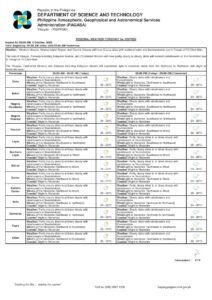
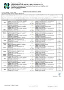
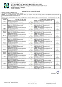
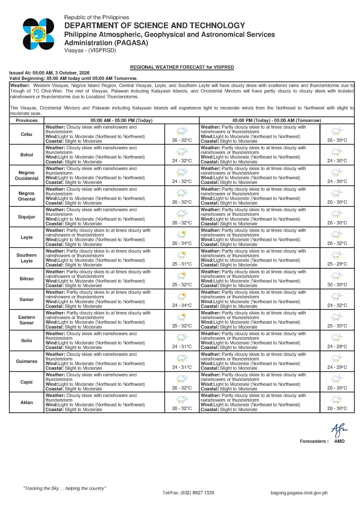
PAGASA issued its regional bulletin at 5:00 AM on Saturday, October 3, 2026, describing overcast and showery conditions for the Visayas region. According to the weather bureau, temperatures in Negros Oriental are expected to range between 26°C and 32°C — warm and humid even during breaks in the rain. Winds are light to moderate, blowing from the northeast to northwest direction, and coastal waters are classified as slight to moderate.
What Is Behind Today’s Conditions
PAGASA’s issued bulletin does not attribute today’s weather to any specific named system — no tropical cyclone, low-pressure area, or northeast monsoon is explicitly cited as the driver. The weather bureau’s forecast does, however, confirm a pattern of rainshowers and thunderstorms that is consistent with the transitional period between the tail end of the southwest monsoon and the early onset of the northeast monsoon — a stretch of the calendar when the Visayas routinely experiences unsettled weather. PAGASA advises the public to rely on the stated forecast conditions rather than assume a particular weather system is responsible.
What the bulletin makes clear is that wet conditions are expected to persist on and off throughout the day. Thunderstorms may bring lightning and sudden bursts of strong wind, adding an element of unpredictability to any given shower. While early October rain is not unusual for Negros Oriental, the possibility of thunderstorms carries practical consequences for various sectors.
Forecast Conditions at a Glance
For Negros Oriental and the broader Visayas region, PAGASA’s 5:00 AM bulletin on October 3, 2026 describes the following conditions:
- Sky condition: Cloudy with rainshowers and thunderstorms
- Temperature range: 26°C (low) to 32°C (high)
- Wind speed: Light to moderate
- Wind direction: Northeast to northwest
- Coastal water condition: Slight to moderate
In practical terms, residents can expect a warm but overcast day with periodic rain and intermittent thunderstorm activity. Brief dry spells between showers are possible, but a fully clear stretch is unlikely. Because winds are blowing from the northeastern to northwestern direction, eastern-facing coastlines — including sections of the Negros Oriental coast from Bais down to Dumaguete and further south toward Bayawan — may experience slightly stronger wind exposure compared to more sheltered western areas.
By the Numbers
- Forecast temperature low: 26°C
- Forecast temperature high: 32°C
- PAGASA morning bulletin issued: 5:00 AM, October 3, 2026
- Extended outlook bulletin issued: 9:00 AM, October 2, 2026
- Friday extended outlook temperature range: 26°C to 30°C
- Saturday extended outlook temperature range: 27°C to 33°C
The Days Ahead: Extended Outlook
Beyond Saturday, PAGASA also released an extended weather outlook on October 2, 2026 at 9:00 AM, covering the succeeding days for the region.
Friday: Partly cloudy to at times cloudy skies, with rainshowers or thunderstorms possible. Temperatures ranging from 26°C to 30°C. Winds light to moderate from the northwest to southwest. Coastal waters: slight to moderate.
Saturday (per extended outlook): Temperatures nudging slightly higher, between 27°C and 33°C. Winds remain light to moderate, shifting to a northwest-to-southwest direction. Coastal waters: slight to moderate.
According to PAGASA’s extended forecast, unsettled conditions are not limited to Saturday alone — similar patterns of cloud cover, periodic rain, and gradually rising temperatures are expected to continue through the days ahead for Negros Oriental and the Visayas.
Understanding “Slight to Moderate” Coastal Waters
PAGASA uses a standardized scale to classify coastal water conditions. A rating of “slight to moderate” — the designation in today’s bulletin — generally means wave heights remain within manageable ranges for larger passenger vessels, but that caution is warranted, particularly for smaller watercraft.
In practical terms, this means:
- Large passenger ferries (such as RO-RO vessels on Dumaguete–Cebu or Dumaguete–Manila routes) should be able to operate under normal conditions, though some rolling and pitching is expected. Passengers prone to motion sickness should take preventive measures.
- Fast craft and OceanJet services (including Dumaguete–Siquijor and Dumaguete–Cebu routes) may be subject to schedule adjustments or delays at the discretion of vessel operators, particularly if thunderstorms develop near departure times. Passengers are advised to confirm directly with their operator before going to the port.
- Small outrigger boats (bangka) should exercise significant caution. Thunderstorms can cause sea conditions to worsen rapidly and produce sudden strong winds and lightning strikes. Small boat operators are urged to wait onshore until any nearby thunderstorm has fully passed.
A “slight to moderate” classification, PAGASA notes, does not indicate calm seas — it means conditions are within the operational range for standard vessels, while small craft and those without sea experience face real risk, especially when thunderstorms are in the forecast.
Guidance by Sector
Fisherfolk and Small-Boat Operators
Light-to-moderate winds and slight-to-moderate seas may not present dangerous conditions under normal circumstances, but PAGASA’s thunderstorm forecast changes the calculus significantly. Lightning at sea is extremely hazardous, and storm cells can develop with little warning in early October. Fisherfolk working off the coasts of Bais, Tanjay, Dumaguete, and Bayawan should watch conditions closely, avoid being caught at sea as storm clouds build, and return to shore early at the first sign of a developing thunderstorm. Calm morning conditions should not be taken as a guarantee for the remainder of the day.
Farmers in Interior and Lowland Areas
Rainshowers and thunderstorms will add soil moisture — beneficial for some crops but potentially harmful for others. Farmers in the sugarcane and vegetable-growing areas of Guihulngan and the upland barangays of Bayawan should be alert to low-lying fields prone to waterlogging. Harvesting and produce transport plans should account for wet roads and slippery farm tracks. Outdoor pesticide spraying or fertilizer application should be deferred, as rainfall is likely to wash off any applied chemicals before they can take effect.
Commuters and Motorists
Wet roads, reduced visibility during heavy downpours, and the potential for localized flooding in low-lying parts of Dumaguete City and other urban areas across the province are all likely throughout the day. Motorists are advised to slow down, increase following distances, and avoid crossing flooded roads or bridges regardless of how shallow the water appears. If a thunderstorm passes directly overhead, it is safer to pull over and wait until it moves on.
Students, Parents, and Schools
As of this writing, no class suspensions have been announced in connection with today’s forecast, as current conditions — while rainy — do not appear to reach the threshold that typically triggers official action. Parents should nonetheless send children to school equipped with rain gear, and should monitor local government announcements throughout the day should conditions deteriorate.
Outdoor Events and Tourism
Visitors heading to Siquijor or planning island-hopping and beach activities elsewhere in the province should have a contingency indoor plan ready. Outdoor events across Dumaguete and the wider province face a real risk of rain interruptions. While brief windows between showers may appear in the morning or early afternoon, according to PAGASA’s forecast, thunderstorms can develop at any point during the day.
Why This Matters
PAGASA’s forecast indicates that thunderstorms accompanying today’s rain carry the risk of lightning and sudden strong gusts, posing real hazards for fisherfolk at sea, small-boat operators, outdoor workers, and travelers using inter-island ferry routes — making advance preparation and close monitoring of conditions essential throughout the day.
Source: breakingnewsnegrosoriental.com