DUMAGUETE CITY, Negros Oriental — November 13, 2026: Negros Oriental will not see clear skies today. The Philippine Atmospheric, Geophysical and Astronomical Services Administration (PAGASA) issued its 5:00 AM bulletin forecasting rainshowers and thunderstorms across the province from early morning through the overnight period into Saturday — affecting coastal travel, fishing operations, farm work, and daily commutes province-wide.
PAGASA’s Official Forecast for November 13
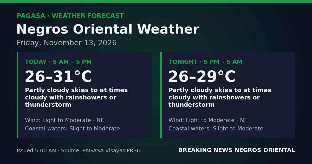
In its Visayas regional forecast table, PAGASA listed Negros Oriental under partly cloudy to at times cloudy skies with rainshowers or thunderstorms for both the daytime and overnight periods.
For the daytime period (5:00 AM to 5:00 PM), PAGASA reported temperatures ranging from 26°C to 31°C, light to moderate winds from the northeast, and slight to moderate coastal waters.
For the overnight period (5:00 PM to 5:00 AM Saturday), PAGASA reported temperatures between 26°C and 29°C, with the same wind direction and coastal sea state conditions continuing through the night.
According to PAGASA’s bulletin, the threat of thunderstorms persists beyond sunset, meaning residents should remain alert well into early Saturday morning.
The Atmospheric Driver Behind Today’s Weather
The northeast wind direction reported in PAGASA’s forecast is consistent with the northeast monsoon — known locally as the amihan — a seasonal wind pattern bringing cool, moisture-laden air from the northeastern Pacific across the Philippine archipelago. As this airflow interacts with the terrain and sea temperatures around Negros Oriental and the broader Visayas region, it produces cloud build-up, rainshowers, and, where atmospheric instability is sufficient, thunderstorms.
PAGASA’s 5:00 AM bulletin carries no active tropical cyclone warning signal, gale warning, or rainfall advisory — whether yellow, orange, or red — for Negros Oriental. Today’s unsettled weather is driven by prevailing monsoon conditions rather than a named storm system, the agency’s data showed.
What PAGASA’s Forecast Terms Mean in Plain Language
“Partly Cloudy to At Times Cloudy with Rainshowers or Thunderstorm”
Periods of sun are possible, but the sky can cloud over rapidly at any point during the day or night and produce a shower or a full thunderstorm. The timing of rain is unpredictable — it will not necessarily fall continuously, but a storm can develop with little advance warning.
“Light to Moderate” Northeast Winds
On land, light to moderate winds are generally manageable. At sea, however, this wind range produces noticeable effects on small vessels, including spray and increased wave action. According to PAGASA’s classification, this is not gale-force wind, but conditions at sea warrant care — particularly in combination with the prevailing sea state.
“Slight to Moderate” Coastal Waters
PAGASA’s sea-state scale places slight seas at roughly 0.5 to 1.25 metres in wave height and moderate seas at approximately 1.25 to 2.5 metres. A slight-to-moderate designation means conditions may remain at the lower end or push toward the higher range. For small outrigger bangka fishing boats, moderate seas carry genuine risk. Larger inter-island vessels can handle these conditions more readily but should still exercise caution, especially if a thunderstorm develops during a crossing. No gale warning has been issued for Negros Oriental’s coastal waters as of the 5:00 AM PAGASA bulletin.
Guidance by Activity
Ferry Passengers on Dumaguete–Siquijor and Other Routes
Passengers planning to board the Dumaguete–Siquijor ferry, OceanJet, or other inter-island craft should confirm schedules with their shipping lines before heading to the port. Slight to moderate coastal waters combined with possible thunderstorms can affect sailing timetables and ride comfort, particularly on smaller fast-craft vessels. These conditions do not automatically result in cancellations, but operators may delay or adjust departures when thunderstorms are active over crossing routes. Travelers are advised to build extra time into their plans and to avoid open, small boats if a storm is visibly developing.
Fisherfolk and Small-Boat Operators
The combination of slight to moderate seas and thunderstorm risk calls for serious caution among those operating small fishing vessels off Negros Oriental’s coastline — including waters near Bayawan, Bais, Mabinay, and around Siquijor. PAGASA’s forecast notes that these conditions apply throughout the day and overnight. Thunderstorms can produce sudden gusts, waterspouts, and lightning that pose significant danger to open-boat fishers. Fisherfolk are advised to monitor the sky closely, avoid venturing far offshore, and return to port immediately if storm clouds build or thunder is audible.
Agricultural Workers and Farmers
Farm workers across Negros Oriental — including those in sugarcane-growing flatlands and upland vegetable areas — should expect wet field conditions throughout the day. Activities requiring dry conditions, such as spraying, fertilizer application, or harvesting, need contingency plans in place. PAGASA’s forecast indicates that sudden heavy rain during a thunderstorm can damage freshly harvested produce left exposed and cause runoff on sloped farm terrain.
Students, Parents, and School Commuters
Many schools in Negros Oriental remain in session. Parents sending children to school on Friday should prepare rain gear — umbrellas and raincoats — since showers or thunderstorms may occur at any time, including during the afternoon dismissal period. Students commuting by foot, bicycle, or open habal-habal motorcycles face the greatest exposure during a sudden downpour. Atmospheric heating in the late afternoon can intensify storm development, according to general PAGASA guidance on thunderstorm behavior.
Outdoor Workers and Event Organizers
Construction workers, delivery riders, market vendors, and others with extended outdoor exposure should prepare for the possibility of a sudden thunderstorm at any point during the day or night. Shelter should be sought immediately when lightning is observed; open elevated areas and trees should be avoided. Those organising outdoor events in Dumaguete, Guihulngan, or elsewhere in the province on November 13 are advised to prepare covered alternatives or build flexible timing into their programmes.
Affected Areas Across Negros Oriental
PAGASA’s forecast applies province-wide, covering all major urban and rural centres including Dumaguete City (provincial capital), Bayawan City (southern coast), Bais City (northern coast), Guihulngan City, and surrounding municipalities. Coastal barangays face the added consideration of slight to moderate sea conditions alongside the thunderstorm risk flagged in the agency’s bulletin.
Source: PAGASA (Philippine Atmospheric, Geophysical and Astronomical Services Administration)