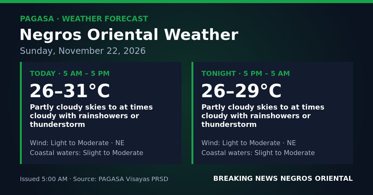
DUMAGUETE CITY, Negros Oriental — November 22, 2026: Negros Oriental faces an unsettled Sunday, with the weather agency forecasting intermittent showers and thunderstorms from early morning through overnight. The Philippine Atmospheric, Geophysical and Astronomical Services Administration (PAGASA) issued its Visayas regional forecast at 5:00 AM today, covering conditions through 5:00 AM on November 23.
PAGASA Forecast Details for November 22
According to PAGASA’s 5:00 AM bulletin, daytime conditions from 5:00 AM to 5:00 PM will feature partly cloudy skies, at times cloudy, with rainshowers or thunderstorm. Temperatures will range between 26°C and 31°C, with northeast winds at light to moderate strength. Coastal waters are described as slight to moderate.
The overnight period from 5:00 PM to 5:00 AM on November 23 carries the same sky condition — partly cloudy at times cloudy, with rainshowers or thunderstorm. Temperatures will range between 26°C and 29°C, with northeast winds remaining at light to moderate strength. Coastal waters continue at slight to moderate.
PAGASA’s forecast indicates no significant improvement in conditions after sunset, with the risk of showers and thunderstorms continuing through the night.
Weather System Behind Today’s Conditions
PAGASA’s issued forecast does not attribute today’s showers and thunderstorms over Negros Oriental to a specific named weather system — such as the northeast monsoon, a low-pressure area, the Inter-Tropical Convergence Zone, or a tropical cyclone. What the forecast does confirm, according to PAGASA, is that northeast winds at light to moderate strength are influencing sea conditions and contributing to the unsettled atmospheric pattern across the province.
The practical result is intermittent showers and the potential for thunderstorms developing at unpredictable times during both day and night. These are not forecast as prolonged, continuous rainfall events, but isolated downpours and electrical storms can develop rapidly and with little warning.
No Active Cyclone Signal or Gale Warning Issued
PAGASA’s bulletin carries no active tropical cyclone wind signal, no gale warning, and no rainfall advisory — whether yellow, orange, or red — specifically for Negros Oriental in this forecast period. The weather agency has not elevated the threat level to a formal warning requiring evacuation or emergency shelter measures based on this bulletin.
Despite the absence of a formal advisory, PAGASA notes that thunderstorms can produce dangerous lightning, sudden strong gusts, localised flash flooding, and rough surf even without an elevated warning classification.
Coastal Waters and Ferry Travel
PAGASA describes coastal waters around Negros Oriental as slight to moderate for both today and tonight. Slight seas present minimal difficulty for larger vessels but can cause discomfort on smaller boats, while moderate seas involve larger, more frequent waves requiring greater caution — particularly for outrigger boats, motorized bancas, and small passenger craft.
Because conditions may shift between these two levels depending on passing showers or thunderstorm-related wind gusts, passengers planning ferry crossings from Dumaguete to Siquijor, Dumaguete to Dapitan, or along other inter-island routes should confirm departure schedules with their operators before travelling to the port. Fast-craft services such as OceanJet and other carriers serving Dumaguete Port may adjust schedules in response to changing sea state. Travellers are advised to allow extra time for potential delays and to avoid small, undecked watercraft given the possibility of sudden squalls.
Guidance for Specific Groups
Fisherfolk and Small-Boat Operators
Northeast winds at light to moderate strength can shift and strengthen quickly during a thunderstorm. PAGASA’s forecast of slight to moderate coastal waters, combined with the possibility of sudden squalls, calls for extra caution along the coasts of Bayawan, Bais, and Mabinay, and around Siquijor. Small-boat operators should avoid venturing far offshore and return to shore promptly if storm clouds develop. Rapidly building cumulus clouds or a darkening northeastern sky are indicators that a squall may be forming.
Farmers and Agricultural Workers
Intermittent showers and possible thunderstorms throughout Sunday may repeatedly interrupt harvesting, planting, and crop-drying activities. Workers in the upland areas of Guihulngan, Valencia, and Mabinay should monitor stream and river levels, as terrain in those areas can accelerate runoff during heavy showers. Harvested crops stored or drying outdoors should be moved under cover before morning field activities begin.
Commuters and Motorists
In Dumaguete City and surrounding municipalities, showers and thunderstorms can cause localised flooding on low-lying streets, reduced visibility, and slippery surfaces on national highways and mountain roads. Motorists should reduce speed during heavy rain, use headlights, and avoid crossing flooded roads regardless of apparent depth. Motorcyclists should exercise particular caution on wet pavement.
Students, Parents, and Schools
PAGASA has issued no suspension-triggering warning for Negros Oriental as of this bulletin. However, intense thunderstorm activity can develop quickly. Students travelling to and from school, particularly those who walk or use open transportation, should carry rain gear. Parents are advised to monitor local school division announcements and barangay advisories throughout the day.
Outdoor Workers and Event Organisers
Outdoor events, construction work, and other activities scheduled for Sunday, November 22 should account for a high probability of rain interruptions and lightning risk during thunderstorm episodes. PAGASA advises seeking shelter immediately upon hearing thunder, as audible thunder indicates lightning is already within striking range. Covered shelter should be immediately accessible for all participants in outdoor activities.
Source: PAGASA Visayas Regional Forecast, November 22, 2026