DUMAGUETE CITY — The southwest monsoon, locally known as the habagat, will keep skies restless over Negros Oriental and the wider Visayas region this Sunday, August 16, 2026. The Philippine Atmospheric, Geophysical and Astronomical Services Administration — PAGASA — has issued a forecast calling for partly cloudy to at times overcast conditions, with scattered rainshowers and thunderstorms anticipated at various points through the day. Anyone with plans to travel, work outdoors, or head out to sea should take note and prepare accordingly.
What PAGASA Is Forecasting
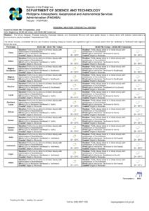
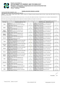
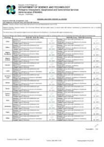
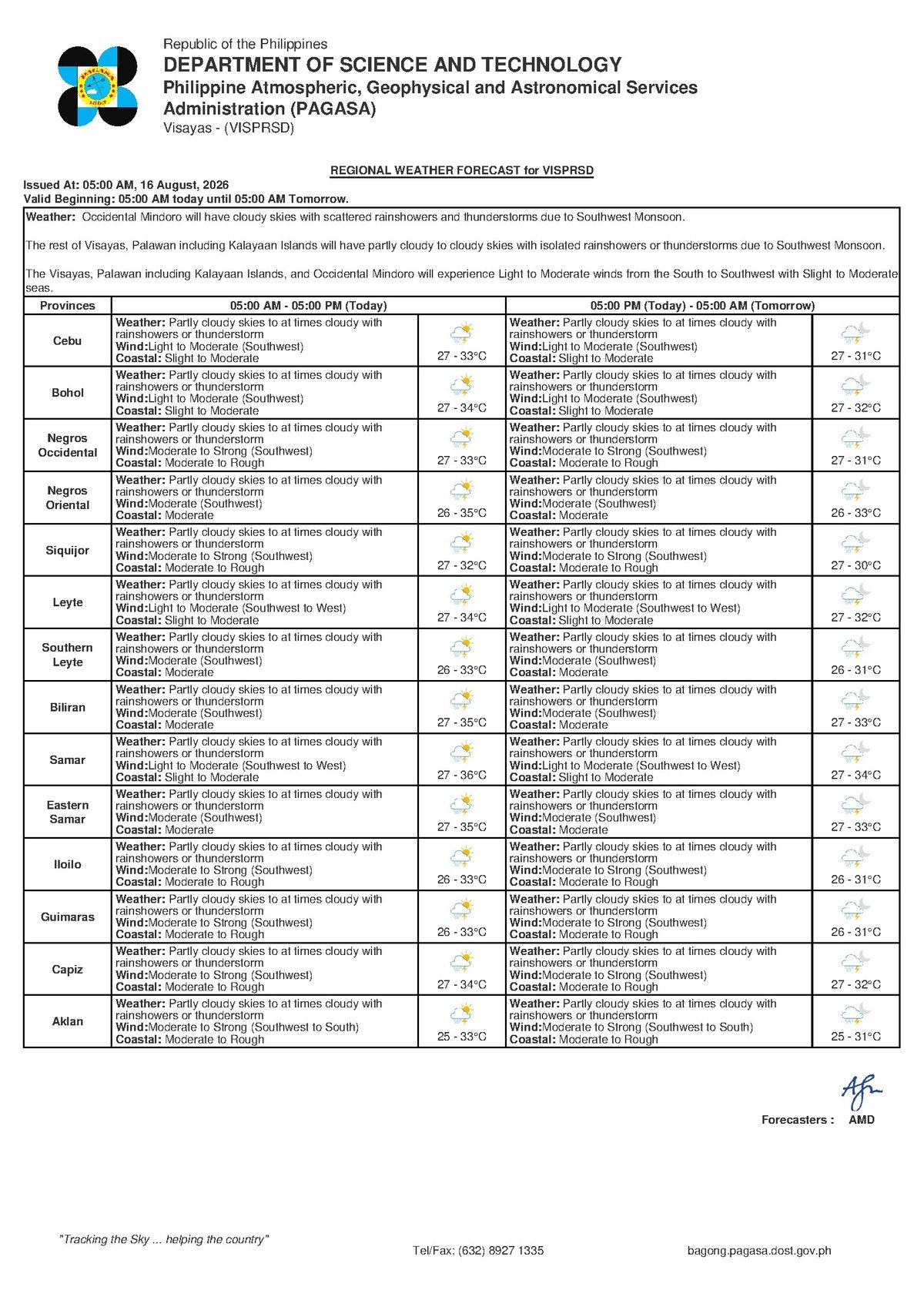
According to PAGASA’s Visayas Regional Forecast, released at 5:00 AM on August 16, 2026, the region can expect intermittent cloud cover and periods of rain throughout the day. Daytime temperatures will fluctuate between a low of 27°C and a high of 33°C, making conditions feel warm and humid — particularly before any afternoon rainfall provides temporary relief. Winds will blow in from the southwest at light to moderate speeds, and coastal waters have been classified as slight to moderate.
The state weather bureau noted that no tropical cyclone, low-pressure area, or other extraordinary weather disturbance is being cited as a trigger for today’s conditions. Instead, the culprit is the seasonal southwest monsoon — a recurring and entirely normal feature of the Philippine climate from roughly June through September each year. While the habagat is not unusual, PAGASA emphasizes that it still warrants vigilance, especially for communities and livelihoods that are directly exposed to the elements.
By the Numbers
- Forecast issued: 5:00 AM, Sunday, August 16, 2026
- Daytime temperature range: 27°C (low) to 33°C (high)
- Extended outlook temperature range (next day): 28°C to 34°C
- Following day’s outlook: 27°C to 33°C
- Wind direction: Southwest, light to moderate speeds
- Coastal water conditions: Slight to moderate
Understanding the Habagat
The southwest monsoon is a large-scale wind system that draws moisture-laden air northward from the warm waters of the South China Sea and surrounding bodies of water. As this moist air mass moves across the Philippine archipelago, it releases its moisture in the form of rain — sometimes accompanied by thunder and lightning, particularly during the warmer afternoon and early evening hours when surface heating intensifies convective activity. This pattern of on-and-off showers interspersed with brief sunny breaks is the hallmark of an active habagat season.
PAGASA’s extended weather outlook, issued at 9:00 AM on August 15, 2026, indicates that this unsettled pattern will not ease significantly in the days immediately ahead. Southwest winds and slight-to-moderate coastal conditions are expected to persist, with no dramatic break on the near-term horizon for the Visayas region. Residents should treat the coming days as an extended habagat episode requiring consistent awareness rather than a brief one-day weather event.
Conditions Across Negros Oriental
In Dumaguete City, the provincial capital, mornings may begin with partial sunshine, but the afternoon will bring a heightened risk of showers and possible thunderstorms as daytime heating combines with monsoon moisture. The temperature is expected to peak at 33°C before cooling off, particularly once rain arrives. Evening and overnight readings will settle near the 27°C mark.
Coastal communities including Bayawan City on the southwestern coast and Bais City on the eastern side of the province will experience similar conditions — intermittent rainfall and the chance of thunderstorms, most likely in the afternoon hours. In the northern interior, Guihulngan City residents should also prepare for alternating cloudy skies and rainshowers throughout the day.
The island province of Siquijor — administratively part of the Negros Oriental region — will see equally unsettled skies, with the same combination of partly cloudy conditions, scattered rain, and possible thunderstorms. Anyone planning to make the ferry crossing between Siquijor and the Negros Oriental mainland later in the day should monitor weather developments closely before departing.
Across the strait, Cebu and the broader Central Visayas sub-region fall under the same general forecast umbrella, with southwest winds and intermittent showers expected there as well.
Advisory for Sea Travelers and Fisherfolk
PAGASA’s classification of coastal waters as slight to moderate means wave heights are elevated enough to make travel aboard small outrigger boats — the type most commonly used by fisherfolk and small passenger operators in the region — potentially uncomfortable and risky, particularly when a squall or thunderstorm develops.
Passengers booked on larger vessels such as OceanJet fast ferries serving routes between Dumaguete and Cebu or between Siquijor and Dumaguete should brace for a choppy crossing. While slight-to-moderate conditions do not automatically result in port closures, sea conditions can deteriorate rapidly when a thunderstorm passes overhead. The state weather bureau advises all sea travelers to verify schedules with their ferry operators before heading to the pier and to allow for the possibility of delays or rerouting.
Bangka operators, small boat owners, and fisherfolk are urged to exercise heightened caution. According to PAGASA, thunderstorms can develop and intensify with very little advance warning, bringing sudden gusts and rough swells. Checking the latest marine bulletins and gale warnings before setting out is strongly recommended.
Guidance for Farmers and Field Workers
Agricultural communities across Negros Oriental — from sugarcane fields in the lowlands to rice paddies in the river valleys and vegetable gardens in the upland barangays — will experience a mixed blessing today. Monsoon rainfall during the growing season is generally beneficial, but thunderstorms introduce the risk of strong, sudden winds that can damage standing crops and uproot young plants.
Farm workers laboring in open fields are advised to move indoors or seek shelter at the first signs of darkening clouds, rumbling thunder, or visible lightning. Particular care should be taken to stay away from tall trees and metal equipment — both of which can serve as lightning attractors during a storm.
For Commuters, Students, and Outdoor Workers
Given the forecast, residents heading out in Dumaguete and other Negros Oriental towns on Sunday morning should bring an umbrella or rain jacket regardless of how clear the sky looks at departure. The habagat season is notorious for rapid weather shifts — a bright morning can turn into a heavy downpour within minutes once afternoon heating kicks in.
Parents bringing children to school activities or weekend events should keep a close eye on weather conditions in the afternoon. Outdoor workers — construction crews, market vendors, event organizers, and sports officials — should build rain contingency plans into their Sunday schedules and ensure that equipment, merchandise, and temporary structures are properly secured before showers begin. Any outdoor gathering should be moved immediately to covered shelter the moment lightning is observed in the vicinity.
The Days Ahead
Based on PAGASA’s extended outlook issued on August 15, 2026, the weather picture for Negros Oriental and the Visayas in the coming days shows little improvement. Temperatures are projected to range between 28°C and 34°C in the near term, with continued light to moderate southwest winds and slight to moderate coastal conditions. The following day’s forecast similarly shows temperatures between 27°C and 33°C under the same monsoon-driven wind and sea regime.
The bottom line is straightforward: bring rain gear everywhere, avoid venturing out on small watercraft if a thunderstorm is building overhead, and seek solid shelter the moment you hear thunder or see lightning — whether you are in a field, at a market, on a pier, or attending an outdoor event. Today’s forecast does not constitute a weather emergency, but it calls for steady, common-sense precautions from all sectors of the community. Monitor the latest official advisories at the PAGASA website for real-time updates throughout the day.
Why This Matters
The southwest monsoon is the dominant weather driver for Negros Oriental and the broader Visayas from June through September, directly affecting the safety of fisherfolk and sea travelers, the productivity of agricultural workers, and the daily routines of commuters and students across the province. PAGASA’s forecast of slight-to-moderate coastal conditions means that small watercraft operators face genuine risk if they venture out without checking the latest marine bulletins, especially when thunderstorms — which can intensify rapidly — are in the forecast. The extended outlook indicating continued habagat conditions over the coming days underscores the need for ongoing preparedness rather than treating Sunday’s weather as an isolated, one-day concern.
Source: PAGASA / breakingnewsnegrosoriental.com