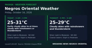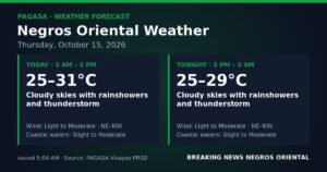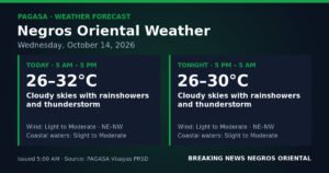
DUMAGUETE CITY, Negros Oriental — September 1, 2026: The southwest monsoon is making its presence felt this Tuesday morning as stormy skies, intermittent heavy showers, and choppy coastal waters settle over Negros Oriental and the rest of the Visayas. PAGASA’s early-morning forecast signals a day that calls for heightened awareness — whether you are fishing off the coast of Bayawan, crossing the strait to Siquijor, or simply trying to get to school or work in Dumaguete.
PAGASA’s Official Forecast for the Visayas
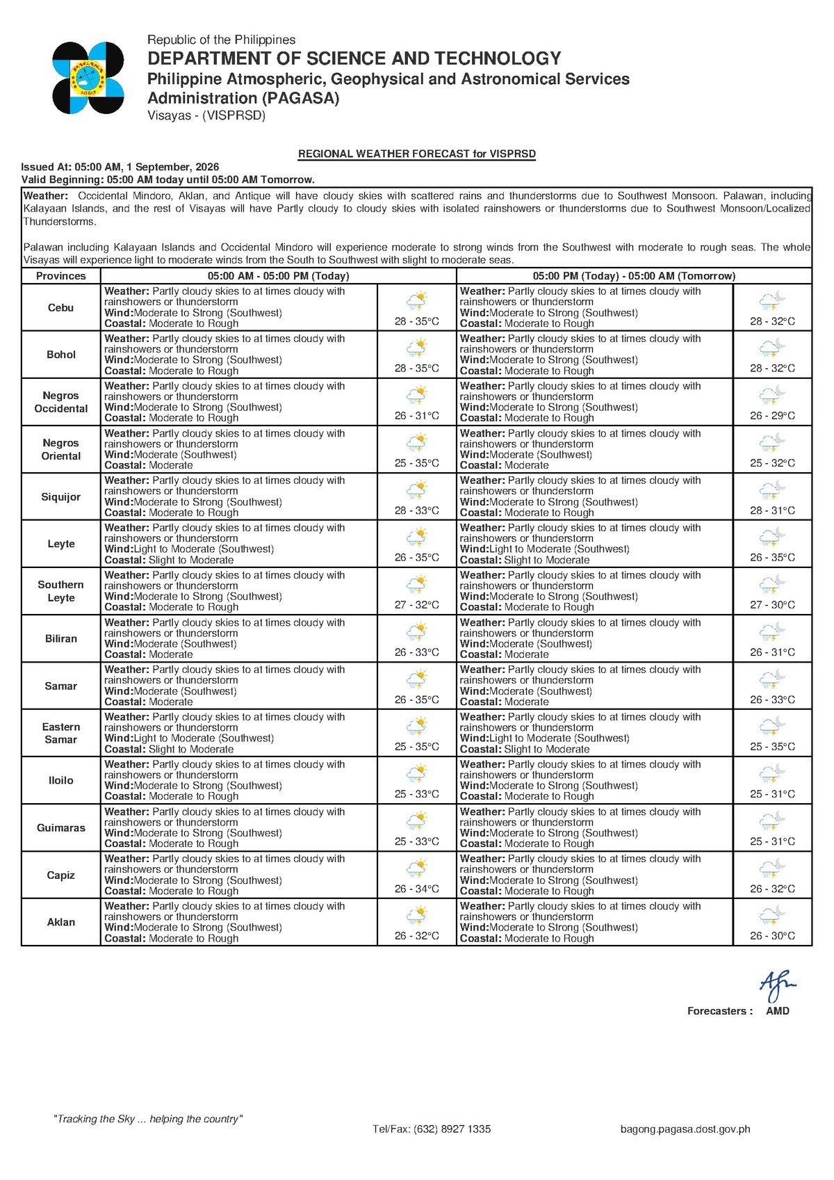
The Philippine Atmospheric, Geophysical and Astronomical Services Administration (PAGASA) released its Visayas regional weather bulletin at 5:00 AM on September 1, 2026, describing skies as partly cloudy to at times cloudy, with scattered rainshowers and thunderstorms expected throughout the day. According to PAGASA, winds are blowing from the southwest at moderate to strong speeds, pushing sea conditions to a moderate to rough advisory along coastal waters. Temperatures across lowland Visayas are forecast to range between 28°C and 35°C.
No tropical cyclone wind signal has been raised for the Visayas as of the time of the bulletin, PAGASA confirmed. The unsettled weather is attributed entirely to the active habagat, or southwest monsoon — the seasonal weather system that dominates the Philippine climate from roughly June through September each year.
The Habagat: What Is Behind Today’s Weather
The habagat is a warm, moisture-heavy wind pattern that flows from the southwest across the Philippine archipelago during the wet season. PAGASA’s data points to southwest winds as the primary driver of today’s conditions — an unmistakable signature of active monsoon flow. When the habagat is in full swing, it funnels bands of clouds and rainfall toward the Visayas, creating the kind of on-and-off showery weather that residents of the region know well from mid-year onward.
Beyond just the rain, it is the habagat’s sustained wind speeds that are responsible for building the swells and choppy conditions currently affecting the sea lanes around Negros Oriental. The province occupies the eastern side of Negros Island, facing both the Tañon Strait and the Bohol Sea — two bodies of water that are especially sensitive to southwest monsoon-generated swells. According to PAGASA, these conditions can develop and persist even in the complete absence of a tropical cyclone, as the monsoon alone is capable of producing hazardous sea states.
Conditions Across the Province and the Region
Across Negros Oriental — from Dumaguete City in the south to the northern urban centers of Guihulngan and Bais, and from the coastal towns of Bayawan to the inland agricultural zones — residents should anticipate an alternating pattern of sun breaks and sudden, potentially heavy rain. PAGASA describes the pattern as “partly cloudy to at times cloudy with rainshowers or thunderstorms,” indicating that clear spells will occur but should not be taken as a sign that the weather has stabilized.
The island of Siquijor, which lies across the Tañon Strait from mainland Negros Oriental, falls under the same PAGASA forecast area. The state weather bureau says it will experience conditions broadly similar to those on the Negros side — intermittent showers, gusty winds, and rough sea passages in between.
The forecast also covers the broader Visayas zone. According to PAGASA, Cebu and the surrounding islands are under identical advisory conditions: partly cloudy to cloudy skies, southwest winds at moderate to strong intensity, scattered thunderstorms, and moderate to rough coastal waters. Afternoon temperatures in sunnier intervals across the Visayas could reach between 32°C and 35°C, while overnight lows will hover near 28°C.
Extended Outlook: Habagat Pattern Holding Through the Week
PAGASA’s extended weather outlook, released at 9:00 AM on August 31, 2026 — the day prior — confirms that Tuesday’s conditions are not an isolated spike in bad weather. The agency’s multi-day projection shows the same temperature band of 28°C to 35°C persisting into the week, with moderate to strong southwest winds and moderate to rough seas maintaining throughout. Wednesday’s maximum temperature shows a marginal dip to 34°C, but sea states and wind patterns are expected to remain largely unchanged, according to PAGASA.
The consistency of the extended forecast is a clear signal from PAGASA that the habagat system is well-entrenched over the Visayas and that residents should treat the current unsettled conditions as a sustained weather regime rather than a single day’s anomaly.
What Moderate to Rough Seas Mean in Practice
While no tropical cyclone warning is in effect, PAGASA’s moderate to rough sea advisory carries significant implications for anyone whose livelihood, travel, or daily activities involve coastal waters. In practical terms, wave heights under this classification are sufficient to swamp or capsize small fishing bancas and outrigger vessels. Even larger inter-island ferries and fast-craft services can experience dangerous rolling, delays, or outright cancellations when swells reach this level.
The concurrent presence of thunderstorms in the PAGASA forecast compounds the maritime risk. Lightning poses a direct and immediate danger to individuals caught in open water, open farmland, or under exposed trees — a hazard that exists independently of rough seas.
Guidance by Sector
Ferry Passengers and Inter-Island Travelers
Those planning to take a ferry or fast craft — for example, on the Dumaguete–Siquijor, Dumaguete–Larena, or Dumaguete–Cebu routes served by operators such as OceanJet, Montenegro Lines, and other local shipping lines — should contact their vessel operator or check port advisories before proceeding to the terminal. Moderate to rough seas give vessel captains and port authorities grounds to delay or cancel sailings in the interest of passenger safety. Travelers should arrive early, carry rain gear, and avoid booking passage on small, informal banca crossings under current sea conditions.
Fisherfolk and Coastal Communities
PAGASA’s sea condition advisory is a direct and formal caution for the fishing communities spread along the Negros Oriental coastline — from Dumaguete and Bayawan in the south to Bais, Bindoy, and Manjuyod further north. Small boats and traditional bancas are at their most vulnerable when southwest winds combine with elevated swells, as they are today. The state weather bureau’s data strongly supports a stay-ashore decision for operators of small craft when any doubt exists about sea safety.
Farmers and Agricultural Workers
The on-and-off showers expected today can benefit rice-growing areas during the growing season, including upland municipalities such as Guihulngan, La Libertad, and Tayasan. However, thunderstorm-associated downpours can be sudden and intense enough to flood low-lying paddies and damage standing crops. According to PAGASA’s forecast, agricultural workers should secure harvested or drying produce and avoid open fields during any active thunderstorm, particularly given the lightning hazard.
Commuters, Students, and Parents
The intermittent nature of today’s showers means conditions in Dumaguete City and surrounding towns could appear deceptively calm in the morning before deteriorating sharply in the afternoon — a routine habagat pattern. Commuters and students should carry umbrellas or rain jackets, and parents are advised to ensure children are prepared for wet-weather conditions throughout the school day. Schools situated in low-lying or flood-prone areas should monitor local conditions actively.
Outdoor Workers and Event Organizers
Construction workers, market vendors, and organisers of outdoor events face a day of unpredictable interruptions. PAGASA’s forecast of thunderstorms — with associated lightning and wind gusts — means that any outdoor operation should have a clear contingency plan for sudden weather deterioration. Postponing non-essential outdoor activities to a more stable day is the prudent course of action given the current forecast.
By the Numbers
- 5:00 AM, September 1, 2026 — time PAGASA issued the Visayas regional forecast bulletin
- 28°C — forecast overnight low temperature across lowland Visayas
- 35°C — forecast daytime high temperature across lowland Visayas
- 34°C — slightly reduced maximum temperature projected for Wednesday by PAGASA’s extended outlook
- 9:00 AM, August 31, 2026 — time PAGASA’s extended weather outlook was issued
- Moderate to rough — official PAGASA coastal water condition rating in effect
Why This Matters
An active habagat producing moderate to rough seas and scattered thunderstorms creates compounding safety risks for coastal communities, maritime passengers, and outdoor workers across Negros Oriental and the wider Visayas. PAGASA’s extended forecast confirms that these conditions are not a brief weather disturbance but a sustained monsoon pattern requiring continuous vigilance in the days ahead. The advisory underscores the importance of checking official PAGASA bulletins before undertaking sea travel or other weather-sensitive activities throughout the week.
Source: Breaking News Negros Oriental (breakingnewsnegrosoriental.com)