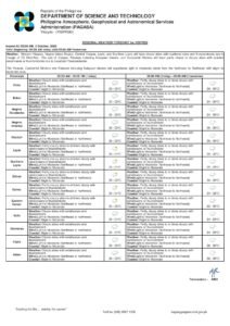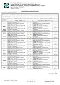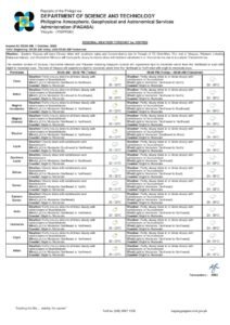
Dumaguete City, Negros Oriental — August 19, 2026: The southwest monsoon is keeping skies unsettled over Negros Oriental on Wednesday, with the Philippine Atmospheric, Geophysical and Astronomical Services Administration (PAGASA) forecasting rainshowers and thunderstorms that could disrupt travel, fishing, farming, and daily commutes throughout the province.
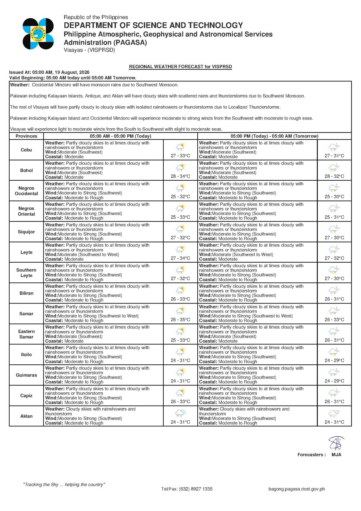
PAGASA’s Regional Forecast for the Visayas, released at 5:00 AM on August 19, 2026, describes conditions as partly cloudy skies that will turn at times cloudy, with rainshowers or thunderstorms expected over the region. The state weather bureau placed temperatures between 27°C and 33°C, with moderate southwest winds prevailing and coastal conditions rated as moderate along all seaboards of Negros Oriental.
The Force Behind the Wet Weather
According to PAGASA, the principal driver of Wednesday’s unsettled atmosphere is the habagat — the Philippine term for the southwest monsoon. This seasonal wind pattern carries warm, moisture-heavy air from the southwest across the archipelago during the middle months of the year. As that moist air rides up over land surfaces and sun-warmed coastal waters, it ascends, cools rapidly, and condenses into the thick cloud formations that spawn the rainshowers and thunderstorms now forecast for the Visayas.
In practical terms, the habagat does not follow a neat schedule. Showers may develop at any hour, and when thunderstorm cells form, they can bring intense downpours, lightning strikes, and sudden strong gusts with minimal advance warning. PAGASA’s forecast makes clear that these conditions apply not only to Negros Oriental but to the entire Visayas region through at least Thursday, August 20, 2026.
By the Numbers
- Forecast temperature range: 27°C to 33°C
- PAGASA Visayas forecast issuance time: 5:00 AM, August 19, 2026
- Extended outlook issuance time: 9:00 AM, August 18, 2026
- Extended outlook valid through: Thursday, August 20, 2026
Weather Across the Province and Neighboring Islands
In Dumaguete City, the provincial capital, Wednesday will see a rotating pattern of partly sunny spells giving way to cloudy skies, with sudden rainshowers or thunderstorms possible at any point. The state weather bureau noted that the same partly-cloudy-to-cloudy, rain-prone pattern extends to the municipalities of Bayawan, Bais, and Guihulngan, as well as to interior barangays in the highlands, where orographic lifting — the forced ascent of air over elevated terrain — can intensify rainfall further.
The forecast also covers nearby island provinces. Across the Tañon Strait toward Cebu and across the Bohol Sea toward Siquijor, PAGASA’s Visayas regional bulletin applies equally, with moderate southwest winds and moderate coastal conditions affecting sea routes throughout the day. There is no active tropical cyclone wind signal or gale warning cited in PAGASA’s Visayas forecast data for Wednesday; however, the explicit mention of thunderstorms means conditions remain hazardous in their own right.
Understanding “Moderate” Coastal Conditions
PAGASA classifies today’s sea states along Negros Oriental’s coasts as moderate. This designation signals choppy waters that can cause significant rolling and pitching aboard inter-island ferries and fast craft, and that pose genuine danger to smaller, open vessels. While moderate conditions do not automatically trigger trip cancellations, shipping operators retain full authority to delay or suspend voyages based on actual sea states at departure time.
Thunderstorms add a separate layer of maritime risk beyond sea swells alone. Lightning over open water, sudden squalls, and sharply reduced visibility can develop within minutes when a storm cell passes overhead — conditions that are categorically unsafe for small motorized fishing boats and bancas.
Guidance for Different Sectors
Commuters and Road Travelers
Motorists and motorcycle riders traveling the Negros Oriental coastal highway — through Bacong, Dauin, Zamboanguita, and south toward Bayawan, or northward through Bais and Guihulngan — should anticipate slippery road surfaces during and after any rainfall. PAGASA’s thunderstorm forecast means that brief but extremely heavy downpours are possible, reducing visibility to near zero in localized areas. Drivers are advised to reduce speed, use headlights during rain, and allow additional travel time. Low-lying stretches near river mouths and coastal barangays are susceptible to flash flooding.
Fisherfolk and Small-Boat Operators
The combination of moderate coastal conditions and an active thunderstorm threat makes Wednesday a high-caution day on the water. PAGASA’s forecast does not indicate safe small-boat conditions for today. Fisherfolk along the coasts of Negros Oriental and around Siquijor should closely monitor the sky before setting out, and anyone already at sea should return to shore the moment skies begin to darken and winds intensify. Lightning over open water is life-threatening, and gusts accompanying thunderstorm cells can arrive with little to no warning.
Ferry Passengers on Dumaguete-Based Routes
Passengers booked on inter-island vessels — including routes connecting Dumaguete to Siquijor, Cebu, Bohol, and other Visayas ports — should verify trip status directly with their shipping line before proceeding to the terminal. Although PAGASA has not issued a gale warning in the available forecast data, moderate sea conditions mean crossings may be noticeably rough. Passengers prone to seasickness should come prepared, and all travelers should comply with crew instructions at all times.
Farmers Across the Province
For agricultural workers tending sugarcane fields in the lowlands and vegetable plots in upland communities such as Valencia and Sibulan, PAGASA’s forecast is a clear signal that the habagat season remains in full force. Harvesting activities are best completed in the early morning before afternoon thunderstorm development becomes more likely. Seedlings and young crops should be secured against gusty winds, and all outdoor workers should evacuate open fields the moment lightning activity begins nearby.
Students, Parents, and Schools
While morning conditions may be relatively manageable, PAGASA’s forecast indicates that thunderstorms can materialize at any hour, including the mid- to late-afternoon window when schools typically dismiss. Parents are encouraged to provide children with rain gear and to leave extra travel time for afternoon pickups. Schools that have outdoor events or physical education activities scheduled for Wednesday should activate contingency plans well in advance.
Construction and Outdoor Workers
Supervisors overseeing construction sites, public works crews, and other outdoor labor operations should brief workers at the start of the day on the thunderstorm risk that PAGASA has flagged. Any visible darkening of the sky or sharp increase in wind speed should be treated as an immediate signal to halt work and seek shelter inside a solid, enclosed structure. Workers must avoid taking cover under large trees or near tall metal fixtures during lightning.
The Outlook Through the Rest of the Week
PAGASA’s extended weather outlook, which was issued at 9:00 AM on August 18, 2026 and remains valid through at least Thursday, August 20, 2026, shows no meaningful improvement in conditions. Southwest winds will persist, temperatures will hold within the 27°C to 33°C band, and partly cloudy to cloudy skies with ongoing rain chances will continue across the Visayas. The state weather bureau’s data contains no projection of a significant break from the habagat pattern in the near term, and residents are advised to treat this period as an active monsoon stretch requiring daily weather awareness.
Why This Matters
PAGASA’s forecast of rainshowers and thunderstorms driven by an active southwest monsoon carries direct consequences for multiple sectors in Negros Oriental — from maritime safety for fisherfolk and ferry passengers to road hazards for commuters and harvest timing for farmers. The explicit thunderstorm warning signals a risk beyond ordinary rain, as lightning, sudden gusts, and flash flooding can cause injury, loss of life, and property damage even without a tropical cyclone present. With similar conditions projected to persist through at least Thursday according to PAGASA, the public, school administrators, vessel operators, and local authorities need to maintain a heightened state of preparedness for the remainder of the week.
Source: PAGASA Regional Forecast for the Visayas, August 19, 2026; breakingnewsnegrosoriental.com