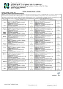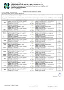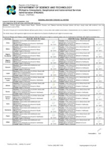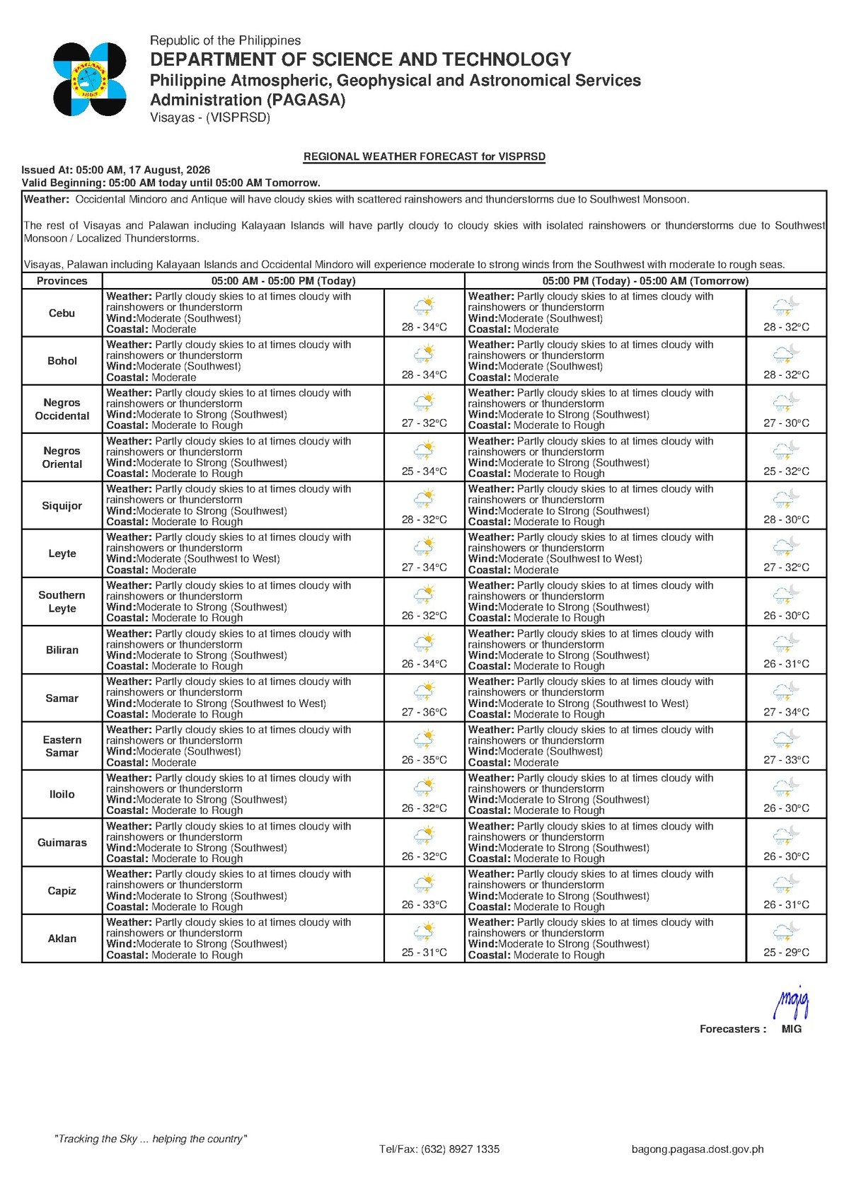
DUMAGUETE CITY, Negros Oriental — August 17, 2026 — An unsettled Monday lies ahead for communities across Negros Oriental, with the Philippine Atmospheric, Geophysical and Astronomical Services Administration (PAGASA) placing the entire Visayas region under a forecast of partly cloudy to at times cloudy skies, accompanied by rainshowers and possible thunderstorms. The weather bulletin, released at 5:00 PM on Saturday, August 16, 2026, covers Dumaguete City, Bayawan, Bais, Guihulngan, and the island province of Siquijor, and remains applicable for Monday’s conditions.
PAGASA noted that temperatures in Negros Oriental will fluctuate between a low of 28°C and a high of 33°C throughout the day. Winds will blow light to moderate from the southwest, while coastal waters are expected to remain slight to moderate in terms of wave conditions. Although these readings do not represent extreme weather on their own, residents are reminded that intermittent showers and afternoon thunderstorms can develop quickly and without much advance notice under such conditions.
The Role of the Southwest Monsoon
According to PAGASA, the prevailing wind pattern across the Visayas is coming from the southwest — a clear indicator that the habagat, or southwest monsoon, is the dominant weather driver this week. The habagat is a large-scale seasonal wind system that pulls warm, moisture-heavy air from the seas southwest of the Philippine archipelago, pushing it inland and producing the wet, showery conditions typical of the rainy season months spanning roughly June through September.
In straightforward terms, the southwest monsoon functions as a massive conveyor of wet air. The warmer the afternoon temperatures, the more likely that accumulated moisture will trigger thunderstorm development — particularly over the interior highlands and along the coasts of Negros Oriental. PAGASA’s forecast language of “rainshowers or thunderstorms” is its standard advisory that atmospheric conditions are favorable for these events to materialize at any point during the day.
Conditions Across the Visayas and Negros Oriental Today
For Monday, August 17, 2026, PAGASA describes Visayas-wide weather as variable — a mix of brief sunny intervals followed by sudden, and at times heavy, showers. When thunderstorms do form, they can bring intense short-duration downpours, gusty winds, and dangerous lightning strikes, even in areas that appear clear only moments before.
Within Negros Oriental, residents of Dumaguete City should anticipate an unpredictable day with conditions likely worsening in the afternoon. The coastal communities of Bayawan and Bais, the inland town of Guihulngan, and the island of Siquijor — separated from the Negros mainland by the Tañon Strait — all fall under the same regional forecast. Siquijor, being a smaller and more exposed island landmass, may be particularly susceptible to rapid weather changes with little warning. Residents of Cebu, on the opposite side of the strait, are under the same Visayas-wide advisory.
Coastal waters rated slight to moderate, combined with light to moderate southwest winds, are within the operating threshold for many fishing vessels. However, PAGASA cautioned that sea conditions can deteriorate sharply and quickly whenever thunderstorm cells develop over or near coastal areas.
Extended Outlook: Southwest Monsoon Holds Through the Week
PAGASA’s extended forecast, issued at 9:00 AM on Saturday, August 16, 2026, indicates that the current wet pattern will persist at least through Monday and Tuesday. On Sunday, temperatures ranged from 27°C to 33°C, and the same temperature band continues into Monday. Wind direction stays southwest throughout the outlook period, and coastal conditions remain at slight to moderate. The weather service’s data shows no indication of a break in the rainy pattern within the current forecast window, suggesting the southwest monsoon is maintaining a firm grip over the region.
No tropical cyclone wind signal, gale warning, or color-coded rainfall advisory has been issued by PAGASA for Negros Oriental as of the latest bulletin. Nonetheless, the agency’s use of “rainshowers or thunderstorms” in its forecast language constitutes a meaningful advisory in its own right — one that warrants practical preparation from all sectors of the community.
By the Numbers
- 28°C — forecast low temperature for Negros Oriental on Monday, August 17, 2026
- 33°C — forecast high temperature for Negros Oriental on Monday, August 17, 2026
- 27°C — Sunday low temperature per PAGASA’s extended outlook
- 5:00 PM, August 16, 2026 — time the primary weather bulletin was issued by PAGASA
- 9:00 AM, August 16, 2026 — time PAGASA’s extended outlook was released
Guidance by Sector: What This Forecast Means for You
Commuters and Motorists
Monday mornings in Dumaguete City and other urban centers may begin with relatively clear skies, but conditions are likely to deteriorate by afternoon. Residents travelling by motorcycle, tricycle, or on foot between barangays should carry rain gear before leaving home rather than waiting for rain to start. Low-lying roads near rivers and drainage channels in Negros Oriental are prone to becoming slippery or temporarily flooded during heavy showers. Motorists should slow down and never attempt to cross flooded roadways regardless of how shallow they appear.
Fisherfolk and Small-Boat Operators
Coastal waters are currently rated slight to moderate with light to moderate southwest winds, conditions that many small fishing vessels can manage. However, fisherfolk operating out of Dumaguete, Bais, Bayawan, and the shores of Siquijor are advised to stay alert, as PAGASA noted that conditions near the coast can worsen rapidly when thunderstorms develop. Operators of inter-island ferry services on routes connecting Dumaguete, Siquijor, Cebu, and other Visayas ports are urged to monitor the latest advisories from the Philippine Coast Guard and PAGASA before departure. Passengers travelling by sea should verify scheduling with their ferry operators beforehand.
Farmers and Agricultural Workers
For Negros Oriental’s farming communities, the southwest monsoon brings both opportunity and risk. While moderate rainfall benefits rice, sugarcane, and vegetable crops during this season, sudden heavy downpours increase the likelihood of waterlogging in flat fields, soil erosion on slopes, and fungal or pest outbreaks in crops already under stress. Farmers in Bayawan, Guihulngan, and inland municipalities should inspect field drainage and refrain from applying fertilizers or pesticides shortly before expected rain, as runoff diminishes their effectiveness and can contaminate nearby waterways. Drying or harvested crops should be sheltered or covered well before the afternoon storm window.
Students, Parents, and Schools
With Monday being a regular school day, parents should send children equipped with umbrellas or raincoats and plan for additional travel time in the afternoon. Schools situated in low-lying barangays should remain alert to the possibility of flooding along approach roads. Though no extreme rainfall advisory has been issued, the threat of thunderstorms means school administrators should monitor PAGASA’s updates throughout the day and have contingency plans ready for after-school dismissal if conditions worsen significantly.
Outdoor Workers and Event Organizers
Construction workers, utility crews, and all others working in exposed outdoor environments across Negros Oriental should plan activities around the probability of afternoon showers and build in buffer time for weather delays. Any outdoor event scheduled for Monday afternoon — particularly in open fields, coastal venues, or elevated terrain — should have a clear rain-and-lightning contingency plan. PAGASA’s standard safety guidance applies: upon hearing thunder or observing lightning, immediately seek shelter in a solid structure and stay clear of open ground, tall trees, and metal objects.
Why This Matters
The southwest monsoon-driven forecast of rainshowers and thunderstorms across Negros Oriental on August 17, 2026, directly affects the daily safety and livelihood activities of residents in Dumaguete City, coastal communities, inland farming areas, and the island of Siquijor. According to PAGASA, the wet pattern shows no sign of easing through at least Tuesday, meaning communities must sustain preparedness measures over multiple days rather than treating Monday as an isolated event. For fisherfolk, farmers, commuters, and school communities alike, timely awareness of PAGASA’s advisory is the most practical tool available for avoiding weather-related harm during this period.
Source: BreakingNewsNegrosOriental.com / PAGASA weather bulletin dated August 16, 2026