Dumaguete City, Negros Oriental — Wednesday, August 26, 2026: The southwest monsoon, known locally as habagat, is keeping weather conditions unsettled across the Visayas today, with the Philippine Atmospheric, Geophysical and Astronomical Services Administration (PAGASA) warning of intermittent rainshowers, possible thunderstorms, and moderate winds in its 5:00 AM forecast for the region. Communities across Negros Oriental, Siquijor, and neighboring Cebu are all covered by the advisory.
The Habagat Effect: What Is Driving Today’s Weather
PAGASA’s morning forecast attributes today’s unsettled conditions entirely to the southwest monsoon — no tropical cyclone, low-pressure area, or other discrete weather disturbance has been identified as a contributing factor. The habagat is a seasonal wind system that draws warm, moisture-heavy air from the South China Sea and the West Philippine Sea into the Philippine archipelago during the mid-year rainy season period. As this moist air mass moves over the Visayas, it generates the partly cloudy to overcast skies, intermittent rainshowers, and occasional thunderstorms that PAGASA is forecasting for today.
According to PAGASA, the mechanism is straightforward: the monsoon functions essentially as a continuous conveyor of oceanic moisture. When that moisture-laden airflow is funneled over land, atmospheric instability builds and rain — sometimes intensifying into thunderstorms — can break out at virtually any hour, not just in the late afternoon as many residents might assume. PAGASA’s data confirms that winds today are blowing from the southwest at moderate speeds, consistent with this monsoon pattern.
Today’s Forecast Conditions for Negros Oriental and the Broader Visayas
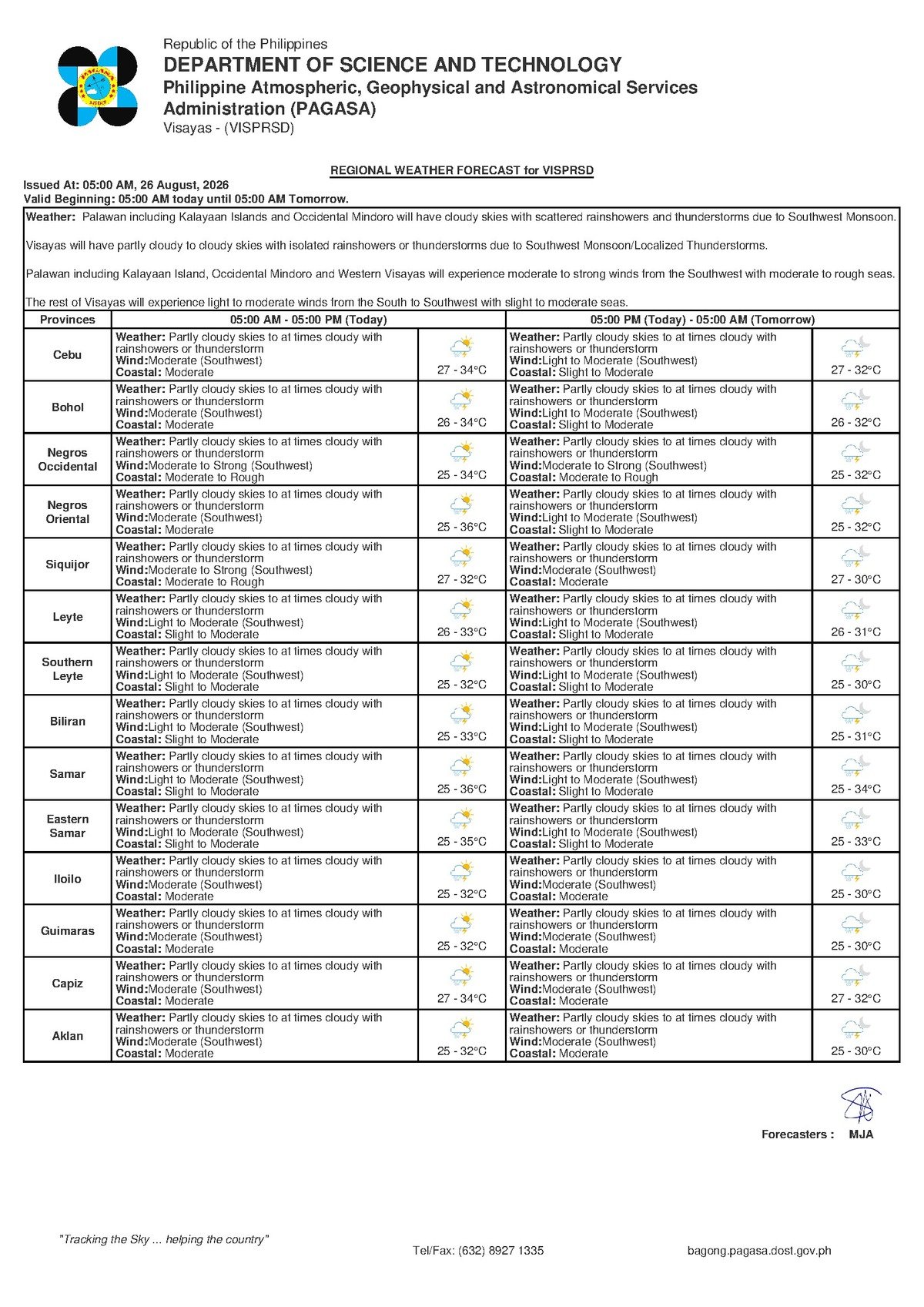
In its regional bulletin issued at 5:00 AM on Wednesday, August 26, 2026, PAGASA outlined the following conditions for the Visayas, which directly cover Negros Oriental — including Dumaguete City, Bayawan, Bais, Guihulngan, and Mabinay — as well as Siquijor and Cebu:
- Sky and precipitation: Partly cloudy to at times cloudy skies; rainshowers and thunderstorms possible at any point during the day.
- Wind direction and strength: Moderate, originating from the southwest.
- Temperature range: 27°C at the low end, rising to a high of 34°C. The combination of the warm overnight low and elevated humidity will make conditions feel muggy even during dry spells.
- Coastal sea conditions: Moderate — seas rougher than calm, with wave heights that can range roughly between 1.25 and 2.5 meters under this classification.
PAGASA has not issued an active typhoon wind signal, rainfall warning, or gale warning for Negros Oriental as of the time of this report. However, as the agency’s own language makes clear, “partly cloudy to at times cloudy with rainshowers or thunderstorm” is not a benign forecast — rain can appear and intensify rapidly, and thunderstorms carry the additional hazards of lightning and sudden strong gusts.
Residents along the coastal towns of both the western and eastern shorelines of Negros Oriental should take note of the moderate sea state, which PAGASA says makes conditions uncomfortable and potentially hazardous for small, non-motorized, or lightly loaded watercraft.
By the Numbers
- 5:00 AM — Time PAGASA issued its regional forecast for the Visayas on August 26, 2026
- 27°C — Forecast temperature low for Negros Oriental and the Visayas today
- 34°C — Forecast temperature high for the region today
- 1.25 to 2.5 meters — Estimated wave height range under PAGASA’s “moderate” coastal classification
- August 28, 2026 (Thursday) — End of the extended outlook period showing similar monsoon conditions
- 9:00 AM, August 25, 2026 — Time PAGASA issued its extended weather outlook covering Tuesday through Thursday
Extended Outlook: Monsoon Pattern Holding Through Thursday
The unsettled weather is not limited to today. PAGASA’s extended weather outlook, which the agency released at 9:00 AM on Tuesday, August 25, 2026, projects that similar monsoon-driven conditions will persist through at least Thursday, August 28. According to PAGASA, the three-day picture looks like this:
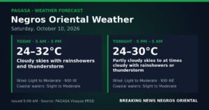
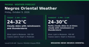
- Tuesday, August 25 (already past): Light to moderate southwest winds; slight to moderate coastal conditions; temperatures between 27°C and 34°C.
- Wednesday, August 26 (today): Moderate southwest winds; moderate coastal conditions; temperatures between 27°C and 34°C.
- Thursday, August 28: Moderate southwest winds continuing; moderate coastal conditions holding; temperatures again between 27°C and 34°C.
The pattern is consistent: the habagat is firmly established over the Visayas and shows no signs of weakening within the outlook window. PAGASA’s data suggests that residents, workers, and travelers should treat rain-readiness not as a single-day precaution but as a multi-day practice for the remainder of the week.
Sector-by-Sector Guidance
Fisherfolk and Small-Boat Operators
PAGASA’s classification of coastal waters as moderate means conditions are already beyond calm sea states. For those operating bancas, small fishing boats, or similar light watercraft in the waters surrounding Negros Oriental, Siquijor, or the Tañon Strait, the agency’s forecast warrants serious caution. Moderate seas can turn significantly more dangerous during a thunderstorm, when squalls and erratic wind shifts can arise with little advance warning. Mariners should consider delaying departures until conditions improve, keeping trips closer to shore, and monitoring updates from the Philippine Coast Guard.
Ferry and Inter-Island Passengers
Travelers on inter-island routes — including those connecting Dumaguete to Cebu, or Dumaguete to Siquijor — should verify schedules with their shipping lines before heading to terminals. While moderate coastal conditions do not automatically trigger cancellations, vessel operators may adjust departure times or routes based on actual sea states at the time of sailing. Passengers are advised to arrive early, monitor Philippine Coast Guard announcements, and avoid boarding watercraft that appear overcrowded or structurally compromised.
Farmers Across Negros Oriental
Agricultural communities in the interior and coastal farming zones of Negros Oriental — including areas around Guihulngan, Bayawan, and Bais — may find the monsoon rains beneficial for crop growth in moderation. However, PAGASA’s forecast of potential thunderstorms introduces the risk of brief but intense downpours that can cause runoff and localized flooding in low-lying fields. Farmers are advised to check field drainage, postpone spraying or fertilizer application during active rainfall, and secure farm equipment and structures against sudden wind gusts that thunderstorms can bring.
Commuters, Students, and Parents
Because PAGASA’s forecast allows for rain at any hour — not only in the late afternoon — students, parents, and commuters across Negros Oriental’s cities and towns should carry rain gear from the moment they leave home in the morning. If thunderstorms develop during school hours, parents should wait for lightning and heavy rain to subside before collecting children rather than venturing out during peak storm activity. Motorists on mountain and interior roads should reduce speed and stay alert for slippery surfaces and possible rockslides during periods of heavy rainfall.
Outdoor Workers and Event Organizers
Construction workers, utility crews, and anyone overseeing outdoor public gatherings — fiestas, markets, sports events — should build contingency plans into today’s schedule. According to established safety guidance consistent with PAGASA advisories, anyone who hears thunder should move immediately to a sturdy indoor shelter and remain there for at least 30 minutes after the last thunderclap before resuming outdoor activity. Lightning is a genuine hazard under thunderstorm conditions, and the absence of a formal government warning does not diminish that risk.
Reading the Forecast Accurately
It is worth emphasizing what PAGASA’s Wednesday forecast does and does not mean. The absence of a typhoon wind signal or rainfall warning for Negros Oriental reflects the fact that no severe or extreme weather event is expected — conditions are, in the agency’s own framing, manageable. However, PAGASA’s use of the phrase “rainshowers or thunderstorm possible at any time of day” is a deliberate signal that the day should not be treated as routine fair weather. Thunderstorms, even brief ones, can produce dangerous lightning strikes, localized flooding from intense downpours, and sudden gusts capable of downing branches or damaging light structures.
The moderate coastal water classification, as PAGASA defines it, corresponds to sea states that pose real risk to small and non-motorized watercraft. Residents and workers across Negros Oriental and Siquijor are encouraged to stay tuned to PAGASA updates throughout the day, as conditions driven by the habagat can shift within hours.
Why This Matters
The southwest monsoon’s sustained grip on the Visayas through at least Thursday means that the rain and storm risks outlined in PAGASA’s forecast are not a one-day concern — communities, fisherfolk, farmers, and travelers across Negros Oriental and neighboring provinces must maintain heightened awareness for several consecutive days. Moderate coastal sea conditions pose genuine safety risks to small watercraft operators, and thunderstorms — even without a formal warning signal — can bring lightning, localized flooding, and wind damage that affect livelihoods and public safety. Staying informed through official PAGASA bulletins remains the most reliable way for residents and workers to make safe decisions as conditions evolve throughout the week.
Source: Breaking News Negros Oriental (breakingnewsnegrosoriental.com)