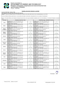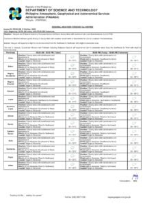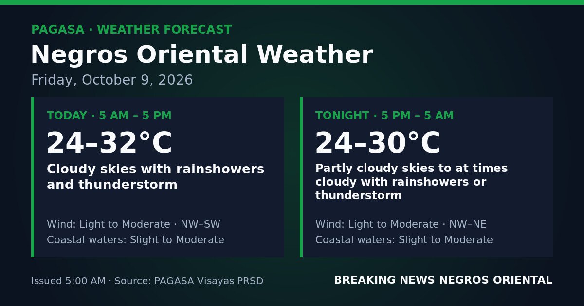
DUMAGUETE CITY, Negros Oriental — October 9, 2026: The Philippine Atmospheric, Geophysical and Astronomical Services Administration (PAGASA) has placed Negros Oriental under a forecast of cloudy skies, rainshowers, and thunderstorms for the entire Friday period — from 5:00 AM today through 5:00 AM Saturday — with unsettled conditions expected to persist through both daytime and overnight hours.
By the Numbers
- Daytime temperature range: 24°C to 32°C
- Overnight temperature range: 24°C to 30°C
- Forecast valid period: 5:00 AM Friday, October 9 to 5:00 AM Saturday, October 10, 2026
- Wave height under “slight” conditions: approximately 0.5 to 1.25 metres
- Wave height under “moderate” conditions: approximately 1.25 to 2.5 metres
Forecast Overview
According to PAGASA, temperatures during daylight hours will sit between 24°C and 32°C. Come nightfall, temperatures are expected to settle between 24°C and 30°C, with the cloud layer continuing to suppress overnight heat.
PAGASA’s 5:00 AM advisory does not attribute today’s weather to any named weather system — no tropical cyclone, low-pressure area, or monsoon is cited as the driving force behind the forecast. The agency’s data nonetheless makes clear that cloudy skies, rainshowers, and thunderstorm potential cover the province for the full 24-hour period. Residents who want to track any developing advisories are encouraged to monitor PAGASA directly at pagasa.dost.gov.ph, where bulletins are updated throughout the day.
Daytime Conditions: 5:00 AM to 5:00 PM
PAGASA forecasts cloudy skies with rainshowers and thunderstorms throughout the daytime hours. Winds will come from the northwest to southwest direction at light to moderate intensity. Coastal waters surrounding Negros Oriental are described by PAGASA as slight to moderate — manageable for larger vessels, but potentially uncomfortable or hazardous for small open boats and bancas.
The rain is unlikely to fall without pause — brief dry spells may occur — but thunderstorms can develop rapidly and with little advance warning. Anyone stepping outdoors from early morning should carry rain gear. If dark clouds are seen gathering, seek shelter without delay.
Overnight Conditions: 5:00 PM to 5:00 AM Saturday
The overnight forecast from PAGASA calls for partly cloudy to at times cloudy skies, with rainshowers or thunderstorms still possible. Winds are expected to shift toward the northwest to northeast direction, remaining light to moderate. Coastal water conditions will continue to be classified as slight to moderate through the night.
Although the overnight period is marginally less severe, the risk of thunderstorms does not clear. Those with Friday evening outdoor plans — whether in Dumaguete, Bais, or Guihulngan — should prepare an alternative arrangement in case conditions deteriorate.
What Slight to Moderate Coastal Waters Mean
PAGASA classifies coastal waters around Negros Oriental as slight to moderate for both the daytime and overnight windows. In practice, “slight” refers to wave heights of roughly 0.5 to 1.25 metres, while “moderate” covers waves of approximately 1.25 to 2.5 metres. Conditions can move toward the upper end of that range quickly when a thunderstorm passes through and temporarily boosts wind speeds.
No gale warning appears in the PAGASA source data for this forecast period. Even so, the agency’s inclusion of thunderstorm potential alongside variable wind directions means those on or near the water should remain alert.
Guidance by Sector
Fisherfolk and Small-Boat Operators
The slight to moderate sea state, paired with thunderstorm risk, poses a genuine hazard for operators of small bancas and open motorboats — particularly in the waters between Negros Oriental and Siquijor, and along the Tañon Strait separating Negros from Cebu. PAGASA’s forecast warrants serious consideration before setting out. Fisherfolk are advised to stay in port or, at minimum, keep trips short and close to shore. Anyone already at sea who spots lightning or hears thunder should return to port immediately rather than waiting to assess how conditions evolve.
Ferry and Inter-Island Passengers
Travellers booked on ferry routes from Dumaguete to Siquijor, Dumaguete to Cebu, or inter-island services out of Bayawan, Bais, or Guihulngan are advised to contact their shipping line or check port authority announcements before heading to the terminal. While PAGASA has not issued a gale warning for this period, slight to moderate seas combined with possible thunderstorms can prompt vessel operators to delay or cancel sailings on short notice. Extra time should be built into travel plans.
Farmers and Agricultural Workers
Persistent rain and thunderstorms carry a dual concern for agricultural workers across Negros Oriental. Though soil moisture aids the growing season, heavy rainshowers can flatten standing crops, erode hillside farm plots, and halt harvest operations — particularly in the sugarcane flatlands near Bais and Bayawan. Farmers with mature or near-ready crops are advised to complete any remaining fieldwork in the early morning before conditions worsen, and to postpone tasks that depend on dry conditions. Low-lying areas should be watched for waterlogging risks.
Students, Parents, and School Commuters
Rainshowers are forecast to begin as early as 5:00 AM, meaning the school commute across the province — from Dumaguete down to Guihulngan — will be wet from the outset. Parents and students should pack rain gear, allow extra travel time, and watch for any advisories from the Department of Education’s Negros Oriental division. Those travelling with young children by motorcycle, tricycle, or on foot should exercise particular care on roads that become slippery shortly after rain starts.
Outdoor Workers and Construction Sites
PAGASA explicitly includes thunderstorms in today’s forecast, which means lightning is a real hazard on elevated work sites, open scaffolding, and exposed agricultural land. Supervisors overseeing outdoor workers in construction and roadworks should have clear protocols ready to suspend operations and move personnel to covered shelter the moment lightning is observed or thunder is audible.
Siquijor and Nearby Islands
Conditions on Siquijor are expected to mirror those on the Negros Oriental mainland, according to the PAGASA forecast. Coastal communities, tourism operators, and boat-tour providers on Siquijor should factor in the slight to moderate sea state and thunderstorm risk before proceeding with marine or outdoor activities. Visitors planning same-day trips from Dumaguete to Siquijor are urged to confirm ferry status before leaving for the port.
Source: Breaking News Negros Oriental (breakingnewsnegrosoriental.com)