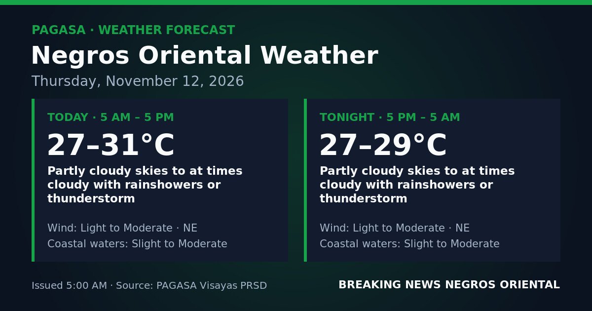
DUMAGUETE CITY, Negros Oriental — November 12, 2026 — The Philippine Atmospheric, Geophysical and Astronomical Services Administration (PAGASA) has placed Negros Oriental under an unsettled weather forecast for the entirety of Thursday, with rainshowers and thunderstorms expected from 5:00 AM through the overnight period ending at 5:00 AM on Friday, November 13.
PAGASA released the forecast at 5:00 AM on November 12, 2026, covering two consecutive windows: daytime (5:00 AM to 5:00 PM) and overnight (5:00 PM to 5:00 AM the following day). According to PAGASA, weather conditions are uniform across both periods, meaning no dry spell is expected at any point during the day or night.
Sky Conditions and Temperatures
PAGASA describes skies over the province as partly cloudy to at times cloudy, with rainshowers or thunderstorms possible within those cloud buildups. Brief sunny breaks may occur between cloud patches, but the agency’s forecast makes clear that dry conditions cannot be relied upon — showers can develop rapidly and thunderstorms may arrive with little ground-level warning.
Daytime temperatures are forecast between 27°C and 31°C, with humidity likely making any pause between showers feel muggy. Overnight temperatures will range from 27°C to 29°C, according to PAGASA, meaning the evening hours will remain warm even if skies temporarily clear.
Northeast Winds and the Amihan
PAGASA attributes the prevailing wind direction to the northeast for both the daytime and overnight periods. This is consistent with the influence of the amihan, or northeast monsoon — a seasonal wind system originating from the Asian continent that affects the Philippines during the cooler months. As the northeast flow crosses the warm waters of the Visayan Sea and surrounding seas, it gathers moisture and delivers cloud cover, rainshowers, and embedded thunderstorms to the eastern and central Visayas. PAGASA’s forecast ties this northeast wind directly to Negros Oriental, indicating the pattern will persist as long as the monsoon flow remains active.
Coverage Across the Province and Nearby Areas
The PAGASA forecast applies uniformly across Negros Oriental, from Guihulngan in the north through Bais down to Bayawan in the south. The island province of Siquijor, situated just across the Tanon Strait, falls under the same forecast. Dumaguete City, as the provincial capital and primary hub for transport, commerce, and education, will experience the same intermittent showers and possible thunderstorms as other parts of the province.
Coastal waters off Negros Oriental are forecast as slight to moderate during both the daytime and overnight periods, according to PAGASA. Slight sea states are generally manageable for larger inter-island vessels, while moderate conditions produce noticeably rough crossings and pose increased risk to small, open watercraft such as bangka-type boats.
Understanding the Forecast Terms
PAGASA classifies slight coastal waters as conditions where wave heights remain low and most inter-island vessels can operate, though small open boats should still exercise caution. Moderate coastal waters means wave heights have risen enough to make crossings considerably rough, with ferry passengers likely to experience significant rolling and small bancas facing heightened risk. Because the forecast spans a range from slight to moderate, sea state may shift between those two levels at any time today or tonight.
Light to moderate northeast winds, as described by PAGASA, are not at gale strength — no gale warning has been issued — but are steady enough to be felt on open water and to affect the handling of small watercraft. These winds, combined with the possibility of embedded thunderstorms that can momentarily spike gusts, mean open-water conditions require heightened awareness.
PAGASA has not issued any tropical cyclone wind signal, gale warning, or rainfall advisory — whether yellow, orange, or red — for Negros Oriental in connection with this forecast. The agency’s outlook reflects a persistent, day-long pattern of unsettled weather calling for routine precaution rather than emergency response.
Guidance for Ferry Passengers and Inter-Island Travelers
Travelers on routes between Dumaguete and Siquijor, or aboard fast craft operators such as OceanJet serving the Cebu corridor, are advised to verify vessel schedules before proceeding to the port. With coastal waters ranging from slight to moderate and thunderstorms possible at any hour, ferry operators may adjust departure times or suspend sailings if conditions worsen. Port staff should be consulted on current sea state upon arrival. Rain gear is recommended, and non-urgent travel may be better deferred to a clearer day.
Guidance for Fisherfolk and Small-Boat Operators
Fisherfolk operating out of Dumaguete, Tampi, Sibulan, Bais, Bindoy, and Bayawan should exercise caution given moderate coastal water forecasts and the risk of embedded thunderstorms. Small, undecked vessels are particularly vulnerable. Those who must go out are advised to stay close to shore, watch for approaching storm clouds, and be prepared to return quickly. Thunderstorms can generate sudden strong gusts with minimal warning.
Guidance for Farmers
Farmers in upland and lowland areas — including those cultivating sugarcane, vegetables, and root crops in Guihulngan, La Libertad, and Bayawan — may find the intermittent rain both beneficial and disruptive. Prolonged showers raise soil saturation concerns, particularly in low-lying fields where drainage should be checked. Activities requiring dry conditions, such as sun-drying harvested crops, should be scheduled with flexibility. Workers in open fields should identify nearby shelter in advance of any developing thunderstorm.
Guidance for Students, Parents, and Schools
Parents in Dumaguete, Bais, Guihulngan, and other towns should equip children with umbrellas, raincoats, or waterproof bags for the morning commute. PAGASA has not issued warning signals that would trigger school suspension thresholds, but heavy rainfall during thunderstorm episodes can produce short-term localized flooding on low-lying roads. Additional travel time is advised, and flood-prone routes should be avoided during and after heavy downpours.
Guidance for Outdoor Workers and Event Organizers
Construction workers, road crews, market vendors, and organizers of outdoor activities should anticipate weather-related interruptions throughout the day. Even brief thunderstorms can halt work, compromise temporary structures, and create slippery surfaces. Workers and participants should know the location of the nearest shelter and have a clear, pre-arranged signal to stop work and seek cover should lightning or strong gusts develop.
Source: PAGASA