DUMAGUETE CITY — No dry spell is in the forecast for Negros Oriental this Sunday. The Philippine Atmospheric, Geophysical and Astronomical Services Administration (PAGASA) has issued a forecast covering the full 24-hour period of November 15, 2026, calling for partly cloudy skies with scattered rainshowers and thunderstorms expected at any point during the day and again overnight.
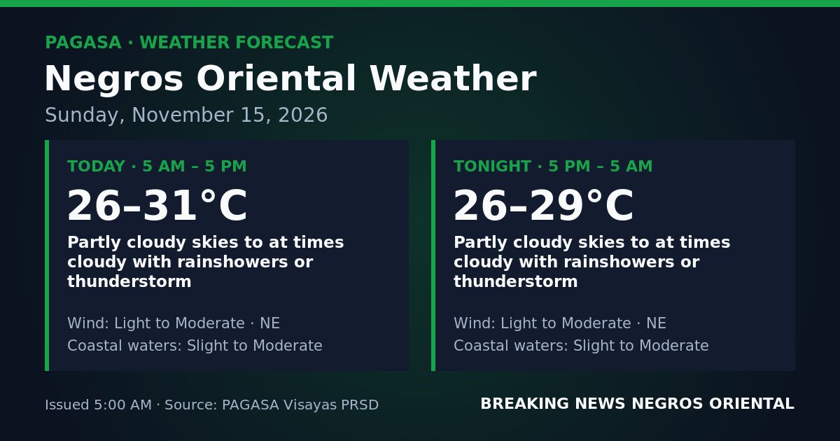
The PAGASA bulletin, released at 5:00 AM on Sunday, November 15, 2026, covers Negros Oriental in two overlapping windows: daytime from 5 AM to 5 PM, and overnight from 5 PM through 5 AM of Monday, November 16.
Daytime Conditions: 5 AM to 5 PM
According to PAGASA, the daytime period will bring partly cloudy skies that will turn at times cloudy, with rainshowers or thunderstorms possible at any hour. Temperatures are forecast to range between 26°C and 31°C. Winds will come from the northeast at light to moderate strength, and coastal waters around Negros Oriental are described as slight to moderate.
Overnight Conditions: 5 PM to 5 AM Monday
The overnight forecast presents essentially the same conditions, PAGASA said — partly cloudy to at times cloudy skies, with rainshowers or thunderstorms again possible. Temperatures are expected to ease to between 26°C and 29°C. Wind direction stays from the northeast at light to moderate strength, and coastal waters remain at slight to moderate.
What Is Driving the Weather
The northeast wind direction is consistent with the amihan, or northeast monsoon, PAGASA data indicates. This seasonal wind pattern draws cooler, moisture-laden air from the northeast into the Philippine archipelago. As that airflow interacts with atmospheric conditions over the Visayas, it promotes cloud formation, rainshowers, and embedded thunderstorms — the precise combination the agency is forecasting for the province today.
No Formal Warnings Currently in Effect
Based on the PAGASA forecast bulletin, no tropical cyclone wind signals, no gale warnings, and no color-coded rainfall warnings — yellow, orange, or red — are currently in effect for Negros Oriental. The weather is unsettled but does not carry the elevated risk levels associated with those warning categories.
The thunderstorm mention in the forecast, however, is itself a caution. PAGASA’s inclusion of thunderstorms signals the potential for sudden intense rainfall, lightning strikes, gusty winds, and rapidly reduced visibility — even in the absence of a formal warning.
On coastal waters, PAGASA’s “slight to moderate” sea-state description refers to wave heights reaching up to around one metre on the slight end and up to two metres or more on the moderate end. Large inter-island vessels in good condition are generally unaffected at these levels, but small and open watercraft — including outrigger fishing boats and motorized bancas — may face instability, particularly if sea state trends toward the moderate range.
Ferry Passengers and Inter-Island Travelers
Those planning to cross between Dumaguete and Siquijor, or along routes connecting Negros Oriental to Cebu and other Visayas islands via fast-craft or RORO services, should check sailing schedules with their ferry operator before proceeding to the port. The Philippine Coast Guard and individual ferry lines make final departure decisions based on actual sea conditions at the time of sailing. Delays are possible.
Fisherfolk and Small-Boat Operators
Fisherfolk operating out of Dumaguete, Bayawan, Bais, Guihulngan, and other coastal barangays across Negros Oriental — as well as those working off Siquijor — should use caution before heading out today. The slight-to-moderate coastal water forecast, combined with the possibility of thunderstorms, adds risk for open boats. Lightning at sea is particularly dangerous. Anyone already out on the water should return to port at the first sign of darkening skies, lightning flashes, or rapidly increasing winds. Small and open watercraft are advised to remain ashore through the full day and overnight period.
Farmers and Agricultural Workers
Agricultural workers in the highland barangays of Guihulngan, Valencia, and other interior municipalities of Negros Oriental should expect rainshowers and possible thunderstorm bursts to interrupt fieldwork at any point. Localised flooding in low-lying farm areas is possible during intense rain. Avoid remaining in open fields during lightning activity. Where harvest operations are needed, the early morning — before cloud build-up intensifies — is the safer window, according to the weather picture PAGASA has outlined.
Students, Commuters, and Outdoor Workers
Residents heading to school or work in Dumaguete, Bais, Bayawan, and other urban centres should carry rain gear, as showers can fall at any hour. The overnight forecast carries the same risk for those with late-night travel. Low-lying roads prone to surface flooding should be monitored following any heavy thunderstorm burst.
Construction workers, market vendors, delivery personnel, and event organisers should build contingency plans into their schedules today. When thunder is heard, PAGASA guidance calls for seeking sturdy shelter immediately and avoiding open ground, tall trees, and metal structures.
Siquijor Island
Siquijor Island faces the same general forecast as Negros Oriental, with partly cloudy to at times cloudy conditions, rainshowers, and possible thunderstorms both during the day and overnight, PAGASA’s bulletin shows. Those planning boat crossings to or from Siquijor should confirm sailing schedules with their ferry operator before travelling to the port, given the slight to moderate coastal water conditions.
Source: PAGASA