DUMAGUETE CITY, Negros Oriental — November 16, 2026 — Negros Oriental is in for an unsettled Monday, with the Philippine Atmospheric, Geophysical and Astronomical Services Administration (PAGASA) placing the entire province under a thunderstorm watch covering both daytime and overnight hours, with no guaranteed dry period at any point during the day.
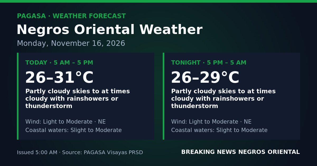
PAGASA’s official forecast for Negros Oriental, released at 5:00 AM on Monday, November 16, 2026, is divided into two 12-hour windows — 5:00 AM to 5:00 PM for the daytime period, and 5:00 PM to 5:00 AM Tuesday for the overnight period. According to PAGASA, both windows carry an identical outlook: partly cloudy skies turning at times cloudy, with rainshowers or thunderstorms possible at any hour.
Northeast Monsoon Driving the Weather
PAGASA’s Visayas regional outlook, also issued at 5:00 AM, identifies the prevailing northeast wind direction as the primary influence on today’s conditions. This pattern is consistent with the amihan, or northeast monsoon — the seasonal wind regime that brings cool, moisture-laden air across the eastern flank of the Visayas during the closing months of the year.
Because the weather driver is a broad monsoon wind pattern rather than a discrete storm system, there is no single peak period when showers or lightning are most likely. PAGASA’s data indicates that thunderstorms can develop and dissipate at unpredictable intervals — during the morning commute, mid-afternoon, or well into the overnight hours.
Official PAGASA Forecast Figures for Negros Oriental
Daytime (5:00 AM – 5:00 PM):
Sky: Partly cloudy, at times cloudy with rainshowers or thunderstorm
Temperature: 26°C to 31°C
Wind: Light to moderate, northeast
Coastal waters: Slight to moderate
Overnight (5:00 PM – 5:00 AM, Tuesday):
Sky: Partly cloudy, at times cloudy with rainshowers or thunderstorm
Temperature: 26°C to 29°C
Wind: Light to moderate, northeast
Coastal waters: Slight to moderate
The thunderstorm risk carries through both forecast windows without interruption, PAGASA noted. This means conditions may appear manageable in the early morning but can deteriorate rapidly at any time. Municipalities spanning the length of the province — from Sibulan and Dumaguete in the north through Bais and Guihulngan in the interior to Bayawan and Basay in the south — should all expect weather variability throughout the day and night.
Understanding the “Slight to Moderate” Coastal Water Advisory
PAGASA classifies coastal sea states using a standard wave-height scale. Today’s classification for Negros Oriental coastal waters is slight to moderate.
Slight seas correspond to wave heights of approximately 0.5 to 1.25 metres. Under these conditions, larger inter-island ferries can generally operate, though smaller bancas and outrigger vessels may find conditions uncomfortable.
Moderate seas correspond to wave heights of roughly 1.25 to 2.5 metres. At this level, small and medium-sized vessels face genuine operational hazards, and passengers aboard larger ferries may experience noticeable rolling and discomfort.
Because today’s advisory spans both categories, sea conditions may shift between these two states at different times across the day and night, according to PAGASA data. Boat operators and fisherfolk should not rely on calm early-morning conditions as an indicator of how the sea will behave later in the day.
As of the 5:00 AM bulletin, PAGASA had not issued a gale warning, a Tropical Cyclone Wind Signal, or a rainfall warning — yellow, orange, or red — for Negros Oriental. The agency nonetheless advises residents to monitor updated bulletins, given that thunderstorm development can be rapid and highly localized.
Ferry Passengers and Inter-Island Travelers
Travelers using Dumaguete port — including fast-craft and roll-on/roll-off services connecting to Cebu, Siquijor, Bohol, and other Visayas destinations — should check with their respective shipping lines or terminal advisories before departure, as slight to moderate seas may affect vessel schedules. PAGASA notes that high-speed craft such as those operated by OceanJet are more sensitive to sea-state changes than conventional ferries. Passengers bound for or returning from Siquijor should verify crossing conditions prior to boarding.
Fisherfolk and Small-Boat Operators
Those fishing along the Tañon Strait, Bohol Sea, and coastal waters of Negros Oriental — including communities in Bais, Dauin, Zamboanguita, and Tayasan — face a combined hazard of choppy seas and sudden thunderstorms throughout Monday and overnight. PAGASA advises continuous weather monitoring. The agency’s standard guidance applies: if lightning is sighted or thunder is heard, vessels should return to shore immediately without waiting for storm conditions to fully develop.
Farmers and Agricultural Workers
Workers in sugarcane, rice, and vegetable areas in interior municipalities such as Guihulngan, La Libertad, and Bindoy should note the persistent thunderstorm risk flagged by PAGASA. While intermittent showers may benefit soil moisture, lightning associated with thunderstorms is a direct hazard for workers in open fields. Harvested crops left in the open should be covered against rain damage.
Students, Commuters, and Outdoor Workers
Rainshowers and thunderstorms are possible at any point during school hours and dismissal, according to the PAGASA forecast. Low-lying and coastal barangays in Dumaguete, Bacong, and nearby municipalities can flood quickly during intense thunderstorm episodes. School administrators and parents should monitor local government announcements on possible weather-related class suspensions. Students should avoid crossing flooded roads or drainage channels.
Construction workers, delivery riders, market vendors, and outdoor event organisers across the province should likewise prepare for sudden rain and have contingency or shelter plans in place, as fair conditions are not expected to hold at any point during the forecast period.
Siquijor and Nearby Provinces
The island province of Siquijor, situated south of Negros Oriental across the Mindanao Sea, is subject to the same northeast wind flow and moisture pattern, according to PAGASA’s Visayas regional outlook. Travelers moving between Siquijor and the Dumaguete or Larena ports should factor in potential changes in sea state and check for updated PAGASA bulletins throughout the day.
Source: PAGASA