DUMAGUETE CITY, Negros Oriental — Southwest monsoon conditions will keep the Visayas unsettled this Saturday, August 22, 2026, with the Philippine Atmospheric, Geophysical and Astronomical Services Administration (PAGASA) forecasting partly cloudy to overcast skies punctuated by scattered rainshowers and thunderstorms throughout the day. The state weather bureau says the pattern is consistent across the entire weekend, with no major storm system currently affecting the region.
PAGASA released its forecast at 5:00 AM on Saturday, August 22, 2026, covering the Visayas region. A separate extended weather outlook, issued at 9:00 AM on August 21, 2026, confirms that the same general conditions — temperature ranges, wind patterns, and sea states — are expected to hold through both Saturday and Sunday.
The Southwest Monsoon at Work
PAGASA attributes today’s weather to the habagat, the southwest monsoon, a large-scale seasonal wind system that typically dominates the Philippine climate from June through October. During this period, moisture-heavy air originating from the Indian Ocean and the South China Sea sweeps across the archipelago, continuously feeding rainshowers and thunderstorm activity across island groups like the Visayas.
When the habagat is in full force, warm surface temperatures cause moist air to rise rapidly into the atmosphere, generating the convective energy that powers afternoon and evening thunderstorms. The result is a familiar pattern for residents of Negros Oriental: relatively clear mornings giving way to increasingly dark skies and heavy downpours by midday or early afternoon. Today is expected to follow exactly that script.
Conditions Forecast for Negros Oriental and the Broader Visayas
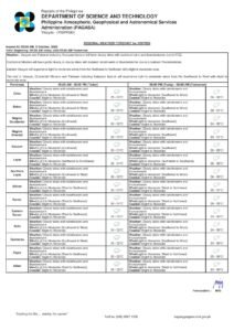
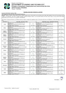
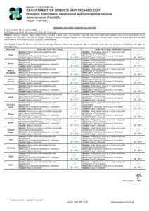
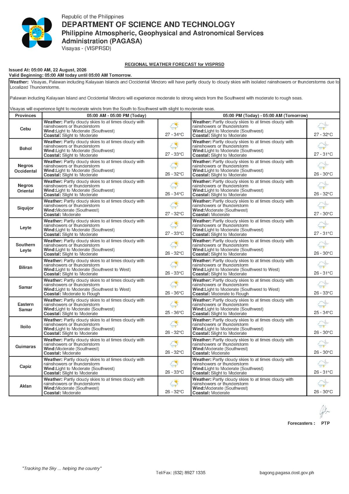
PAGASA’s forecast covers Negros Oriental, Siquijor, Cebu, and the rest of the Visayas region for Saturday, August 22, 2026. The specific parameters are as follows:
- Sky condition: Partly cloudy to at times cloudy; scattered rainshowers or thunderstorms likely
- Temperature range: 27°C (minimum) to 34°C (maximum)
- Wind direction: Southwest
- Wind speed: Light to moderate
- Coastal water conditions: Slight to moderate
The extended outlook issued by PAGASA on the morning of August 21 shows the same temperature band of 27°C to 34°C holding across Friday, Saturday, and Sunday, with southwesterly winds remaining light to moderate and coastal seas staying at slight to moderate levels. According to PAGASA, this is not a one-day weather event — the province and the wider region are in an extended stretch of unsettled, rain-prone conditions.
In Dumaguete City, expect a warm and partly sunny morning followed by a rising probability of thunderstorms in the afternoon and early evening. Bayawan City in the south, Bais City on the eastern coast, and Guihulngan City in the northern part of the province are all under the same forecast. Residents of Siquijor island should also brace for gusty winds whenever thunderstorms pass through their area.
No Storm Warnings Active as of This Morning
Importantly, PAGASA’s 5:00 AM issuance on August 22, 2026 confirms that no tropical cyclone wind signals, gale warnings, or formal rainfall advisories — whether yellow, orange, or red — are currently in effect for the Visayas. There is no tropical cyclone threatening or influencing the region at this time.
That said, the absence of formal warnings does not eliminate the need for caution. PAGASA notes that thunderstorms, even without a named storm behind them, can produce sudden heavy downpours, dangerous lightning, and brief strong gusts. These are localised hazards that can escalate rapidly, particularly during the warmest hours of the afternoon when atmospheric instability peaks.
The agency’s guidance is consistent with habagat-season advisories: residents do not need to take emergency-level action, but ordinary daily planning should account for the likelihood of afternoon rain.
Guidance for Specific Groups in Negros Oriental
Ferry Passengers and Inter-Island Travelers
PAGASA describes coastal water conditions as slight to moderate — generally manageable for larger commercial vessels, but potentially uncomfortable or hazardous for smaller outrigger craft (bangkas). Passengers travelling on routes such as Dumaguete–Siquijor, Dumaguete–Cebu, or Dumaguete–Bohol through carriers like OceanJet or Montenegro Lines should verify departure schedules with their shipping lines before proceeding to the port. Ferry operators may suspend or delay sailings if thunderstorms develop near port areas, even in the absence of an active gale warning.
Fisherfolk and Small-Vessel Operators
Medium-sized fishing boats should be able to operate under today’s light to moderate wind conditions and slight to moderate seas. However, PAGASA’s forecast of afternoon thunderstorms is a serious consideration for small-boat and bangka fishermen along the coasts of Negros Oriental and Siquijor. Thunderstorms can build quickly over open water during the afternoon, and small vessels offer little protection against sudden strong winds or rough waves. The practical advice is to head back to shore well before dark and to watch the sky closely for signs of approaching weather.
Farmers and Agricultural Workers
Daytime temperatures reaching as high as 34°C combined with afternoon moisture from the habagat create conditions that are broadly beneficial for rice, sugarcane, and vegetable crops — the backbone of Negros Oriental’s agricultural economy. However, fieldwork should ideally be wrapped up during the morning hours. Open-field workers face real lightning risk during thunderstorm activity, and farmers in low-lying coastal areas — particularly around Bayawan, Bais, and Manjuyod — should be watchful for localised flash flooding if a storm cell drops an intense burst of rain in a short period.
Commuters, Students, and Families
Afternoon travel in Dumaguete City and other urban centres in Negros Oriental may be disrupted by heavy rain, especially if thunderstorms develop before the evening commute. Motorists are advised to reduce speed on rain-slicked roads, particularly on mountain routes connecting Dumaguete to Valencia and Zamboanguita. Parents of school-age children attending afternoon or outdoor activities should pack rain gear and stay in contact with school administrators in case events are postponed due to deteriorating weather.
Outdoor Workers and Event Organizers
Construction workers, road crews, and other outdoor labourers should schedule critical tasks for the morning, when skies are more likely to be clear. Vendors along Rizal Boulevard in Dumaguete, tourism operators at Apo Island, and weekend event organisers should have covered or indoor contingency areas ready. PAGASA’s forecast makes clear that a fast-moving thunderstorm can arrive with little warning during the afternoon, and preparation is far easier than improvisation when rain begins.
By the Numbers
- 5:00 AM, August 22, 2026 — Time of PAGASA’s primary forecast issuance
- 9:00 AM, August 21, 2026 — Time of the extended weekend weather outlook issuance
- 27°C — Forecast minimum temperature for the Visayas on Saturday
- 34°C — Forecast maximum temperature for the Visayas on Saturday
- 3 days (Friday–Sunday) — Duration covered by PAGASA’s extended outlook showing the same weather pattern
Weekend Outlook: Sustained Unsettled Weather
PAGASA’s extended forecast, released at 9:00 AM on August 21, 2026, projects that conditions on both Saturday and Sunday will be essentially identical: temperatures holding between 27°C and 34°C, light to moderate southwesterly winds, and slight to moderate coastal seas. The weather bureau’s data suggests the region remains in a sustained habagat-influenced weather pattern, meaning residents should treat today’s rain-readiness measures as applicable through the rest of the weekend as well.
There is no indication from PAGASA that a significant weather system will move in or that conditions will worsen dramatically beyond what is already forecast. The current situation calls for awareness and routine precaution rather than alarm.
Why This Matters
The active southwest monsoon is keeping the entire Visayas — including Negros Oriental, Siquijor, and Cebu — in a multi-day stretch of rain-prone weather, directly affecting livelihoods that depend on predictable outdoor conditions, from farming and fishing to inter-island transport and tourism. While PAGASA confirms no tropical cyclone or formal warning is in effect, the documented risk of sudden afternoon thunderstorms means that residents, travellers, and workers face real day-to-day hazards requiring practical preparation. The extended weekend forecast showing identical conditions across Saturday and Sunday underscores that this is a sustained weather pattern, not a passing isolated event.
Source: breakingnewsnegrosoriental.com / PAGASA forecast issuance, August 22, 2026