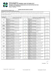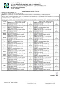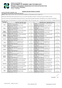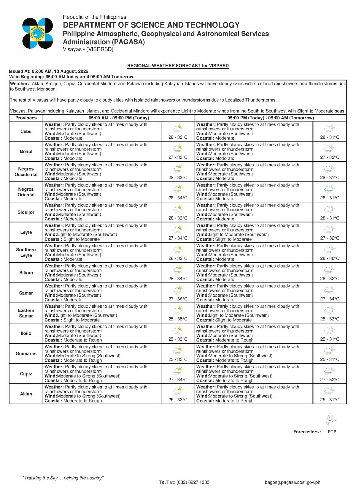
DUMAGUETE CITY, Negros Oriental — August 13, 2026 — The southwest monsoon, locally called habagat, is keeping weather unsettled across Negros Oriental today, with the state weather bureau PAGASA forecasting intermittent rainshowers and thunderstorms throughout Thursday for communities stretching from Dumaguete to Guihulngan, Bais, Bayawan, and the neighboring island province of Siquijor. The forecast was released by PAGASA through its 5:00 AM Regional Forecast for the Visayas.
Skies will range from partly cloudy to at times overcast, with rain and storm activity capable of appearing and intensifying at any point during the day — a weather pattern that carries practical implications for mariners, farmers, commuters, and anyone with outdoor plans across the province.
The Force Behind Today’s Weather
PAGASA’s forecast identifies the southwest monsoon as the primary driver of Thursday’s unsettled conditions. The habagat is a seasonal weather system active from roughly June through October each year, funneling warm, moisture-heavy air from the direction of the South China Sea and the Sulu Sea into the Philippine archipelago. When this humid airflow meets the mountain terrain of islands such as Negros, the air is forced upward, cools, and releases its moisture — often rapidly — in the form of rain and, at times, powerful thunderstorms.
This mechanism explains why shower activity during habagat season can escalate with very little advance notice. Skies may appear only partly cloudy in the morning, yet by midday or afternoon, towering storm clouds can build quickly, bringing lightning, gusty winds, and heavy downpours. According to PAGASA, this pattern is expected to persist not only through Thursday but continuing into Friday and the weekend, with no significant improvement anticipated in the near term.
By the Numbers
- Forecast temperature range on Thursday: 28°C to 33°C
- Forecast temperature range on Friday: 27°C to 33°C
- PAGASA’s 5:00 AM Regional Forecast issued: August 13, 2026
- PAGASA’s extended outlook issued: 9:00 AM, August 12, 2026
- Sea condition rating across Visayas coastal waters: Moderate
Conditions Across the Visayas on Thursday
In its 5:00 AM bulletin, PAGASA described the following forecast parameters for the Visayas region on August 13, 2026:
Sky condition: Partly cloudy to at times cloudy, with rainshowers or thunderstorms occurring at various periods throughout the day.
Temperature: A range of 28°C to 33°C — warm and humid, with heat potentially feeling more oppressive during brief dry spells between rain episodes.
Winds: Blowing from the southwest at moderate speeds.
Coastal waters: Rated moderate across Visayas sea areas.
The extended weather outlook, which PAGASA issued at 9:00 AM on Wednesday, August 12, 2026, projects similar conditions persisting through Friday — with temperatures dipping slightly on the lower end to 27°C — and carrying into the weekend. Southwest winds remain moderate in both the Thursday and Friday outlooks, and coastal sea states are likewise expected to stay at moderate levels.
What Moderate Seas Mean for Mariners
PAGASA has rated coastal waters across the Visayas as moderate for Thursday. This classification generally indicates conditions manageable for larger commercial vessels — ROROs and fast craft such as those serving the Dumaguete-to-Siquijor, Dumaguete-to-Cebu, and other inter-island routes — but potentially challenging and at times hazardous for smaller open watercraft, including bancas and motorized outriggers.
It is important to note, PAGASA said, that this is not a gale warning, and no data in the current forecast points to the kind of rough seas that would automatically trigger a suspension of ferry operations. That said, the combination of moderate seas and the active threat of sudden thunderstorms — which generate unpredictable gusts and rapidly building swells — means marine conditions can deteriorate without much warning. Passengers scheduled to travel on inter-island sea routes are advised to confirm departure schedules directly with their shipping lines before proceeding to the port.
For small-boat operators — fisherfolk running bancas, those providing inter-barangay water transport, or operators catering to tourists — the risks are more acute. Thunderstorm-driven squalls during habagat season can develop within minutes, producing dangerous conditions that are difficult to predict even in the short term, according to PAGASA’s guidance on southwest monsoon weather behavior.
Guidance for Specific Sectors
Fisherfolk and Coastal Communities
Anyone heading out on the water today should exercise heightened caution. PAGASA’s moderate coastal water rating, layered with the active risk of thunderstorms, makes today a day to stay closer to shore than usual. Tall, dark, anvil-shaped cumulonimbus clouds forming overhead are a clear signal to head back to port — without waiting for rain to begin. Lightning in open water is extremely dangerous, and there is no protection aboard a small vessel once a storm develops. Small-boat operators are strongly encouraged to monitor sky conditions continuously and err on the side of caution.
Farmers and Agricultural Workers
The rainshowers brought by the southwest monsoon can be beneficial for crops in need of moisture, but heavy or sustained episodes — particularly those accompanied by thunderstorms — carry risks of crop damage, waterlogging in low-lying fields, and disruption to harvesting schedules. Farmers in areas near rivers and drainage channels in Bayawan, Bais, and the Guihulngan corridor should remain alert to the possibility of localized flooding if intense rainfall concentrates over their areas. PAGASA’s forecast does not specify localized flood warnings, but the general pattern of monsoon-driven thunderstorms carries this inherent risk. Securing harvested produce and farm equipment ahead of heavier showers is advisable.
Commuters and Students
Wet road surfaces should be expected throughout the day in Dumaguete and surrounding municipalities. Brief but intense downpours can reduce visibility sharply, flood low-lying streets and underpasses, and make travel on mountain roads to interior barangays especially risky. Students commuting by motorcycle or on foot should carry rain gear. Parents are advised to monitor whether school administrators issue any weather-related advisories, particularly if a thunderstorm intensifies during school hours. Staying hydrated remains important even in rainy weather, given the warm temperature range of 28°C to 33°C forecast for the day.
Outdoor Workers and Event Organizers
Construction workers, port workers, and others with sustained outdoor exposure should anticipate work interruptions throughout the day as storm episodes come and go. PAGASA advises seeking shelter at the first sign of thunder or visible lightning — not waiting until rain becomes heavy. Any outdoor events scheduled for Thursday in the province — sports competitions, community gatherings, fiesta activities — should have contingency arrangements ready. Given that PAGASA’s extended outlook shows no clear break in the southwest monsoon through the weekend, there is no reliable window of calm weather in the immediate days ahead.
Ferry and Sea Passengers
Travelers planning to use inter-island sea routes — particularly those crossing from Dumaguete to Siquijor, or taking fast craft services toward Cebu and other Visayas ports — should confirm trip status with their respective shipping lines before leaving home. While moderate coastal conditions do not automatically result in trip cancellations, PAGASA notes that sudden thunderstorm activity can prompt port authorities and vessel operators to delay or suspend sailings for safety. Building extra time into travel plans and having a backup option if departures are postponed is the prudent approach.
Extended Forecast: Southwest Monsoon to Continue Through Weekend
PAGASA’s extended weather outlook — issued at 9:00 AM on August 12, 2026, and covering Thursday through the weekend — projects a continuation of the prevailing monsoon pattern. Temperatures on Friday are expected to range from 27°C to 33°C, with moderate southwest winds and moderate coastal conditions persisting. Partly cloudy to cloudy skies with rainshowers and thunderstorms are likewise carried through the extended forecast period, according to PAGASA.
In practical terms, this means there is no near-term return to dry, settled weather across Negros Oriental and the broader Visayas region. Residents and businesses dependent on outdoor conditions should plan accordingly for at least the next several days.
Why This Matters
The active southwest monsoon is a province-wide concern during the June-to-October wet season, affecting the safety of fisherfolk and maritime passengers, the livelihoods of farmers, and the daily routines of commuters and students across Negros Oriental. PAGASA’s sustained forecast of moderate coastal conditions and recurring thunderstorms through the weekend signals that communities must remain alert and prepared rather than treating this as a single-day weather event. For sectors directly exposed to outdoor and maritime conditions, timely awareness of PAGASA’s daily bulletins can make the difference between a safe workday and a dangerous one.
Source: Breaking News Negros Oriental (breakingnewsnegrosoriental.com) / PAGASA Regional Forecast