The southwest monsoon is asserting itself across Negros Oriental this Monday, August 10, 2026, delivering the kind of unsettled, rain-prone day that the province knows well during the height of the habagat season. The Philippine Atmospheric, Geophysical and Astronomical Services Administration (PAGASA) released its Visayas regional forecast at 5:00 AM today, warning of intermittent rainshowers, possible thunderstorms, and coastal waters rough enough to keep small vessels out of the sea.
PAGASA’s Official Forecast for August 10
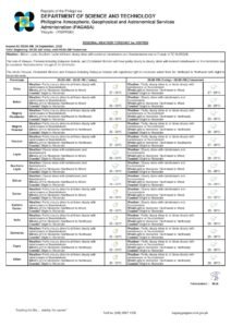
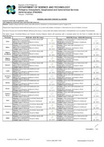
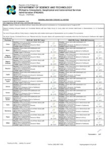
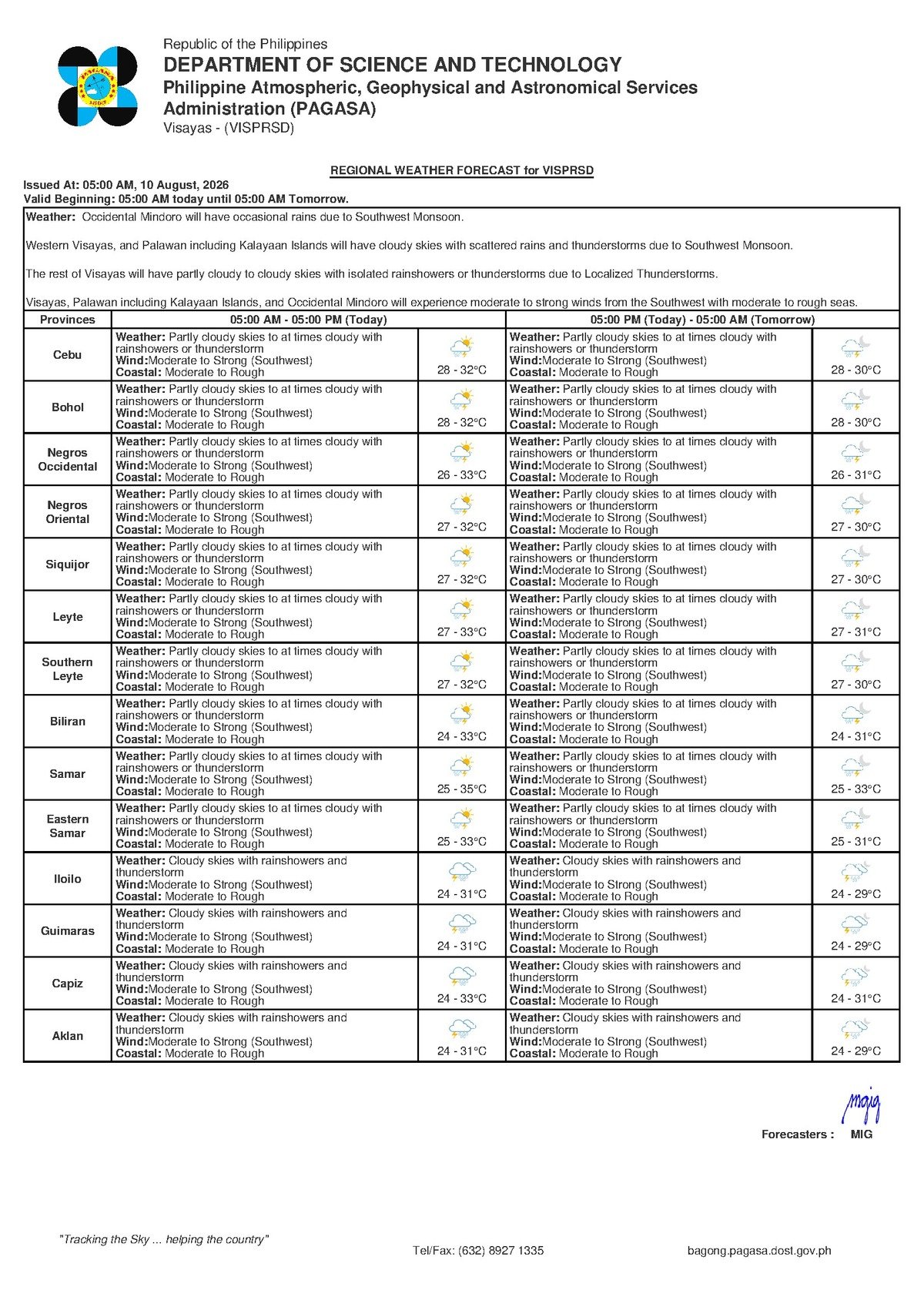
According to PAGASA’s 5:00 AM forecast issued on August 10, 2026, the Visayas region — which includes Negros Oriental — will experience partly cloudy to at times overcast skies, with rainshowers and thunderstorms possible at various points throughout the day. The agency placed temperatures within a range of 28°C to 32°C, with winds blowing from the southwest at moderate to strong speeds. Coastal waters across the region are classified as moderate to rough.
This is consistent with the extended weather outlook PAGASA released earlier at 9:00 AM on Sunday, August 9, 2026. That outlook forecast essentially similar conditions for Monday — temperatures between 26°C and 33°C, southwest winds at moderate to strong intensity, and moderate to rough coastal conditions. PAGASA’s extended forecast further indicates that these conditions are expected to persist into Tuesday, making this a multi-day weather episode rather than an isolated occurrence.
By the Numbers
- 5:00 AM — time PAGASA released its August 10 Visayas regional forecast
- 9:00 AM, August 9, 2026 — time PAGASA’s extended weather outlook was issued
- 28°C to 32°C — temperature range per the 5:00 AM forecast
- 26°C to 33°C — temperature range per the extended Sunday outlook
The Habagat: What Is Driving Today’s Conditions
The weather pattern responsible for Monday’s forecast is the southwest monsoon, widely referred to locally as the habagat. As PAGASA’s prevailing wind data indicates, moisture-heavy air is being drawn in from the southwest and pushed across the Visayas archipelago. When this warm, water-laden air rises over land and open water, it forms the thick cloud banks, persistent rainshowers, and thunderstorm cells that are defining this week’s weather across the region.
The habagat typically holds sway over the Philippines from June through September, and August is historically one of its most active months. The strong southwesterly winds generated by this monsoon are also the primary reason coastal waters are elevated to moderate-to-rough status. Residents of Negros Oriental who have lived through previous habagat seasons will recognize this combination of symptoms — but familiarity does not reduce the risks they carry.
Breaking Down What the Forecast Means in Practice
Sea Conditions and the Risk to Small Vessels
PAGASA’s classification of coastal waters as “moderate to rough” carries real operational consequences for the province’s fishing communities and inter-island travelers. The sea lanes around Negros Oriental — including those connecting Dumaguete to Siquijor, the waters off Bayawan along the southern coast, and the Tañon Strait near Bais — are all potentially affected. Small fishing boats, bangkas, and any craft not certified for rough open-water conditions face significant danger under these sea states.
Fisherfolk operating out of coastal barangays in Dumaguete, Bayawan, Bais, Guihulngan, and other shoreline communities are strongly urged to stay in port or fish only in sheltered nearshore waters. The Philippine Coast Guard is the authoritative body for vessel departure clearances, and no small-boat operator should put to sea today without checking in with the Coast Guard first. It is also worth emphasizing that calm conditions at dawn do not guarantee that the sea will stay manageable — southwest winds typically intensify as the day wears on.
Inter-Island Ferry Travel
Passengers holding tickets for ferry routes departing from Dumaguete — whether headed to Siquijor, Cebu, or other Visayas destinations — should contact their ferry operators before traveling to the port. Rough sea conditions regularly trigger trip cancellations, schedule delays, or route diversions, particularly for smaller fast-craft vessels. The Philippine Coast Guard advises travelers to monitor official weather bulletins and heed any suspension orders before proceeding. Non-essential crossings should be reconsidered until conditions improve.
Rainshowers and Thunderstorm Risks
The phrase “rainshowers or thunderstorms” in PAGASA’s forecast is worth unpacking. Rain under this classification is not steady or predictable — it can arrive suddenly, intensify within minutes, and then ease off, only to return. Afternoon and evening hours typically see the heaviest thunderstorm activity during habagat conditions. Thunderstorms bring risks beyond rainfall: lightning poses a direct danger to anyone caught outdoors, strong wind gusts can topple structures or fallen debris, and brief heavy downpours can overwhelm drainage in low-lying barangays and trigger flash flooding near river channels.
Road Travel and Commuters
Motorists and riders traveling along the coastal highway — whether northward through Bais and Guihulngan or southward toward Bayawan — as well as those navigating mountain roads into the interior of the province, should be prepared for sudden rain squalls and limited visibility during thunderstorm episodes. Wet asphalt lengthens stopping distances, and elevated terrain roads can collect runoff and debris during heavy showers. Drivers are advised to reduce speed when rain hits, keep headlights on, and allow additional travel time for any journey planned for today.
Farmers and Agricultural Communities
For Negros Oriental’s farming communities — including sugarcane growers in the lowlands, rice farmers in flood-prone flatlands, and vegetable growers in the upland areas — today’s weather is a double-edged situation. Habagat rainfall contributes needed soil moisture, but repeated heavy rain episodes risk waterlogging low-lying fields and damaging crops nearing harvest. PAGASA’s forecast of possible thunderstorms is also a safety concern: agricultural workers should cease fieldwork and take shelter during active lightning periods. Farmers should also monitor drainage conditions in flood-prone farm areas.
Students, Families, and Schools
Parents and guardians sending children to school today should ensure rain gear is packed. While PAGASA has not issued any extreme or severe rainfall warning that would ordinarily trigger mandatory school suspensions, local government units retain full authority to suspend classes based on actual observed conditions on the ground. Families are advised to monitor announcements from the Negros Oriental provincial government, their respective city or municipal governments, and school administrations throughout the morning hours.
Outdoor Workers and Community Events
Construction workers, market vendors, utility crews, and others working in exposed settings should build interruptions into their schedules today. Anyone caught outdoors when lightning becomes visible should immediately seek shelter inside a sturdy building. Organizers of open-air events should have weather contingency plans ready — afternoon thunderstorms are a realistic and forecast-consistent possibility today.
What to Expect Through Tuesday
PAGASA’s extended weather outlook, issued on Sunday, August 9, 2026, makes clear that the current weather regime is not expected to lift quickly. The same combination of southwest monsoon winds, intermittent rainshowers or thunderstorms, and moderate-to-rough coastal waters is forecast to carry through at least Tuesday. Residents, fisherfolk, and local officials across Negros Oriental should plan accordingly and continue monitoring PAGASA bulletins as they are updated throughout the day.
For the most current weather information, the public is encouraged to follow PAGASA’s official advisories, check with the Philippine Coast Guard for marine updates, and monitor announcements from local government units for any emergency or precautionary directives as conditions develop.
Why This Matters
The combination of moderate-to-rough seas and intermittent thunderstorms poses documented risks to fishing communities, inter-island ferry passengers, and low-lying coastal barangays in Negros Oriental — groups directly dependent on safe sea and weather conditions for their livelihoods and safety. PAGASA’s multi-day forecast extending through Tuesday means these hazards are not a single-day disruption but a sustained weather episode requiring continued vigilance. Timely public awareness of these conditions — particularly the marine safety classification and the thunderstorm risk — is essential for preventing weather-related accidents and ensuring communities can make informed decisions about travel, work, and outdoor activities.
Source: breakingnewsnegrosoriental.com (BNNO original forecast report)