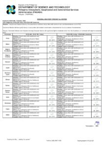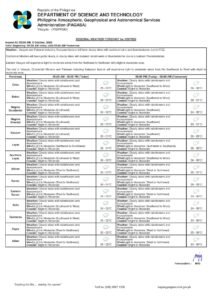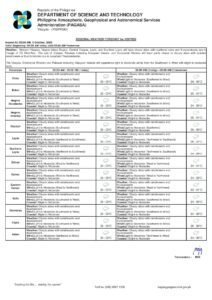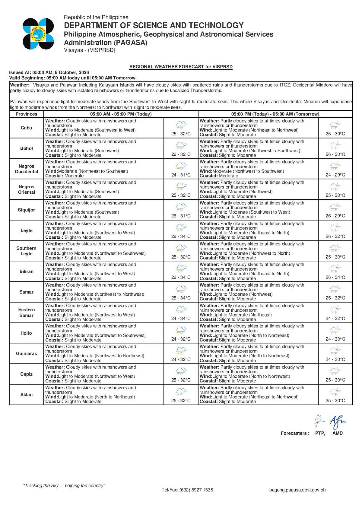
DUMAGUETE CITY, Negros Oriental — October 8, 2026 — A wet and unsettled Thursday is in store for Negros Oriental, with the Philippine Atmospheric, Geophysical and Astronomical Services Administration (PAGASA) issuing a 5:00 AM regional forecast that calls for cloudy skies, rainshowers, and thunderstorms across the province. Coastal waters are rated slight to moderate, a condition that carries implications for inter-island ferry travel, small-boat fishing, and any planned outdoor activities in the province and nearby areas such as Siquijor and southern Cebu.
What Is Behind Today’s Weather Pattern
The unsettled conditions are being driven by winds coming in from the southwest to west, according to PAGASA’s regional bulletin. This pattern is consistent with the southwest monsoon — locally called habagat — which funnels warm, moisture-heavy air from the sea onto land, producing sustained cloud cover and creating the atmospheric conditions that generate rainshowers and thunderstorms.
PAGASA’s forecast explains that when this moisture-laden air is pushed over the warm land surface during daytime heating, it rises rapidly and produces the electrical storm activity being forecast for today. Meanwhile, the northeastern and northern sections of the Visayas are receiving winds from the northeast to northwest, pointing to a transitional atmospheric setup across the broader region — with western Visayas carrying the heavier weather burden on this particular day.
Two Weather Zones Across the Visayas
PAGASA’s regional bulletin divides the Visayas into two distinct weather zones for Thursday:
Western Visayas (covering Negros Oriental and Siquijor): Cloudy skies with rainshowers and thunderstorms. Temperature range: 25°C to 32°C. Winds: Light to moderate, blowing from the southwest to west. Coastal waters: Slight to moderate.
Eastern and Northern Visayas (covering areas near Cebu and Bohol): Partly cloudy to at times cloudy, with rainshowers or thunderstorms. Temperature range: 25°C to 30°C. Winds: Light to moderate, from the northeast to northwest. Coastal waters: Slight to moderate.
Within Negros Oriental, PAGASA’s bulletin means that communities stretching from Dumaguete in the south through Bais and Guihulngan in the north, and across to Bayawan on the western coast, should all brace for the possibility of heavy, localised downpours at any hour. The state weather bureau notes that thunderstorms typically intensify during the warmer afternoon window between noon and 5:00 PM, when rising heat accelerates storm development and gusty winds can accompany even a forecast classified as light to moderate overall.
The island province of Siquijor, situated just southeast of Negros Oriental, falls under the same southwest-to-west wind pattern. PAGASA’s forecast places Siquijor in the same rainshower and thunderstorm category, with slight to moderate sea conditions separating the island from the Negros coastline.
By the Numbers
- 5:00 AM — time of PAGASA’s official regional forecast issuance
- 25°C — forecast low temperature for Western Visayas (including Negros Oriental)
- 32°C — forecast high temperature for Western Visayas (including Negros Oriental)
- 25°C to 30°C — temperature range for Eastern and Northern Visayas
- Noon to 5:00 PM — peak window for afternoon thunderstorm development
What “Slight to Moderate” Coastal Conditions Mean
PAGASA describes today’s coastal waters as slight to moderate — meaning wave heights are low enough to be manageable for larger commercial vessels but are not calm. For small fishing bancas and outrigger boats, these conditions can become uncomfortable and hazardous, particularly when gusty winds accompanying thunderstorms arrive with little warning. The state weather bureau has not issued a formal gale warning for the area based on the data in today’s bulletin, but the combination of active thunderstorms and moderate coastal waters still requires caution for anyone operating on or near the sea.
PAGASA’s bulletin also confirms that no tropical cyclone warning signals are in effect for Negros Oriental or the Visayas region as of this forecast. No active rainfall advisories — whether yellow, orange, or red — are cited in today’s source data. The primary hazard today is localised thunderstorm activity: brief but potentially intense bursts of heavy rain, lightning, and gusty winds, not a named storm system.
Guidance for Key Sectors
Ferry Passengers and Inter-Island Travellers
Those planning to travel by ferry — whether on the Dumaguete–Siquijor route, fast-craft services between Dumaguete and Cebu, or longer routes toward Tagbilaran in Bohol — are advised to verify vessel schedules with their operators before proceeding to the port. According to PAGASA’s marine data, slight to moderate coastal conditions can trigger delays, rerouting, or trip cancellations, particularly for smaller fast-craft vessels. Operators such as OceanJet and other fast-craft services operating out of Dumaguete port should be contacted directly. Passengers are advised to allow extra travel time and to bring rain gear.
Fisherfolk and Small-Boat Operators
PAGASA’s forecast of slight to moderate seas combined with active thunderstorm potential makes Thursday a high-caution day for those working on the water. Small banca operators and fisherfolk in waters surrounding Negros Oriental — including the Tañon Strait between Negros and Cebu and the open sea off Siquijor — should watch for rapidly building dark clouds or the sound of thunder, both of which are signals to return to port immediately without waiting for rain to begin. Larger commercial vessels are encouraged to monitor PAGASA’s updated marine bulletins and gale warning advisories continuously at pagasa.dost.gov.ph.
Farmers Across Negros Oriental
Agricultural communities in Negros Oriental — from sugarcane flatlands to vegetable farms in elevated barangays — will see both benefit and risk from today’s weather. PAGASA’s forecast of rainshowers provides natural irrigation, but the thunderstorm component introduces the potential for heavy, localised downpours that can cause surface runoff, slope erosion, and crop damage from waterlogging. The state weather bureau’s forecast implicitly advises that farmers ensure drainage channels are clear, avoid open fields during lightning-active afternoon hours, and prioritise outdoor harvesting and fieldwork during the morning before storm activity ramps up.
Students, Parents, and School Commuters
Parents in Dumaguete, Bayawan, Bais, Guihulngan, and communities province-wide should prepare children for rain, particularly in the afternoon. While morning conditions may still be manageable, PAGASA’s forecast indicates that heavy, localised rain becomes more likely as daytime heating progresses. No class suspension orders are indicated in today’s PAGASA bulletin, but parents are advised to monitor announcements from their respective local government units and to contact schools directly if conditions worsen. Children should be reminded not to shelter under trees during lightning activity.
Outdoor Workers and Event Organisers
Construction crews, road workers, market vendors, and all personnel working outdoors across Negros Oriental are advised by the forecast to schedule their most labour-intensive tasks in the morning hours. PAGASA’s outlook of cloudy skies with thunderstorm potential means safe afternoon working windows could be limited. Organisers of outdoor community events, sports competitions, or public gatherings in the province today should have a contingency shelter plan in place. According to the state weather bureau’s forecast, lightning from thunderstorms can arrive with minimal warning, making open-area exposure during afternoon hours a significant risk.
Why This Matters
PAGASA’s bulletin identifies that the slight to moderate coastal conditions will affect ferry schedules, small-boat fishing operations, and outdoor activities across Negros Oriental and neighbouring areas including Siquijor and southern Cebu. The state weather bureau’s forecast further notes that thunderstorms can develop rapidly during afternoon hours and bring strong, gusty winds even when the overall wind classification remains light to moderate — posing risks to anyone on or near the water and in open areas.
Source: breakingnewsnegrosoriental.com (BNNO)