DUMAGUETE CITY, Negros Oriental — August 21, 2026 — Southwest monsoon conditions will bring unsettled and rainy weather to Negros Oriental and the rest of the Visayas on Friday, with the Philippine Atmospheric, Geophysical and Astronomical Services Administration (PAGASA) warning of rainshowers and thunderstorms that are expected to persist beyond today. The weather bureau released its regional forecast at 5:00 AM on Friday, August 21, 2026, covering the full Visayas area.
From ferry passengers departing Dumaguete’s Sibulan port to sugarcane farmers in the uplands of Guihulngan, the day’s weather is set to affect a wide cross-section of daily life across the province. Proper preparation is strongly advised.
Friday’s Official Weather Forecast
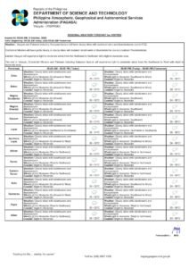
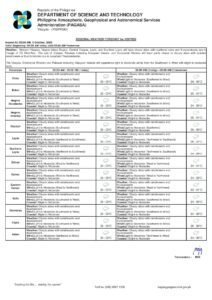
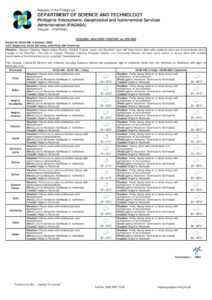
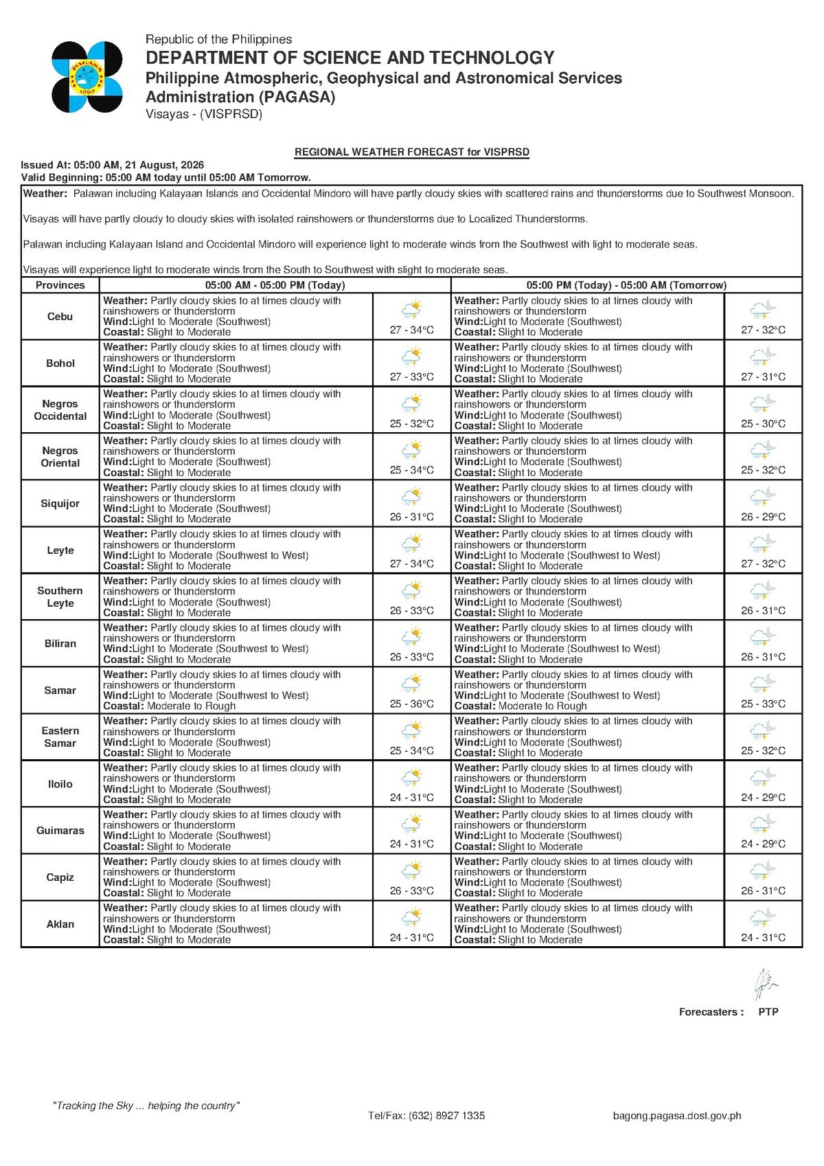
PAGASA’s 5:00 AM forecast for Friday, August 21, 2026 describes partly cloudy to at times cloudy conditions over the Visayas, including Negros Oriental, with rainshowers and thunderstorms expected throughout the day. The weather bureau placed temperature ranges between a low of 27°C and a high of 34°C. Winds are blowing in from the southwest at light to moderate speeds, and coastal waters have been classified as slight to moderate.
These conditions are not a one-day event. According to PAGASA’s extended outlook, issued at 9:00 AM on August 20, 2026, similar weather — including the same temperature band, southwest wind direction, and coastal sea classification — is projected to continue into the days ahead.
The Weather Driver: Southwest Monsoon (Habagat)
While PAGASA’s raw regional data does not name a specific weather disturbance, the southwest wind pattern is the unmistakable signature of the habagat, or southwest monsoon — the dominant wind system over the Philippines from roughly June through September. The habagat draws warm, moisture-saturated air from the southwest across the archipelago, producing the characteristic cycle of partially clear mornings followed by afternoon cloud buildup, heavy showers, and thunderstorm activity that defines the Philippine wet season.
According to the PAGASA forecast, residents should not be misled by a relatively dry morning. The habagat pattern frequently produces deceptive conditions in the early hours that deteriorate sharply by midday or mid-afternoon. Rainfall can be sudden, intense, and localized — making advance preparation important even if skies appear manageable at sunrise.
Coverage: Negros Oriental Urban Centers and Siquijor
All major urban centers in Negros Oriental — Dumaguete City, Bayawan City, Bais City, and Guihulngan City — fall within the same regional forecast zone and will be subject to the same conditions of rainshowers and possible thunderstorms. The island of Siquijor, which sits just off Negros Oriental’s southern tip and is connected to Dumaguete by regular ferry services, is likewise under the same forecast.
Neighboring Visayas provinces, including Cebu, are also covered by the same PAGASA regional forecast. Inter-island conditions will therefore be broadly similar across the central Philippines throughout the day.
Despite the rainy outlook, temperatures reaching up to 34°C combined with high wet-season humidity will still produce muggy, uncomfortable conditions during any dry breaks between rain episodes. Staying hydrated and avoiding prolonged exposure during midday heat remain advisable, the PAGASA forecast conditions suggest.
Coastal Waters and Sea Conditions
PAGASA has classified coastal waters as slight to moderate for Friday. In practical terms, slight seas feature small waves of up to approximately half a meter — generally manageable for larger vessels but still worth monitoring for small outrigger boats and bancas. Moderate seas, with wave heights of one to two meters, are within the operating range of larger ferries and cargo ships but represent genuinely challenging and potentially hazardous conditions for small wooden fishing craft.
As of the 5:00 AM Friday forecast, PAGASA had issued no gale warning. However, the weather bureau noted that southwest winds at light to moderate speeds, combined with moderate seas, can shift rapidly — especially in the wake of a thunderstorm, when localized squalls may temporarily intensify both wind and wave conditions.
Guidance by Sector
Ferry Passengers and Inter-Island Travelers
Passengers booked on routes out of Dumaguete’s Sibulan port — including services to Siquijor, Tagbilaran in Bohol, and Cebu — are advised to confirm departure status directly with their ferry operators before heading to the port. While no gale warning is in effect as of this forecast, slight-to-moderate seas can still cause rougher crossings, schedule delays, or operator-initiated cancellations. Arriving early and maintaining a flexible timetable is prudent, particularly for non-urgent travel.
Fisherfolk and Small Vessel Operators
Small fishing boats and bancas operating from coastal areas around Dumaguete, Bayawan, Bais, and other coastal barangays in the province face elevated risk. According to PAGASA’s sea condition classification, moderate seas combined with the possibility of thunderstorm-driven squalls warrant extra caution. The weather bureau’s advisories consistently recommend that small vessel operators stay near shore or remain in port when these combined conditions are present, and that no one put to sea during an active thunderstorm.
Farmers in the Interior
Agricultural communities in the upland and interior areas of Negros Oriental — including those in Guihulngan, La Libertad, and Vallehermoso — can expect intermittent rainfall throughout the day. PAGASA’s wet-season forecasts note that while rain is broadly beneficial for standing crops, farmers should avoid open-field work during active thunderstorm periods, especially when lightning is present. Harvested produce, seedlings, and farming equipment should be secured against sudden, heavy downpours.
Students, Parents, and Daily Commuters
Parents of school-age children in Dumaguete and surrounding towns should send their children with rain gear — umbrellas, raincoats, or waterproof bags — especially in preparation for the afternoon dismissal period, when wet-season showers are often most intense. Commuters on motorcycles and tricycles using provincial roads should reduce speed on wet road surfaces. Low-lying roads and areas near drainage channels are susceptible to flash flooding during heavy rain events, and the public is urged to remain alert.
Outdoor Workers and Event Organizers
Construction workers, road crews, market vendors, and organizers of community events scheduled for Friday should incorporate weather contingencies into their planning. PAGASA’s forecast of partly cloudy to cloudy skies with rainshowers means usable weather windows will occur but cannot be guaranteed to last throughout the day. Anyone overseeing an outdoor event in Negros Oriental this Friday should have a covered backup venue or a contingency plan ready to activate on short notice.
What to Expect Over the Weekend
PAGASA’s extended weather outlook, released on the morning of August 20, 2026, indicates that the current pattern is unlikely to break over the near term. Southwest winds are projected to remain at light to moderate speeds, temperatures are expected to hold in the 27°C to 34°C band, and coastal sea conditions will continue at slight to moderate levels. The weather bureau recommends that residents across the region monitor its daily forecasts for any developments, particularly in the event that a stronger weather system enters the area.
By the Numbers
- 5:00 AM — Time PAGASA issued the Friday regional forecast
- 27°C — Forecast minimum temperature for Negros Oriental and the Visayas on Friday
- 34°C — Forecast maximum temperature for the same area
- ~0.5 meters — Maximum wave height under “slight” coastal sea classification
- 1–2 meters — Wave height range under “moderate” coastal sea classification
- August 20, 2026, 9:00 AM — Time PAGASA issued its extended weather outlook covering the coming days
Why This Matters
Rainshowers and thunderstorms across Negros Oriental on Friday directly affect daily movement, livelihood, and safety for tens of thousands of residents — from fisherfolk at sea and farmers in the field to students commuting to school and passengers relying on inter-island ferry routes. The classification of coastal waters as slight to moderate, while below gale-warning threshold, is a meaningful hazard for small vessel operators who form a significant part of the province’s coastal economy. With PAGASA projecting similar conditions to continue beyond Friday, the impact on agriculture, transport, and outdoor activity is expected to extend through the coming days.
Source: breakingnewsnegrosoriental.com / PAGASA regional forecast, August 21, 2026