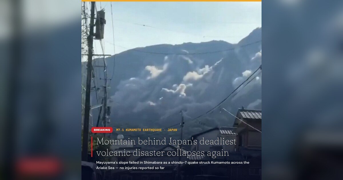
A mountain with one of the deadliest histories in Japanese geology shifted again on Tuesday afternoon, when a strong earthquake rattled southern Japan and sent debris cascading down a slope that had already shown signs of instability for months. The 7.1-magnitude tremor struck Kumamoto Prefecture at 4:27 p.m. local time (3:27 p.m. Philippine time), triggering a partial collapse of Mayuyama in Shimabara, Nagasaki — the same volcanic flank that crumbled into the sea in 1792 and generated a tsunami that killed approximately 15,000 people.
The Japan Meteorological Agency (JMA) placed the earthquake’s epicenter roughly five kilometers east of Uto City at a depth of about 10 kilometers. The United States Geological Survey conducted its own independent measurement and put the magnitude at 6.8, slightly lower than the JMA’s assessment.
Highest Shaking Intensity Recorded in Two Locations
According to the JMA, the earthquake produced a maximum seismic intensity of 7 — the top rating on Japan’s shindo scale — in Uki City and Hikawa Town. That level of shaking is severe enough to topple reinforced structures, make it impossible for people to move on foot, and cause cascading infrastructure failures across wide areas.
Prime Minister Sanae Takaichi confirmed that injuries had been recorded and reported fires, power outages, building collapses, and damage to roads and bridges throughout the affected zone.
Eastern Face of Mayuyama Gives Way Near Shimabara City
The slope failure at Mayuyama — specifically the eastern, city-facing side of the mountain — was captured on monitoring cameras and confirmed by Shimabara City officials, according to Nagasaki broadcasters KTN and NBC. Firefighters on the ground witnessed the collapse as it happened, and videos recorded by local residents showed white plumes of debris rushing down the mountainside while emergency alerts blared across the city.
As of Tuesday evening, no casualties directly from the collapse had been reported. Nagasaki Prefecture deployed a disaster helicopter at 5:12 p.m. to conduct an aerial survey of Mayuyama. Officials stated that no unusual activity was detected at the nearby Fugendake lava dome on Mount Unzen.
Warning Signs Had Been Building Since April
Tuesday’s collapse did not occur without warning. Shimabara City had already documented surface peeling on Mayuyama’s slopes following a notable earthquake in April. That existing damage was further aggravated when heavy rains struck in June, prompting city authorities to bring in specialists for a formal inspection of the mountain.
The 7.1-magnitude earthquake on Tuesday appears to have been enough to push the compromised slope beyond its structural limits, though authorities are still working to fully assess the extent of the collapse.
More Than 150,000 Residents Ordered to Evacuate
Prime Minister Takaichi’s office reported that more than 150,000 people were directed to move to evacuation centers in the wake of the earthquake. Around 40,000 homes in the affected area lost electrical power.
NHK footage broadcast after the event showed burning structures, collapsed buildings, large fissures along an elevated expressway, and a freight train that had derailed. Expressway overpasses in Yatsushiro suffered major damage, and a section of a bridge in the same city came down. Chipmaker TSMC ordered workers to evacuate its plant in the area, while Sony announced it was assessing its facilities for potential damage.
Tsunami Alert Raised and Lifted; Shelters Activated
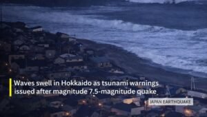
The JMA issued a tsunami warning covering the Ariake and Yatsushiro Seas, with projections of waves up to one meter. That warning was subsequently lifted. In Nagasaki Prefecture, Minamishimabara registered a seismic intensity of 5-strong, issued a Level 4 evacuation order, and opened eight emergency shelters. Shimabara City opened an additional seven shelters to accommodate displaced residents.
JR Kyushu halted operations on its conventional rail lines and suspended Nishi-Kyushu Shinkansen service as a precautionary measure in the aftermath of the quake.
The 1792 Precedent That Tuesday’s Event Echoes
Mayuyama’s collapse in May 1792 remains the most lethal volcanic-related disaster in Japanese recorded history. During an eruption sequence at Mount Unzen, a series of earthquakes caused the mountain’s flank to break away and plunge into the Ariake Sea, generating a tsunami that devastated coastal communities in what is now Kumamoto Prefecture. The calamity is remembered through the Japanese phrase “Shimabara erupted, Higo affected” — a reference to the cross-bay reach of the destruction, which claimed around 15,000 lives on both shorelines.
Tuesday’s earthquake inverted that historical geography in a notable way: rather than seismic activity originating on the Shimabara side and sending destruction toward Kumamoto, it was a Kumamoto-area earthquake that once again destabilized the same mountain across the bay.
JMA Links Epicenter to Region Near 2016 Hinagu Fault Zone
The JMA noted that Tuesday’s epicenter is located approximately 20 kilometers from the Hinagu fault zone, the same fault system responsible for the April 2016 Kumamoto earthquake sequence, which killed more than 270 people. However, JMA officials cautioned that it was premature to establish a definitive connection between Tuesday’s event and that earlier seismic series.
The agency also warned residents across the region to remain on high alert for powerful aftershocks and an elevated risk of landslides for approximately one week following the main shock.
By the Numbers
- 7.1 — earthquake magnitude recorded by the Japan Meteorological Agency
- 6.8 — magnitude independently measured by the United States Geological Survey
- 7 — maximum seismic intensity (shindo scale peak) registered in Uki City and Hikawa Town
- 10 km — depth at which the earthquake’s epicenter was located
- 150,000+ — residents ordered to relocate to evacuation centers
- 40,000 — households that lost power following the quake
- ~15,000 — people killed in the original 1792 Mayuyama collapse and resulting tsunami
- 270+ — fatalities recorded during the April 2016 Kumamoto earthquake sequence
- 20 km — approximate distance between Tuesday’s epicenter and the Hinagu fault zone
- 5:12 p.m. — time Nagasaki Prefecture dispatched an aerial survey helicopter to assess Mayuyama
Why This Matters
Tuesday’s earthquake ranks among the strongest to strike the Kumamoto region since the catastrophic 2016 sequence, with peak shaking reaching Japan’s highest intensity rating and the disaster prompting the evacuation of more than 150,000 people. The partial collapse of Mayuyama is especially concerning because the slope had already been structurally weakened by prior seismic activity and rainfall, and the JMA has warned that landslide risk will remain elevated for roughly a week — leaving an unknown volume of unstable material on a mountainside overlooking a populated city. The event further underscores the sustained seismic vulnerability of the Kyushu region, where active fault systems and a history of catastrophic volcanic and earthquake events continue to pose direct risks to densely settled communities and major industrial facilities alike.
Source: Breaking News Negros Oriental / Originally reported by wire reports