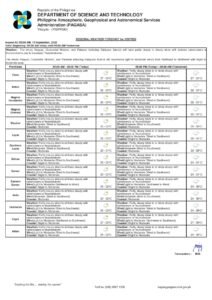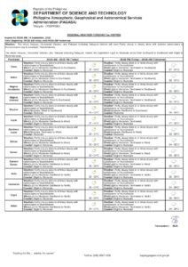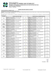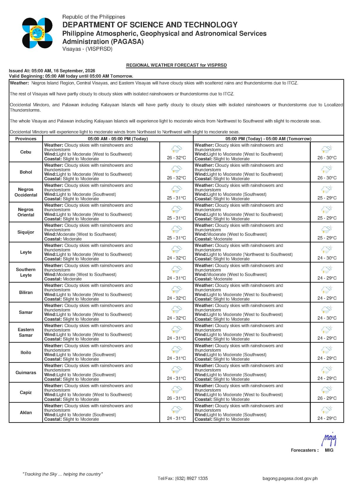
DUMAGUETE CITY, Negros Oriental — September 16, 2026 — The Philippine Atmospheric, Geophysical and Astronomical Services Administration (PAGASA) has placed the entire Visayas region under a wet weather advisory for Wednesday, with cloudy skies, rainshowers, and active thunderstorms expected to persist throughout the day. The bulletin, released at 5:00 AM on September 16, 2026, covers communities across Negros Oriental — from Guihulngan in the north down to Bayawan in the south — and extends to the island province of Siquijor.
Wednesday’s Forecast at a Glance
According to PAGASA’s early morning bulletin, Wednesday will be a consistently overcast day with no significant dry windows anticipated. The agency’s forecast specifically calls for cloudy skies with rainshowers and thunderstorms, meaning rainfall may arrive in sudden, intense bursts at any point during the day. Lightning activity is a real concern, particularly during the more intense thunderstorm episodes.
PAGASA reported that temperatures will range between a low of 26°C and a high of 32°C — somewhat cooler than typical for mid-September, as the heavy cloud cover limits daytime heating. Winds are described as light to moderate, blowing from the west to southwest direction, while coastal wave conditions are classified as slight to moderate.
By the Numbers
- Forecast low temperature: 26°C
- Forecast high temperature: 32°C
- PAGASA bulletin time: 5:00 AM, September 16, 2026
- Extended outlook issued: 9:00 AM, September 15, 2026
- Extended outlook temperature range (Wednesday–Thursday): 26°C to 33°C
The Weather Driver: Habagat Season at Its Peak
The west-to-southwest wind direction identified in PAGASA’s bulletin is a hallmark of the habagat, or southwest monsoon — the seasonal wind system that draws warm, moisture-heavy air from the South China Sea and Sulu Sea across the Philippine archipelago from approximately June through October. PAGASA’s data indicates that this monsoon airflow, when it makes contact with the Philippine landmass and interacts with local atmospheric conditions, generates the widespread cloudiness and persistent wet weather that Negros Oriental and the broader Visayas are experiencing.
September falls squarely in the heart of the habagat season, and the pattern PAGASA is forecasting for today is entirely consistent with what the region typically sees during this period.
What “Slight to Moderate” Seas Actually Mean
PAGASA’s classification of coastal conditions as slight to moderate deserves careful interpretation. In practical terms, wave heights under this category are elevated enough to cause smaller watercraft — including the motorized outriggers and bancas widely used by fishing communities in Negros Oriental — to rock substantially and potentially ship water. Larger commercial passenger vessels are not typically suspended at this level, but the classification does not imply safe conditions for small boats.
Fisherfolk operating along the coasts of Dumaguete, Bais, Bayawan, and throughout Siquijor’s shoreline communities are advised to assess actual conditions at the water’s edge before setting out. According to PAGASA, no gale warning has been issued for this period, but conditions remain unsettled and can shift rapidly once thunderstorm activity intensifies.
Inter-Island and Ferry Travel Considerations
Passengers with planned crossings on routes such as Dumaguete to Siquijor or connections toward Cebu should check directly with their ferry operators — including OceanJet, Montenegro Lines, and other fast craft services — before proceeding to the port. PAGASA has not issued a vessel suspension advisory in today’s available data; however, slight to moderate seas combined with active thunderstorm conditions can prompt individual operators to make last-minute adjustments based on real-time sea state readings.
Travellers should allow additional time at the terminal, keep important documents and electronics in waterproof bags, and avoid boarding any vessel that appears overcrowded or poorly maintained, particularly when weather conditions are unsettled.
Guidance for Key Sectors
Agricultural Communities
Farmers across Negros Oriental’s interior municipalities — those working sugarcane, vegetable, and root crop lands — will find today’s rainfall a mixed blessing. While crops benefit from moisture, the heavy bursts associated with thunderstorm episodes can flatten standing crops, damage flowering plants, and waterlog low-lying fields. PAGASA’s forecast makes it inadvisable to apply pesticides or fertilisers today, as rain will wash these off before absorption occurs. Farmers should also watch for rapid runoff on hillside or sloped agricultural land.
Fisherfolk and Boat Operators
The concurrent presence of slight-to-moderate seas and active thunderstorms creates a compounded hazard for anyone working on the water. PAGASA and safety protocols consistently emphasise that lightning poses a direct, lethal threat to individuals on open water during a thunderstorm. Small-boat operators from Siquijor, Bais Bay, and the Bayawan coastline are strongly urged to avoid open-water operations whenever thunderstorm activity is visible or audible. If thunder can be heard, the lightning hazard is immediate — return to shore without delay.
Students, Parents, and Schools
Parents preparing children for school should ensure they carry raincoats or umbrellas, as downpours may be sudden and unpredictable throughout the day. Schools scheduled to hold outdoor events — including flag ceremonies, sports activities, or open-air programmes — should have indoor backup venues prepared. Monitor official school communications for any weather-related schedule changes as the day progresses.
Commuters and Outdoor Workers
Motorcycle riders — one of the most common modes of transport across Negros Oriental — face heightened risk on rain-slicked roads today. Reduced speed, greater following distance, and avoidance of flooded road sections are essential precautions. Outdoor workers in construction, road maintenance, or related fields should observe standard lightning safety protocols: seek shelter inside a sturdy building or a hard-topped vehicle at the first sound of thunder, and wait a minimum of 30 minutes after the last thunderclap before resuming work outdoors.
Extended Outlook: Unsettled Pattern Continues Into Thursday
According to PAGASA’s extended weather outlook issued at 9:00 AM on September 15, 2026, the unsettled conditions affecting Negros Oriental and the Visayas are not expected to clear quickly. The agency’s projections indicate that similar weather — light to moderate west-to-southwest winds, slight to moderate coastal conditions, and a temperature range of 26°C to 33°C — will persist through at least Thursday.
Residents and businesses planning outdoor activities, farm operations, or sea travel later in the week should factor in the likelihood of continued cloud cover and intermittent rain, as PAGASA’s data suggests no significant improvement in the near-term weather outlook for the region.
Safety Reminder
PAGASA’s overarching advisory for September 16, 2026 is clear: rain and thunderstorms are expected to affect Negros Oriental and the wider Visayas throughout the day. The most critical safety action for any resident today is to stay away from open water and exposed outdoor areas whenever active thunderstorm conditions are present. If thunder is audible, immediate shelter should be sought — and maintained until at least 30 minutes have passed since the last thunderclap.
Why This Matters
PAGASA’s September 16 forecast signals a full day of weather disruption for Negros Oriental and the Visayas, directly affecting livelihoods in agriculture, fishing, and inter-island transport at the height of the southwest monsoon season. The combined threat of thunderstorms and elevated coastal wave conditions poses genuine safety risks for small-boat operators and outdoor workers who may underestimate changing conditions. With the extended outlook showing no break through Thursday, communities across the region must sustain precautionary measures over multiple days rather than treating this as an isolated weather event.
Source: Breaking News Negros Oriental (breakingnewsnegrosoriental.com)