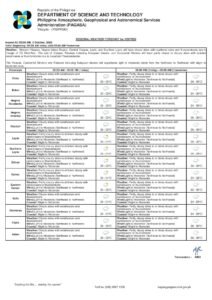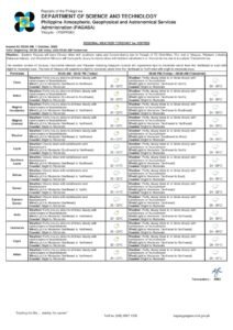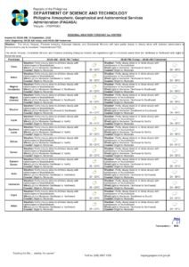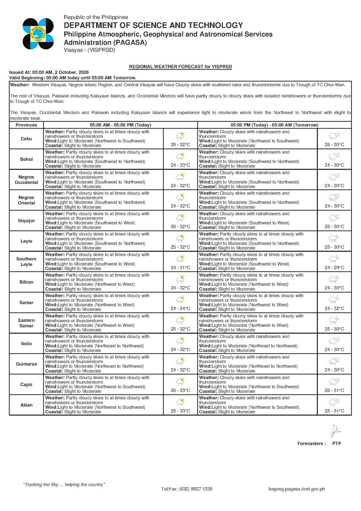
DUMAGUETE CITY, Negros Oriental — PAGASA’s 5:00 AM regional bulletin for October 2, 2026 places Negros Oriental, Siquijor, and the rest of the Visayas under a forecast of cloudy skies, rainshowers, and thunderstorms throughout the day, with temperatures staying between 26°C and 30°C.
From fishing communities along Tambobo Bay to ferry passengers bound for Siquijor, and from upland farmers in Zamboanguita to students in Dumaguete and Guihulngan, the day calls for extra preparation before stepping outside.
Weather Pattern Behind the Rain
According to PAGASA, no specific weather system — such as a tropical cyclone, low-pressure area, or named monsoon — has been identified as the cause of today’s conditions in the issued bulletin. What the agency confirms is a broad Visayas-wide pattern of cloudiness and rain accompanied by light to moderate winds blowing from the northwest to southwest.
PAGASA notes this directional wind pattern is consistent with the transitional atmospheric conditions typical of October in the central Philippines, when the country shifts between the tail end of the southwest monsoon season and the early onset of the northeast monsoon. Residents are advised to monitor the official PAGASA website for any updated bulletins identifying a specific weather driver.
Friday Forecast Conditions at a Glance
The following conditions were detailed in PAGASA’s regional forecast issued at 5:00 AM on October 2, 2026, covering Negros Oriental and surrounding Visayas provinces:
- Sky condition: Cloudy with rainshowers and thunderstorms
- Temperature range: 26°C (low) to 30°C (high)
- Wind speed: Light to moderate
- Wind direction: Northwest to Southwest
- Coastal water condition: Slight to moderate
In practical terms, PAGASA’s forecast points to gray skies for most of the day, with rainfall arriving in bursts rather than as a continuous drizzle. The specific mention of thunderstorms means brief but intense downpours with lightning are possible at any hour. A temperature ceiling of 30°C suggests the cloud cover and rain are moderating what would otherwise be a warmer day.
For Siquijor island — located south of Negros Oriental across the Tañon Strait and Bohol Sea — the same Visayas-wide forecast applies. Communities in Siquijor town, Larena, and Lazi should also expect intermittent rain and the possibility of thunderstorms during the day.
By the Numbers
- 5:00 AM — time of PAGASA’s main regional forecast bulletin, October 2, 2026
- 26°C to 30°C — temperature range in the 5:00 AM bulletin for October 2
- 27°C to 33°C — temperature range in PAGASA’s extended outlook for October 2
- 26°C to 32°C — temperature range recorded for Thursday, October 1
- 0.5–1.25 meters — wave height range for slight seas
- 1.25–2.5 meters — wave height range for moderate seas
- 9:00 AM, October 1, 2026 — time of PAGASA’s extended weather outlook issuance
Multi-Day Outlook From PAGASA
PAGASA’s extended weather outlook, issued at 9:00 AM on October 1, 2026, covers conditions leading into and through Friday:
Thursday, October 1 (now passed): Partly cloudy to at times cloudy skies, with rainshowers or thunderstorms possible. Temperatures ranged from 26°C to 32°C, with light to moderate winds from the northwest to northeast, and slight to moderate coastal conditions.
Friday, October 2 (today): The extended outlook confirms an unsettled pattern continuing, with temperatures projected at 27°C to 33°C — a slightly warmer range than what the 5:00 AM morning bulletin shows — and winds from the northwest to southwest. Coastal sea conditions remain slight to moderate.
PAGASA notes that the 5:00 AM regional bulletin is the most current and operationally authoritative forecast, while the extended outlook serves as a broader multi-day trend guide. Both forecasts agree that rain and thunderstorms remain in the picture for the Visayas through this period.
Coastal Waters: What “Slight to Moderate” Means
PAGASA classifies today’s coastal sea conditions around Negros Oriental — including the Tañon Strait between Negros and Cebu, and the sea passages toward Siquijor and Bohol — as slight to moderate.
Slight seas refer to wave heights of roughly 0.5 to 1.25 meters. These conditions are generally manageable for larger vessels but can already be uncomfortable and risky for very small bancas and non-motorised outrigger craft.
Moderate seas refer to wave heights that can reach approximately 1.25 to 2.5 meters. At this level, small fishing boats face genuine hazard, particularly if thunderstorm activity temporarily intensifies winds beyond their usual light-to-moderate range.
As of the current PAGASA bulletin, no formal gale warning has been issued for these waters — a reassuring signal for inter-island ferry operators. Nevertheless, PAGASA advises mariners to remain alert, as the combination of moderate seas and active thunderstorms means conditions can deteriorate with little advance warning.
Guidance by Sector
Fisherfolk and Small-Boat Operators
Those operating small bancas or outrigger boats — whether departing from the Dumaguete City port area, the Sibulan landing, Tampi in Amlan, or the fishing villages of Bayawan and Basay — should exercise heightened caution today. PAGASA has not issued a gale warning, but slight to moderate seas combined with active thunderstorm potential mean sea conditions can shift quickly. Sudden strong gusts accompanying thunderstorms carry the risk of swamping or capsizing small craft. If dark clouds are observed building and thunder is heard, mariners are urged to return to shore immediately and wait for the storm to fully pass before resuming activity.
Ferry Passengers and Inter-Island Travelers
Those planning to travel by ferry or fast craft — including routes between Dumaguete and Siquijor, Dumaguete and Cebu, or Dumaguete and Bohol — should confirm sailing schedules with their shipping line before proceeding to the port. Larger vessels are generally rated to operate under moderate sea conditions, but PAGASA’s forecast of active thunderstorms means the Philippine Coast Guard or individual operators may delay or cancel sailings at their discretion. Travelers are advised to allow extra time, carry rain gear, and verify their vessel’s sailing status via the operator’s hotline or directly at the terminal.
Farmers Across Negros Oriental
Agricultural communities — including sugarcane farmers in the lowlands of La Libertad and Bindoy, and vegetable growers in the upland barangays of Zamboanguita and Siaton — may find today’s intermittent rainfall beneficial for moisture-hungry crops during early October. However, PAGASA’s thunderstorm forecast also brings the risk of localised flooding in low-lying farm areas and lightning danger for workers in open fields. Farmers are advised to avoid open-field work during active thunderstorm episodes, seek shelter in a sturdy structure — not under trees or inside open farm sheds — and wait a minimum of 30 minutes after the last thunderclap before resuming outdoor activities.
Students, Commuters, and Parents
Rainfall is expected to be intermittent rather than sustained throughout the day, which means dry intervals are likely. However, PAGASA’s thunderstorm forecast means sudden heavy downpours remain possible at any point. Students and parents in Dumaguete, Bais, Guihulngan, and other municipalities are advised to carry umbrellas or raincoats. Parents monitoring school schedules should watch for any local government announcements on class suspensions, as no weather warning affecting school operations had been issued as of the latest available PAGASA bulletin.
Source: Breaking News Negros Oriental (breakingnewsnegrosoriental.com)