DUMAGUETE CITY, Negros Oriental — July 9, 2026: The southwest monsoon is firmly in charge of the weather across Negros Oriental today, with the Philippine Atmospheric, Geophysical and Astronomical Services Administration (PAGASA) issuing a forecast of rainshowers, thunderstorms, and moderate to rough coastal conditions that will affect everyone from fisherfolk in Bais to ferry passengers bound for Siquijor or Cebu, and farmers working the upland fields of Guihulngan and Bayawan.
PAGASA’s Official Forecast for Today
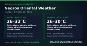
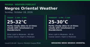
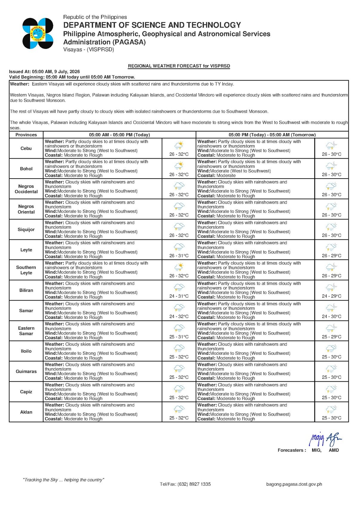
The PAGASA Visayas Regional Forecast, released at 5:00 AM on July 9, 2026, paints a picture of unsettled conditions throughout the day. The agency describes skies as partly cloudy to at times cloudy, with rainshowers and thunderstorms expected to occur at various intervals. Temperature readings are projected to swing between a minimum of 26°C and a maximum of 32°C. Winds are blowing in from the west to southwest at moderate to strong speeds, and coastal waters have been classified as moderate to rough.
A separate Extended Weather Outlook issued by PAGASA at 9:00 AM on July 8, 2026 further indicates that these unsettled conditions are not a one-day event. The agency projects that Wednesday and Thursday will bring more of the same — westerly to southwesterly winds of moderate strength, comparable temperature ranges of 25°C to 32°C, and continued rough coastal swell. No significant easing of conditions is expected before the week’s end.
The Southwest Monsoon at Work
The weather driver behind today’s forecast is the habagat, or southwest monsoon — the dominant wind system of the Philippine rainy season. According to PAGASA’s analysis, winds blowing consistently from the west to southwest are pushing warm, moisture-saturated air masses from the South China Sea and Sulu Sea across the archipelago. When the habagat is active at moderate to strong intensity, it reliably generates cloudiness, periodic rainshowers, and the kind of afternoon and evening thunderstorms that residents of the Visayas know well from June through September.
Importantly, PAGASA has not linked today’s conditions to any active tropical cyclone. There is no named storm currently threatening Negros Oriental. The active southwest monsoon alone is sufficient to produce hazardous coastal conditions and trigger sudden, intense downpours — particularly as afternoon heat destabilizes the atmosphere and thunderstorm cells develop over land and water alike.
Conditions Across the Province and Nearby Islands
The forecast covers Negros Oriental in its entirety — from the provincial capital Dumaguete in the south, through the coastal cities of Bais and Guihulngan in the north, to the agricultural lowlands and highlands around Bayawan in the southwest. Mornings may offer brief, relatively dry windows, but PAGASA’s forecast makes clear that conditions will deteriorate as the day advances, with thunderstorm risk rising through the afternoon and into evening hours.
The same forecast envelope extends to neighboring island provinces. Siquijor, separated from Negros Oriental by the Tanon Strait, and Cebu to the north are both under the same broad advisory — partly cloudy to cloudy skies, intermittent rainshowers or thunderstorms, and moderate to rough coastal waters. Anyone planning inter-island travel today must treat weather conditions as a serious variable in their itinerary.
Understanding the Coastal Hazard Warning
PAGASA’s classification of coastal waters as “moderate to rough” carries real consequences for maritime activity. Wave heights under this classification are elevated enough to pose serious risk to small, non-motorized watercraft, and can challenge even smaller motorized vessels. Fisherfolk and small boat operators along the coasts of Dumaguete, Bais, Bayawan, and Guihulngan — including those who regularly work the waters between Negros Oriental and Siquijor — are strongly advised by PAGASA’s forecast to exercise extreme caution before departing.
For those whose vessels are small or whose crews lack experience navigating rough-water conditions, the prudent course is to remain ashore until seas improve. Coast guard units and barangay officials along the coast are available for consultation and should be the first point of contact for any fisherfolk uncertain about conditions in their specific waters.
Inter-island ferry passengers traveling between Dumaguete and Cebu, Siquijor, or other Visayas ports should prepare for possible delays, schedule adjustments, or cancellations. Shipping lines routinely modify operations based on coast guard advisories during moderate to rough sea conditions. Passengers are advised to contact their shipping line directly or monitor official social media channels before proceeding to the port terminal.
Guidance for Different Sectors
Daily Commuters and Urban Residents
Thunderstorms can build rapidly and produce intense, short-duration downpours that overwhelm drainage in low-lying urban areas. Commuters in Dumaguete and other town centers should keep rain gear readily accessible, avoid low-lying roads and drainage channels during heavy rain bursts, and build extra time into their schedules — especially for afternoon travel when thunderstorm activity characteristically peaks.
Agricultural Communities
Farmers in Bayawan, Guihulngan, and upland municipalities face a mixed day. While the seasonal rainfall supports crop growth, the strong wind gusts that accompany active thunderstorm cells can damage standing corn, vegetables, and other vulnerable crops. PAGASA’s forecast warrants securing loose structures and materials on farm properties. Those farming near river systems or flood-prone lowlands should keep a close eye on local water levels if rainfall becomes prolonged or particularly heavy.
Students, Schools, and Parents
PAGASA itself does not carry the authority to suspend classes — that responsibility lies with local government units. However, the agency’s forecast of thunderstorms and moderate to strong winds is a signal for school administrators, particularly in coastal and low-lying areas, to remain watchful. Parents are urged to follow announcements from their city or municipal government throughout the day. Should thunderstorms intensify during dismissal hours, students and staff are safest sheltering in place until conditions ease.
Outdoor and Construction Workers
Workers in exposed or elevated outdoor environments face compounded risk today. The combination of moderate to strong westerly winds and the probability of thunderstorms creates conditions where a sudden gust or downpour can be genuinely dangerous for anyone on scaffolding, rooftops, or open terrain. Scheduling outdoor tasks for morning hours, before afternoon thunderstorm risk peaks, and having a clear, pre-planned shelter route are practical precautions. Organizers of outdoor community events should watch for westward cloud build-up and increasing gusts — early warning signs of an approaching thunderstorm cell.
What the Next Two Days Hold
PAGASA’s extended outlook offers little relief for those hoping conditions will ease quickly. Through Wednesday and into Thursday, the agency projects continued moderate to strong southwest winds, persistent cloud cover with rainshowers and thunderstorms, and sustained coastal swell. Residents, businesses, and travelers dependent on outdoor activities or inter-island sea routes should plan for disruption to remain the baseline through at least the latter half of this week.
By the Numbers
- Forecast issued: 5:00 AM, July 9, 2026
- Minimum temperature: 26°C (July 9); 25°C (extended outlook)
- Maximum temperature: 32°C
- Extended outlook coverage: through Thursday, July 11, 2026
- Extended outlook reference bulletin issued: 9:00 AM, July 8, 2026
Why This Matters
The active southwest monsoon affecting Negros Oriental and the Visayas today poses documented risks to maritime safety, agricultural infrastructure, and daily mobility across the province — hazards that PAGASA has formally flagged through its official forecast bulletins. With moderate to rough seas persisting through at least Thursday, fishing communities and inter-island ferry passengers face sustained disruption to their livelihoods and travel plans. The absence of a typhoon does not diminish these risks; PAGASA’s data makes clear that monsoon-driven conditions alone are sufficient to endanger small vessels and trigger dangerous localized flooding.
Source: PAGASA Visayas Regional Forecast, July 9, 2026; originally reported by breakingnewsnegrosoriental.com