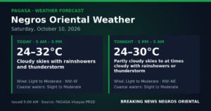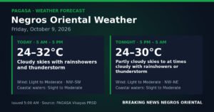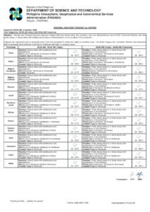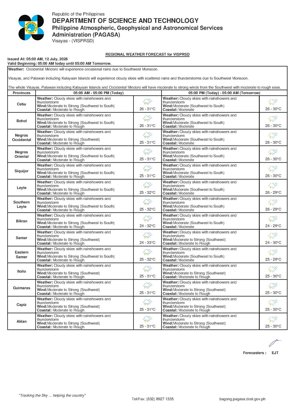
DUMAGUETE CITY, Negros Oriental — The southwest monsoon, locally called the habagat, is asserting itself forcefully across the Visayas this Sunday, July 12, 2026, bringing with it a combination of heavy cloud cover, intermittent thunderstorms, and coastal seas that range from moderate to rough. PAGASA issued its regional forecast at 5:00 AM, placing the entire province of Negros Oriental — from coastal Dumaguete down to Bayawan and northward through Bais and Guihulngan — as well as neighboring Siquijor Island squarely under unsettled and potentially hazardous weather conditions.
The Force Behind Today’s Weather
The culprit behind Sunday’s gloomy outlook, according to PAGASA, is the habagat — the seasonal southwest monsoon wind system that dominates Philippine weather during the middle months of the year. This weather pattern drives warm, moisture-heavy air in from the southwest, pushing it across open seas and into the elevated terrain of the Visayas. When that moisture-laden air rises over Negros Island’s interior ridges, it condenses rapidly, producing thick cloud banks, persistent showers, and electrical storms.
PAGASA’s forecast describes winds blowing from the southwest to south at moderate to strong speeds. The practical result of those wind directions is that Dumaguete City’s exposed western coastline and the eastern shores of Negros Island receive the full brunt of open-sea swells generated across the Visayan and Mindanao Seas. Think of the habagat as an atmospheric pump — continuously drawing moisture from warm tropical waters and releasing it as rain across the region throughout the day.
What Conditions Look Like Across the Province and Beyond
For residents of Negros Oriental, PAGASA’s 5:00 AM bulletin paints a consistent and unwelcoming picture for the day ahead. The agency’s forecast for the Visayas region includes the following conditions specific to the province and its neighbors:
- Sky: Overcast and cloudy throughout the day, with no meaningful clearing anticipated.
- Rainfall: Rainshowers and thunderstorms expected at multiple points — not a constant downpour, but recurring bouts of heavy rain that may arrive with little warning.
- Temperature range: Between 26°C and 31°C — warm and oppressively humid even during rain, with minimal overnight cooling.
- Wind direction and strength: Southwest to south, moderate to strong throughout the day.
- Coastal sea state: Moderate to rough — wave heights sufficient to pose real risks to small watercraft and discomfort even aboard larger passenger vessels.
Siquijor Island, lying across a channel that is especially vulnerable to southwest monsoon swells, faces the same forecast conditions as Negros Oriental. The southern coastlines of Cebu — the principal destination for many inter-island commuters and travelers from this province — are also under PAGASA’s Visayas-wide advisory, making the entire Dumaguete–Siquijor–Cebu maritime corridor a significant concern for Sunday travel.
Breaking Down “Moderate to Rough”: What Wave Heights Actually Mean
PAGASA’s use of the phrase moderate to rough carries specific technical meaning that residents and travelers should understand before making any decisions about sea travel. As defined by the agency’s marine weather standards:
Moderate seas correspond to wave heights of roughly 1.25 to 2.5 meters. At this level, even sizable roll-on/roll-off (RoRo) ferries will experience noticeable rolling, and small outrigger vessels — the traditional bangka common to Visayan coastal communities — face genuine difficulty maintaining safe navigation. Rough seas push wave heights higher still, to approximately 2.5 to 4 meters, creating genuinely dangerous conditions for any small craft and making for a deeply uncomfortable ride even aboard large passenger ships.
PAGASA’s bulletin underscores that passengers planning to board vessels on the Dumaguete–Siquijor, Dumaguete–Cebu, or Bais–Cebu routes should contact their respective shipping lines before proceeding to the pier. Operators such as OceanJet, Montenegro Lines, and Lite Shipping routinely suspend or delay scheduled departures once coastal conditions reach the rougher end of this spectrum. Travelers should not presume their booked sailing will depart as scheduled.
Practical Guidance for Different Sectors
Sea Travelers and Inter-Island Commuters
Sunday is traditionally a busy travel day, with many passengers returning from weekend trips or heading to Cebu for Monday work or school. PAGASA’s forecast of moderate to rough coastal seas and moderate to strong winds places the main inter-island routes from Negros Oriental at elevated risk of delay or cancellation. Call your shipping line, check official social media pages, and arrive at the port prepared for extended waiting times in wet conditions. Bring rain gear and waterproof bags for documents and electronics.
Fishing Communities and Small Boat Operators
PAGASA’s marine forecast is a clear advisory for fisherfolk operating out of Dumaguete, Bayawan, Bais, Guihulngan, Siaton, and Siquijor’s coastal communities to remain onshore today. Small motorized outriggers and traditional fishing bangka are not built to safely handle wave heights in the rough range. Small boat operators should suspend sea trips and monitor PAGASA’s updated marine bulletins for any sign of improving conditions before venturing out.
Farmers and Agricultural Workers
Recurring thunderstorms forecast for Sunday present a complex situation for Negros Oriental’s agricultural sector — including sugarcane and rice growers in the flatlands between Dumaguete and Bais, and vegetable farmers in upland communities near La Libertad and Guihulngan. While the habagat delivers much-needed soil moisture, persistent wet conditions heighten the risk of fungal crop diseases and limit field access. Agricultural workers should hold off on pesticide and fertilizer applications today, as rainfall will dilute and wash away any chemicals applied before they can be properly absorbed. Mature produce ready for harvest should be gathered now, ahead of worsening conditions.
Students, Parents, and School Communities
With intermittent thunderstorms possible at any hour throughout Sunday, families should prepare for wet morning commutes. Rain gear, waterproof school bags, and appropriate footwear are strongly advised. During heavy thunderstorm episodes, the safest course is to remain indoors, away from open windows, tall trees, and metal structures. Schools located in low-lying or flood-prone barangays should stay attentive to local government and NDRRMC advisories as the morning develops.
Outdoor Workers and Event Organizers
Construction crews, market vendors, and organizers of any outdoor gatherings scheduled for Sunday should treat today’s forecast as a firm signal to prepare shelter contingencies. Thunderstorms in particular can develop rapidly with little advance warning. Organizers of open-air events across the province and in Siquijor should activate backup arrangements, as extended outdoor activity is not advisable under today’s forecast.
The Days Ahead: Extended Outlook from PAGASA
According to PAGASA’s extended weather outlook issued at 9:00 AM on July 11, 2026, the unsettled pattern is not a one-day event. The agency’s multi-day projection indicates:
- The immediate days following Sunday: Temperatures between 26°C and 32°C, moderate to strong southwest winds, and moderate to rough coastal conditions continuing — broadly comparable to today’s situation.
- Further into next week: Temperatures between 25°C and 32°C, winds easing to light to moderate from the southwest to south, and coastal sea states improving to slight to moderate — indicating gradual improvement in sea conditions.
- Into the following days: Light to moderate winds with temperatures in the 26°C to 32°C range, suggesting the habagat may moderate somewhat, though the outlook data trails off before providing a full picture.
PAGASA’s extended forecast suggests the current intensity of the southwest monsoon will ease gradually as the week progresses toward next weekend. However, residents should not anticipate any dramatic break in the wet pattern in the near term. The habagat season still has weeks to run, and the overall wet and unsettled character of the coming days is expected to persist.
By the Numbers
- 5:00 AM — Time of PAGASA’s regional forecast for Sunday, July 12, 2026
- 26°C to 31°C — Temperature range forecast for Negros Oriental on Sunday
- 1.25 to 2.5 meters — Wave height range defining moderate seas
- 2.5 to 4 meters — Wave height range defining rough seas
- 26°C to 32°C — Temperature range in the extended outlook for succeeding days
- 9:00 AM, July 11, 2026 — Time the extended weather outlook was issued by PAGASA
Why This Matters
PAGASA’s forecast of moderate to rough seas and recurring thunderstorms across Negros Oriental on Sunday, July 12, 2026 poses direct risks to inter-island ferry operations, small-scale fishing livelihoods, and agricultural activity throughout the province — sectors that large numbers of residents depend on daily. The advisory that shipping operators including OceanJet, Montenegro Lines, and Lite Shipping may suspend sailings highlights the potential for significant disruption to commerce and travel across the Dumaguete–Siquijor–Cebu corridor. With PAGASA’s extended outlook indicating the unsettled pattern will persist through much of the coming week, communities across the province need to plan accordingly and monitor official updates regularly.
Source: breakingnewsnegrosoriental.com