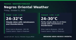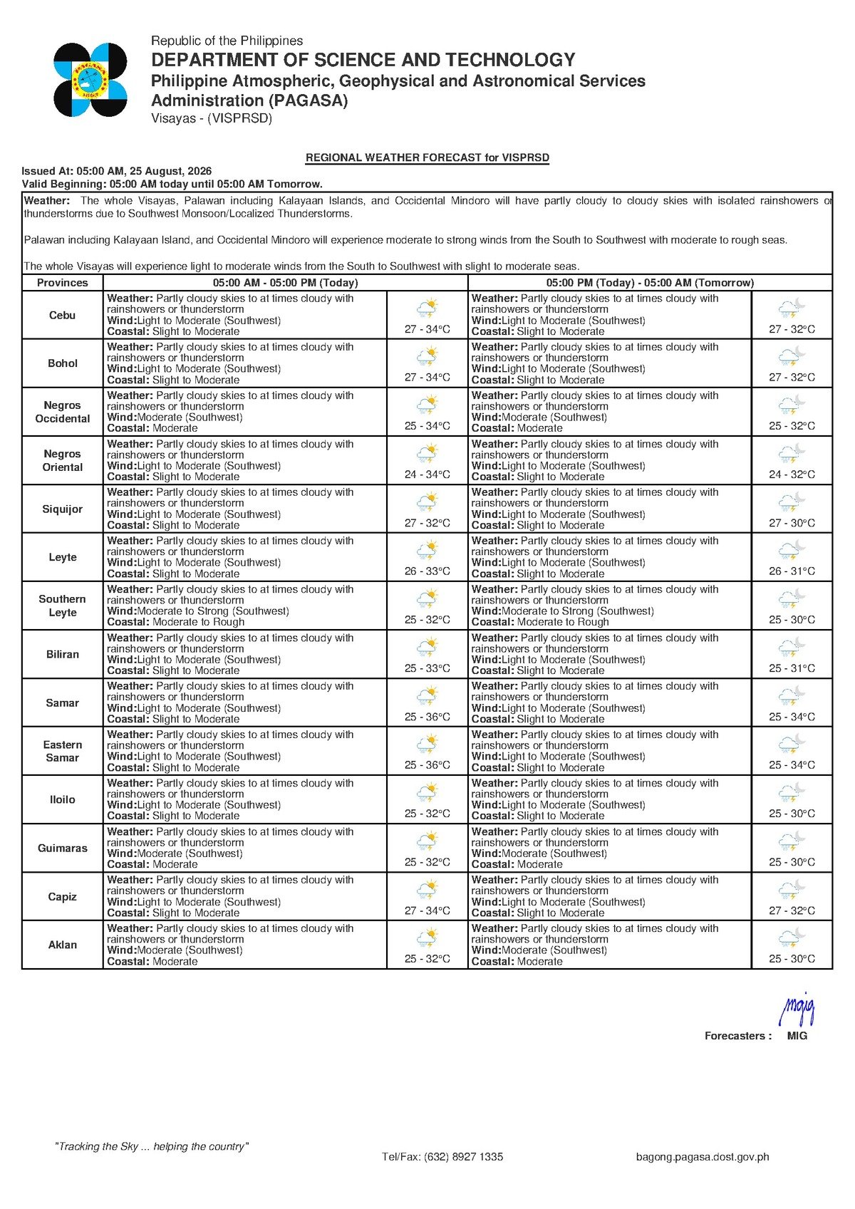
DUMAGUETE CITY — The Philippine Atmospheric, Geophysical and Astronomical Services Administration (PAGASA) has placed Negros Oriental under a thunderstorm advisory for Tuesday, August 25, 2026, warning that the southwest monsoon — known locally as habagat — will bring intermittent rainshowers and potentially intense afternoon thunderstorms across the province and the broader Visayas region. The forecast was released at 5:00 AM on August 25.
No tropical cyclone is currently threatening the area, PAGASA confirmed, but the agency cautioned that the absence of a formal storm signal does not eliminate weather-related risks. Thunderstorms spawned by the habagat can produce localized heavy downpours, strong gusty winds, and dangerous lightning strikes — even on days that begin with relatively clear skies.
The Force Behind Today’s Weather
According to PAGASA, winds blowing from the southwest are the primary driver of today’s unsettled conditions. The habagat is a seasonal wind system that draws warm, moisture-rich air northeastward across the Philippine archipelago during the mid-year period. When that moist air rises over land and collides with afternoon surface heat, it generates the kind of scattered convective storms that meteorologists are predicting for August 25.
This afternoon thunderstorm cycle is a well-established pattern for Negros Oriental during the latter half of the year. Mornings typically begin partly cloudy and warm, with conditions deteriorating through midday as heat builds. Showers or electrical storms tend to develop between early and late afternoon, then ease off toward evening. PAGASA’s advisory underscores that these storms can intensify rapidly even when early-morning skies appear calm.
Forecast Details for Negros Oriental and Neighboring Areas
PAGASA’s regional bulletin covers the entire Visayas, encompassing Negros Oriental — from the provincial capital of Dumaguete in the south, through Bais City along the central coast, to Guihulngan City in the north — as well as Siquijor, Cebu, Eastern Visayas, and Western Visayas provinces.
For Negros Oriental specifically, the weather agency’s forecast parameters are as follows:
- Sky condition: Partly cloudy to at times cloudy
- Precipitation: Rainshowers or thunderstorms expected
- Temperature range: 27°C (low) to 34°C (high)
- Wind speed: Light to moderate
- Wind direction: Southwest
- Coastal waters: Slight to moderate conditions
Siquijor, separated from southern Negros Oriental by the Tañon Strait, falls under the same regional forecast and can expect near-identical conditions. Cebu, situated to the northeast, is also covered by the advisory — though PAGASA’s data shows Cebu’s temperature ceiling reaching only 32°C, slightly lower than Negros Oriental’s projected high of 34°C.
By the Numbers
- 5:00 AM — Time the PAGASA forecast bulletin was issued on August 25
- 27°C to 34°C — Temperature range forecast for Negros Oriental
- 27°C to 32°C — Temperature range forecast for Cebu
- 0.5–1.25 meters — Typical wave height under “slight” sea conditions
- Up to 2.5 meters — Wave height possible under “moderate” sea conditions
- 30 minutes — Recommended wait time after the last thunderclap before resuming outdoor activity
- 9:00 AM, August 24, 2026 — Time of PAGASA’s extended weather outlook issuance
Warning Levels and What They Mean
PAGASA’s August 25 bulletin carries no active tropical cyclone wind signals — Signal No. 1 through Signal No. 5 — for Negros Oriental or any part of the Visayas. There is likewise no color-coded rainfall warning (yellow, orange, or red) cited in the regional forecast for this area as of the 5:00 AM issuance.
The weather agency is, however, flagging the likelihood of rainshowers and thunderstorms — a forecast category that, while not carrying a formal color-coded warning, still poses real hazards. PAGASA has consistently advised the public that thunderstorm activity in the Philippines can produce localized flooding, high winds, and deadly lightning, particularly in low-lying and coastal communities.
Regarding coastal and marine conditions, PAGASA’s classification of “slight to moderate” seas means larger commercial vessels can generally operate safely, but small open boats and motorized bancas face elevated risk. The weather agency advises all small watercraft operators to consult the latest marine advisories before departure and to seek shelter immediately if a squall develops while at sea.
Practical Guidance by Activity and Sector
Residents and Commuters in Dumaguete, Bais, and Bayawan
PAGASA’s forecast pattern suggests mornings will be workable but afternoons carry significant risk of sudden, intense rainfall. Anyone with outdoor obligations — school runs, market trips, or business errands — is advised to complete them before midday. Carrying an umbrella or waterproof jacket is strongly recommended. Parents of school-age children should prepare rain gear in advance of afternoon dismissal, which typically falls within the peak thunderstorm window under habagat conditions.
Fisherfolk and Small Boat Operators
Those operating small motorized bancas along the coasts of Dumaguete, Bais, and Guihulngan, as well as around Siquijor, should exercise heightened caution given the slight to moderate sea state reported by PAGASA. The combination of gusty winds and choppy waters during an afternoon squall can be extremely dangerous for small open watercraft. The weather agency recommends checking the most current coastal and marine advisories before heading out, and maintaining close watch on changing skies throughout the day.
Inter-Island Passengers on Dumaguete Routes
Travelers using fast-craft and ferry services — including routes connecting Dumaguete to Cebu, Siquijor, and other Visayas destinations — should factor in the possibility of rougher-than-normal crossings. Larger ferries are generally capable of operating under slight to moderate sea conditions, but passengers with sensitivity to sea motion are advised to take appropriate precautions. Confirming departure status directly with your shipping line before travel is advisable, particularly if a thunderstorm is developing near the scheduled departure time.
Farmers in Guihulngan, Bayawan, and Upland Communities
The forecast high of 34°C combined with afternoon thunderstorms presents a dual challenge for agricultural communities across Negros Oriental, according to PAGASA’s bulletin. While monsoon rain provides needed moisture for crops, sudden heavy downpours can cause flash flooding in low-lying fields, dislodge newly planted seedlings, or damage mature standing crops. Farmers are urged to inspect field drainage and refrain from outdoor work when thunder and lightning are active nearby.
Outdoor Workers and Event Organizers
Construction crews, market vendors, and organizers of any outdoor gatherings scheduled for Tuesday, August 25 should prepare contingency plans for rain and electrical storms in the afternoon hours. PAGASA’s longstanding public safety guidance holds that upon hearing thunder, individuals should immediately move indoors and remain sheltered for at least 30 minutes after the last audible thunderclap before resuming outdoor activity. Lightning is a life-threatening hazard regardless of the overall storm intensity.
Extended Outlook Through the Coming Days
PAGASA’s extended weather outlook, issued at 9:00 AM on August 24, 2026, projects that similar conditions will continue in the near term. Temperatures between 27°C and 33°C, light to moderate southwest winds, and slight to moderate coastal conditions are expected to persist over the following days. The weather agency’s data indicates no significant shift in the prevailing pattern is anticipated in the immediate period ahead.
In practical terms, PAGASA is signaling that the cycle of partly cloudy mornings punctuated by afternoon or early-evening thunderstorms is the dominant weather regime for Negros Oriental this week — not an isolated single-day event. Residents, workers, and travelers across the province are encouraged to treat this forecast as a continuing advisory and plan their activities accordingly.
Why This Matters
PAGASA’s forecast of habagat-driven thunderstorms across Negros Oriental on August 25 carries direct consequences for a wide cross-section of the province’s population — from fisherfolk navigating slight to moderate coastal seas, to farming communities in upland barangays facing the twin pressures of heat and sudden heavy rain. The absence of a formal storm signal does not diminish these risks; PAGASA explicitly warns that thunderstorms can produce intense, localized hazards including flooding, dangerous winds, and lightning even without a cyclone in the vicinity. With similar conditions forecast to continue through the coming days, sustained public awareness and preparedness are essential to preventing weather-related injuries and livelihood disruptions across the province.
Source: breakingnewsnegrosoriental.com