DUMAGUETE CITY, Negros Oriental — September 2, 2026: The state weather bureau PAGASA has placed the entire Visayas region under an unsettled weather forecast for Wednesday, with scattered rainshowers and thunderstorms expected to develop at various points throughout the day — affecting communities across Negros Oriental, from the coastal cities of Dumaguete, Bayawan, and Bais to the upland municipalities of Guihulngan and La Libertad, and extending to the island province of Siquijor.
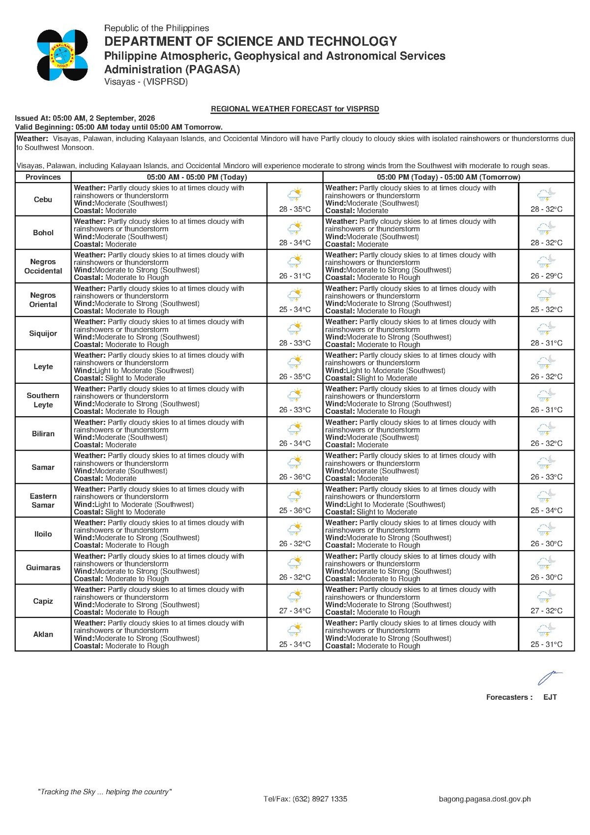
According to PAGASA’s Visayas regional forecast bulletin issued at 5:00 AM on September 2, 2026, skies over the region will be partly cloudy to at times cloudy, with rain and the possibility of lightning at any hour. The forecast does not describe an all-day downpour — rather, a day of variable conditions where dry stretches can give way quickly to localized, potentially heavy showers.
By the Numbers
- Temperature range for Negros Oriental: 28°C to 35°C on Wednesday
- Temperature range for Siquijor: 28°C to 32°C on Wednesday
- Extended outlook temperature range: 27°C to 34°C through Thursday
- PAGASA morning forecast bulletin issued at 5:00 AM, September 2, 2026
- Extended outlook issued at 9:00 AM, September 1, 2026
The Weather Driver: Habagat in Full Effect
PAGASA’s forecast data points clearly to the southwest monsoon — known locally as the habagat — as the dominant weather system at work this week. Winds across Negros Oriental are blowing from the southwest at moderate speed, funneling warm and moisture-heavy air from open ocean into the Visayas. As this air mass meets the elevated interior terrain of Negros Oriental, it is forced upward, cools rapidly, and generates the scattered rain and thunderstorms being forecast.
This is a well-understood and expected feature of the Philippine rainy season. PAGASA has not issued any tropical cyclone wind signals, gale warnings, or color-coded rainfall alerts — such as yellow, orange, or red advisories — for the Visayas region as of this forecast. The concern today is not a single catastrophic event, but the cumulative and often unpredictable behavior of scattered afternoon thunderstorms, which can intensify quickly and with limited advance notice.
Conditions Across the Province and Siquijor
For Negros Oriental as a whole, PAGASA’s bulletin carries identical forecast descriptions for both primary forecast zones: partly cloudy to at times cloudy skies with rainshowers or thunderstorms, southwest winds at moderate intensity, and moderate coastal sea conditions. Temperatures will dip to 28°C overnight and climb to a high of 35°C during afternoon hours.
Siquijor sees broadly similar conditions, the weather bureau reported — partly cloudy to at times cloudy skies with the same thunderstorm risk, though with a slightly cooler temperature ceiling of 32°C. Coastal conditions around the island are likewise rated as moderate, meaning seas are choppy enough to affect smaller watercraft.
Understanding “Moderate”: Winds and Coastal Conditions
PAGASA’s classification of winds and coastal sea conditions as “moderate” carries practical meaning for those living and working near the water. Moderate winds are strong enough that trees sway noticeably, loose objects can be displaced, and anyone out in open spaces will feel a consistent push. On the water, moderate sea conditions produce waves sufficient to make small, open-hulled boats uncomfortable and, depending on sea state and boat design, potentially hazardous — particularly in the channels between islands.
Passengers booked on fast-craft services between Dumaguete and Siquijor, or on routes to Cebu, should verify sailing status with their respective shipping lines before proceeding to the port. While moderate coastal conditions do not trigger automatic cancellations, the Philippine Coast Guard and individual operators may issue advisories or make last-minute decisions to delay trips if thunderstorms approach ferry routes.
Guidance by Sector
Fisherfolk and Coastal Operators
Small-boat fishermen operating out of Dumaguete, Bais, Bayawan, Bindoy, and the coastal communities of Siquijor face compounding risks today, PAGASA’s forecast data suggests. Moderate seas alone call for heightened caution; the additional threat of a sudden squall accompanying a thunderstorm — bringing sharp wind gusts and reduced visibility — makes today a day for conservative decision-making on the water. Anyone already at sea who observes dark, towering cloud formations should return to shore without delay. Lightning over open water is an immediate and serious hazard.
Farmers and Agricultural Communities
Upland farming communities in Guihulngan, Pamplona, La Libertad, and the interior barangays of Negros Oriental may benefit from the added soil moisture brought by today’s showers — but outdoor fieldwork should be suspended when thunder becomes audible or lightning is visible. PAGASA’s forecast warns that thunderstorms can bring brief but intense bursts of rain, raising the possibility of localized flooding in low-lying agricultural land and along smaller river channels. Farmers are advised to move livestock and portable equipment to safer, elevated ground as a precaution.
Students, Families, and Schools
Morning conditions may appear calm and manageable in many parts of Negros Oriental, but PAGASA’s forecast makes clear that rainshowers and thunderstorms can develop at any hour — including during and after school hours. Parents should ensure children have rain gear available, and pickup and shelter arrangements for the afternoon should be confirmed in advance. Schools situated near small rivers or historically flood-prone low areas should stay alert, particularly if heavy rain persists for extended periods.
Commuters and Outdoor Workers
Tricycle and motorcycle riders, market vendors, construction workers, and others spending extended hours outdoors in Dumaguete City and surrounding areas should not be lulled by patches of sunshine during the morning. The partly cloudy description in the PAGASA bulletin simply means cloud cover will vary — not that rain will hold off all day. Carrying a raincoat or compact umbrella is strongly advisable. Workers at heights — on scaffolding or rooftops — should descend and seek solid cover at the first sign of thunder. Urban flooding is possible in low-lying and poorly drained sections of Dumaguete and other town centers if a concentrated thunderstorm delivers rainfall faster than drainage systems can accommodate.
What to Expect Through Thursday
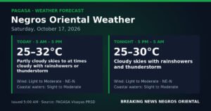
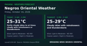
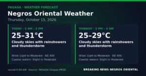
According to PAGASA’s extended weather outlook released at 9:00 AM on September 1, 2026, the same broad pattern is expected to persist into Thursday. The outlook shows temperatures ranging between 27°C and 34°C, with moderate southwest winds and moderate coastal conditions continuing through the near-term forecast period. This points to a weather regime that will not resolve quickly — residents and workers across the province should plan for continued rain and thunderstorm potential through at least the middle of the week, the bureau indicated.
The extended outlook provides no indication of a strengthening weather system or incoming tropical cyclone. Conditions appear to be driven entirely by the prevailing southwest monsoon, which typically sustains similar patterns for days at a time during the height of the rainy season in the Philippines.
Why This Matters
PAGASA’s forecast of scattered thunderstorms across Negros Oriental and the broader Visayas has direct implications for maritime safety, agricultural activities, and daily commuting — particularly given that moderate coastal conditions place small fishing vessels at risk and fast-craft ferry operations may face disruptions. The persistence of the southwest monsoon through at least Thursday means these hazards are not a one-day concern but an extended risk window requiring sustained awareness. Although no severe weather warnings have been issued, the unpredictable and rapid development of thunderstorms means that communities across the province — coastal, upland, and urban — must remain prepared and responsive throughout the coming days.
Source: Breaking News Negros Oriental / PAGASA Visayas Regional Forecast, September 2, 2026