DUMAGUETE CITY — No sunshine is in store for Negros Oriental this Thursday. The Philippine Atmospheric, Geophysical and Astronomical Services Administration (PAGASA) released its 5:00 AM regional bulletin for October 15, 2026, covering the entire province — from Dumaguete City in the south up through Guihulngan in the north, and extending across the Tañon Strait to Siquijor — with cloudy skies, rainshowers, and thunderstorms forecast without interruption for both daytime and overnight periods.
According to PAGASA, the wet conditions are not expected to ease at any point during the day or night, meaning residents from coastal towns to inland municipalities will contend with rain from early morning straight through until midnight and beyond.
Full Forecast Details from PAGASA
PAGASA’s official Visayas regional forecast breaks Thursday’s outlook into two periods:
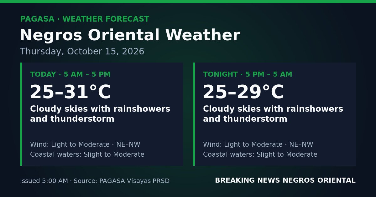
Daytime — 5:00 AM to 5:00 PM, October 15: Cloudy skies with rainshowers and thunderstorm. Temperatures will fall between 25°C and 31°C. Winds will come from the northeast to northwest direction at light to moderate strength. Coastal waters will be slight to moderate.
Overnight — 5:00 PM, October 15 to 5:00 AM, October 16: Cloudy skies with rainshowers and thunderstorm will continue. Temperatures will range from 25°C to 29°C. Wind direction and strength remain unchanged — light to moderate from the northeast to northwest. Coastal sea conditions stay at slight to moderate.
The near-identical conditions across both forecast windows indicate that the weather system influencing the province has a strong, stable grip on the region for the duration of Thursday.
By the Numbers
- Forecast issued: 5:00 AM, October 15, 2026
- Daytime temperature range: 25°C to 31°C
- Overnight temperature range: 25°C to 29°C
- Forecast coverage: two consecutive 12-hour periods (5:00 AM Oct. 15 to 5:00 AM Oct. 16)
What Is Behind the Weather
PAGASA’s regional data table for Negros Oriental does not name a specific weather system driving Thursday’s conditions. Residents who want to understand whether the rain is linked to the northeast monsoon (amihan), a low-pressure area, or another synoptic feature are encouraged to visit PAGASA’s national weather bulletin at pagasa.dost.gov.ph, where broader weather patterns are typically explained in full.
Breaking Down What the Forecast Language Means
Rainshowers and Thunderstorm
In PAGASA’s standardised terminology, “rainshowers” refers to intermittent rainfall — wet spells will come and go rather than pouring non-stop. “Thunderstorm,” however, signals the presence of intense convective cells capable of producing sudden heavy downpours, lightning, and strong localised gusts within a brief timeframe. A temporary dry spell in a given area does not mean the rain has passed; a thunderstorm cell can develop rapidly and bring heavy rain within minutes.
Light to Moderate Winds
Winds blowing from the northeast to northwest at light to moderate speeds are strong enough to rustle leaves and move small branches but are not at structurally damaging levels under normal conditions. PAGASA notes that this refers to the background wind speed — individual thunderstorm cells can produce localised gusts that spike well above that general range when they pass directly overhead.
Slight to Moderate Coastal Waters
PAGASA’s sea-state scale runs from calm through smooth, slight, moderate, rough, and higher. “Slight to moderate” conditions along the Negros Oriental coastline mean wave heights that larger commercial vessels can handle but that pose added difficulty and discomfort for small outrigger boats (bancas). This is not a gale warning, but neither is it safe flat-water sailing for small craft.
No Typhoon Signals or Gale Warnings Issued
PAGASA’s bulletin for Negros Oriental on October 15, 2026 carries no tropical cyclone wind signals (Signal No. 1 through No. 5), no gale warnings, no colour-coded rainfall advisories (yellow, orange, or red), and no heat index warnings. The weather threat today is sustained rain and thunderstorms — disruptive and potentially hazardous, but categorically different from the warnings associated with typhoon-strength events.
PAGASA nonetheless advises residents to remain alert, as thunderstorm conditions can cause localised flooding in low-lying areas and along waterways even in the absence of a province-wide rainfall advisory.
Impacts Across the Province
Commuters in Dumaguete and Nearby Towns
Rain and sudden thunderstorm bursts are likely to affect the morning and evening rush in Dumaguete City and surrounding communities. Low-lying barangays can see rapid water accumulation during heavy shower spells. Motorcycle and tricycle riders are advised to allow extra travel time, carry rain gear, and exercise caution on wet roads. Motorists should account for reduced visibility during peak rainfall.
Fisherfolk and Small-Boat Operators
Slight to moderate sea conditions along the Negros Oriental coastline — from Bayawan northward through Bais Bay to Guihulngan — are workable but carry elevated risk for small outrigger vessels. PAGASA’s forecast also includes thunderstorm activity, which can bring sudden squalls and dangerous lightning over open water. Fisherfolk are advised to put out only if local skies are clear in the morning, return to shore well ahead of deteriorating conditions, and never wait for rain to arrive before heading back.
Passengers on Inter-Island Routes
Travellers booked on ferry or fast-craft routes connecting Dumaguete to Siquijor, Dumaguete to Cebu, and Bais to Cebu should contact their vessel operators or the port authority before proceeding to the terminal. According to PAGASA’s sea-state assessment, slight to moderate waters combined with possible thunderstorm activity may prompt shipping lines to adjust departure schedules or suspend trips if conditions deteriorate. Passengers should not assume a scheduled voyage will proceed without first verifying with the carrier.
Farmers in Agricultural Municipalities
Farming communities in Bayawan, Bais, La Libertad, Bindoy, and surrounding municipalities face a difficult day in the fields. PAGASA’s all-day rain and thunderstorm forecast raises the risk of soil erosion in upland areas and waterlogging in lowland paddies for crops including sugarcane, rice, corn, and vegetables. Farmers are advised to defer harvesting where possible, ensure drainage channels are kept clear, and secure drying crops and farm equipment. Workers who hear or see lightning should immediately move to a sturdy shelter — not under trees.
Students, Parents, and Schools
With thunderstorms forecast from early morning through the full school day and into the evening across Dumaguete, Sibulan, Santa Catalina, Mabinay, and other municipalities, parents and school administrators are advised to monitor official local government and school announcements regarding class suspensions or schedule adjustments throughout the day.
Why This Matters
PAGASA’s forecast warns that thunderstorm conditions — even without a formal province-wide rainfall advisory — can produce localised flooding in low-lying areas and near waterways, posing direct risks to commuters, fisherfolk, farmers, students, and outdoor workers across Negros Oriental on October 15, 2026.
Source: breakingnewsnegrosoriental.com / PAGASA Visayas Regional Forecast