DUMAGUETE CITY, Negros Oriental — October 29, 2026 — Negros Oriental is in for a wet and unsettled Thursday, with rainshowers and thunderstorms forecast across the province from early morning through the overnight hours, based on a bulletin released at 5:00 AM by the Philippine Atmospheric, Geophysical and Astronomical Services Administration (PAGASA).
PAGASA’s Forecast for Negros Oriental
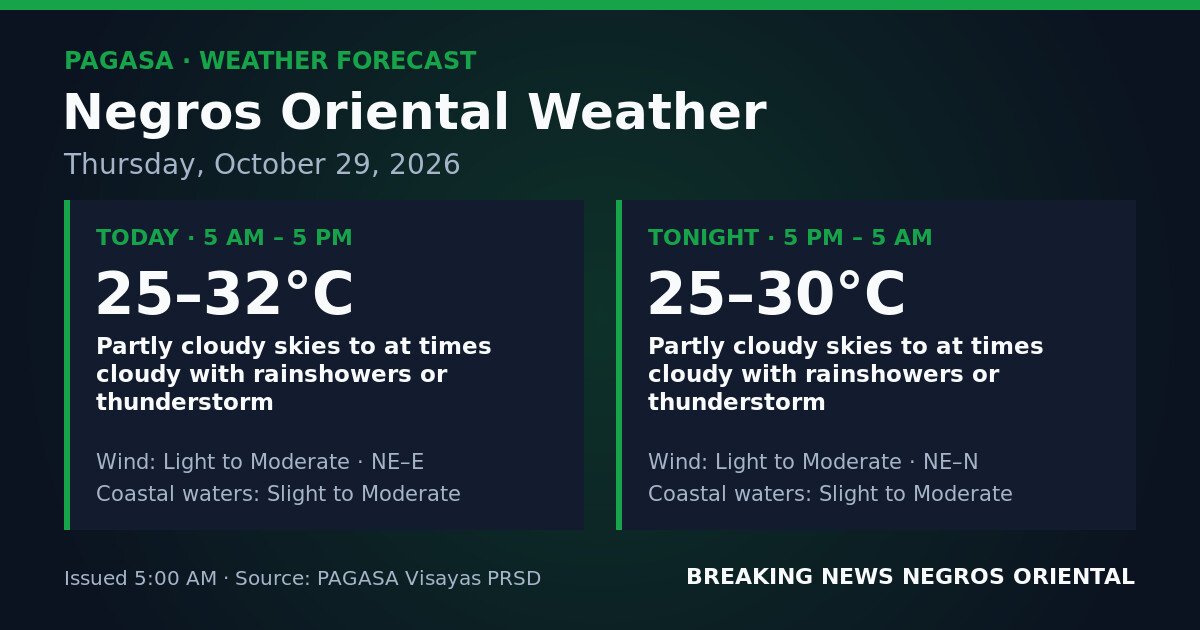
PAGASA’s Visayas regional forecast table, issued at 5:00 AM on October 29, 2026, places Negros Oriental under partly cloudy to at times cloudy skies with rainshowers or thunderstorms across two consecutive 12-hour periods that together cover the full 24-hour day.
For the daytime period from 5:00 AM to 5:00 PM, PAGASA forecasts partly cloudy to at times cloudy skies with rainshowers or thunderstorms. Temperatures will range between 25°C and 32°C. Winds will blow from the northeast to east direction at light to moderate strength. Coastal waters are described as slight to moderate.
For the overnight period from 5:00 PM to 5:00 AM Friday, the same cloudy sky conditions with rainshowers or thunderstorms are expected to continue. Temperatures will ease to a range of 25°C to 30°C. Winds will shift slightly to a northeast to north direction, remaining light to moderate. Coastal waters will stay at slight to moderate levels.
PAGASA’s forecast means there is no extended dry window during either period. Showers or thunderstorms may occur at any hour of the day or night.
No Specific Weather System Identified
The PAGASA source data for this bulletin does not attribute today’s conditions to a named weather system — no tropical cyclone, low-pressure area, northeast monsoon, or southwest monsoon is cited as the identified driver of the unsettled weather over Negros Oriental. PAGASA does make clear, however, that the province is under disturbed atmospheric conditions producing both rainshowers and the possibility of thunderstorms for the full bulletin period.
According to PAGASA, the wind direction during the day — northeast to east, shifting to northeast to north overnight — reflects a broad-scale circulation pattern affecting the Visayas. Cloudy and showery conditions tied to this wind pattern are expected to persist through the entire 24-hour forecast window.
What “Slight to Moderate” Coastal Waters Mean
PAGASA classifies Negros Oriental’s coastal waters as slight to moderate for both forecast periods. Slight seas generally refer to wave heights of up to approximately 1.25 metres — conditions in which small outrigger vessels and fishing craft can typically operate, though watchfulness is advised. Moderate seas describe choppier conditions with wave heights that can reach up to 2.5 metres, posing meaningful risk to small and light watercraft and causing noticeable rolling even on larger passenger vessels.
Because the forecast spans the full slight-to-moderate range without specifying where conditions will settle, PAGASA advises small-craft operators to plan against the moderate end of that range. The agency has not issued a gale warning for this forecast period, according to the source data. However, PAGASA notes that the presence of thunderstorm potential introduces the risk of sudden gusty winds that are not reflected in the baseline coastal water classification.
Guidance for Ferry Passengers and Inter-Island Travelers
Passengers with bookings on OceanJet, Montenegro Lines, or other ferry services operating out of Dumaguete to Siquijor, Cebu, and other Visayas ports should confirm vessel departure status with operators before heading to the pier. Slight to moderate seas combined with the possibility of thunderstorms at any hour may prompt precautionary delays or cancellations at the discretion of vessel operators and the Philippine Coast Guard. Bringing rain gear and allowing extra time is advisable, as is having an alternate plan if a vessel is held at port.
Advisory for Fisherfolk and Small-Boat Operators
Fisherfolk working waters off Dumaguete, Dauin, Zamboanguita, Bayawan, and along the Tanon Strait should exercise careful judgment given PAGASA’s slight to moderate coastal water forecast. Owners and operators of small bangka and light fishing craft face the greatest exposure. PAGASA warns that thunderstorms can generate sudden strong winds and lightning over open water with very little advance warning — anyone caught at sea when a thunderstorm develops should seek shelter immediately. If sea conditions shift toward the moderate end of the forecast range, small craft should return to shore or remain in port.
Farmers and Agricultural Workers
Intermittent rain is expected throughout Thursday across both the upland and lowland areas of the province, including sugarcane-growing municipalities and vegetable farming areas around Guihulngan, Bais, La Libertad, and Bindoy. While moderate rainfall can be beneficial to field crops, PAGASA’s thunderstorm potential means intense, short-duration downpours are possible, which can produce surface runoff and localised waterlogging in low-lying areas. Harvesting and post-harvest drying activities should account for the possibility of rain at any point during the day or night, and harvested produce should be kept covered and protected from sudden showers.
Students, Commuters, and School Communities
Wet conditions are expected during both the morning school run and the afternoon dismissal period across Dumaguete City and the rest of the province. Rainshowers or thunderstorms may occur during any part of school hours, according to PAGASA’s forecast. Parents fetching children in the afternoon should carry rain protection and allow for possible traffic slowdowns on wet roads. School administrators are advised to monitor PAGASA updates throughout the day in case of intensifying rainfall.
Outdoor Workers, Event Organisers, and Travelers to Siquijor
Construction workers, market vendors, and others in outdoor occupations across Dumaguete, Bais, Tanjay, Mabinay, and other municipalities should plan around the reality that rain may arrive at any hour. Outdoor events scheduled for Thursday should have covered or indoor contingency arrangements in place. PAGASA advises that when thunder is heard, individuals should move indoors or to a hard-topped vehicle immediately and remain there for at least 30 minutes after the last thunderclap.
Residents and visitors planning to cross to Siquijor from Dumaguete, Liloan, or other departure points in the province should note that the same slight to moderate coastal conditions and thunderstorm potential apply to those waters. Confirming vessel status with the ferry operator before departure and again before boarding is recommended.
Temperature Outlook
Daytime temperatures will remain warm despite the cloud cover, ranging from 25°C to 32°C between 5:00 AM and 5:00 PM, according to PAGASA. After sunset, temperatures will ease into the 25°C to 30°C range through to Friday morning.
Source: Philippine Atmospheric, Geophysical and Astronomical Services Administration (PAGASA)