DUMAGUETE CITY, Negros Oriental — October 28, 2026: The Philippine Atmospheric, Geophysical and Astronomical Services Administration (PAGASA) has placed Negros Oriental under an all-day rain and thunderstorm forecast, with unsettled conditions expected to persist from early Wednesday morning through the following predawn hours. The 5:00 AM regional bulletin covers both daytime and overnight periods without interruption.
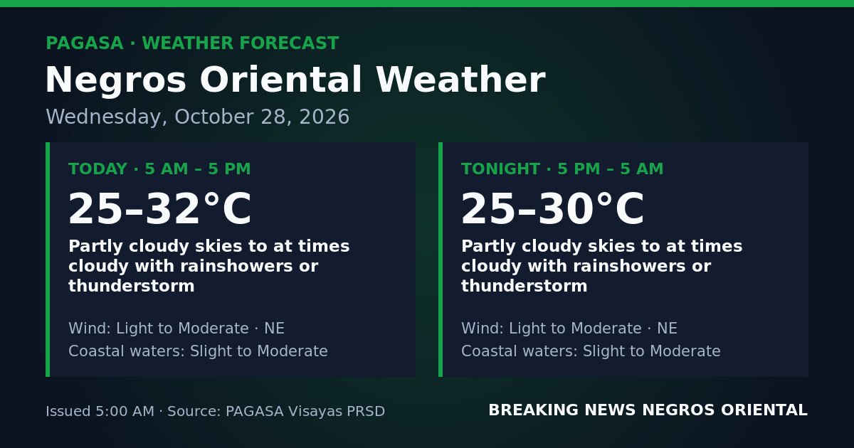
PAGASA’s Visayas regional forecast, issued at 5:00 AM on October 28, 2026, outlines two consecutive weather windows for the province.
During the daytime period — covering 5:00 AM to 5:00 PM — skies over Negros Oriental will be partly cloudy to at times cloudy, with rainshowers or thunderstorms possible at any hour. Temperatures are expected to range between 25°C and 32°C. Winds will come from the northeast at light to moderate strength, and coastal waters are rated slight to moderate, according to PAGASA.
The overnight period, running from 5:00 PM on Wednesday through 5:00 AM on Thursday, October 29, carries virtually identical conditions, PAGASA said. Skies remain partly cloudy to at times cloudy, with the same rainshower and thunderstorm possibilities continuing. Temperatures will ease slightly to a range of 25°C to 30°C, while northeast winds and slight to moderate coastal waters persist.
PAGASA’s forecast data for this bulletin does not identify a specific weather system — such as a named tropical cyclone, a low-pressure area, the northeast monsoon (amihan), the southwest monsoon (habagat), the Inter-Tropical Convergence Zone (ITCZ), or a shear line — as the driver of today’s conditions over the province. No tropical cyclone wind signals and no gale warnings are currently in effect for Negros Oriental, the agency’s data shows.
Despite the absence of a named system, PAGASA’s figures make clear that weather over Negros Oriental on Wednesday is genuinely unsettled. The forecast of thunderstorms across both the daytime and overnight windows means that lightning, gusty winds, and abrupt drops in visibility are possible with little advance notice at the local level.
What the Coastal Water Rating Means
PAGASA uses standardised terminology for sea conditions. A “slight” coastal water rating corresponds to wave heights of approximately 0.5 to 1.25 metres — manageable for most vessels but requiring basic caution, especially for small open bancas. A “moderate” rating refers to wave heights of roughly 1.25 to 2.5 metres, which can be noticeably rough for outrigger boats and smaller motorised craft and may make inter-island ferry trips uncomfortable even on larger vessels.
Today’s slight-to-moderate rating means conditions could fall anywhere within that range. With thunderstorms also forecast, sea conditions have the potential to deteriorate quickly and without much warning, PAGASA’s bulletin indicates.
Guidance for Fisherfolk and Boat Operators
Fishing communities along the Negros Oriental coastline — including those in Bayawan, Bais, Tanjay, and coastal barangays facing the Bohol Strait — face a day requiring heightened caution. The slight-to-moderate coastal water forecast already places small open fishing vessels in conditions where care is warranted, and the added thunderstorm risk at any hour — including overnight — makes conditions potentially hazardous for bancas and small motorised boats.
Those already at sea should watch for darkening clouds, rising winds, or distant thunder and return to shore immediately at the first such sign, without waiting for rain to begin. Operators planning overnight runs should weigh the fact that the overnight forecast carries the same thunderstorm risk as the daytime period.
Ferry Passengers and Inter-Island Routes
Travelers on routes between Dumaguete and Siquijor, or on connections to Cebu and other Visayas ports, should verify schedules with ferry operators — including OceanJet and other inter-island services — before departing Wednesday. While no gale warning is currently in effect, the combination of slight-to-moderate seas and thunderstorm risk may prompt operators to adjust departure times based on real-time conditions. The Philippine Coast Guard and PAGASA are the appropriate authorities to monitor for any updated advisories throughout the day.
Farmers and Agricultural Workers
Agricultural areas including Guihulngan, La Libertad, and Canlaon face the prospect of repeated work interruptions as rainshowers and possible thunderstorms move through both during the day and overnight. Lightning poses a serious hazard for those in open fields or elevated and exposed terrain. Workers caught outdoors when a thunderstorm approaches — signalled by darkening skies, rumbling, or sudden gusts — should leave open areas immediately and seek sturdy shelter away from isolated trees or metal farm equipment.
Commuters, Students, and Drivers
Because PAGASA’s forecast makes no distinction between morning, afternoon, or evening for when rainshowers or thunderstorms may occur, rain gear is a practical necessity throughout Wednesday across Negros Oriental. Children heading to school should be prepared for wet conditions and instructed to move indoors promptly if a thunderstorm develops. Drivers — particularly on mountain roads where runoff and reduced visibility compound the hazard — should reduce speed, increase following distance, and use headlights during heavy rain.
Outdoor Events and Public Activities
Community gatherings, outdoor sports, and public construction activities scheduled for Wednesday in Negros Oriental should have contingency arrangements in place, given that PAGASA’s thunderstorm forecast applies across all hours of the day and overnight.
Source: PAGASA — Philippine Atmospheric, Geophysical and Astronomical Services Administration