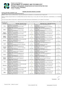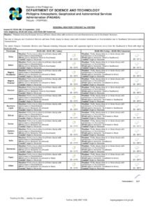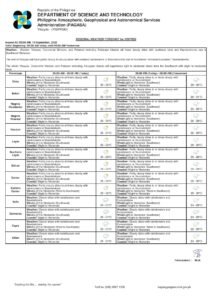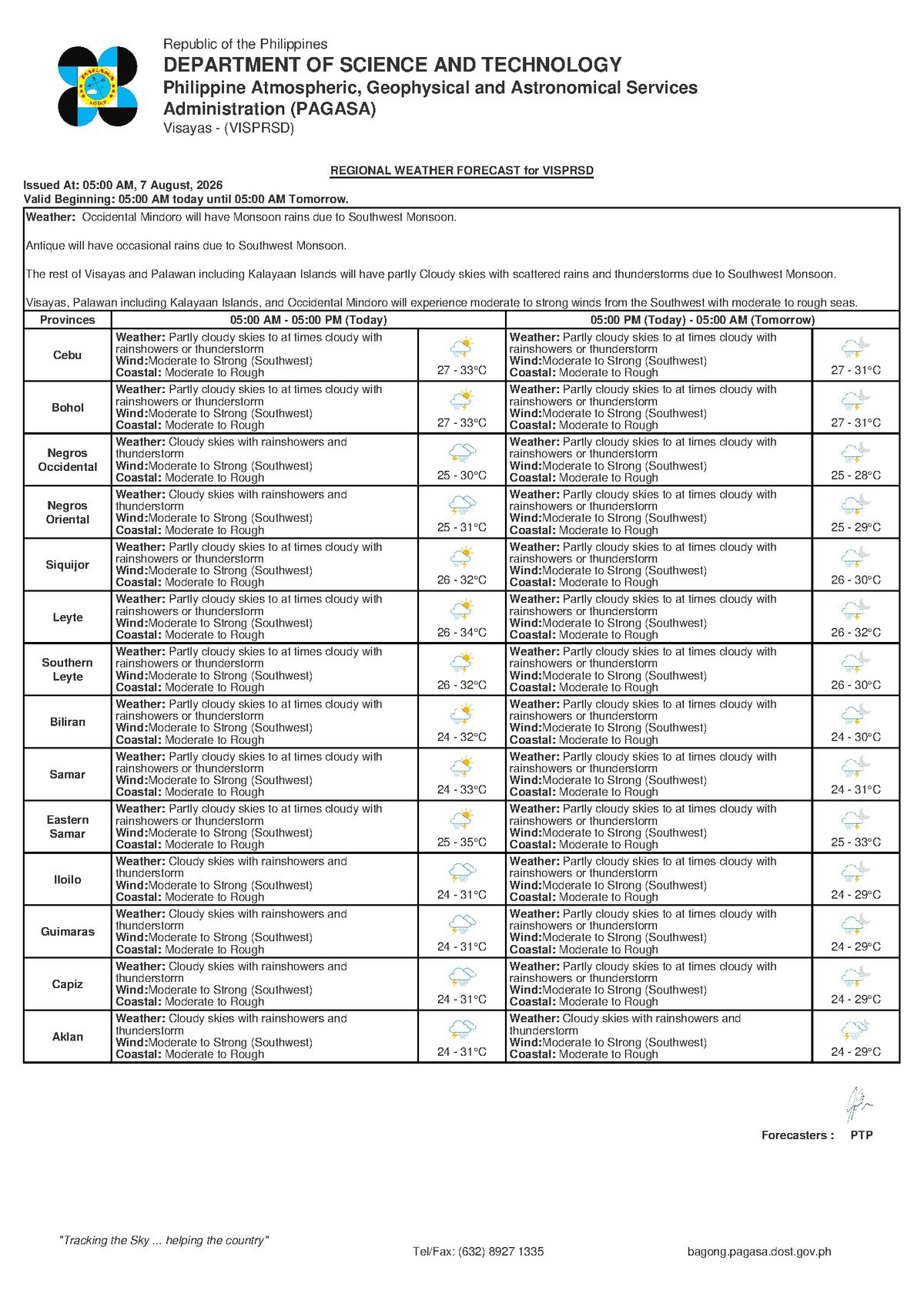
DUMAGUETE CITY, Negros Oriental — The southwest monsoon is making its presence felt across Negros Oriental and the broader Visayas this Friday, August 7, 2026, with the Philippine Atmospheric, Geophysical and Astronomical Services Administration (PAGASA) warning of rainshowers, thunderstorms, and hazardous coastal waters that will affect maritime travel, fishing operations, and daily life across the province.
PAGASA released its 5:00 AM regional weather bulletin on Friday covering the Visayas, painting a picture of an unsettled day dominated by the habagat, the seasonal southwest monsoon wind that sweeps across the Philippines from roughly June through September. A separate Extended Weather Outlook, issued by PAGASA at 9:00 AM on August 6, 2026, further indicates that these conditions are not expected to dissipate quickly — similar weather is likely to persist in the days ahead.
The Force Behind the Weather
According to PAGASA, the primary driver of today’s conditions is the active southwest monsoon. The habagat pushes moisture-rich air northeastward across the archipelago, generating widespread cloud cover, rainfall, and thunderstorm activity across the Visayas. It is important to note that no typhoon is needed to trigger this level of disruption — a sufficiently strong habagat alone is capable of grounding vessels, producing flooding rains in coastal lowlands, and bringing thunderstorms that arrive with little warning.
The same southwesterly wind flow driving rain inland is also responsible for churning coastal waters into rough conditions. PAGASA classifies today’s sea state along Negros Oriental’s coastline and surrounding waters as moderate to rough, a designation with serious implications for anyone planning to be on the water.
By the Numbers
- 5:00 AM, August 7, 2026 — Time of PAGASA’s regional forecast bulletin
- 9:00 AM, August 6, 2026 — Time of PAGASA’s Extended Weather Outlook issuance
- 27°C — Forecast low temperature for the Visayas
- 33°C — Forecast high temperature for the Visayas
- 1.25–2.5 meters — Typical wave heights under moderate sea conditions
- 2.5–4 meters — Typical wave heights under rough sea conditions
What the Forecast Covers
Based on PAGASA’s 5:00 AM bulletin, the weather profile for the Visayas region on August 7, 2026 includes:
- Sky conditions: Partly cloudy to cloudy, with rainshowers and thunderstorms
- Temperature: Low of 27°C, high of 33°C
- Winds: Moderate to strong from the southwest
- Coastal waters: Moderate to rough
For Negros Oriental, the forecast touches virtually every coastal community. Residents in Dumaguete City, Bacong, Dauin, Zamboanguita, and Bayawan City along the southwestern coastline should expect intermittent showers with possible thunderstorms throughout the day. Bais City and Guihulngan City on the province’s northern coastal stretch face the same outlook. Inland and upland communities — including those in mountainous interior barangays — are not exempt: thunderstorm cells can produce locally heavy rainfall even far from the coast, PAGASA noted.
Across the Tañon Strait, Siquijor Island is equally exposed to the southwest winds, and sea conditions there mirror those off Negros Oriental. In Cebu, particularly the southern and western portions facing the Tañon Strait, PAGASA’s forecast reflects the same unsettled pattern.
Understanding “Moderate to Rough” at Sea
PAGASA’s designation of coastal waters as moderate to rough carries real-world consequences that go beyond numbers on a chart. Under moderate sea conditions — wave heights typically between 1.25 and 2.5 meters — small bancas and outrigger vessels find it difficult to maintain safe headings. Even seasoned fisherfolk describe moderate seas as physically demanding and unpredictable.
When conditions shift to rough — wave heights climbing toward 2.5 to 4 meters — even larger passenger ferries and fast craft can experience significant rolling, delays, and the possibility of cancellation. Both PAGASA and the Philippine Coast Guard routinely advise all small vessels to remain berthed when rough sea conditions are forecast. Today’s outlook places conditions anywhere within that moderate-to-rough range, and PAGASA warns the situation could reach the rougher end, especially during thunderstorm squalls, which bring sudden bursts of intensified wind and rapidly building waves.
Guidance for Key Sectors
Travelers and Ferry Passengers
Anyone planning inter-island travel — whether from Dumaguete to Siquijor, Dumaguete to Cebu, or along any other Visayas route — should verify trip status with their ferry or fast craft operator before heading to the pier. Operators serving Dumaguete Port, including OceanJet, are subject to Philippine Coast Guard advisories that can trigger schedule adjustments, delays, or outright cancellations when coastal waters approach the rougher end of the forecast range. PAGASA’s bulletin does not specify a precise time window when conditions may ease, making early confirmation with operators essential before travel.
Fisherfolk and Small-Vessel Operators
PAGASA’s forecast signals a high-risk day on the water for fisherfolk operating bancas and small motorized boats along the Negros Oriental coast. The combination of moderate to strong southwest winds, rough seas, and the unpredictable intensity of thunderstorm squalls makes open-water fishing particularly dangerous today. Fisherfolk operating out of Dumaguete, Dauin, Zamboanguita, Bayawan, Bais, and Guihulngan are strongly encouraged to forgo open-water trips and wait for improved conditions. Those already at sea should watch for squall indicators — sudden wind increases, rapidly darkening skies, or the presence of waterspouts — and return to port without delay.
Agricultural Communities
Farmers working in the upland and lowland areas of Negros Oriental — including those cultivating sugarcane, rice, and vegetables in interior barangays — should anticipate waterlogged soils persisting throughout the day. Soil preparation and planting activities that require dry ground are inadvisable. Drainage management around fields and low-lying agricultural areas deserves attention, as heavy thunderstorm cells can produce localized flash flooding. On a more positive note, the active monsoon reduces the irrigation burden for most crops during this period.
Students, Parents, and Schools
Thunderstorms may develop at any hour of the day — not only at predictable morning or afternoon intervals. Parents sending children to school should pack adequate rain gear. School administrators are encouraged to follow local disaster risk reduction and management protocols in the event of a significant thunderstorm during school hours, including holding students on campus until it is safe for them to travel. Parents should monitor their school’s official communication channels for weather-related announcements from local government units.
Commuters and Outdoor Workers
Road users traveling along the Negros Oriental coastal highway and through Dumaguete City should be prepared for wet surfaces and reduced visibility during rain squalls. Construction workers, outdoor event organizers, and personnel working in exposed or elevated areas should secure loose equipment and materials before beginning work. PAGASA and safety protocols alike recommend seeking immediate shelter once thunder becomes audible — waiting for a lightning strike before moving indoors is never advisable.
What to Expect in the Coming Days
PAGASA’s Extended Weather Outlook, issued at 9:00 AM on August 6, 2026, indicates that conditions similar to today’s are likely to persist in the near term across the Visayas. The southwest monsoon typically remains active through September, meaning that episodes of rough seas, rainshowers, and thunderstorms are not isolated events but part of a broader seasonal pattern. Residents, travelers, and workers across Negros Oriental and the wider Visayas are advised to monitor PAGASA updates regularly as the week progresses.
Why This Matters
The combination of moderate to rough seas and thunderstorm activity across Negros Oriental and the Visayas directly threatens maritime safety for fisherfolk and inter-island passengers at a time when the southwest monsoon is at its most active. PAGASA’s forecast underscores that even without a typhoon, the habagat alone can produce conditions hazardous enough to disrupt livelihoods, delay supply chains dependent on inter-island shipping, and put lives at risk for those who venture onto the water without checking conditions first. With similar weather expected to continue in the days ahead, sustained public vigilance and regular monitoring of official PAGASA advisories remain critical for communities throughout the province and the broader Visayas region.
Source: Breaking News Negros Oriental (breakingnewsnegrosoriental.com)