Dumaguete City — July 28, 2026: The Philippine Atmospheric, Geophysical and Astronomical Services Administration (PAGASA) has placed Negros Oriental and the entire Visayas region under a forecast of rainshowers and thunderstorms for Tuesday, urging residents, fisherfolk, ferry passengers, and outdoor workers to take precautions throughout the day. The bulletin was issued at 5:00 AM on July 28, 2026.
From the southern tip of Dumaguete City to the northern reaches of Guihulngan, and from the coastal municipalities along the Tañon Strait to the island of Siquijor across the Bohol Sea, the forecast paints a similar picture: warm and humid conditions with clouds building during the day and rain or thunderstorms possible at multiple points before nightfall.
The Full Forecast from PAGASA
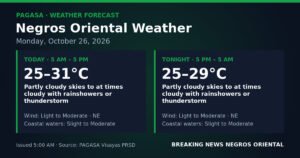
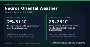
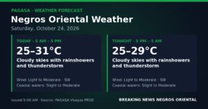
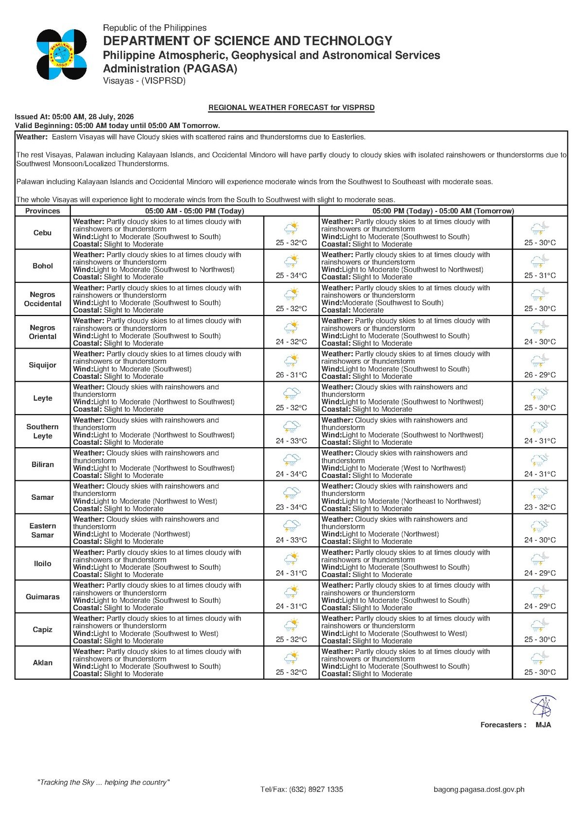
According to PAGASA’s 5:00 AM regional bulletin, skies over Negros Oriental and the broader Visayas will be partly cloudy to at times cloudy, with rainshowers or thunderstorms expected to develop during the course of the day. Temperatures will hover between a low of 25°C and a high of 32°C — conditions consistent with the heart of the wet season.
Winds are forecast to blow from the southwest to south at light to moderate speeds, PAGASA said. Coastal waters — including the Tañon Strait separating Negros from Cebu, and the seas encircling Siquijor — are rated at slight to moderate in terms of wave height and overall sea state.
By the Numbers
- Forecast bulletin issued at 5:00 AM, July 28, 2026
- Minimum temperature: 25°C
- Maximum temperature: 32°C
- Slight sea wave heights: approximately 0.5 to 1.25 metres
- Moderate sea wave heights: approximately 1.25 to 2.5 metres
- Extended outlook temperatures for Monday: 26°C to 32°C
- Extended outlook temperatures for the following Tuesday: 25°C to 31°C
- Extended outlook bulletin issued at 9:00 AM, July 27, 2026
What Is Driving the Rain
The southwest-to-south wind direction identified in PAGASA’s bulletin is a hallmark of the southwest monsoon, known locally as the habagat. The habagat typically influences Philippine weather from June through September each year, pulling warm, moisture-laden air across the archipelago from the South China Sea and the surrounding ocean. As that moist air rides over land and rises in elevation, it cools and condenses — producing the recurring cycle of overcast skies, afternoon rainshowers, and sudden thunderstorms that Visayans recognise as a fixture of the season.
The terrain of Negros Oriental amplifies this effect, according to the source data. The mountain ranges above Guihulngan City and the highlands surrounding Dumaguete force incoming moist air upward, increasing the intensity of localized rainfall in elevated and inland areas. This means interior communities can experience heavier downpours than what coastal areas receive at the same time.
The practical consequence, as PAGASA’s forecast makes clear, is that weather conditions can shift rapidly — from partly sunny in the morning to stormy by midday or afternoon. Thunder and lightning accompany many of these events, and residents should not assume a dry morning guarantees a dry afternoon.
Coastal Waters: What the Rating Means
PAGASA describes today’s sea state as slight to moderate. To put those terms in plain context: slight seas carry wave heights of roughly 0.5 to 1.25 metres — navigable for larger vessels, though uncomfortable for small craft. Moderate seas, with wave heights of approximately 1.25 to 2.5 metres, present a genuine hazard to small bancas and fishing boats, especially if a squall or thunderstorm passes through without warning.
PAGASA has not issued a gale warning for these waters as of the 5:00 AM bulletin, meaning conditions are not at a severe or dangerous extreme. Nevertheless, the weather bureau’s forecast explicitly includes the possibility of thunderstorms — which can generate sudden gusts and dangerous lightning even without a formal gale warning in effect — making vigilance essential for anyone on the water.
Advisories for Different Groups
Ferry Passengers and Inter-Island Travelers
Anyone planning to board a vessel from Dumaguete port — whether bound for Cebu aboard fast ferries such as OceanJet or heading to Siquijor — should confirm schedules directly with their shipping lines before traveling to the terminal. Slight-to-moderate seas can cause rolling and discomfort on fast craft, and a passing thunderstorm may prompt temporary delays. Travelers departing from ports in Bayawan or Bais toward Bohol or other destinations are advised to follow the same precaution.
Fisherfolk and Small-Boat Operators
PAGASA’s combination of moderate coastal conditions and thunderstorm potential makes Tuesday a day requiring heightened caution for fishermen operating in the Tañon Strait, along the Bohol Sea shoreline, or in waters around Siquijor. Sudden squalls accompanying thunderstorms can bring sharp wind gusts and dangerous lightning with little warning. The standard safety guidance applies: if dark clouds are building, winds are rising sharply, or thunder is audible, return to shore immediately rather than waiting for conditions to worsen.
Farmers and Agricultural Workers
For farming communities in the rice- and corn-growing areas of Guihulngan, La Libertad, and other inland municipalities, today’s scattered rainfall may support crops during the growing season — though localized heavy downpours from thunderstorm cells can also cause runoff and soil erosion on hillside farms. Those with palay or other harvested crops drying outdoors should prepare to shelter or cover them quickly. Heavier outdoor fieldwork is best planned for morning hours, ahead of the higher afternoon and evening storm probability.
Students, Commuters, and the General Public
Students heading to school and commuters on the road should carry rain gear — even a light umbrella provides meaningful protection during a sudden shower. Afternoon dismissal times in many schools across Negros Oriental may overlap with peak thunderstorm activity. Motorists should expect reduced visibility in heavy rain spells and plan accordingly.
Construction workers, market vendors, and others with outdoor duties in Dumaguete, Bayawan, and across the province are advised to schedule the most physically demanding tasks for the earlier part of the day. PAGASA’s thunderstorm warning is not precautionary language — lightning is a genuine hazard during these events, and workers should seek sturdy, enclosed shelter the moment thunder is heard. Open fields, isolated trees, and metal structures should be avoided during a storm.
The Outlook Beyond Tuesday
PAGASA’s extended weather outlook, issued at 9:00 AM on July 27, 2026, indicates that Tuesday’s conditions are part of a sustained weather pattern rather than an isolated event. For the following Monday in the outlook window, the weather bureau forecasts temperatures of 26°C to 32°C, with light to moderate southwest-to-south winds and slight-to-moderate coastal conditions. The Tuesday after that is forecast slightly cooler at 25°C to 31°C, with south-to-southwest winds and similar sea states.
In practical terms, PAGASA’s extended outlook signals that Negros Oriental and the broader Visayas should expect the current pattern of warm days, scattered rainshowers, and possible thunderstorms to persist through the coming days — consistent with an active southwest monsoon season.
Why This Matters
PAGASA’s forecast of rainshowers and thunderstorms across Negros Oriental affects a wide range of daily activities — from inter-island ferry operations and small-boat fishing to agriculture and school attendance — in a province whose economy and daily life are closely tied to weather conditions. The slight-to-moderate coastal advisory, combined with the possibility of sudden thunderstorms, poses a real safety risk to fisherfolk and maritime commuters who depend on these waters. PAGASA’s extended outlook further indicates this is not a temporary disruption but a continuing pattern driven by the active southwest monsoon, underscoring the need for sustained preparedness across communities in Negros Oriental and the wider Visayas.
Source: breakingnewsnegrosoriental.com (BNNO)