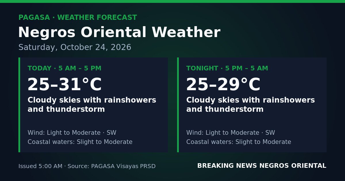
DUMAGUETE CITY, Negros Oriental — Southwest monsoon moisture will keep Negros Oriental blanketed in clouds, rainshowers, and thunderstorms for the entirety of Saturday, October 24, 2026, according to the Philippine Atmospheric, Geophysical and Astronomical Services Administration (PAGASA). The official forecast, released at 5:00 AM, covers the full province — from Dumaguete in the capital to Guihulngan in the north and Bayawan in the south — as well as the island province of Siquijor across the strait.
PAGASA said the unsettled weather will persist through both the daytime period of 5:00 AM to 5:00 PM and the overnight period of 5:00 PM to 5:00 AM on October 25, meaning thunderstorm activity will be present from before sunrise through the early hours of the following morning.
Southwest Monsoon Behind the Prolonged Rains
The weather agency identified winds blowing in from the southwest as the primary driver of conditions over Negros Oriental. The southwest monsoon — known locally as habagat — draws warm, moisture-heavy air from the direction of the Sulu Sea and the western Pacific across the Visayas. PAGASA explained that when this moist airflow meets land and encounters atmospheric instability, it generates the kind of persistent rain and thunderstorm activity forecast for the province on Saturday.
In practical terms, warm and wet air is being pushed in from the southwest, and that accumulated moisture is discharging as sustained rain and electrical storms across Negros Oriental and nearby areas.
Daytime Conditions: 5:00 AM to 5:00 PM
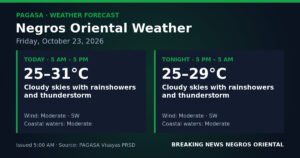
PAGASA’s daytime forecast calls for cloudy skies with rainshowers and thunderstorms lasting through the entire morning and afternoon. Temperatures during this period will range between 25°C and 31°C. Winds will be light to moderate, originating from the southwest. Coastal waters along the Negros Oriental seaboard — including those facing Siquijor and Cebu — are forecast at a slight to moderate sea state.
Overnight Conditions: 5:00 PM to 5:00 AM (October 25)
The weather agency said there will be no improvement after dark. PAGASA’s overnight forecast mirrors the daytime picture: cloudy skies with continuing rainshowers and thunderstorms well past midnight. Overnight temperatures will ease slightly, settling between 25°C and 29°C. Wind direction and strength remain the same — light to moderate from the southwest — and coastal waters continue at a slight to moderate sea state through the night.
Understanding the Forecast Terms
Rainshowers and thunderstorms are more severe than ordinary rain events. PAGASA’s inclusion of thunderstorms signals the presence of lightning — a direct safety risk — along with sudden heavy downpours that can produce localized flooding and rapidly reduced visibility. The agency’s forecast of thunderstorms in both periods means residents should not assume conditions will remain mild even in the absence of a formal storm warning.
Light to moderate winds are sustained but not destructive on land. However, when combined with rain and reduced visibility, even these wind speeds can raise the hazard level for outdoor work and road travel.
Slight to moderate coastal waters, according to PAGASA’s classification, refer to wave heights generally ranging from 0.5 to 1.25 meters for slight seas and up to around 2.5 meters for moderate seas. The agency’s forecast indicates sea state may shift within that range throughout the day and night, posing challenges particularly for smaller watercraft.
Road Travel and Commuters
Continuous rain and thunderstorms throughout Saturday will leave roads wet across the province — from the national highway connecting Dumaguete north through Bais and Guihulngan, to mountain routes in interior communities such as Valencia and Pamplona. PAGASA’s forecast of sudden heavy bursts associated with thunderstorm activity means drivers should reduce speed, extend following distances, and watch for flash flooding in low-lying sections of road during and after intense rain episodes.
Fisherfolk and Coastal Vessel Operators
PAGASA has not issued a gale warning alongside this forecast, but the combination of slight to moderate seas and active thunderstorms — which can generate sudden squalls — means small outrigger boat (bangka) operators working out of Dumaguete, Bais, Zamboangita, Bayawan, and other coastal communities along the Negros Oriental seaboard face elevated risk. Fishing communities are urged to assess conditions before departure and return to shore if weather worsens.
Passengers travelling on inter-island routes such as those operated by OceanJet between Dumaguete and Cebu, Dumaguete and Siquijor, or Bais and other Visayas ports are advised to check directly with their shipping lines regarding any schedule adjustments or cancellations driven by the sea state and weather conditions.
Agricultural Sector
Farms across Negros Oriental — including sugarcane and rice-growing areas — can expect field operations such as harvesting, plowing, and fertilizer or pesticide application to be disrupted by a full day of rain. Prolonged rainfall may also cause standing water that stresses crops vulnerable to waterlogging. PAGASA’s forecast advises farmers to secure equipment and harvested produce and to ensure drainage around fields is clear ahead of the rains.
Schools, Parents, and Weekend Activities
With thunderstorms forecast throughout the daytime hours on a Saturday that may include weekend classes, review sessions, or school-organised events, the weather agency’s forecast effectively requires contingency planning from school administrators and parents across the province. The standard safety guidance applies: if thunder is audible, lightning is within striking range — move indoors immediately and keep away from windows, metal structures, and tall trees. Schools in Dumaguete, Bais, Bayawan, and elsewhere holding Saturday programmes should have indoor fallback arrangements in place.
Outdoor Workers and Events
Construction crews, utility workers, and outdoor laborers across the province face hazardous conditions, particularly those working near bodies of water, on elevated structures, or in open areas where lightning risk is heightened. PAGASA’s thunderstorm forecast covers the full workday. Event organisers with outdoor markets, sports fixtures, or cultural programmes scheduled for Saturday should prepare contingency measures or consider moving activities under cover.
Siquijor and the Surrounding Sea Crossing
Siquijor island, a short ferry ride from Dumaguete, falls within the same weather pattern that PAGASA has identified for Negros Oriental. Residents and visitors there should similarly expect unsettled conditions throughout Saturday. Those planning the sea crossing between Siquijor and Dumaguete should factor in the slight to moderate sea state flagged in PAGASA’s coastal waters forecast before boarding any vessel, particularly smaller craft.
Source: Breaking News Negros Oriental (breakingnewsnegrosoriental.com), based on PAGASA forecast issued October 24, 2026