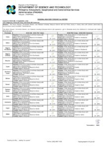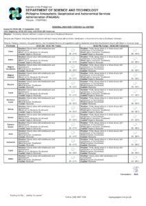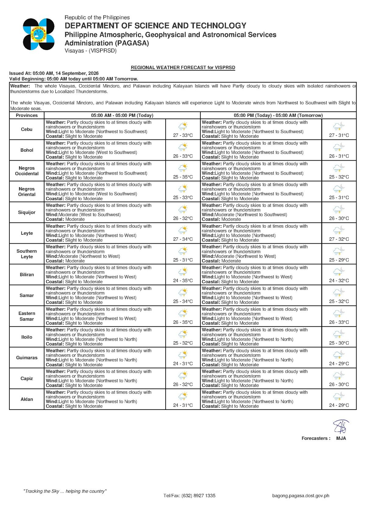
State weather bureau PAGASA has placed Negros Oriental and the rest of the Visayas under an unsettled weather forecast for Monday, September 14, 2026, with scattered rainshowers and thunderstorms expected to develop throughout the day. The agency’s Regional Forecast, released at 5:00 AM on September 14, 2026, describes conditions as partly cloudy to at times overcast, with periodic bursts of rain and thunder likely from morning through evening.
While no specific weather disturbance — such as a tropical cyclone or a low-pressure area — has been identified as driving today’s conditions, PAGASA confirms that the overall atmospheric setup across the Visayas carries enough instability to produce convective activity consistent with the mid-September rainy season. Residents in Dumaguete City, Bais, Guihulngan, Bayawan City, and surrounding communities throughout the province should prepare for intermittent wet weather and occasional thunder throughout the day.
By the Numbers
- 27°C — minimum temperature forecast for Negros Oriental and the Visayas on Monday
- 33°C — maximum daytime temperature expected during the afternoon
- 5:00 AM, September 14, 2026 — time the PAGASA Regional Forecast was officially issued
- 0.5 to 1.25 meters — wave height range for “slight” sea conditions as defined by PAGASA
- 1.25 to 2.5 meters — wave height range for “moderate” sea conditions
- 9:00 AM, September 13, 2026 — time of PAGASA’s Extended Weather Outlook covering early-week conditions
- 27°C to 34°C — temperature range noted in the Extended Outlook for Sunday and Monday combined
Weather Conditions in Detail
According to PAGASA, temperatures across Negros Oriental on Monday will fluctuate between 27 degrees Celsius at night and 33 degrees Celsius during the warmest part of the afternoon. Even during dry breaks between showers, the air will feel warm and humid, which is typical of tropical rainy-season weather. Winds are forecast to blow at light to moderate speeds from the northwest to southwest, keeping surface conditions generally manageable for land-based activities while still generating noticeable wave action on open water.
Coastal waters surrounding the Visayas — including those along the coasts of Negros Oriental and the island of Siquijor — are rated by PAGASA as “slight to moderate” for Monday. In practical terms, slight seas feature wave heights of roughly 0.5 to 1.25 meters, which larger commercial vessels can typically navigate under normal conditions. Moderate seas, with wave heights of 1.25 to 2.5 meters, can cause noticeable rolling even on bigger ferries and pose a genuine hazard to small outrigger boats and traditional bancas.
PAGASA has not issued any gale warning for waters in this area based on the available forecast data, meaning the coastal condition rating serves as a precautionary advisory rather than a danger signal. However, mariners and inter-island passengers are encouraged to take the rating seriously when making travel decisions.
No Named System, But Caution Still Warranted
The absence of a named tropical cyclone or declared monsoon surge does not mean today’s weather should be taken lightly. PAGASA’s forecast data indicates that the Visayas is experiencing general atmospheric instability characteristic of the rainy season in mid-September. This type of setup frequently produces brief but intense rain bursts and lightning strikes, particularly during the mid-afternoon to early evening hours when convective storms typically peak in the tropics.
Residents are not facing an extreme or emergency weather event based on the current PAGASA advisory, but they should remain alert to rapidly changing conditions — a clear morning sky can give way to a heavy thunderstorm within hours during this season.
Guidance for Inter-Island Travelers and Mariners
For those planning ferry trips between Dumaguete and Siquijor, or voyages to Cebu and other Visayas destinations, the slight to moderate sea conditions forecast by PAGASA warrant extra caution. Fast-craft operators, including lines such as OceanJet, may adjust departure schedules or delay sailings depending on actual sea states at the time of departure. Passengers should confirm trip status directly with their vessel operator before proceeding to the port and should allow extra time for potential delays.
Small-boat operators and fisherfolk along the coasts of Negros Oriental and Siquijor are urged by PAGASA’s advisory to exercise particular vigilance on Monday. Light to moderate winds, slight to moderate wave heights, and the added risk of sudden thunderstorms can combine to create unexpectedly dangerous conditions in open water. Thunderstorms can bring rapid wind gusts and lightning with very little advance warning. Those who must go out to sea are advised to remain close to shore and return to port immediately at the first sign of darkening skies or approaching thunder.
Practical Reminders for Farmers, Students, and Outdoor Workers
Agricultural communities in areas such as Bayawan City and Guihulngan will experience the same pattern of intermittent showers that covers the rest of the province. While rainfall during the rainy season can benefit crops, PAGASA’s forecast of afternoon thunderstorms means farmers working in open fields should plan to seek covered shelter well before the typical mid-afternoon storm peak. Lightning poses a serious risk in exposed agricultural areas, and anyone working under large isolated trees during a thunderstorm is in particular danger. Spraying of pesticides or fertilizer application should also be postponed if heavy rain is expected, as runoff will render such applications ineffective.
With Monday being a regular school day, parents and guardians in Dumaguete, Bais, Guihulngan, Bayawan, and nearby communities should prepare children for a wet commute. Rain gear — umbrellas and waterproof bags — should be packed, as showers can develop without much warning. Schools should follow established safety protocols if thunderstorms occur during class hours, keeping students indoors until lightning activity and heavy rain have passed.
Construction crews, market vendors, event organizers, and other outdoor workers across the province should factor the likelihood of afternoon thunderstorms into their scheduling. PAGASA’s forecast suggests morning hours may offer relatively clearer windows, but conditions can shift quickly. Any outdoor community events or sports activities planned for Monday should have covered contingency venues or postponement arrangements in place.
Early-Week Outlook
PAGASA’s Extended Weather Outlook, issued at 9:00 AM on September 13, 2026, indicates that the pattern of partly cloudy to cloudy skies with rainshowers or thunderstorms will persist into the early part of the week. The temperature range of 27°C to 34°C, combined with light to moderate northwest-to-southwest winds and slight to moderate coastal conditions, is expected to carry through at least the first few days of the work week, the weather agency indicated. Residents should continue monitoring PAGASA bulletins for updates as conditions develop.
Why This Matters
Scattered thunderstorms and unsettled coastal conditions directly affect the daily routines of tens of thousands of residents across Negros Oriental — from fisherfolk and ferry passengers navigating the waters between the province and Siquijor or Cebu, to farmers, students, and outdoor workers who depend on weather conditions to plan their day safely. PAGASA’s advisory, while not signaling an extreme weather event, provides critical guidance that allows communities to make informed decisions about travel, livelihood activities, and safety. Staying informed through official PAGASA bulletins throughout the day remains the most reliable way to respond to changing conditions during the rainy season.
Source: breakingnewsnegrosoriental.com / PAGASA Regional Forecast, September 14, 2026