DUMAGUETE CITY, Negros Oriental — A wet Friday is in store for the Visayas region, with the state weather bureau issuing an early-morning forecast of cloudy skies, rainshowers, and thunderstorms for July 31, 2026. From coastal communities along the Negros Oriental shoreline to the island province of Siquijor and across to Cebu, the habagat — the southwest monsoon — is firmly in control of the region’s weather, and residents, commuters, fisherfolk, and farmers are all advised to take precautions before heading out.
PAGASA’s July 31 Bulletin at a Glance
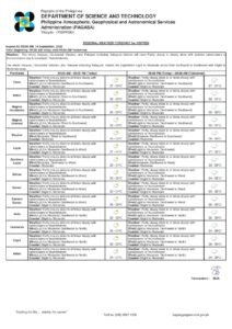
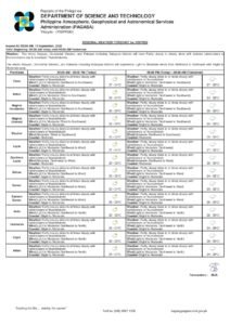
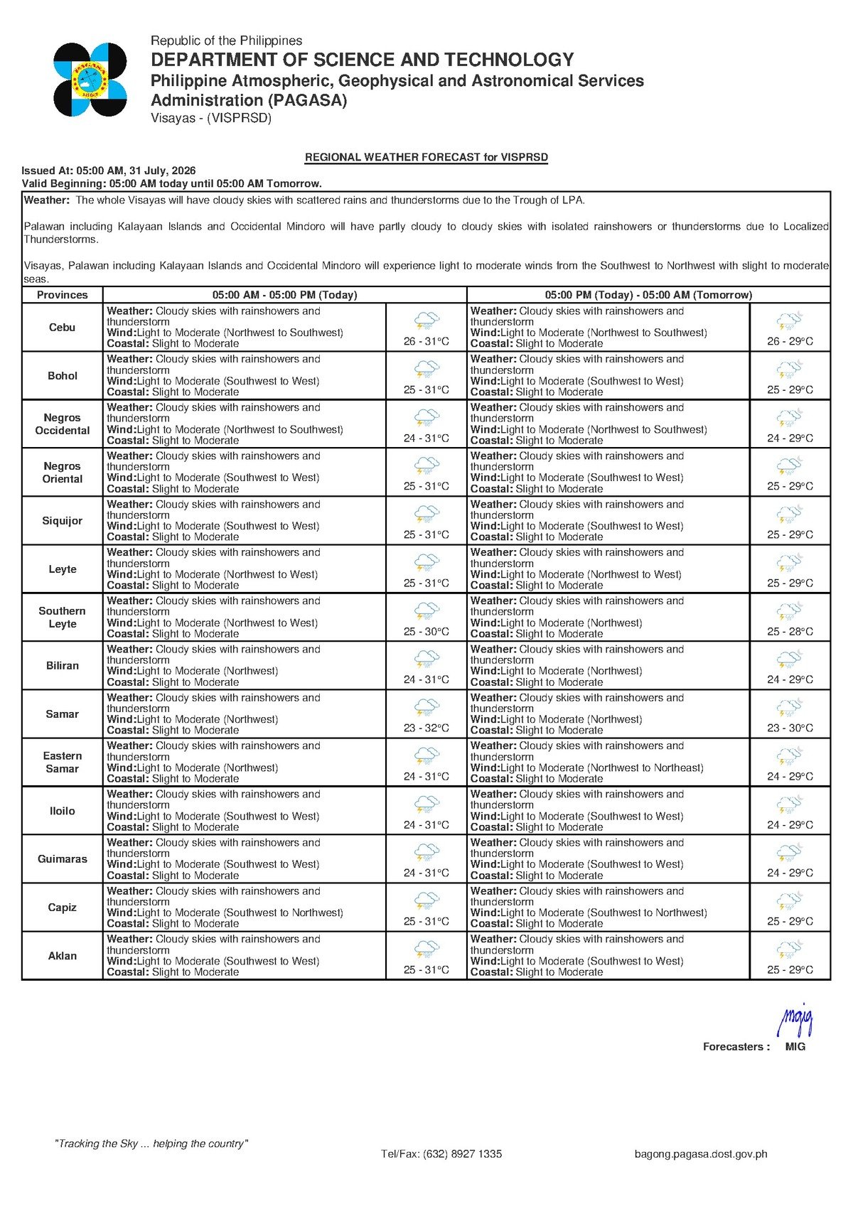
The Philippine Atmospheric, Geophysical and Astronomical Services Administration (PAGASA) released its 5:00 AM forecast on July 31, 2026, covering the entire Visayas region, which includes Negros Oriental. The bulletin calls for cloudy skies with rainshowers and thunderstorms throughout the day, with daytime temperatures ranging between 26°C and 31°C. Winds are blowing from the northwest to southwest at light to moderate speeds, and coastal waters have been rated at a slight to moderate condition.
Notably, PAGASA’s bulletin does not identify any tropical cyclone, low-pressure area, or other intensifying weather system as a contributing factor. This is standard wet-season weather for the Visayas — unsettled and potentially disruptive, but within the normal range of conditions for this time of year.
By the Numbers
- Forecast temperature range on July 31: 26°C to 31°C
- Forecast temperature range on August 1: 26°C to 29°C
- Extended outlook temperature range (Friday, July 31): 26°C to 32°C
- Extended outlook temperature range (Thursday context): 25°C to 31°C
- “Slight” wave height: approximately 0.5 to 1.25 meters
- “Moderate” wave height: approximately 1.25 to 2.5 meters
- PAGASA extended outlook issued: 9:00 AM, July 30, 2026
The Habagat: What Is Driving Today’s Weather
According to PAGASA’s bulletin, the northwest-to-southwest wind direction is a clear signature of the southwest monsoon, or habagat — the dominant wind system over the Philippines from approximately June through September each year. The habagat draws warm, moisture-heavy air northeastward across the archipelago from the southwest. As this saturated air rises over land, it cools, condenses, and produces the clouds, afternoon downpours, and electrical storms that are a defining feature of the wet season in the Visayas.
PAGASA’s data confirms that no extraordinary synoptic system is amplifying these conditions today. What residents are dealing with is the habagat doing what it does every year — delivering persistent wet weather across the region with no clear end in sight until the monsoon retreats in the coming months.
Coverage Across Negros Oriental and Neighboring Provinces
The PAGASA regional forecast applies across the whole of the Visayas, meaning the same conditions will be felt throughout Negros Oriental — from Dumaguete City in the south, through the central corridor towns of Bais and Manjuyod, northward to Guihulngan, and along the southwestern coast to Bayawan. Inland agricultural areas and upland communities will be equally subject to intermittent rain and the possibility of thunderstorm activity, particularly during the afternoon and evening hours.
The island of Siquijor, which lies across the Siquijor Strait from the Negros Oriental coast, is included in the same PAGASA Visayas forecast and can expect conditions to mirror those on the mainland. Cebu, to the east, is likewise covered under PAGASA’s Visayas regional bulletin.
Thunderstorms in the Philippines during the wet season tend to be short in duration but high in intensity. PAGASA’s historical data and operational forecasts consistently show that these events can produce localized heavy downpours, sudden gusts of wind, and dangerous lightning within very short windows. Residents should not wait for conditions to worsen visibly before seeking shelter.
What “Slight to Moderate” Coastal Conditions Mean in Practice
PAGASA has classified the coastal waters around Negros Oriental and the wider Visayas as slight to moderate for July 31. In operational terms, “slight” refers to wave heights of roughly 0.5 to 1.25 meters, while “moderate” covers the range from approximately 1.25 to 2.5 meters. For large commercial ferries, these conditions are generally manageable. For small open boats, motorized outriggers, and fishing bancas, however, even the lower end of moderate swells represents a real and serious hazard — particularly when combined with the gusty winds that can accompany afternoon thunderstorm activity.
No gale warning has been included in PAGASA’s bulletin for this period, which indicates conditions have not reached the most severe classifications on the agency’s scale. That said, the absence of a gale warning does not mean the waters are without risk, and small-vessel operators should exercise heightened caution throughout the day.
Extended Weekend Outlook
PAGASA’s extended weather outlook, issued at 9:00 AM on July 30, 2026, projects the wet pattern continuing into the days ahead. The outlook for Friday, July 31, cites temperatures of 26°C to 32°C with light to moderate northwest-to-southwest winds and slight to moderate coastal conditions. The Thursday reference period in the same outlook recorded 25°C to 31°C under similar wind and sea conditions. For Saturday, August 1, the bulletin tightens the temperature band slightly to 26°C to 29°C, with winds and coastal ratings remaining broadly unchanged.
According to PAGASA’s outlook, the consistency of wind direction and coastal condition ratings across the forecast period points to a settled, entrenched wet-season pattern with no significant change expected in the near term.
Guidance for Key Sectors
Commuters and Road Users
Rain bursts associated with afternoon thunderstorms typically reduce road visibility and create slippery surfaces. Motorists travelling the national highway between Dumaguete and Bayawan, or along the northern coastal road through Bais and Guihulngan, are advised by the forecast to drive at reduced speeds and keep a greater following distance. Pedestrians should carry rain gear and wear appropriate footwear for wet conditions.
Ferry Passengers on Dumaguete Routes
Inter-island travel from Dumaguete port — including services to Siquijor and Cebu operated by carriers such as OceanJet, Montenegro Lines, and others — is not suspended under the current bulletin. However, the slight to moderate coastal conditions flagged by PAGASA mean that schedules are subject to change on short notice, especially if thunderstorm activity intensifies during sailing windows. Passengers are advised to confirm their bookings directly with their ferry operators on the day of travel and to allow additional time at the terminal in case of schedule adjustments.
Fisherfolk and Small-Boat Operators
The PAGASA bulletin’s combination of slight-to-moderate coastal conditions and active thunderstorm potential presents a meaningful risk to anyone operating small vessels or open bancas. Sudden squalls during thunderstorms can generate sharp wind gusts capable of destabilising small craft with little warning. Fisherfolk are strongly encouraged to complete their sea activities during morning hours when conditions are typically calmer, maintain close proximity to shore, and return to port before the afternoon window when electrical storm risk climbs. Any rapid darkening of the sky or audible thunder should be treated as an immediate signal to head back to port.
Farmers Across Negros Oriental
For farming communities in the sugarcane and rice-growing flatlands around Bais, Manjuyod, and the northern municipalities, PAGASA’s forecast represents the familiar double-edged reality of wet-season agriculture. Regular moisture supports growing crops, but the intense, localised downpours associated with thunderstorms can cause standing water in low-lying fields and physical damage to crops that are newly planted or approaching harvest maturity. Harvested produce stored in open or partially covered structures should be secured and protected ahead of today’s expected rainfall.
Why This Matters
PAGASA’s July 31 forecast confirms that the southwest monsoon is maintaining a firm grip on the Visayas, bringing conditions that directly affect the daily lives of residents across Negros Oriental, Siquijor, and Cebu — from road safety and ferry travel to livelihoods at sea and on the farm. While the bulletin does not signal an extraordinary or cyclone-driven weather event, the sustained pattern of thunderstorms and slight-to-moderate coastal waters over consecutive days increases cumulative risk for fisherfolk, small-boat operators, and those working in flood-prone agricultural areas. The consistency of conditions through the weekend, as confirmed by PAGASA’s extended outlook, means that preparedness — not just for today but for the days ahead — remains essential.
Source: breakingnewsnegrosoriental.com / PAGASA regional forecast bulletin