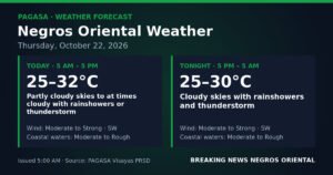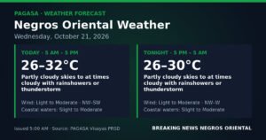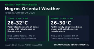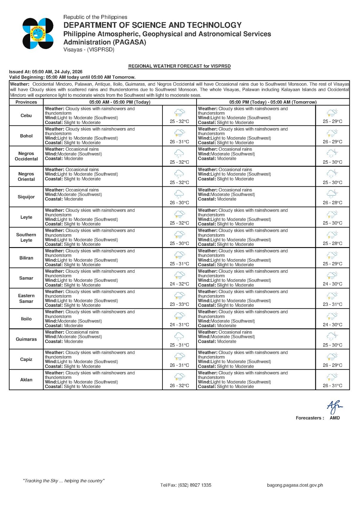
DUMAGUETE CITY, Negros Oriental — July 24, 2026: Wet weather is settling in across Negros Oriental and the Visayas for the next several days, with no significant break in sight before the weekend. The Philippine Atmospheric, Geophysical and Astronomical Services Administration (PAGASA) issued its regional forecast at 5:00 AM Thursday, warning of cloudy skies, rainshowers, and embedded thunderstorms that will affect coastal communities, agricultural areas, ferry routes, and daily commuters throughout the province and surrounding islands.
The advisory covers not just Negros Oriental but the broader Visayas region, and an extended weather outlook — released by PAGASA at 9:00 AM on July 23 — confirms that these conditions are expected to hold at least through Saturday, July 26.
The Force Behind the Wet Weather
According to PAGASA’s bulletin, the primary driver of the current weather pattern is the southwest monsoon, known locally as habagat. Winds are blowing from the southwest at light to moderate speeds, consistent with the monsoon system that typically dominates the Philippine archipelago from June through September each year.
The habagat works by pushing warm, moisture-heavy air from the open sea across the Visayas landmass. The result is persistent cloud cover, repeated bouts of rainfall, and thunderstorms that can build and intensify within a short period, sometimes bringing heavy localized downpours with very little warning. Residents in flood-prone barangays — including parts of Dumaguete City, Tanjay, and coastal communities along the western shoreline of Negros Oriental — should stay alert to rapidly changing conditions.
Unlike a typhoon that arrives and departs within days, the habagat is a seasonal system. It does not produce one steady, continuous rain event but instead cycles through bursts — a heavy downpour, a short lull, then another round of showers. This intermittent pattern makes outdoor planning especially difficult and raises the risk of localized flooding in low-lying areas throughout the province.
Current and Extended Forecast at a Glance
PAGASA’s 5:00 AM forecast for the Visayas on July 24 describes the following conditions:
- Sky condition: Cloudy with rainshowers and thunderstorms
- Temperature range: 25°C to 32°C across most forecast areas, with at least one zone showing a cooler 25°C to 29°C range, indicating more heavily clouded or rain-saturated localities
- Wind direction and speed: Southwest, light to moderate
- Coastal water condition: Slight to moderate seas
The extended outlook issued by PAGASA projects similar conditions for Friday, with temperatures forecast between 26°C and 32°C, the same southwest wind direction, and coastal waters remaining in the slight to moderate range. Saturday’s forecast mirrors Friday’s pattern, though PAGASA notes that wind speeds on Saturday may increase slightly to a more consistent moderate level — a detail that sea travelers and fishing communities should take seriously when making weekend plans.
By the Numbers
- 5:00 AM — Time of PAGASA’s July 24 regional forecast bulletin
- 25°C to 32°C — Temperature range for most of the Visayas on July 24
- 26°C to 32°C — Forecast temperatures for Friday, July 25
- 0.5 to 1.25 meters — Typical wave heights under “slight” sea conditions
- 1.25 to 2.5 meters — Wave heights possible under “moderate” sea conditions
- July 26 — Latest date covered by PAGASA’s extended weather outlook
Understanding “Slight to Moderate” Coastal Seas
PAGASA’s classification of coastal waters as being in “slight to moderate” condition carries practical significance for anyone traveling by sea. Slight seas generally involve wave heights between 0.5 and 1.25 meters, while moderate seas can produce waves reaching 1.25 to 2.5 meters. In combination, this range means that larger commercial vessels can typically continue operations, but small outrigger bancas — the watercraft most commonly used by fisherfolk in Negros Oriental, Siquijor, and across the Tañon Strait — will encounter noticeable and potentially hazardous wave action.
PAGASA has not raised a formal gale warning for the area in this bulletin, meaning conditions have not yet crossed the official threshold for a maritime advisory. However, the agency’s forecast makes clear that the combination of slight-to-moderate seas and active thunderstorm activity creates genuine risk for small craft. Thunderstorms embedded in monsoon cloud systems can rapidly generate strong gusts, choppy water, and reduced visibility — conditions that can deteriorate far faster than a fisherfolk on open water can safely react to.
Guidance for Key Sectors in Negros Oriental
Fishing Communities and Small-Boat Operators
Fisherfolk operating out of Dumaguete, Sibulan, Dauin, Zamboanguita, and communities along the Siquijor coastline are strongly advised to exercise caution today. PAGASA’s forecast of slight to moderate seas, combined with the persistent threat of thunderstorm activity, means small outrigger bancas should remain close to shore. Waterspouts and sudden strong winds are among the hazards that can emerge when thunderstorms pass through monsoon-affected coastal areas. Anyone already at sea who observes a rapidly building dark cloud formation should head back to port without delay.
Ferry Passengers and Inter-Island Travelers
Travellers using inter-island ferry services departing from Dumaguete — including routes to Siquijor, Cebu, and other Visayas destinations served by operators such as OceanJet and Montenegro Lines — should verify their schedules directly with their carrier before proceeding to the port. According to standard maritime practice observed during habagat season, fast craft such as OceanJet vessels are more sensitive to wave conditions than conventional roll-on, roll-off ferries, and slight-to-moderate seas can trigger schedule delays or temporary trip suspensions. Build in extra time and confirm trip status before departure.
Farmers Across the Province
For agricultural communities in Bayawan, Bais, Guihulngan, and the upland barangays of Negros Oriental, the ongoing monsoon rainfall presents both benefit and risk. The moisture supports crop growth during the growing season, but persistent heavy showers and thunderstorms can waterlog soil, disrupt field operations, and damage vegetables and recently harvested grain. PAGASA’s forecast suggests cloud cover and showers will continue throughout the day, so farmers with mature crops should prioritize any field work during morning dry intervals where possible. Operating farm equipment during active lightning conditions should be avoided entirely.
Students, Commuters, and Daily Workers
With thunderstorms forecast throughout the day, residents heading out across Negros Oriental should carry rain gear as a standard precaution. Low-lying sections of Dumaguete City — particularly streets near the city market and areas adjacent to drainage outflows and estuaries — are prone to rapid flooding during heavy downpours. Motorcycle riders and habal-habal operators are advised to slow down on rain-slicked roads and to pull over safely when a thunderstorm intensifies. Outdoor workers in construction, utilities, and related sectors should be prepared to suspend exposed or elevated work when lightning activity is observed nearby.
Outdoor Events and Public Gatherings
Any outdoor event or activity planned in Negros Oriental on Thursday should have a covered contingency arrangement in place. With rainshowers and thunderstorms likely throughout the day and into the evening, the probability of weather disruptions is high. Organizers and employers should monitor conditions continuously and be ready to make real-time adjustments to protect participants and workers.
What to Expect Through the Weekend
PAGASA’s extended forecast gives no indication of a significant improvement in conditions before Saturday. The southwest monsoon is expected to maintain its hold over the Visayas, keeping temperatures in the mid-to-upper 20s to low 30s Celsius range, sustaining southwest winds at light to moderate speeds, and keeping coastal waters in the slight to moderate condition range. The noted increase in wind speed forecast for Saturday warrants particular attention from those planning sea travel over the weekend.
Given the dynamic nature of monsoon weather, PAGASA advises residents to check updated forecasts daily, as multi-day outlooks can be overtaken by rapid changes in conditions — especially during the most active phase of the habagat season.
Why This Matters
The southwest monsoon’s sustained grip on the Visayas through at least July 26 poses real and immediate risks across multiple sectors of daily life in Negros Oriental — from the safety of fisherfolk navigating slight-to-moderate seas prone to rapid deterioration, to the livelihoods of farmers contending with persistent wet field conditions, and the travel plans of ferry passengers on routes sensitive to wave action. Because habagat-driven weather is inherently unpredictable in its intensity and timing, PAGASA’s call for vigilance is not precautionary language alone — it reflects the documented pattern of sudden, heavy rainfall events that characterise this season. Residents, workers, and travelers who fail to account for rapidly changing conditions during this period face elevated exposure to flooding, maritime incidents, and lightning-related hazards.
Source: Breaking News Negros Oriental (breakingnewsnegrosoriental.com)