Sunday, September 13, 2026, will be a wet one for residents across the Visayas, including Negros Oriental and the island province of Siquijor. The Philippine Atmospheric, Geophysical and Astronomical Services Administration (PAGASA) has placed the entire region under a forecast of intermittent rainshowers and thunderstorms, with variable winds and unsettled coastal conditions likely to affect activities on land and at sea throughout the day.
By the Numbers
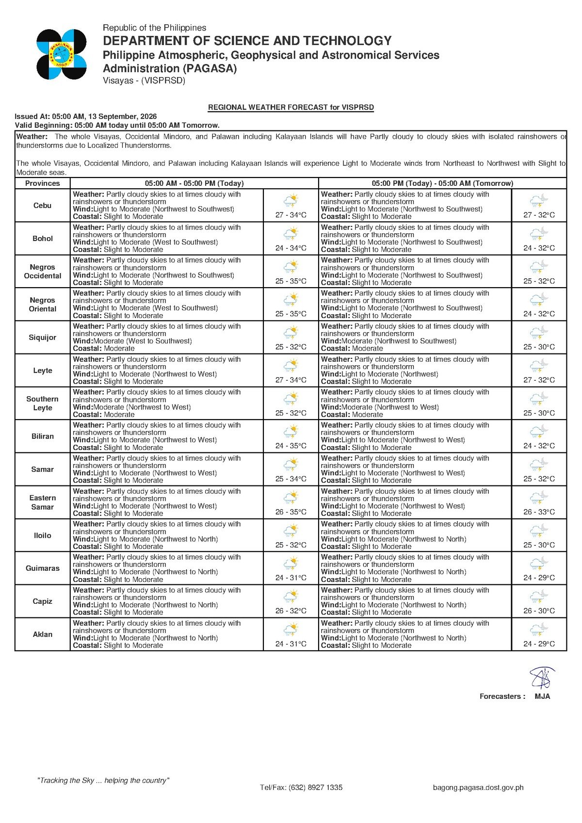
- Forecast issued: 5:00 AM, Sunday, September 13, 2026
- Minimum temperature: 27°C
- Maximum temperature: 34°C
- Extended outlook issued: 9:00 AM, September 12, 2026
- Saturday temperature range (extended outlook): 27°C to 33°C
- Slight seas wave height (approximate): 0.5 to 1.25 meters
- Moderate seas wave height (approximate): 1.25 to 2.5 meters
PAGASA’s Morning Bulletin
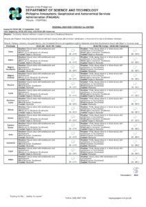
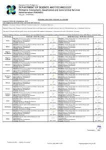
At 5:00 AM on September 13, 2026, PAGASA released its Visayas regional weather forecast, describing skies ranging from partly cloudy to at times overcast, with rainshowers and thunderstorms expected to develop during the day. According to PAGASA, winds will blow from the northwest to southwest at light to moderate speeds, while coastal waters are rated as slight to moderate — conditions that call for heightened awareness among those working or traveling at sea.
The weather agency’s forecast does not attribute today’s unsettled conditions to a specific weather system such as a tropical cyclone, a low-pressure area, or a named monsoon surge. Instead, PAGASA describes a broad pattern of variable winds and scattered convective activity — the kind of transitional, rainy-season setup typical of the Visayas in September. The absence of a named system, however, does not eliminate risk. Scattered thunderstorms embedded within this type of pattern can still deliver sudden heavy downpours, dangerous lightning, and sharp wind gusts with little advance warning.
Temperature and Wind Conditions
Despite the expected cloud cover and intermittent rain, PAGASA’s forecast shows that temperatures will remain warm across the region. Overnight and early morning readings will hover around 27°C, climbing to a peak of approximately 34°C during the afternoon hours. This means that even on a rainy day, heat and humidity will still be significant factors for those spending time outdoors. Staying hydrated remains important, particularly for workers and those engaged in strenuous activity.
Winds will come from a northwest to southwest direction at light to moderate intensity. Under normal circumstances, these wind speeds are not damaging in themselves. However, PAGASA’s bulletin notes that thunderstorm cells embedded within the broader weather pattern can temporarily produce much stronger and more unpredictable gusts — a hazard for small watercraft, outdoor structures, and anyone caught in the open during an active storm cell.
What “Slight to Moderate” Coastal Waters Mean in Practice
PAGASA has classified coastal waters around the Visayas as slight to moderate. In practical terms, “slight” seas correspond to wave heights of roughly 0.5 to 1.25 meters, while “moderate” seas involve waves from about 1.25 to 2.5 meters. For large commercial ferries and cargo vessels, these conditions are generally workable. For smaller watercraft — outrigger fishing boats (bancas), pump boats, and similar vessels — moderate seas combined with the gusty, unpredictable winds that accompany thunderstorms can create genuinely hazardous situations.
Fisherfolk operating out of coastal communities in Negros Oriental, including those in Bais along Tañon Strait, Dumaguete, and Amlan, are advised by PAGASA to exercise careful judgment before heading out. Those already at sea who observe dark clouds building or hear thunder are urged to return to port without delay. Conditions can deteriorate rapidly when a thunderstorm cell develops overhead or nearby.
Travel by Ferry and Inter-Island Vessels
Passengers planning to travel between Dumaguete and Siquijor, Cebu, or other Visayas destinations — whether aboard fast craft, roll-on/roll-off (RORO) vessels, or smaller pump boats — should verify schedules and check for any advisories from their shipping lines or the Philippine Coast Guard before proceeding to the port. Slight to moderate sea conditions may affect passenger comfort and, if conditions deteriorate, could prompt schedule adjustments by operators. Small pump boats used for short inter-island crossings face the highest risk under these conditions and should exercise maximum caution.
Implications for Negros Oriental’s Various Communities
For Negros Oriental — stretching from Dumaguete City in the south through the sugar-growing areas of Guihulngan in the north, and from the fishing communities along Tañon Strait to the upland barangays of Bayawan — PAGASA’s forecast means that rain should be expected at virtually any hour of the day, not merely in the afternoon.
Farmers tending crops across the province may benefit from the additional rainfall during a period when soil moisture supports growing crops, but open fields during active thunderstorms present a serious lightning risk. Agriculture workers in exposed terrain should seek sturdy shelter at the first sound of thunder and avoid standing near tall trees, metal fences, or farm equipment during a storm.
Commuters, students, and parents in Dumaguete City and surrounding municipalities should carry rain protection throughout the day. Low-lying and flood-prone barangays may experience brief flooding or slippery road surfaces during heavy bursts of rain associated with passing thunderstorm cells. Drivers are advised to slow down and allow extra travel time. Event organizers running outdoor activities — fiestas, sports events, construction work, or community gatherings — should prepare contingency plans and identify available indoor or covered spaces where participants can take shelter quickly if a storm approaches.
Looking Ahead: Conditions Through the Weekend
PAGASA’s extended weather outlook, issued at 9:00 AM on September 12, 2026, indicates that this pattern of variable winds and intermittent rain is not limited to Sunday alone. The Saturday outlook within that same bulletin showed temperatures between 27°C and 33°C, with light to moderate winds from the northwest to north direction, and slight to moderate coastal water conditions — a profile very similar to Sunday’s forecast. The Sunday entry in the extended data also references southwest to south winds, suggesting that wind direction is shifting gradually as the weekend progresses. Taken together, the extended outlook paints a picture of persistent unsettled weather through at least the close of the weekend.
Residents and travelers across the Visayas are encouraged to monitor PAGASA’s official website and social media channels for updated bulletins throughout the day, as forecasts can change as new data becomes available.
Why This Matters
PAGASA’s forecast of rainshowers and thunderstorms across the Visayas on September 13, 2026, carries real safety implications for coastal communities, fisherfolk, ferry passengers, and outdoor workers throughout the region. Slight to moderate sea conditions combined with the potential for sudden, intense thunderstorm activity mean that both land-based and maritime activities require extra caution and flexible planning. The forecast also underscores the importance of monitoring official PAGASA bulletins regularly during the rainy season, when conditions can shift quickly and without a named weather system as a visible warning signal.
Source: breakingnewsnegrosoriental.com