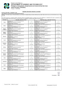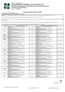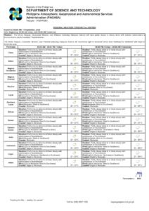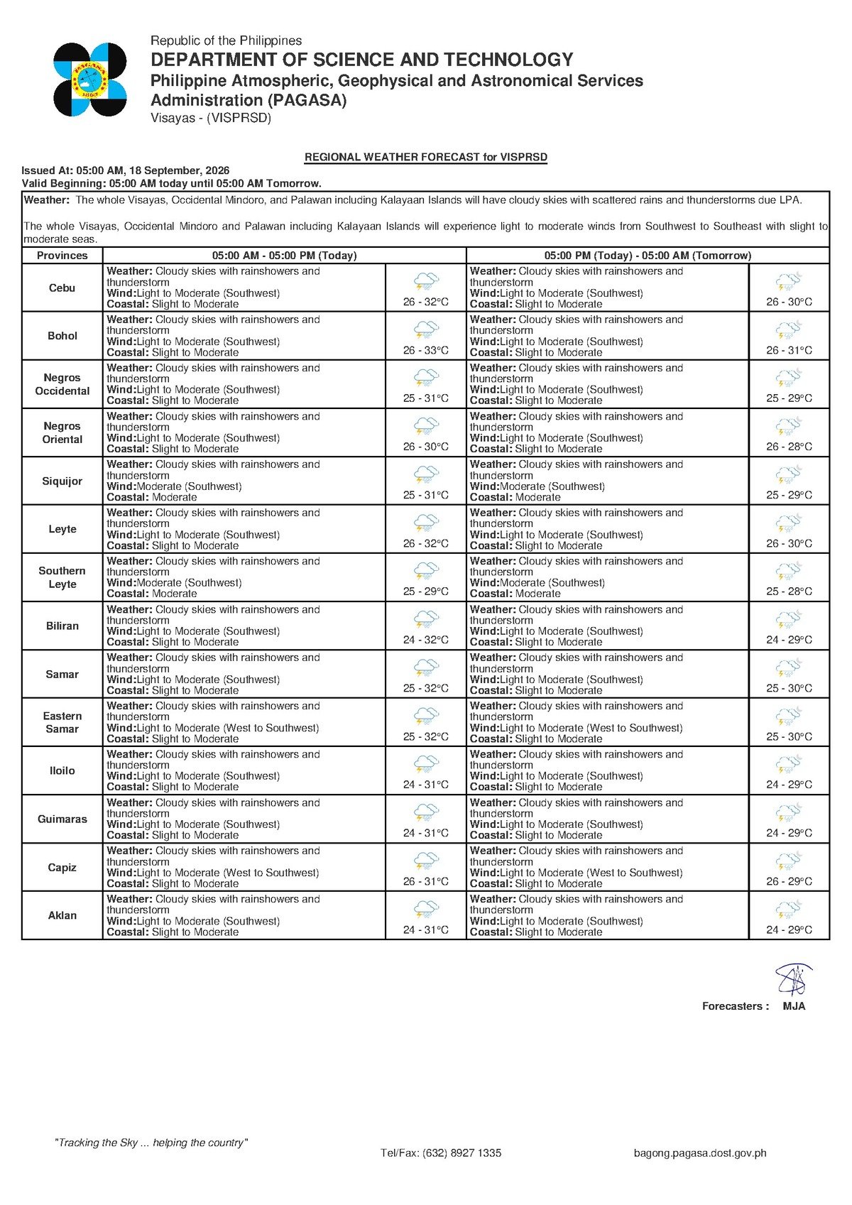
Southwest monsoon winds will keep the skies over Negros Oriental and the broader Visayas region grey and unsettled this Friday, September 18, 2026, with rainshowers and thunderstorms expected to persist throughout the day. The Philippine Atmospheric, Geophysical and Astronomical Services Administration (PAGASA) released its 5:00 AM regional weather bulletin for the Visayas, painting a consistently rainy picture not only for today but extending through the weekend as well.
From the coastal towns of Bayawan and Bais to the highland farm communities of Guihulngan, La Libertad, and Tayasan — and from the urban streets of Dumaguete City to inter-island routes headed toward Siquijor, Cebu, and Tagbilaran — residents and travelers will need to exercise extra caution and build flexibility into their Friday plans.
The Force Behind the Rain: Southwest Monsoon
PAGASA attributed the unsettled conditions to the southwest monsoon, known locally as habagat — a seasonal wind system that draws warm, moisture-heavy air from the surrounding seas into the Philippine archipelago during the rainy season months. As that moist air rises over land and encounters cooler air higher in the atmosphere, it generates the widespread cloudiness, intermittent rainshowers, and thunderstorm activity that define habagat weather. This is a familiar seasonal pattern for mid-September across the Visayas, though it carries real risks particularly during thunderstorm episodes when lightning, heavy downpours, and sudden wind gusts can occur.
According to the PAGASA bulletin, no active tropical cyclone wind signals, gale warnings, or rainfall warning advisories are in effect for Negros Oriental or neighboring provinces as of this forecast. The weather disturbance is entirely monsoon-driven rather than tied to a named storm — but PAGASA cautioned that the risks from flooding, lightning strikes, and deteriorating coastal conditions during thunderstorm outbreaks remain genuine and should not be taken lightly.
Friday’s Official Forecast at a Glance
The PAGASA 5:00 AM Visayas regional bulletin for Friday, September 18, 2026, describes the following conditions for Negros Oriental and surrounding areas:
- Sky condition: Cloudy skies with rainshowers and thunderstorms
- Temperature range: 26°C (low) to 32°C (high)
- Wind speed: Light to moderate
- Wind direction: Southwest
- Coastal condition: Slight to moderate
Despite the overcast skies and rain, temperatures will remain warm — ranging between 26°C and 32°C — meaning humidity will feel elevated throughout the day. Residents from coastal Dumaguete and Zamboanguita to inland communities like Mabinay and Santa Catalina should expect intermittent showers with the potential for heavier bursts when thunderstorms develop.
By the Numbers
- Forecast temperature low: 26°C (Friday)
- Forecast temperature high: 32°C (Friday), rising to 33°C by Saturday
- Saturday temperature low: 27°C
- Thursday temperature high: 31°C
- PAGASA bulletin release time: 5:00 AM, September 18, 2026
- Extended outlook issued: 9:00 AM, September 17, 2026
- Estimated wave height range under “slight to moderate” coastal conditions: approximately 0.5 to 2 metres
What “Slight to Moderate” Coastal Waters Mean
For those heading out to sea or boarding inter-island vessels, PAGASA’s designation of coastal waters as slight to moderate is an important signal. In practical terms, wave heights in this range typically fall between roughly half a metre and two metres. Larger passenger ferries and roll-on/roll-off (RORO) vessels are generally capable of operating under these conditions, but smaller outrigger boats and bancas face considerably greater difficulty — particularly when thunderstorms cause winds to spike abruptly.
While there is no gale warning attached to this bulletin, PAGASA’s guidance underscores that sea conditions can shift rapidly during thunderstorm episodes, and mariners of all vessel sizes should maintain heightened vigilance.
Guidance Across Key Sectors
Fisherfolk and Small-Boat Operators
Those fishing out of the shores of Bayawan, Bais, Bindoy, Zamboanguita, or Siquijor should treat today’s conditions with particular care. The combination of slight to moderate seas and a high probability of thunderstorms throughout the day creates conditions that can worsen without warning. Lightning at sea poses a serious and immediate hazard. PAGASA’s forecast advises that if small-boat operators must venture out, they should do so early, keep close to shore, and return to port at the first sign of dark cloud buildup or distant thunder.
Inter-Island Ferry Passengers
Travelers booked on inter-island routes — including services connecting Dumaguete to Cebu, Siquijor, and Tagbilaran operated by carriers such as OceanJet — should confirm departure schedules with their respective shipping lines before proceeding to the port. While “slight to moderate” seas typically permit ferry operations to continue, individual operators may modify or delay sailings if thunderstorms directly affect port zones or travel routes. Passengers are advised to bring rain gear and allow extra buffer time for potential delays.
Farmers and Agricultural Workers
Inland farming communities in Guihulngan, La Libertad, Tayasan, and the highland areas of Negros Oriental face a dual reality today: the habagat rains support crop growth but simultaneously raise the risk of localised flooding in low-lying fields and damage to harvested produce left exposed to the elements. Agricultural workers should secure crops and drying areas ahead of anticipated rainfall intensification and avoid open-field work during thunderstorm periods due to lightning danger.
Motorists and Daily Commuters
Road users on provincial highways — including National Highway segments through Valencia, Sibulan, Santa Catalina, and Mabinay — should anticipate wet, slippery surfaces for the duration of Friday. Heavy rain bursts associated with thunderstorms can reduce visibility significantly. Drivers and motorcycle riders are advised to reduce speed, extend following distances, activate headlights during downpours, and watch for roadside debris or flooding in low-elevation road sections.
Students, Parents, and Schools
Given that showers are probable at multiple intervals throughout the school day, parents are encouraged to send children with rain gear — waterproof bags and umbrellas in particular. Should thunderstorms intensify and persist, individual schools may exercise discretion regarding outdoor activities. Families should monitor official school communication channels and prepare to arrange early pickup if flooding develops along school routes.
Outdoor Workers and Event Planners
Construction crews, market vendors, road workers, and organizers of any outdoor gatherings in Dumaguete or elsewhere in Negros Oriental this Friday should maintain contingency plans for rain interruptions. Thunderstorms can arrive suddenly and bring concentrated bursts of heavy rainfall. PAGASA’s standard advisory applies: seek sturdy, enclosed shelter when lightning is active, and avoid standing beneath isolated trees or in open areas when thunder is audible.
Extended Outlook: Unsettled Weather Continues Through the Weekend
According to PAGASA’s extended weather outlook issued at 9:00 AM on September 17, 2026, the current pattern of southwest monsoon influence is not confined to Friday. The three-day picture for the Visayas shows:
- Thursday: 26°C–31°C | Light to moderate southwest winds | Slight to moderate coastal seas
- Friday: 26°C–32°C | Light to moderate southwest winds | Slight to moderate coastal seas
- Saturday: 27°C–33°C | Light to moderate southwest winds | Slight to moderate coastal seas
Temperatures inch upward slightly by Saturday — reaching as high as 33°C — but the prevailing wind direction, coastal sea state, and general weather character remain consistent across all three days. PAGASA’s data suggests that residents and businesses across Negros Oriental and the wider Visayas should plan for continued wet and unsettled weather at minimum through the weekend, adjusting schedules, outdoor activities, and logistical preparations accordingly.
Why This Matters
The sustained habagat-driven rain and thunderstorms forecast across Negros Oriental through the weekend affect a broad cross-section of daily life — from the livelihoods of small-boat fisherfolk and farmers to the safety of inter-island ferry passengers, commuters, and schoolchildren. PAGASA’s absence of gale warnings or cyclone signals offers some reassurance, but the agency’s own bulletin makes clear that lightning, localised flooding, and rapidly shifting coastal conditions during thunderstorm episodes represent real, present hazards. Awareness of the extended outlook through Saturday is particularly important for those whose work, travel, or agricultural activities depend on stable weather, as the multi-day monsoon pattern leaves little window for safe outdoor or maritime operations without careful planning and monitoring.
Source: Breaking News Negros Oriental (breakingnewsnegrosoriental.com)