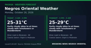
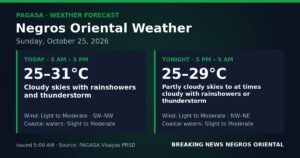
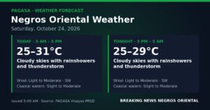
Southwest monsoon conditions will keep the skies unsettled over Negros Oriental, Siquijor, and the wider Visayas on Friday, September 11, 2026, as the Philippine Atmospheric, Geophysical and Astronomical Services Administration (PAGASA) warns of rainshowers and thunderstorms that could strike at any point during the day. The agency released its regional weather forecast at 5:00 AM Friday, describing partly cloudy to at times cloudy skies — conditions that may appear calm early in the morning before deteriorating into afternoon downpours.
The forecast covers communities throughout Negros Oriental, including Dumaguete City, Bayawan, Bais, Guihulngan, and Tanjay, as well as the island province of Siquijor, all of which fall under PAGASA’s regional Visayas advisory.
The Southwest Monsoon at Work
PAGASA’s forecast data identifies southwest winds blowing at light to moderate speeds as the primary driver of Friday’s weather. This wind pattern is the signature of the habagat, the southwest monsoon that dominates the Philippine weather system from June through November. The habagat continuously transports warm, moisture-saturated air from open waters toward the archipelago, where it rises, cools, and condenses into the rain clouds responsible for the wet conditions expected Friday.
According to PAGASA, no tropical cyclone or low-pressure area is cited as a direct cause of Friday’s rain in the regional forecast. Instead, the sustained southwest wind flow alone is sufficient to generate the scattered rainshowers and thunderstorms that will affect the Visayas throughout the day — a reminder that even without a named weather system, the monsoon season delivers consistent and sometimes intense rainfall.
Friday Weather Conditions at a Glance
PAGASA’s 5:00 AM regional forecast describes the following conditions for the Visayas, including Negros Oriental and Siquijor:
- Sky condition: Partly cloudy to at times cloudy
- Precipitation: Rainshowers or thunderstorms
- Temperature range: 28°C (low) to 34°C (high)
- Wind speed: Light to moderate
- Wind direction: Southwest
- Coastal condition: Slight to moderate
By the Numbers
- 5:00 AM — Time PAGASA issued its Friday regional forecast
- 28°C — Forecast low temperature for the Visayas on Friday
- 34°C — Forecast high temperature for the Visayas on Friday
- September 10, 2026, 9:00 AM — Time PAGASA released its extended weather outlook covering Friday through the weekend
- Slight to moderate — Coastal sea conditions forecast for Friday
- Moderate — Coastal conditions expected to intensify to by Saturday
What the Coastal Forecast Means for Sea Travel
PAGASA classifies Friday’s coastal conditions as “slight to moderate,” which in practical terms means that larger inter-island ferries should be able to operate without significant disruption, but smaller watercraft — particularly the low-freeboard bangka outriggers used by fisherfolk along the Tañon Strait and around Siquijor — face a more precarious situation. Slight-to-moderate swells can cause smaller vessels to roll unpredictably, and any thunderstorm that develops quickly can produce sudden wind gusts and waterspouts that magnify the risk for those at sea.
According to PAGASA’s forecast, no gale warning has been issued for Friday. Nevertheless, passengers traveling by inter-island ferry — including those on routes between Dumaguete and Cebu, or on services to Siquijor operated by OceanJet and similar carriers — are advised to verify departure schedules directly with their vessel operator before proceeding to the port. Thunderstorms associated with the southwest monsoon can develop rapidly and affect even short sea crossings with little advance notice.
Guidance for Different Sectors
Fisherfolk and Small-Boat Operators
Fisherfolk operating out of Dumaguete, Bayawan, Tanjay, and communities along the Siquijor coastline should exercise caution on Friday. PAGASA’s forecast explicitly includes thunderstorms as a possibility throughout the day, and these systems are capable of producing sudden, intense wind gusts as well as waterspouts — hazards that are particularly dangerous for small, open vessels. The agency’s advice is consistent with standard maritime safety practice: if a thunderstorm is observed approaching, return to shore immediately rather than waiting until the system is directly overhead.
Commuters and Daily Travellers
PAGASA’s inclusion of thunderstorms in the forecast means that residents across Negros Oriental should carry rain gear when leaving the house on Friday. Afternoon hours represent the highest-risk window for thunderstorm development during active habagat conditions. Low-lying portions of Guihulngan, Bais, and Bayawan that are susceptible to localised flooding should be monitored, especially if heavy rain accumulates rapidly during a storm cell. Motorists are reminded to slow down on wet roads and to avoid attempting to cross flooded streets, causeways, or bridges, however shallow the water appears.
Farmers and Agricultural Workers
Negros Oriental’s sugarcane and rice farming communities will receive some benefit from the expected rainshowers, which provide natural irrigation for crops — particularly in drier upland areas that have not seen sufficient rainfall in recent weeks. However, PAGASA’s forecast also warns of thunderstorms that carry gusty winds capable of flattening young plants, damaging standing crops, or accelerating hillside soil erosion. Agricultural workers are advised to move equipment and loose materials to sheltered locations before afternoon hours and to schedule any harvest or field activities for the calmer morning window.
Students, Parents, and Schools
Parents preparing to send children to school on Friday should pack rain gear and remain attentive to local government announcements throughout the day. While PAGASA has not signalled severe or extreme weather that would automatically trigger school suspensions, the possibility of sudden afternoon thunderstorms could make the school run — particularly the afternoon pickup — wet and difficult. Parents in municipalities with known flash-flood-prone areas are especially encouraged to monitor advisories and make early arrangements for fetching children.
Outdoor Workers and Event Organisers
Construction crews, market vendors, and outdoor workers in Dumaguete City and other municipalities should structure their workday to account for the likelihood of afternoon showers. Organisers of outdoor events — whether community gatherings, sports competitions, or festivals — should have covered backup venues or postponement plans ready. PAGASA’s forecast notes that lightning accompanies the expected thunderstorms, posing a direct danger to anyone in open fields, on elevated terrain, or near tall trees. The standard precaution applies: seek shelter inside a solid structure at the first sound of thunder.
The Weekend Outlook: Conditions Expected to Intensify Saturday
PAGASA’s extended outlook, issued at 9:00 AM on Wednesday, September 10, 2026, projects a modest intensification of conditions heading into Saturday. The agency anticipates winds shifting from light-to-moderate southwest to moderate southwest-to-westerly, with coastal sea conditions climbing from slight-to-moderate to moderate. According to PAGASA, this shift suggests slightly choppier seas and a windier environment across Negros Oriental and surrounding waters by Saturday. Residents planning weekend inter-island trips, fishing excursions, or coastal activities are advised to check the latest PAGASA forecast update before departure.
The agency’s broader message for both Friday and the approaching weekend is consistent: the southwest monsoon remains active over the Visayas, and residents should treat the possibility of rainshowers and thunderstorms not as a remote chance but as a near-daily reality for the foreseeable duration of the wet season.
Practical Reminders
PAGASA advises the public to stay updated through its official channels for any changes to the forecast as conditions evolve throughout the day. Weather during the southwest monsoon season can shift quickly, and a forecast that appears mild in the morning may call for greater caution by midday if convective activity intensifies over land or sea. According to PAGASA, residents should avoid unnecessary exposure to lightning during active thunderstorm periods and should report any flooding or storm damage to their respective local government units promptly.
Why This Matters
PAGASA’s forecast of scattered rainshowers and thunderstorms across Negros Oriental and the Visayas on Friday, September 11, 2026, signals that the southwest monsoon continues to pose a persistent risk of sudden, intense rainfall that can affect transportation, agriculture, and public safety across a wide area. The projected intensification of winds and coastal conditions heading into Saturday further underscores the need for residents — particularly fisherfolk, ferry passengers, and those in flood-prone communities — to plan ahead and stay informed. Consistent public awareness of even moderate monsoon forecasts is essential for reducing weather-related injuries, economic losses, and disruptions to daily life during the June-to-November wet season.
Source: Breaking News Negros Oriental (breakingnewsnegrosoriental.com) / PAGASA regional forecast, September 11, 2026