DUMAGUETE CITY, Negros Oriental — A wet and overcast day is in store for Negros Oriental and the rest of the Visayas this Thursday, with the Philippine Atmospheric, Geophysical and Astronomical Services Administration (PAGASA) placing the entire region under a forecast of cloudy skies, rain showers, and thunderstorms as of its 5:00 AM bulletin issued on September 17, 2026.
PAGASA’s Official Forecast at a Glance
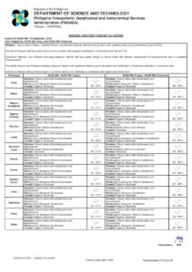
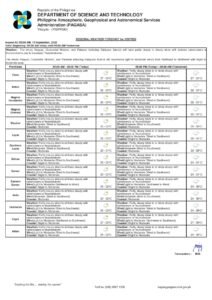
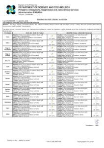
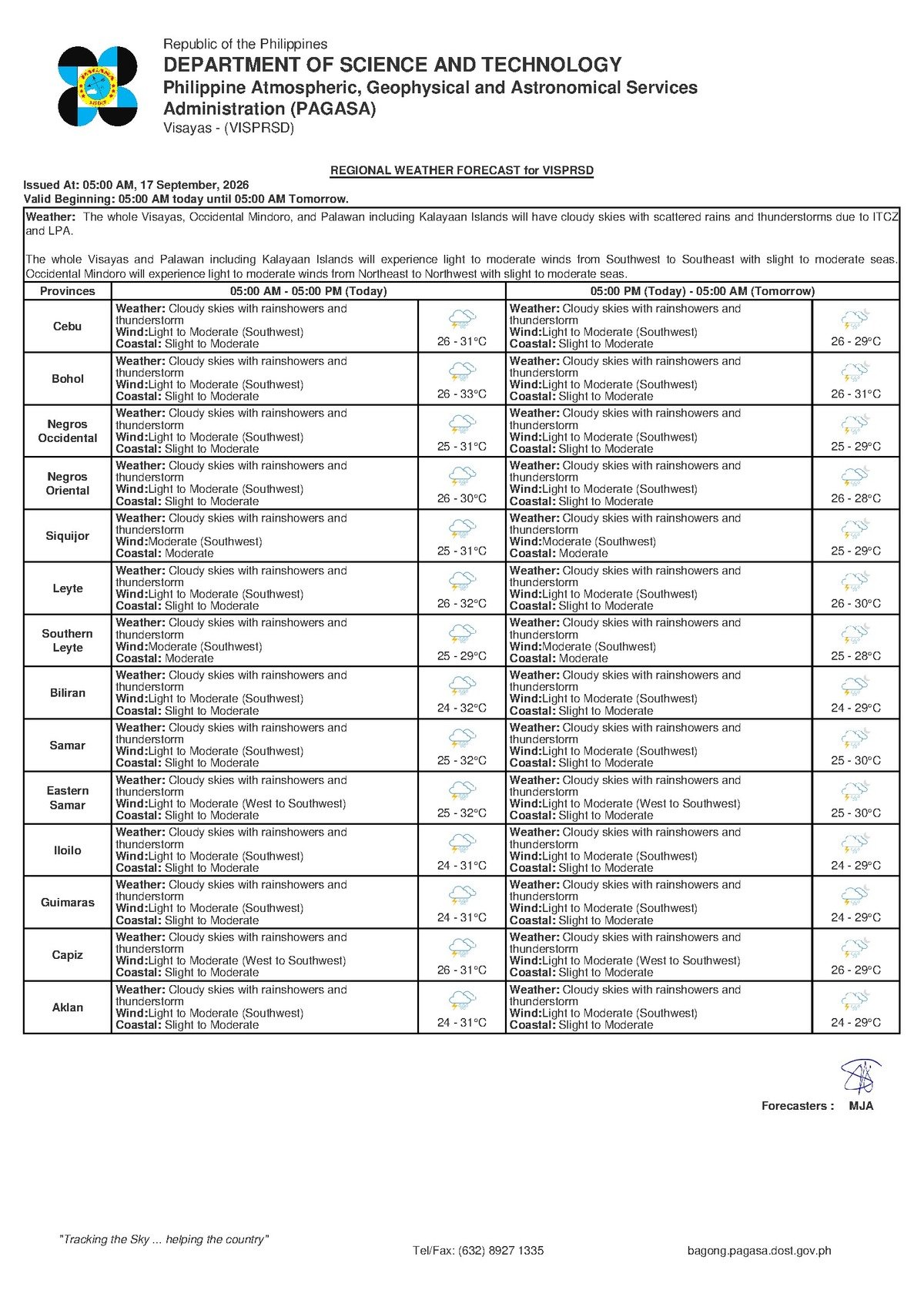
In its Regional Forecast for the Visayas released at 5:00 AM on September 17, 2026, PAGASA said cloudy skies with rain showers and thunderstorms are expected to prevail across the region for the rest of the day. The forecast covers Negros Oriental, Siquijor, Cebu, and adjacent provinces.
PAGASA reported that temperatures will fluctuate between 26°C on the low end and 31°C on the high end, while winds blowing from the southwest are classified as light to moderate. Coastal waters have been rated as slight to moderate — conditions that warrant vigilance particularly among small watercraft operators and fisherfolk.
A separate extended weather outlook issued by PAGASA at 9:00 AM on September 16, 2026 — the day prior — indicated that these unsettled conditions are projected to carry over into the following days, with peak temperatures potentially reaching 32°C and the southwest wind pattern expected to remain dominant over the region.
The Science Behind the Rain: Southwest Monsoon at Work
PAGASA attributed the rainy conditions to the habagat, or southwest monsoon — the large-scale seasonal wind system that sweeps warm, moisture-heavy air from the sea onto the Philippine archipelago during the rainy season, which typically runs from June through October. As this moisture-laden air moves inland and rises over the terrain, it cools rapidly, condenses into clouds, and produces the sustained overcast conditions, afternoon rain showers, and evening thunderstorms that are characteristic of habagat weather.
While this behavior falls squarely within the expected seasonal pattern, PAGASA’s guidance makes clear that normal seasonal conditions can still pose significant hazards — particularly for those who live and work near coastlines or rely on sea travel for daily movement.
Conditions Across Negros Oriental’s Cities and Coastal Communities
For Dumaguete City, the provincial capital, Thursday is likely to feel heavy and humid, punctuated by rain bursts that could intensify during the afternoon hours. Inland cities such as Guihulngan City and Bais City are similarly expected to experience overcast and unsettled skies throughout the day.
Coastal areas carry additional concerns. Bayawan City on the southwestern fringe of the province faces southwest-driven swells rolling in through the Tañon Strait and the Visayan Sea, compounding the risk for small fishing vessels and bangka operators working near shore.
Siquijor Island, which sits across a short sea channel from Negros Oriental, falls under the same PAGASA forecast umbrella — cloudy with rain showers and thunderstorms. According to PAGASA’s advisory, residents and travelers in Siquijor are urged to check sea conditions before attempting crossings by smaller boats.
Across the water in Cebu — which lies east of Negros — conditions mirror those in Negros Oriental, with slight to moderate coastal swells affecting the western Cebu coastline’s ports and fishing communities, PAGASA noted.
Decoding the Forecast: What PAGASA’s Terms Mean in Practice
Rain Showers and Thunderstorms
A rain shower, as defined in PAGASA’s weather terminology, is a short but sometimes intense burst of precipitation. Thunderstorms, on the other hand, involve heavier rainfall paired with lightning and thunder. These can build rapidly — particularly in the afternoon when surface heat and humidity peak — and may intensify with very little warning. PAGASA’s standard safety guidance advises the public to seek indoor shelter immediately upon hearing thunder and to avoid trees, metal structures, and open bodies of water.
Light to Moderate Winds
While light to moderate winds are not independently dangerous, the combination of these winds with rain showers and elevated swells creates risky conditions for smaller watercraft. Larger inter-island vessels are generally more capable of handling such conditions, but PAGASA recommends that all passengers confirm departure status with their ferry operators before proceeding to any port.
Slight to Moderate Coastal Conditions
Coastal waters rated as slight to moderate by PAGASA indicate wave heights above calm baseline levels. Small fishing boats and bangkas are especially vulnerable. Larger ferry services — including carriers operating the Dumaguete–Cebu and Dumaguete–Siquijor routes — can ordinarily function under these conditions, but PAGASA strongly advises small boat operators to monitor for any gale warnings before heading out to sea.
Practical Guidance for Key Sectors
Ferry Passengers and Road Commuters
Travelers planning to take a ferry from Dumaguete Port to Siquijor, Cebu, or other Visayas destinations on Thursday are advised to check with their carriers — including OceanJet, Montenegro Lines, or other operators — for any schedule adjustments arising from the slight to moderate sea state. Arriving early, bringing waterproof clothing, and building extra time into travel plans are all recommended. Road users in Dumaguete and surrounding towns should brace for possible traffic slowdowns during peak rain episodes and watch out for flooding on low-lying streets.
Fisherfolk and Small Boat Operators
The combination of slight to moderate swells and the elevated risk of sudden thunderstorms makes Thursday a day that demands extra caution on the water. Fisherfolk operating small bangkas along the coasts of Bayawan, Bais, and across the Tañon Strait are advised by PAGASA to limit their time offshore and return to safe harbor well ahead of any approaching storm. Lightning over open water is classified as an immediate, serious hazard. Those who must go out are urged to stay close to the shoreline and continuously monitor sky conditions.
Farmers in Agricultural Zones
For farmers working in Negros Oriental’s sugarcane and corn belts — particularly those inland of Guihulngan, Bais, and La Libertad — the rains are consistent with the ongoing monsoon season. While crops generally benefit from moisture, repeated heavy downpours raise concerns about soil erosion on hillside farms and waterlogging in low-lying fields. Fertilizer and pesticide applications should be postponed during or just before heavy rain, as runoff diminishes effectiveness and risks contaminating nearby waterways. Loose farm materials and equipment should be secured against gusts associated with passing thunderstorms.
Students, Parents, and Schools
Children heading to school on Thursday should be dressed in waterproof gear, and parents are reminded that thunderstorms are most likely to peak during afternoon hours — coinciding with dismissal periods. Schools located in flood-prone barangays in Dumaguete and other low-lying areas are encouraged to monitor local weather updates closely. While PAGASA has not issued a suspension-level warning as of the 5:00 AM bulletin, the state weather bureau noted that thunderstorms can intensify rapidly, and local government units should be monitored for any updated advisories.
Outdoor Workers and Event Organizers
Construction workers, street vendors, and others whose livelihoods depend on outdoor conditions across Dumaguete, Bayawan, and other parts of Negros Oriental should plan for rain-related interruptions on Thursday. Event organizers are advised to prepare shelter contingencies. Lightning accompanying today’s thunderstorms is a genuine hazard for workers in exposed positions — particularly those in open fields, on scaffolding, or near water bodies.
The Outlook for the Rest of the Week
Based on PAGASA’s extended forecast issued on September 16, the conditions described above are not expected to ease significantly through the remainder of the work week. Cloudy skies, light to moderate southwest winds, and slight to moderate coastal swells are projected to persist across the Visayas region in the coming days. Temperatures are expected to remain within the 26°C to 32°C band, and PAGASA indicated no near-term sign of substantial improvement. The region will continue to feel the full effects of the southwest monsoon season for the foreseeable future.
Members of the public are encouraged to follow official PAGASA updates — available through the agency’s website and its official social media channels — and to heed any advisories from local government units and the Philippine Coast Guard as conditions evolve throughout Thursday and into the weekend.
By the Numbers
- 5:00 AM — Time of PAGASA’s Regional Visayas forecast issued on September 17, 2026
- 9:00 AM, September 16, 2026 — Time of the extended weather outlook preceding Thursday’s bulletin
- 26°C – 31°C — Forecast temperature range for Thursday, September 17
- 32°C — Projected peak temperature under the extended forecast outlook
Why This Matters
The PAGASA forecast of cloudy skies, rain showers, and thunderstorms across Negros Oriental and the Visayas on September 17, 2026 carries direct implications for sea travel safety, agricultural operations, and the daily movement of tens of thousands of residents across the region. The simultaneous elevation of coastal water conditions to slight to moderate — combined with the unpredictability of afternoon thunderstorms — means that fisherfolk, ferry passengers, and outdoor workers face concrete, documented risks throughout the day. With PAGASA projecting that these monsoon-driven conditions will persist through the rest of the week, the public’s awareness of the forecast and adherence to the agency’s safety advisories is essential to minimizing weather-related incidents.
Source: breakingnewsnegrosoriental.com (BNNO)