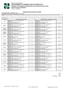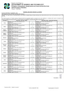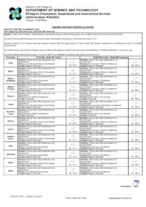
DUMAGUETE CITY, Negros Oriental — August 3, 2026 — The southwest monsoon, locally called habagat, is keeping skies unsettled over Negros Oriental and the rest of the Visayas this Monday, with the state weather bureau PAGASA forecasting a mix of partly cloudy to overcast conditions accompanied by rainshowers and thunderstorms throughout the day. The forecast, released at 5:00 AM on August 3, 2026, is expected to affect commuters, coastal workers, farmers, students, and inter-island travellers across the province.
Southwest Monsoon at the Root of Today’s Weather
PAGASA’s regional bulletin identifies winds blowing from the southwest to west as the primary driver of today’s unsettled conditions. This wind pattern is the hallmark of the habagat, a seasonal monsoon system that typically prevails over the Philippines from June through September. During active habagat phases, the system draws warm, moisture-heavy air from the South China Sea into the archipelago, generating sustained cloud cover, intermittent rainfall, and the increased likelihood of afternoon thunderstorms.
Notably, PAGASA’s bulletin does not reference any active low-pressure area or tropical cyclone in connection with this forecast. The weather agency described conditions as consistent with an active monsoon pattern — meaning the rain is driven entirely by the seasonal wind system rather than by any named storm. As PAGASA has consistently warned in similar bulletins, monsoon-driven rain can develop rapidly, intensify without significant advance notice, and affect wide areas simultaneously.
Forecast Details for Negros Oriental and Nearby Provinces
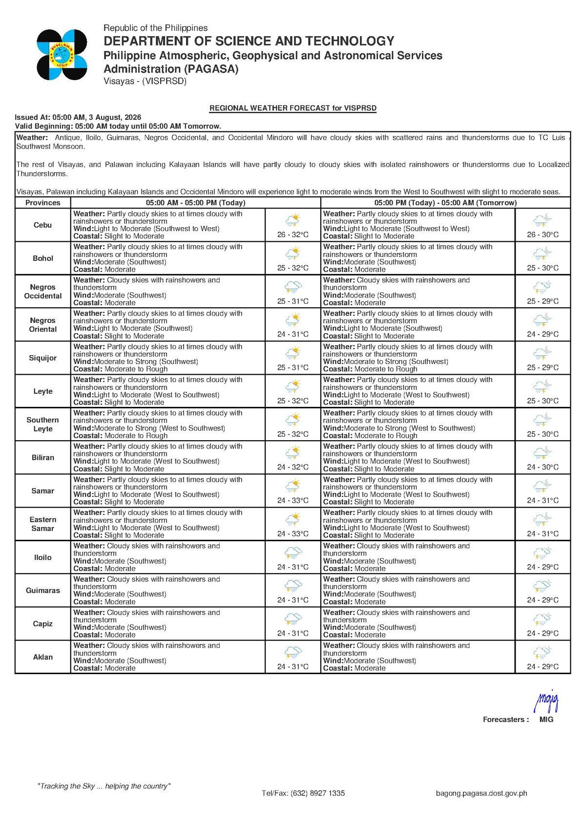
The weather conditions PAGASA projects for Negros Oriental today are broadly shared by the rest of the central Visayas corridor. According to the agency’s bulletin, the following conditions apply to the region:
- Sky condition: Partly cloudy to at times cloudy
- Precipitation: Rainshowers and thunderstorms likely
- Temperature: Low of 26°C / High of 32°C
- Wind speed: Light to moderate
- Wind direction: Southwest to west
- Coastal waters: Slight to moderate
The provinces of Siquijor and Cebu are under virtually the same forecast, according to PAGASA — partly cloudy skies, rainshowers or thunderstorms, light to moderate southwesterly winds, and slight to moderate seas. This means that weather disruptions affecting inter-island travel and fishing operations are not isolated to Negros Oriental; the entire central Visayas subregion faces comparable conditions on this day.
Temperatures will remain warm throughout Monday. PAGASA places the low at 26°C and the daytime high at 32°C for Dumaguete and the surrounding province. While these temperatures are not in themselves alarming, the combination of heat, high humidity, and intermittent rainfall creates conditions where thunderstorms can develop — particularly in the afternoon and early evening hours, the peak window for convective storm activity during monsoon season.
Coastal Waters: What “Slight to Moderate” Means in Practice
PAGASA classifies today’s sea conditions as “slight to moderate.” The weather agency defines these terms in practical wave-height terms:
- Slight seas correspond to wave heights of approximately 0.5 to 1.25 metres — generally safe for larger vessels but potentially hazardous for very small watercraft.
- Moderate seas refer to wave heights of roughly 1.25 to 2.5 metres — conditions that present real navigational challenges for small and medium-sized craft and demand extra caution even aboard inter-island ferries.
With conditions sitting at the boundary between these two categories, small fishing boats, bancas, and outrigger vessels should exercise extreme caution before venturing out. While PAGASA has not issued a gale warning for this forecast period, the state weather bureau has repeatedly noted that the combination of moderate seas and active thunderstorms can create rapidly deteriorating and hazardous conditions at sea without much prior warning.
Passengers and operators of inter-island routes — including services by OceanJet, fast craft, and Roll-on/Roll-off (RoRo) ferries connecting Dumaguete to Cebu, Siquijor, and other Visayas ports — are advised by PAGASA to coordinate directly with their respective shipping lines before travelling. Vessel operators conduct their own sea-condition assessments independent of PAGASA’s bulletins and may cancel or delay trips even in the absence of a formal gale warning.
Guidance by Sector
Commuters and Motorists
Wet road conditions are expected to persist throughout the day, with afternoon and evening thunderstorms posing the greatest risk to road users. Motorists travelling along provincial routes connecting Dumaguete to Bayawan, Bais, Guihulngan, and interior towns should reduce speed and be prepared for sudden drops in visibility during heavy downpours. PAGASA has consistently highlighted that flash flooding is a risk during thunderstorm activity in low-lying and flood-prone barangays — situational awareness on the road is essential.
Fisherfolk and Coastal Operators
The combination of slight-to-moderate seas and possible thunderstorms makes this a day requiring heightened caution for those working at sea. Fisherfolk operating off the coastal municipalities of Dumaguete, Bayawan, Bais, Tanjay, and other coastal towns along Negros Oriental should carefully assess sea conditions before departing and consider returning to port early if clouds darken or winds strengthen. PAGASA has noted that thunderstorms are capable of generating sudden strong gusts and waterspouts that pose acute dangers to small watercraft. When conditions are uncertain, the state weather bureau advises mariners to remain ashore.
Farmers and Agricultural Workers
For those working in Negros Oriental’s sugarcane, rice, and vegetable-growing areas — including interior municipalities such as Guihulngan, La Libertad, and Vallehermoso — today’s scattered rains present a double-edged situation. The moisture can help sustain crops during dry intervals, but sudden heavy downpours from thunderstorms can damage young plants, accelerate runoff on hillside fields, and cause waterlogging in low-lying paddies. Agricultural workers are advised to avoid applying fertilisers or pesticides ahead of expected rain, as these inputs are likely to be washed off the soil surface before they can be absorbed.
Students, Parents, and Schools
PAGASA has not issued any suspension-triggering rainfall warning for Negros Oriental under this forecast. However, the weather bureau’s bulletins consistently note that thunderstorms during active monsoon conditions can develop rapidly during afternoon hours — typically between 1:00 PM and 5:00 PM. Parents and school administrators are encouraged to ensure students depart campus with sufficient time to reach home before afternoon storm activity peaks. Schools situated in flood-prone areas should confirm that standard weather protocols are in place and ready to be activated.
Outdoor Workers and Event Organisers
Workers in construction, public works, and other outdoor occupations should monitor sky conditions closely and have access to covered shelter throughout the day. Organisers of outdoor events in Dumaguete or other parts of Negros Oriental are advised to prepare rain contingency plans and, where possible, schedule activities in the morning hours — when conditions are typically more settled before afternoon convective activity begins to build.
Extended Outlook: Unsettled Weather Expected to Continue
According to PAGASA’s extended weather outlook, issued at 9:00 AM on August 2, 2026, the unsettled pattern driven by the active southwest monsoon is forecast to persist through the coming days. Residents and workers across Negros Oriental should not expect a prompt return to dry conditions. The weather agency advises the public to monitor its official updates regularly, as conditions can shift with relatively little notice during active habagat periods.
By the Numbers
- Forecast issued: 5:00 AM, August 3, 2026
- Extended outlook issued: 9:00 AM, August 2, 2026
- Temperature low: 26°C
- Temperature high: 32°C
- Slight seas wave height range: 0.5 to 1.25 metres
- Moderate seas wave height range: 1.25 to 2.5 metres
- Peak thunderstorm window: 1:00 PM to 5:00 PM
Why This Matters
Active southwest monsoon conditions affecting the entire central Visayas corridor — including Negros Oriental, Siquijor, and Cebu — mean that disruptions to fishing, inter-island travel, agriculture, and daily commuting are likely to be widespread and simultaneous rather than localised. PAGASA’s forecast of possible thunderstorms alongside moderate coastal seas heightens safety risks particularly for small watercraft and outdoor workers who may have limited warning before conditions deteriorate. With the agency’s extended outlook indicating that the unsettled pattern will persist beyond Monday, residents and key sectors should treat today’s advisory not as a one-day concern but as the beginning of a sustained weather period requiring continued vigilance.
Source: Breaking News Negros Oriental (breakingnewsnegrosoriental.com) / PAGASA regional weather bulletin, August 3, 2026