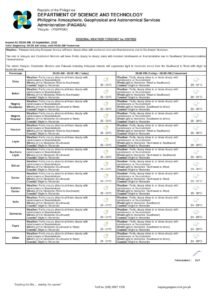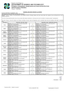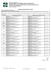
DUMAGUETE CITY, Negros Oriental — August 6, 2026: The southwest monsoon tightened its grip on Negros Oriental in the early hours of Thursday, with the Philippine Atmospheric, Geophysical and Astronomical Services Administration (PAGASA) issuing a series of thunderstorm advisories that placed Bais City and Pamplona under imminent storm threat while Tanjay City was already being pelted by moderate to heavy rain, lightning, and strong winds before sunrise.
The weather authority confirmed that the habagat, or southwest monsoon, is the driving force behind all active warnings and advisories issued across the Visayas as of early Thursday morning. The storm pattern is expected to persist through at least the weekend, keeping sea conditions dangerous and raising the risk of flash floods and landslides across the province.
Understanding the Habagat
The southwest monsoon is a large seasonal wind system that pushes warm, moisture-heavy air from the southwest across the Philippine archipelago during the middle months of the year. According to PAGASA, as this moisture-laden air moves over warm coastal waters and rises over land, it cools and releases its energy as heavy rainfall and thunderstorms — events that can be sudden, intense, and capable of triggering flash flooding with little advance notice.
This is not a single isolated weather disturbance but rather a broad, sustained atmospheric pattern. PAGASA identified the habagat as the named weather driver responsible for all active storm conditions across the Visayas region on Thursday.
Active Warnings Issued for Negros Oriental
Thunderstorm Advisory No. 3 — 4:52 AM, August 6
PAGASA’s Thunderstorm Advisory No. 3, released at 4:52 in the morning, identified Bais City and Pamplona as localities in Negros Oriental where moderate to heavy rainshowers accompanied by lightning and strong winds were expected to arrive within 30 minutes to one hour. Tanjay City was listed as already experiencing these hazardous conditions, which PAGASA said could last one to two hours and had the potential to spread into surrounding areas.
A Thunderstorm Advisory is not a preliminary watch — it is an active alert. PAGASA specifically flagged the risk of flash floods and landslides as associated hazards under this advisory. Residents in the named areas were advised to seek sturdy shelter immediately, avoid trees and electrical poles, and prepare to evacuate to higher ground if living near rivers, streams, or low-lying terrain.
Thunderstorm Advisory No. 4 — 6:19 AM, August 6
A follow-up advisory from PAGASA at 6:19 AM extended thunderstorm alerts into Negros Occidental, naming Victorias, Manapla, Cadiz City, Sagay City, Murcia, Hinoba-an, and Candoni, among others. Additional coverage extended across Aklan, Capiz, Antique, Iloilo, and Guimaras, with Bacolod City already under active conditions. PAGASA noted that the same storm band producing conditions in Negros Occidental is the one affecting Negros Oriental, and that the weather could shift.
Thunderstorm Watch — 10:00 PM, August 5
The night before, at 10:00 PM on Wednesday, PAGASA issued a Thunderstorm Watch that included Negros Oriental, Siquijor, and Cebu among more than a dozen provinces. A Watch designation means the atmosphere is primed for storm development within a 12-hour window — a step below an Advisory, but a clear signal that residents should be alert and monitoring updates. That 12-hour window was still active as of early Thursday.
Heavy Rainfall Warning No. 2 — Yellow Level — 6:07 AM, August 6
PAGASA’s Yellow-Level Heavy Rainfall Warning, issued at 6:07 AM, was focused on Occidental Mindoro and northern Palawan — areas receiving the heaviest direct habagat rainfall. While Negros Oriental is not under this specific warning at present, PAGASA defined Yellow Level as conditions where flooding is possible in low-lying areas and landslides are possible in mountainous terrain. The rain band extends into Antique, immediately to the north, under the same southwest monsoon system.
Weather Outlook for Negros Oriental Through the Weekend
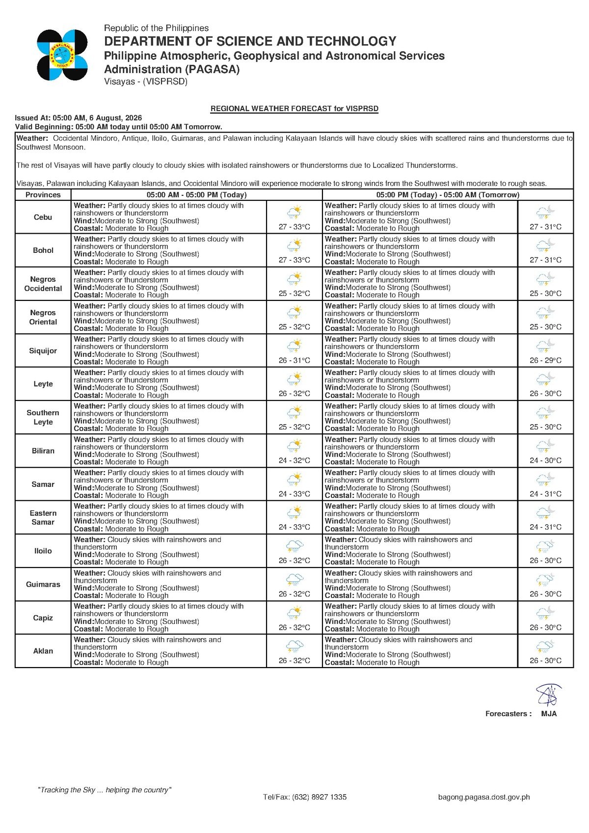
PAGASA’s extended forecast for Negros Oriental describes persistently unsettled conditions through at least Sunday, August 10. Thursday’s temperature range is 27°C to 31°C, with partly cloudy to overcast skies and thunderstorm activity expected. Winds are blowing from the southwest at moderate to strong speeds, and coastal waters are rated moderate to rough.
Friday’s forecast shows temperatures between 26°C and 32°C, maintaining the same wind and sea conditions. Over the weekend, Saturday and Sunday temperatures dip to a low of 25°C, but PAGASA forecasts continued rough seas and moderate to strong southwest winds, with no break in the pattern in sight through the end of the forecast period.
Wider Visayas Impact
The habagat is not confining its effects to Negros Oriental. According to PAGASA, Antique, Aklan, Capiz, Iloilo, Guimaras, and Negros Occidental were all touched by thunderstorm activity in the early morning hours. The Thunderstorm Watch issued Wednesday night named Siquijor, Cebu, Bohol, Leyte, Southern Leyte, Biliran, Eastern Samar, and Samar as additional storm-prone areas — meaning the storm environment is broad and affecting virtually the entire Visayas region at the same time.
Guidance for Affected Communities
Fisherfolk and Small-Boat Operators
PAGASA’s data consistently rates coastal waters as moderate to rough throughout the forecast period, with moderate to strong southwest winds. For fisherfolk operating bancas and small wooden vessels out of coastal barangays and ports across Negros Oriental, these are genuinely hazardous sea states. PAGASA’s forecast strongly indicates that small vessel operations should be suspended or restricted to sheltered nearshore waters. No improvement in sea conditions is forecast through Sunday, August 10.
Ferry and Inter-Island Passengers
Travellers intending to take fast craft or ferry services — including routes between Dumaguete and Cebu, Siquijor, or Tagbilaran — should check directly with their operators before heading to the port. PAGASA warns that moderate to rough seas combined with strong southwest winds are conditions under which maritime authorities may restrict or cancel sailings, especially for smaller fast-craft vessels. Passengers are advised to build contingency time into their travel plans.
Farmers
The sustained habagat, together with active thunderstorm conditions, brings risks of waterlogged fields, wind damage to standing crops, and soil erosion on hillside and sloped farms. PAGASA’s warnings of possible landslides are particularly relevant for farmers working elevated terrain in Negros Oriental’s interior municipalities. Securing harvested produce and monitoring drainage on low-lying fields is advisable during this period.
Students, Parents, and Commuters
With thunderstorm advisories active since before dawn and conditions forecast to persist through the day, parents should monitor official school suspension announcements. PAGASA advises commuters to stay away from low-water crossings, flooded streets, and roads running near riverbanks or hillsides, particularly during periods of heavy rainfall. Do not attempt to wade through or drive across flooded roads.
By the Numbers
- 4:52 AM — Time PAGASA issued Thunderstorm Advisory No. 3 naming Bais City and Pamplona
- 6:19 AM — Time PAGASA issued Thunderstorm Advisory No. 4 covering Negros Occidental and nearby provinces
- 6:07 AM — Time PAGASA issued Heavy Rainfall Warning No. 2 (Yellow Level) for Occidental Mindoro and northern Palawan
- 10:00 PM, August 5 — Time the Thunderstorm Watch was issued naming Negros Oriental, Siquijor, and Cebu
- 27°C–31°C — Thursday temperature range for Negros Oriental per PAGASA forecast
- 25°C — Forecast low temperature for the weekend (Saturday–Sunday)
- 1–2 hours — Duration PAGASA estimated for active thunderstorm conditions in Tanjay City
- 30 minutes to 1 hour — Lead time cited in Advisory No. 3 before conditions hit Bais City and Pamplona
Why This Matters
The southwest monsoon is not a passing squall — PAGASA’s forecast shows no let-up in rough seas, strong winds, and thunderstorm activity across Negros Oriental through at least Sunday, August 10, creating an extended period of elevated risk for coastal communities, farmers, and travellers. The simultaneous issuance of multiple thunderstorm advisories and a Thunderstorm Watch covering nearly the entire Visayas region signals a broad and serious weather event, not a localised incident. Compliance with PAGASA’s advisories — particularly among fisherfolk and ferry passengers — is essential to preventing weather-related casualties during this sustained monsoon surge.
Source: Breaking News Negros Oriental / PAGASA advisories dated August 5–6, 2026