Just before dawn on Friday, July 10, 2026, seismological instruments picked up a moderate tectonic earthquake originating off the coast south-southwest of Balangiga in Eastern Samar. The Philippine Institute of Volcanology and Seismology (PHIVOLCS-DOST) confirmed the event and released an official bulletin at 1:23 AM, roughly 36 minutes after the tremor was recorded.
Earthquake Parameters
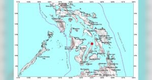
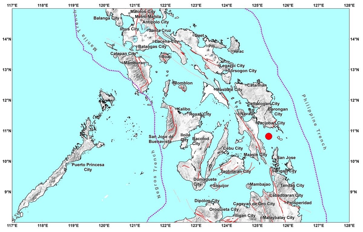
According to PHIVOLCS-DOST, the earthquake registered a magnitude of Mw 4.9 and struck at exactly 12:46:50 AM on July 10, 2026. The agency placed the epicenter at geographic coordinates 10.81°N, 125.37°E, situating it approximately 33 kilometers south and slightly to the west of Balangiga, Eastern Samar.
PHIVOLCS-DOST further noted that the quake originated at a depth of 91 kilometers beneath the surface — a measurement that places it within the intermediate-depth range. This relatively deep focus generally limits the amount of surface-level shaking produced, even when the magnitude itself is moderate. The earthquake was classified as tectonic in origin, meaning it resulted from the natural movement and stress release along geological fault structures rather than volcanic activity.
Shaking Felt Across Several Provinces
Despite its depth, the earthquake was felt instrumentally across a broad geographic area spanning multiple provinces in the Visayas and parts of Mindanao. PHIVOLCS-DOST recorded varying intensity levels across these locations using the PHIVOLCS Earthquake Intensity Scale (PEIS).
The most pronounced shaking was measured at Intensity III, recorded in the Leyte towns of Abuyog, Dulag, and Mahaplag. At this intensity level, the tremor is generally perceptible indoors — people may notice vibrations in objects, hanging items may sway, and the sensation is similar to the rumble of a passing heavy vehicle. However, Intensity III is not typically associated with structural damage under normal construction standards.
A step below, Intensity II was recorded in Hinundayan, Southern Leyte, and Alangalang, Leyte. This level of shaking is described as very slight — often felt only by individuals who are at rest, lying down, or located on upper floors of buildings. It is unlikely to be noticed by people in motion or engaged in physical activity.
The weakest detectable level, Intensity I, was registered instrumentally in several other areas. According to PHIVOLCS-DOST, these locations include:
- Baybay and Hilongos in Leyte
- Sogod in Southern Leyte
- Villareal in Samar
- San Francisco in Cebu
- The City of Surigao in Surigao del Norte
At Intensity I, shaking is typically imperceptible to humans without special sensitivity and is detected primarily through seismic instruments. Residents in these areas would not ordinarily feel anything unusual.
No Damage Reported, No Aftershocks Expected
PHIVOLCS-DOST assessed that the July 10 earthquake is not expected to produce any structural damage to buildings or infrastructure. The agency also stated that no aftershocks are anticipated following this seismic event, which is consistent with its intermediate depth and moderate magnitude profile.
The bulletin released by PHIVOLCS-DOST at 1:23 AM was described as the sole official communication for this event, with the agency indicating that no follow-up bulletins are planned unless new or updated information requires a revision. This is standard practice for earthquakes that fall below the threshold likely to affect communities.
About the PHIVOLCS Earthquake Intensity Scale
The PHIVOLCS Earthquake Intensity Scale is the official framework used by Philippine seismologists to describe the effects of an earthquake on people, structures, and the environment at any given location. It runs from Intensity I — detectable only by instruments — to Intensity X, which represents catastrophic destruction. The scale differs from magnitude in that magnitude measures the energy released at the earthquake’s source, while intensity describes what is actually experienced at specific points on the surface.
PHIVOLCS-DOST, operating under the Department of Science and Technology, is mandated to monitor seismic and volcanic activity across the Philippines and to provide timely public information to help communities assess risk and respond appropriately. The agency maintains a real-time earthquake monitoring network that covers the entire archipelago.
Philippines Earthquake Context
The Philippines sits along the Pacific Ring of Fire, one of the most seismically active zones on Earth. The country experiences thousands of earthquakes each year, the vast majority of which are too small or too deep to be felt by the general public. Eastern Samar and the surrounding waters of the Philippine Sea and Leyte Gulf are areas with historically significant seismic activity, owing to the complex interaction of tectonic plates in the region. Earthquakes of magnitude 4 to 5 are relatively common and, at sufficient depth, typically pose little risk to communities, as corroborated by the PHIVOLCS-DOST assessment for this event.
Residents in earthquake-prone areas are consistently encouraged by authorities to remain informed through official channels and to follow preparedness protocols established by local disaster risk reduction and management offices.
By the Numbers
- Mw 4.9 — magnitude of the earthquake
- 33 kilometers — distance south-southwest of Balangiga, Eastern Samar where the epicenter was located
- 91 kilometers — depth of focus beneath the surface
- 12:46:50 AM, July 10, 2026 — exact time the earthquake was recorded
- 1:23 AM — time PHIVOLCS-DOST issued its official bulletin
- Intensity III — highest shaking level recorded, in Abuyog, Dulag, and Mahaplag, Leyte
- 6 provinces/areas — geographic spread of instrumental intensity recordings
Why This Matters
Tectonic earthquakes along the Eastern Visayas corridor are a recurring feature of Philippine geological life, and accurate, timely reporting by PHIVOLCS-DOST plays a critical role in helping communities quickly determine whether emergency response is needed. In this case, the agency’s assessment that no damage or aftershocks are expected provides immediate reassurance to residents in the affected provinces, reducing unnecessary alarm. The broad instrumental detection across Leyte, Southern Leyte, Samar, Cebu, and Surigao del Norte also underscores the far-reaching nature of even moderate seismic events originating in the Eastern Samar area.
Source: PHIVOLCS-DOST official bulletin via breakingnewsnegrosoriental.com wire reports