DUMAGUETE CITY, Negros Oriental — October 11, 2026 — No dry spells are expected across Negros Oriental today. The Philippine Atmospheric, Geophysical and Astronomical Services Administration (PAGASA) released its official Visayas regional forecast at 5:00 AM Sunday, covering weather conditions from 5:00 AM October 11 straight through to 5:00 AM on Monday, October 12, 2026 — and the picture is uniformly wet from start to finish.
What PAGASA Is Forecasting
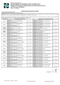
According to PAGASA’s official forecast table for the province, cloudy skies paired with rainshowers and thunderstorms are expected during both the daytime and overnight windows. The state weather bureau did not identify a named weather system — such as a tropical cyclone, low-pressure area, or southwest monsoon — as the specific driver of today’s conditions. Instead, winds blowing from the southeast to southwest direction are sustaining an active, moisture-heavy atmosphere over the region.
Hour-by-Hour Breakdown
Daytime Period: 5:00 AM – 5:00 PM
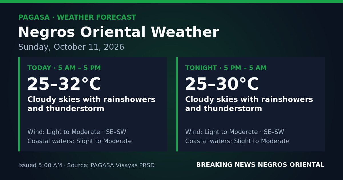
PAGASA forecasts cloudy skies with rainshowers and thunderstorms through the afternoon. Temperatures will range between 25°C and 32°C. Wind direction is from the southeast to southwest at light to moderate intensity. Coastal waters surrounding the province are classified as slight to moderate.
Overnight Period: 5:00 PM – 5:00 AM (Monday)
The wet pattern does not ease after sunset. PAGASA’s forecast calls for continued cloudy skies, rainshowers, and thunderstorms through the night. Overnight temperatures will range from 25°C to 30°C, with wind direction and intensity remaining from the southeast to southwest at light to moderate strength. Coastal waters hold at slight to moderate.
By the Numbers
- Forecast coverage: 24 hours (5:00 AM Sunday to 5:00 AM Monday, October 12)
- Daytime temperature range: 25°C to 32°C
- Overnight temperature range: 25°C to 30°C
- Slight seas: wave heights of approximately 0.5 to 1.25 metres
- Moderate seas: wave heights of approximately 1.25 to 2.5 metres
What “Slight to Moderate” Coastal Waters Mean
PAGASA classifies coastal waters around Negros Oriental as slight to moderate for the entire forecast period. Slight sea conditions — with wave heights of roughly 0.5 to 1.25 metres — are generally manageable for passenger vessels but can be uncomfortable for small, open bancas. Moderate conditions — wave heights reaching 1.25 to 2.5 metres — pose meaningful risk for small watercraft and outrigger boats, and may cause noticeable rolling even on larger ferries.
Because the forecast spans the full range from slight to moderate, sea conditions could reach the higher end at any point during the day or night. PAGASA’s available source data for this period does not cite an active gale warning, but the sea state forecast alone calls for caution on the water.
Guidance for Specific Groups
Ferry Passengers and Inter-Island Travelers
Routes between Dumaguete and Siquijor, as well as those running toward Cebu and other Visayas ports, fall within the forecast’s slight-to-moderate sea range. Passengers booked on carriers serving Negros Oriental terminals — including OceanJet, Lite Ferries, and similar operators — are advised to confirm schedules directly with their operator before proceeding to the port. At the moderate end of the sea state range, fast-craft vessels in particular may be subject to delays or rerouting.
Fisherfolk and Small Boat Operators
Fishers departing from Dumaguete, Bayawan, Bais, and other coastal communities should take extra care before heading out. PAGASA warns that slight-to-moderate coastal waters combined with active thunderstorms present real danger to small outrigger vessels and open bancas. Lightning over open water during thunderstorm activity is a particular hazard. The state weather bureau advises fisherfolk to monitor official forecasts before departure and to return to shore before any thunderstorm arrives in their area.
Farmers in Interior and Coastal Communities
Agricultural areas across Negros Oriental — including sugarcane, rice, and vegetable-growing zones in the interior and coastal lowlands — should prepare for possible water accumulation in low-lying fields given the all-day rain and thunderstorm forecast. Farmers with crops ready for harvest are urged to prioritise fieldwork in the earliest hours before heavier rain episodes set in. Lightweight equipment and farm materials that could be displaced by gusty winds accompanying thunderstorms should be secured. Drainage channels in flood-prone areas should be cleared and checked.
Students, Parents, and Event Organisers
While Sunday generally sees lighter school activity, families planning events or preparing for early Monday school runs should note that the overnight forecast also carries thunderstorms. Parents are advised to keep children indoors during active thunderstorm episodes and away from flooded streets and drainage areas. Outdoor event organisers and construction workers across Dumaguete City and the wider province face a full-day rain pattern; temporary structures and scaffolding should be checked for stability, and electrical equipment in exposed areas should be assessed for water risk.
Siquijor Under the Same Weather Pattern
Siquijor, situated across the Bohol Sea from Dumaguete, falls within the same PAGASA regional forecast. The island province can expect comparable cloudy and rainy conditions throughout Sunday. Travellers planning crossings between Siquijor and Dumaguete are advised to confirm vessel schedules and monitor coastal water conditions with their ferry operator before departure.
Temperature Outlook
A daytime peak of 32°C is on the forecast, though cloud cover and active rain periods will keep perceived temperatures lower than that figure for most of the day. The overnight low of 25°C means the province stays warm and humid well after dark. Those who must be outdoors during any break in the rain should stay hydrated and carry rain gear at all times.
Why This Matters
PAGASA’s forecast indicates that rainshowers and thunderstorms pose risk for small watercraft operators and outdoor workers across the full 24-hour period. The state weather bureau advises the public to monitor official updates before making any travel or outdoor activity decisions, and to move indoors immediately if a thunderstorm develops nearby.
Track the latest official advisories at pagasa.dost.gov.ph.
Source: breakingnewsnegrosoriental.com