DUMAGUETE CITY, Negros Oriental — No dry spell is expected anywhere in the province on Monday, October 12, 2026. The Philippine Atmospheric, Geophysical and Astronomical Services Administration (PAGASA) issued its 5:00 AM forecast placing Negros Oriental under cloudy skies, rainshowers, and thunderstorms that are set to persist continuously from early morning straight through the following night.
The forecast, released by PAGASA under the agency’s Visayas regional weather bulletin, covers the full 24-hour window from 5:00 AM Monday through 5:00 AM Tuesday, October 13.
Forecast Breakdown by Period
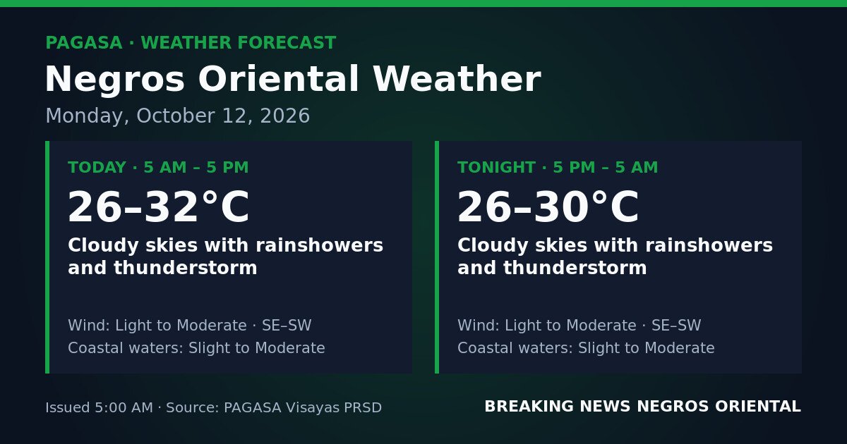
According to PAGASA, the daytime window (5:00 AM to 5:00 PM) will bring cloudy skies with rainshowers and embedded thunderstorms. Temperatures during this period are expected to range from 26°C to 32°C. Winds will come from the southeast to southwest at light to moderate speeds, while coastal waters around the province are rated slight to moderate.
Conditions show little change heading into the overnight period (5:00 PM to 5:00 AM Tuesday). PAGASA’s forecast maintains the same cloudy, rainy, and thundery outlook, with temperatures dipping slightly to a range of 26°C to 30°C. Wind direction and strength remain southeast to southwest at light to moderate, and coastal sea state stays at slight to moderate.
PAGASA’s forecast covers the entirety of the province — from Dumaguete City along the coastal zone, through interior and southern towns such as Bais, Guihulngan, and Bayawan, and extending to the island of Siquijor.
By the Numbers
- Forecast issued: 5:00 AM, Monday, October 12, 2026
- Daytime temperature range: 26°C – 32°C
- Overnight temperature range: 26°C – 30°C
- “Slight” wave heights: approximately 0.5 to 1.25 metres
- “Moderate” wave heights: approximately 1.25 to 2.5 metres
- Coverage window: 24 hours (5:00 AM Monday to 5:00 AM Tuesday)
No Named Weather System Cited
PAGASA’s issued forecast for Negros Oriental does not attribute Monday’s wet conditions to a specific weather system — no monsoon surge, low-pressure area, or tropical cyclone is named as the driver in the source data. The agency describes expected conditions without a system-level explanation. For any accompanying advisory identifying a synoptic cause, PAGASA directs the public to its general weather bulletin at pagasa.dost.gov.ph.
What PAGASA’s data does establish clearly is a sustained pattern — cloud cover, continuous rain, and embedded thunderstorms blanketing the province for at least the next 24 hours from forecast issuance.
What “Slight to Moderate” Coastal Waters Mean
PAGASA applies standardised sea-state terminology that carries practical weight for anyone on or near the water. Under the agency’s scale, slight conditions correspond to wave heights of roughly 0.5 to 1.25 metres — generally workable for seaworthy vessels but requiring care from operators of smaller bancas and outriggers. Moderate conditions represent wave heights of around 1.25 to 2.5 metres, which PAGASA considers a meaningful risk to small craft and demand heightened vigilance even aboard larger vessels.
With Negros Oriental’s coastal waters forecast at the slight-to-moderate range, conditions may shift across that spectrum depending on location and time of day. PAGASA has not included a gale warning or any tropical cyclone wind signal for the province in this forecast. The public is advised to verify the latest marine advisories directly with PAGASA before departing by sea.
Guidance for Specific Activities
Ferry Passengers and Inter-Island Travelers
Travelers using Dumaguete Port for routes to Cebu, Siquijor, Dapitan, or other destinations should verify vessel departure status with their ferry operator before heading to the port. Slight to moderate sea conditions can affect schedules — particularly for smaller fast-craft services. Passengers crossing the Siquijor Strait should note that the channel can be more exposed to wind and wave action during unsettled weather. Bringing rain gear and allowing extra travel time is advisable.
Fisherfolk and Small-Boat Operators
Coastal communities along Dumaguete, Bais, Bayawan, and the Tañon Strait shoreline of Negros Oriental should treat the slight-to-moderate sea-state rating seriously. According to PAGASA’s forecast, light to moderate southeasterly to southwesterly winds combined with active thunderstorm cells can produce unpredictable conditions on the water. Lightning at sea presents an extreme hazard. Operators of open bancas and outrigger vessels are advised to assess actual conditions at their departure point before casting off, and to consider remaining ashore if the outlook is unfavorable. Anyone already at sea when a thunderstorm approaches should return to shore immediately.
Farmers and Agricultural Workers
Sustained rainshowers throughout Monday and overnight increase the likelihood of soil saturation across Negros Oriental’s farming areas — including sugarcane zones in the interior and highland vegetable farms. Low-lying or sloped fields face elevated surface-runoff risk. Harvesting or ground-preparation work that depends on dry conditions should be postponed where possible. Livestock and poultry enclosures should be checked and secured against wind and rain. Field inspections for crop stress or disease should only be conducted when it is safe to move through active thunderstorm conditions.
Students, Parents, and School Commuters
Parents sending children to school in Dumaguete City, Guihulngan, Bais, or other municipalities should prepare rain gear and monitor school announcements for any closures or advisories related to localized flooding near campuses. Motorcycle riders and pedestrians should exercise extra caution during thunderstorm bursts, when rainfall intensity can spike rapidly and road surfaces become slick. Moving under large trees or near waterways during active lightning should be avoided.
Outdoor Workers and Event Organizers
Construction workers, utility crews, market vendors, and anyone engaged in outdoor activity should anticipate disruptions throughout the day. PAGASA warns that thunderstorms can develop with little advance notice; lightning poses a serious risk to workers operating at height or in open areas. Organizers of any outdoor public events on October 12, 2026 should have contingency arrangements ready and track PAGASA bulletins closely during morning hours.
Wider Visayas Context
PAGASA’s October 12 Visayas regional forecast covers multiple provinces beyond Negros Oriental, with cloudy and rainy conditions also affecting Cebu, Siquijor, and neighboring Visayas areas. The agency notes that specific wind and weather parameters for other provinces may vary from those cited for Negros Oriental, and residents of those areas should consult PAGASA’s Visayas regional forecast page for figures applicable to their location.
Why This Matters
PAGASA’s forecast establishes that there is no expected dry window across Negros Oriental for the entirety of Monday, October 12 through the pre-dawn hours of Tuesday — a full 24-hour period of rain and thunderstorm exposure that the agency advises warrants extra caution for residents commuting, traveling by sea, farming, or working outdoors.
Source: breakingnewsnegrosoriental.com / PAGASA Visayas Regional Forecast, October 12, 2026