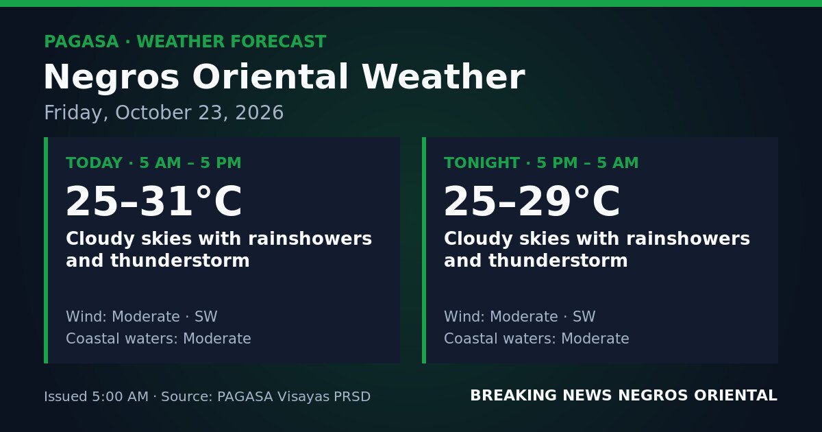
DUMAGUETE CITY, Negros Oriental — October 23, 2026: A continuous stretch of unsettled weather will blanket Negros Oriental through the entire day and night of Friday, October 23, 2026, according to the Philippine Atmospheric, Geophysical and Astronomical Services Administration (PAGASA). The agency’s forecast, issued at 5:00 AM Friday, calls for cloudy skies, rainshowers, and thunderstorms province-wide — running without break from 5:00 AM Friday through 5:00 AM Saturday.
Daytime and Overnight Conditions
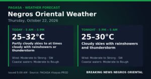
PAGASA’s forecast for the daytime period — 5:00 AM to 5:00 PM — calls for overcast skies with rainshowers and the likelihood of thunderstorms across Negros Oriental. Temperatures during the day will range from 25°C to 31°C. Winds are coming from the southwest at moderate strength, and coastal waters around the province are rated as moderate.
The agency said conditions will carry over into the night without relief. From 5:00 PM Friday through 5:00 AM Saturday, PAGASA forecasts the same pattern — cloudy skies, rainshowers, and thunderstorms — with overnight temperatures between 25°C and 29°C. Moderate southwesterly winds and moderate coastal waters are expected to persist through the early morning hours.
Weather System Behind the Forecast
PAGASA’s Visayas regional forecast page notes that active tropical cyclone-related products are currently in force at the national level, including a Severe Wind Impact Based Forecast and a Tropical Cyclone Warning for Shipping. The agency has not identified a specific weather system by name in the Negros Oriental provincial forecast table for this period. However, the pattern of sustained cloudiness, recurring rainshowers, and thunderstorms driven by moderate southwesterly winds is consistent with moisture-laden flow affecting the Visayas region, PAGASA’s data shows.
According to PAGASA, no dry interval is expected between now and Saturday morning — warm, moisture-heavy air is being pushed steadily across the region, keeping skies overcast and triggering repeated bursts of rain and lightning through both day and night.
Understanding “Moderate” Winds and Coastal Waters
PAGASA classifies both the winds and the sea state around Negros Oriental as “moderate” for the full forecast period. Moderate southwesterly winds are sustained breezes strong enough to sway branches and interfere with umbrella use in open areas, and they add chop to open water. While not gale-force, these winds are steady and, when combined with rain, make outdoor conditions unpleasant and sea conditions demanding.
Moderate coastal waters, in PAGASA’s sea-state classification, refers to wave heights that pose genuine challenges for small vessel navigation. This rating sits between calm and rough — small bancas and open outrigger boats face real difficulty and risk in these conditions, while larger inter-island vessels may experience increased rolling and extended transit times.
Guidance by Sector
General Public and Commuters
Rain can be expected at any hour across Negros Oriental on Friday. Low-lying streets in Dumaguete City and other urban centres may experience flooding during heavy downpours or intense thunderstorm episodes. Motorists should reduce speed on wet roads and exercise caution during periods of reduced visibility. Pedestrians should avoid standing under tall, isolated trees when lightning is active. Rain gear should be carried at all times.
Ferry Passengers and Inter-Island Travellers
Moderate coastal waters will affect ferry routes out of Dumaguete, including crossings to Siquijor and routes toward Cebu. PAGASA’s active Tropical Cyclone Warning for Shipping, listed on the national forecast page, signals that maritime conditions across the broader region are being closely monitored. Passengers booked with OceanJet, Montenegro Lines, and other inter-island operators should confirm their schedules directly with their shipping lines before travelling, as vessel operators may adjust or suspend trips in coordination with the Philippine Coast Guard if conditions worsen. Do not board any vessel that appears overloaded, and allow extra travel time.
Fisherfolk and Small-Boat Operators
Coastal communities along Negros Oriental’s shores — including Bais, Bayawan, Zamboanguita, Dauin, and northern coastal barangays — should take PAGASA’s moderate sea-state rating seriously. Small bancas and motorized outriggers are especially vulnerable when moderate wave action combines with gusty thunderstorm bursts. The agency’s data indicates that lightning at sea alongside moderate waves poses serious risk to small vessels. Fisherfolk are advised to assess shore conditions carefully before departing, and to delay if thunderstorms are already forming.
Farmers and Agricultural Workers
A full 24-hour period of rain across Negros Oriental raises concerns for agricultural areas in both the interior uplands and the coastal plains. Soil saturation poses a risk for root crops and recently planted fields, and prolonged exposure to rain and thunderstorm activity may damage pre-harvest crops. Workers in hillside and low-lying farms should remain alert to runoff and waterlogging. PAGASA’s forecast suggests that afternoon thunderstorms will be a particular concern — harvested produce should be secured under shelter before that window.
Students, Parents, and Schools
Families in Dumaguete, Bais, Guihulngan, and other parts of the province should prepare for heavy rain during both morning school drop-off and afternoon pick-up. Students commuting on foot or by open tricycle face the most exposure, and rain gear is essential. School authorities are urged to monitor local conditions closely, particularly if thunderstorm activity intensifies in their area.
Outdoor Events and Construction
Outdoor gatherings, open-air markets, sports events, community programmes, and construction work scheduled for Friday in Negros Oriental face a high probability of disruption given PAGASA’s all-day storm forecast. Organizers should prepare contingency plans or consider rescheduling. Construction supervisors should secure loose materials that could become hazards under gusty thunderstorm conditions.
Siquijor and Nearby Islands
Siquijor, situated close to Negros Oriental, can expect similarly unsettled weather on Friday. Sea crossings between Siquijor and Dumaguete will be subject to the same moderate coastal water conditions described in PAGASA’s forecast. Travellers planning day trips to Siquijor or returning to the mainland on Friday should factor in possible weather-related ferry delays.
Source: Breaking News Negros Oriental (breakingnewsnegrosoriental.com), based on PAGASA forecast data issued October 23, 2026.