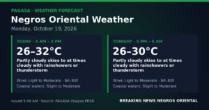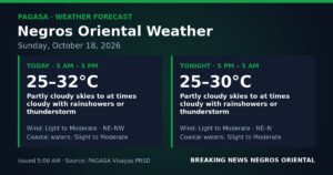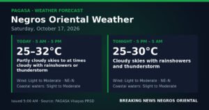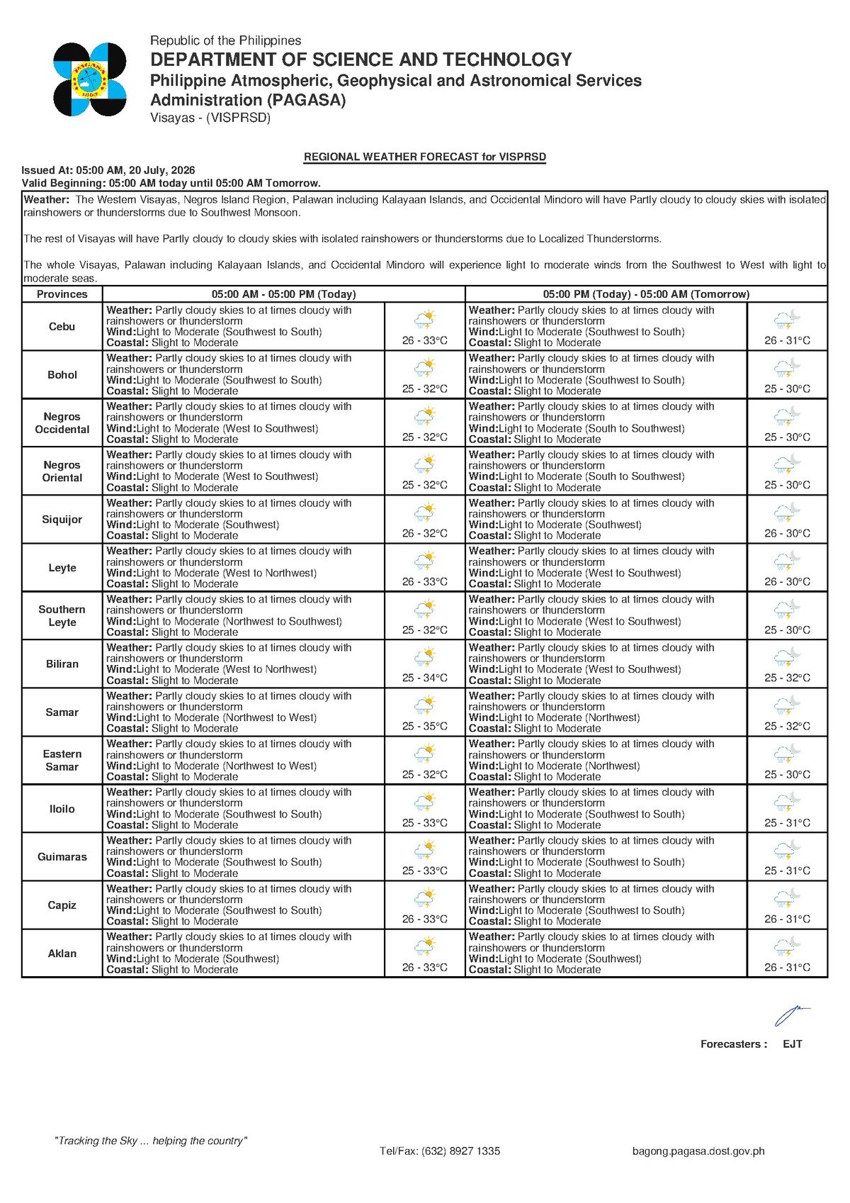
The state weather bureau PAGASA has placed the entire Visayas region under a forecast of partly cloudy to at times cloudy skies, with intermittent rainshowers and thunderstorms expected throughout Monday, July 20, 2026. The agency’s Visayas Regional Forecast, released at 5:00 AM on July 20, covers Negros Oriental and its surrounding provinces, including Siquijor Island and the Cebu coastline across the Tañon Strait.
According to PAGASA, temperatures across the Visayas will range from a low of 26°C overnight to a daytime high of 33°C. Winds are blowing from the southwest to south direction at light to moderate speeds, while coastal waters are classified as slight to moderate — conditions that carry practical implications for sea travelers, fisherfolk, and those working outdoors.
What Is Driving the Unsettled Weather
Although PAGASA’s July 20 bulletin does not attribute today’s weather to a single named weather system, the southwesterly wind direction is consistent with the southwest monsoon — known locally as habagat — which is a dominant feature of the Philippine weather pattern during this time of year. The southwest monsoon draws warm, moisture-laden air from the Sulu Sea and the Western Philippine Sea toward the Visayas, creating favorable conditions for thunderstorm development, particularly during the afternoon and evening hours.
PAGASA’s extended weather outlook, which was issued at 9:00 AM on July 19, 2026, indicates that no dramatic improvement is expected in the days immediately following July 20. Both Sunday and the following Monday are projected to bring light to moderate southwesterly winds, slight to moderate coastal conditions, and the same temperature range of 26°C to 33°C. Residents and workers who depend on stable weather conditions should continue monitoring updated PAGASA bulletins as the agency refines its forecasts daily.
Coverage Across the Region
The forecast covers the full extent of the Visayas, including Negros Oriental — from the provincial capital Dumaguete City to coastal municipalities such as Bayawan, Bais, Bacong, and Dauin, as well as the agricultural interior towns of Guihulngan, La Libertad, Vallehermoso, and communities situated along the foothills of Canlaon. Siquijor Island, which sits just across a short sea channel from Negros Oriental, falls under the same Visayas-wide weather pattern.
Morning conditions are expected to be partly sunny and warm, with the 33°C peak temperature making the early hours feel hot and humid. Cloud build-up is anticipated to increase as the day progresses, raising the likelihood of showers and thunderstorms by early to mid-afternoon. An overnight low of 26°C will offer moderate relief once the day’s activity subsides.
No Active Storm Warning, but Caution Still Advised
PAGASA has not issued any tropical cyclone wind signal, rainfall warning color code — whether yellow, orange, or red — or gale warning for Negros Oriental waters in connection with today’s forecast. The absence of a formal emergency advisory means there is no extraordinary threat in effect. However, the agency’s “slight to moderate” coastal sea classification and the potential for thunderstorms still warrant attention from specific sectors of the population.
According to PAGASA, rainshowers or thunderstorms in a regional forecast indicate that these weather events are possible but will not necessarily occur at every location at the same time. When thunderstorms do develop, however, they can produce sudden heavy rainfall within a short period, dangerous lightning, and gusty winds — often with little advance notice, especially in the afternoon.
Guidance for Key Sectors
Fisherfolk and Small-Boat Operators
The slight to moderate coastal sea advisory is a direct concern for fishing communities along the Negros Oriental shoreline — from Bacong and Dauin in the south to Bayawan, and along the Tañon Strait from Bais northward toward Guihulngan. Light to moderate southwesterly winds can generate short, choppy swells that make small-boat navigation difficult, particularly in open water. PAGASA advises fisherfolk to check wind direction and sea conditions before departing, and to return to shore immediately if a thunderstorm is seen building on the horizon. Lightning over open water is extremely hazardous. Coordination with the local coast guard unit is strongly recommended before heading out.
Ferry and Sea Travel Passengers
Those planning to use the Dumaguete–Siquijor, Dumaguete–Larena, or Dumaguete–Cebu routes — including fast-craft services such as OceanJet and roll-on/roll-off (RoRo) vessels — should be aware that slight to moderate seas may affect schedules and comfort. While larger vessels are generally equipped to operate under these conditions, shipping operators may exercise discretion during periods of active thunderstorm activity. Passengers are advised to check with their shipping line or the Dumaguete City port authority for real-time updates, especially for afternoon sailings when thunderstorm risk is at its highest.
Farmers and Agricultural Workers
For those working the agricultural lands of Guihulngan, La Libertad, Vallehermoso, and the upland communities near Canlaon, the intermittent rainfall may provide some moisture benefit. However, PAGASA warns that thunderstorm-driven rain can be short and intense, increasing the risk of localized runoff and flash flooding near drainage channels and riverbanks. Workers drying rice or corn are advised to move harvests under cover before noon to avoid damage from sudden afternoon downpours.
Students, Parents, and School Administrators
With the school year underway, PAGASA’s forecast carries no suspension-level advisory as of the 5:00 AM bulletin. Nevertheless, afternoon thunderstorms could coincide with dismissal periods. Schools with outdoor activities or afternoon sports events scheduled are advised to prepare contingency plans and to watch for any updated PAGASA advisories issued closer to midday.
Commuters and the General Public
Residents commuting within Dumaguete City and other urban centers across Negros Oriental are advised to bring an umbrella or raincoat even if morning skies appear clear. According to PAGASA, thunderstorms in monsoon-season weather patterns typically develop and intensify during the early to mid-afternoon. Outdoor construction workers and event organizers should secure loose materials that could be displaced by gusty winds. The public is also reminded to avoid taking shelter under isolated trees during lightning activity.
By the Numbers
- 26°C — overnight low temperature forecast for the Visayas on July 20, 2026
- 33°C — daytime high temperature forecast for the Visayas on July 20, 2026
- 5:00 AM, July 20, 2026 — time PAGASA issued the Visayas Regional Forecast
- 9:00 AM, July 19, 2026 — time PAGASA issued the extended weather outlook covering the following days
Why This Matters
The PAGASA forecast for July 20 reflects the continuing influence of the southwest monsoon over the Visayas, a weather pattern that affects millions of residents across multiple provinces, including fisherfolk, farmers, commuters, students, and sea travelers. While no emergency-level advisory is in force, the combination of intermittent thunderstorms and slight to moderate coastal seas presents real safety considerations — particularly for small-boat operators and those relying on inter-island ferry routes. Staying informed through updated PAGASA bulletins remains essential as conditions can change rapidly during the monsoon season.
Source: Breaking News Negros Oriental (breakingnewsnegrosoriental.com)