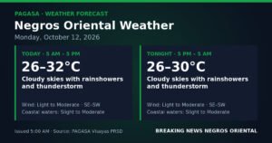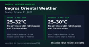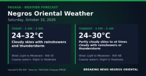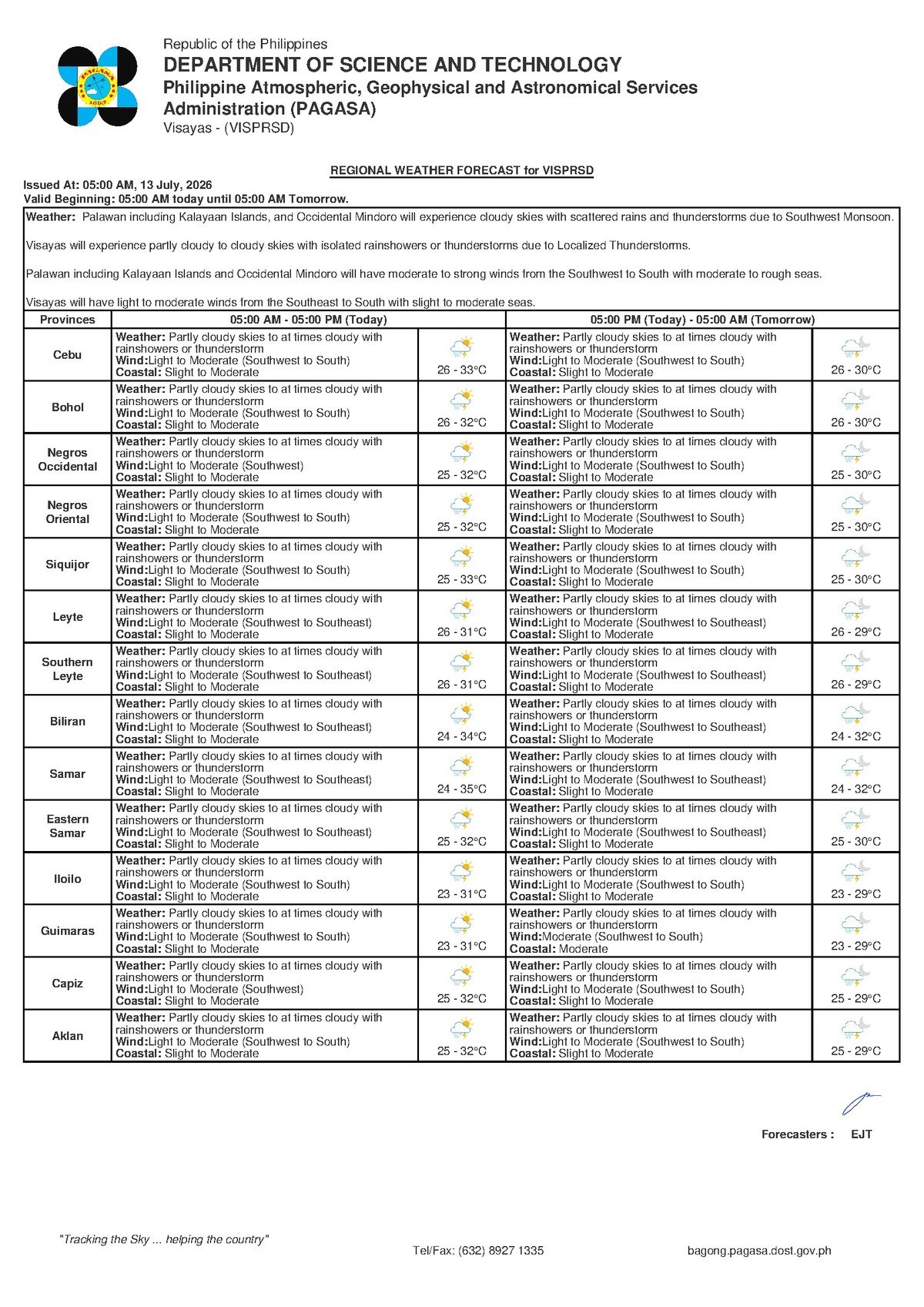
State weather bureau PAGASA has placed the entire Visayas region under an unsettled weather advisory for Monday, July 13, 2026, flagging the likelihood of rainshowers and thunderstorms throughout the day driven by the prevailing southwest monsoon. The agency’s 5:00 AM bulletin covers communities across Negros Oriental — from coastal Dumaguete City and Bayawan in the south to the agricultural towns of Bais and Guihulngan in the north — as well as the island province of Siquijor and the broader Visayas.
PAGASA’s forecast, released at 5:00 AM on July 13, describes prevailing conditions as partly cloudy to at times cloudy skies, with scattered rainshowers and the possibility of thunderstorms developing, particularly during the afternoon when solar heating peaks. Daytime temperatures are expected to reach a maximum of 33°C, while overnight lows will settle at around 26°C — warm, but moderated by persistent cloud cover and passing rain bands.
The Weather Driver: Southwest Monsoon
According to PAGASA, winds across the Visayas on Monday will blow from the southwest to south at light to moderate speeds. This wind pattern is characteristic of the habagat, or southwest monsoon — the seasonal atmospheric phenomenon that typically prevails over the Philippine archipelago from June through September each year. The habagat funnels warm, moisture-rich air from the surrounding seas inland over the Visayas, fuelling cloud formation, afternoon convective showers, and occasional thunderstorm activity.
PAGASA’s broader bulletin notes that tropical cyclone warning products were active at the time of this advisory’s release. However, the regional forecast for Visayas as issued does not attribute Monday’s conditions to any named tropical cyclone or low-pressure area. The agency advises the public to check the latest tropical cyclone advisories directly at pagasa.dost.gov.ph for the most up-to-date picture. The weather data discussed in this article is drawn exclusively from PAGASA’s regional Visayas forecast for 5:00 AM, July 13, 2026.
Conditions Across the Region
Both data panels included in PAGASA’s bulletin show nearly identical readings across the Visayas: partly cloudy to at times cloudy skies, rainshowers or thunderstorms expected during the day, temperatures ranging from 26°C overnight to 33°C at peak afternoon heat, and light to moderate southwesterly to southerly winds. Coastal waters, the agency said, are in a slight to moderate state — meaning small to moderate wave action is present but conditions are not considered immediately dangerous for most properly equipped vessels.
For communities in Negros Oriental, PAGASA’s forecast translates to a day of alternating partly sunny spells and overcast periods, punctuated by episodes of rain. Thunderstorms — which carry lightning, sudden gusty winds, and intense short-duration downpours — are most likely to develop in the late morning and afternoon hours as surface heat builds and releases as convective storms. In Bayawan City along Negros Oriental’s southwestern coast, southwesterly winds may push moderate wave swells onshore, and those in low-lying coastal areas are advised to monitor sea conditions through the day.
What These Forecast Terms Mean
In PAGASA’s standard forecast language, “slight to moderate” coastal conditions refer to wave heights that are manageable for larger, licensed passenger vessels under normal operations. They are not a formal gale warning, but they are a clear signal that the sea is active and requires caution — particularly for smaller, open fishing boats. PAGASA has not issued a gale warning for the area in this bulletin, but the agency recommends that passengers and vessel operators monitor updates before any departure.
A forecast of “rainshowers or thunderstorms” in PAGASA terminology does not indicate continuous rainfall. Instead, it signals that rain can arrive suddenly and with intensity. Thunderstorms, specifically, can bring lightning strikes, abrupt wind gusts, and brief but heavy downpours capable of triggering localised flash flooding in low-lying or poorly drained areas. These conditions do not constitute a severe weather warning, but they are an established signal to take routine protective measures.
Practical Guidance for Specific Groups
Fisherfolk and Small-Boat Operators
Slight to moderate seas are within the operating range of larger commercial vessels, but small open bancas working the waters off Dumaguete, Dauin, Zamboanguita, and the Tañon Strait face elevated risk once thunderstorm activity begins. PAGASA’s bulletin indicates winds can build quickly during convective events. Fisherfolk are advised to complete their work and return to shore well before skies darken — ideally before noon — rather than waiting for rain to begin before heading back to port.
Ferry Passengers on Inter-Island Routes
The Dumaguete–Siquijor and Dumaguete–Cebu routes operate under slight to moderate sea conditions on Monday, which falls within the standard operating range for licensed passenger ferries. Passengers travelling with operators such as OceanJet and Montenegro Lines are encouraged to confirm schedules before proceeding to the port. Of particular note, PAGASA’s extended outlook for Sunday, July 14 indicates winds strengthening to moderate to strong and seas shifting to moderate to rough — a considerable deterioration that may affect Sunday evening crossings and Monday-morning departures. Travellers with plans over the next two days should factor this into their preparations.
Farmers in Interior and Northern Areas
Intermittent rainfall on Monday is broadly beneficial for crops requiring moisture during mid-season growth. However, the PAGASA forecast cautions that farmers should refrain from applying fertilisers or pesticides ahead of an anticipated thunderstorm, as runoff from heavy rain can wash away applications and sharply reduce their effectiveness. Lightweight farm equipment, drying harvests, and tarps should be secured before afternoon storm activity. Anyone working in open fields should seek shelter at the first sound of thunder, as lightning poses the most immediate danger during convective storm events.
Students, Parents, and Schools
PAGASA has not issued a class-suspension recommendation — those decisions remain with local government units. With the forecast calling for rainshowers and the possibility of afternoon thunderstorms, parents are advised to ensure children carry rain gear to school. Schools with outdoor activities or sports events scheduled for Monday afternoon should prepare contingency arrangements in case storms develop before those activities conclude.
Commuters and Outdoor Workers
Road users should expect wet and potentially slippery surfaces, especially on mountain routes linking Dumaguete to inland barangays such as Valencia and Santa Catalina, where steep terrain accelerates stormwater runoff during heavy showers. Motorcycle and tricycle riders are advised to reduce speed and use headlights during rain periods. Outdoor workers in construction and agriculture should monitor weather conditions closely and move to covered shelter during any lightning activity, as no open structure or tree provides adequate protection during a thunderstorm.
Extended Outlook Through the Week
According to PAGASA’s extended weather outlook issued at 9:00 AM on July 12, 2026, conditions are set to shift significantly by the coming Sunday. On Sunday, July 13, winds are forecast to increase to moderate to strong from the southwest to south, and coastal waters are expected to turn moderate to rough — a meaningful step up from Monday’s slight to moderate seas. By Monday, July 14, some easing is projected, with temperatures ranging from 25°C to 32°C and winds returning to light to moderate from the southwest to south.
The Sunday deterioration in particular deserves close attention from ferry passengers, fisherfolk, and coastal residents. Moderate to rough seas represent conditions under which smaller vessels may be restricted or cancelled outright by the Philippine Coast Guard, and mariners should review PAGASA and Coast Guard advisories before planning any sea crossing over the coming weekend.
By the Numbers
- 33°C — forecast daytime high temperature across the Visayas on July 13, 2026
- 26°C — forecast overnight low temperature
- 25°C to 32°C — projected temperature range for Monday, July 14, 2026
- 5:00 AM — time of PAGASA’s regional Visayas forecast bulletin, July 13
- 9:00 AM, July 12 — time of PAGASA’s extended weather outlook issuance
Why This Matters
The combination of southwest monsoon winds, scattered thunderstorms, and slight to moderate coastal seas affects a wide cross-section of daily life across Negros Oriental and the broader Visayas — from the safety of fisherfolk and inter-island ferry passengers to the productivity of farmers and the routines of students and commuters. PAGASA’s warning of a further deterioration to moderate to rough seas by Sunday, July 14 adds urgency for anyone planning sea travel in the coming days. Staying informed through PAGASA’s official advisories at pagasa.dost.gov.ph remains the most reliable way to make safe decisions during this period of unsettled monsoon weather.
Source: breakingnewsnegrosoriental.com