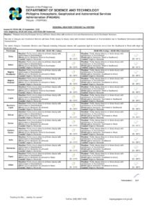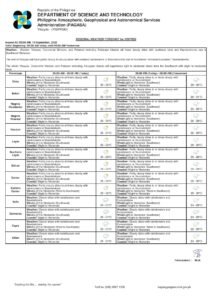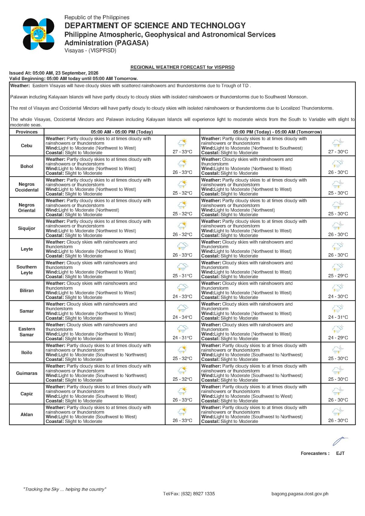
Dumaguete City, Negros Oriental — September 23, 2026 — Intermittent rain and the threat of thunderstorms will define Wednesday’s weather across Negros Oriental, according to the state weather bureau. The Philippine Atmospheric, Geophysical and Astronomical Services Administration (PAGASA) released its 5:00 AM regional bulletin warning that skies ranging from partly cloudy to overcast could produce sudden heavy downpours and lightning at any hour of the day — a forecast with direct implications for fisherfolk, ferry passengers, farmers, students, and outdoor workers throughout the province.
What PAGASA’s Morning Bulletin Says
PAGASA’s early-morning forecast for Wednesday, September 23, 2026 describes a watchful, mixed weather outlook for Negros Oriental and the broader Visayas region. The state weather agency advises that skies will shift between partly cloudy and cloudy throughout the day, with rainshowers or thunderstorms possible at virtually any time. Those brief windows of sunshine that appear in the morning — common in Dumaguete or as far north as Guihulngan — should not be taken as a sign that the day will stay dry. Conditions can deteriorate rapidly.
According to PAGASA, temperatures in Negros Oriental will range between a low of 27°C and a high of 33°C, while the wider Visayas region will see temperatures hovering between 27°C and 30°C. Winds are blowing lightly to moderately from the northwest to west, and coastal sea conditions are classified as slight to moderate.
By the Numbers
- Negros Oriental temperature range: 27°C (low) to 33°C (high)
- Visayas-wide temperature range: 27°C to 30°C
- Slight coastal wave heights: approximately 0.1 to 1.25 meters
- Moderate coastal wave heights: up to approximately 2.5 meters
- PAGASA bulletin release time: 5:00 AM, September 23, 2026
The Atmospheric Conditions Behind Today’s Forecast
PAGASA’s bulletin does not point to a single named weather disturbance — such as a tropical cyclone, the southwest monsoon (habagat), or the incoming northeast monsoon (amihan) — as the direct cause of Wednesday’s unsettled conditions. Nevertheless, the combination of northwesterly to westerly winds and the timing in late September — a transitional period between monsoon seasons — is consistent with the atmospheric instability that typically characterizes this part of the year. Simply put, the skies over the Visayas are currently primed to generate showers and thunderstorms at unpredictable intervals.
It is also worth noting that the PAGASA website listed an active tropical cyclone bulletin as of the date of this forecast. However, PAGASA’s regional Visayas forecast does not attribute Wednesday’s conditions directly to any tropical cyclone, and no tropical cyclone wind signal has been assigned to Negros Oriental. Residents are urged to monitor pagasa.dost.gov.ph regularly for any updates to cyclone advisories that could alter the weather picture for the province.
Coverage Across Negros Oriental and the Visayas
The PAGASA forecast applies to the entire Visayas region — covering Negros Oriental, Negros Occidental, Cebu, Bohol, Siquijor, Leyte, and Samar. For Negros Oriental in particular, the state weather agency’s description of partly cloudy to cloudy skies with potential rainshowers or thunderstorms applies from Guihulngan in the northern end of the province down through Bais, Dumaguete, and Bayawan in the south. The timing of showers, however, will differ from municipality to municipality throughout the day.
Siquijor Island, separated from Dumaguete by the Tañon Strait and the Bohol Sea, falls within the same Visayas forecast coverage area. According to PAGASA, Siquijor can expect comparable conditions — partly cloudy skies with scattered rainshowers or thunderstorms, light to moderate winds, and slight to moderate coastal sea states.
The temperature range of 27°C to 33°C will feel considerably warmer once humidity is factored in. During the lulls between rain episodes, the heat index — the combined effect of air temperature and moisture — can push the perceived temperature well beyond the measured figure. Anyone spending extended time outdoors is advised to stay properly hydrated.
Understanding Coastal Water Conditions
PAGASA classifies Wednesday’s coastal waters for the Visayas as slight to moderate. For those unfamiliar with these maritime ratings, the distinction carries practical consequences. Slight conditions correspond to wave heights of roughly 0.1 to 1.25 meters — relatively calm seas that most vessels can navigate without significant difficulty. Moderate conditions, by contrast, involve waves that can reach up to approximately 2.5 meters, which can be hazardous for small, open watercraft including bancas and small motorized fishing boats.
Because the forecast spans a range from slight to moderate, sea conditions may change as the day progresses — particularly during thunderstorm passages, when sudden gusts can intensify wave action along coastal stretches. PAGASA advises small boat operators and fisherfolk to treat this range seriously and to seek updated marine bulletins before venturing out.
Guidance for Different Sectors of the Community
Fisherfolk and Small-Boat Operators
Those operating bancas and small motorized vessels out of coastal barangays in Dumaguete, Bais, Bayawan, Amlan, and other shoreline communities along the Negros Oriental coast face heightened risk on Wednesday. Thunderstorms can develop quickly and with little advance warning, bringing sudden squalls and heavier swells. PAGASA advises monitoring updated marine bulletins before departing. If dark clouds begin forming or thunder becomes audible, return to shore without delay — do not wait for conditions to visibly worsen before turning back.
Ferry and Inter-Island Passengers
Travelers intending to board ferries, fast crafts, or inter-island vessels on the Dumaguete–Siquijor, Dumaguete–Cebu, or Dumaguete–Bohol routes should verify departure schedules directly with their shipping lines before heading to the port. While moderate coastal conditions do not automatically trigger cancellations, shipping operators may adjust sailing times or exercise caution during active thunderstorm episodes. Arriving at the terminal early is advisable, as afternoon thunderstorms — which are most frequent during the latter half of the day across the Visayas — could cause unexpected schedule changes.
Farmers and Agricultural Workers
Agricultural workers in Negros Oriental’s upland municipalities — including Valencia, Pamplona, Tayasan, and Manjuyod — should factor intermittent showers and the risk of lightning into their field plans for Wednesday. While rainfall can be beneficial for crops, lightning presents a direct and serious hazard to anyone working in exposed open areas. At the first rumble of thunder or flash of lightning, workers should immediately seek shelter inside a sturdy structure. Tall trees offer no safe shelter and can attract lightning strikes. Post-harvest produce or materials stored or drying outdoors should be covered or moved to shelter before midday, as afternoon shower timing is highly unpredictable.
Students, Parents, and School Administrators
Given the real possibility of thunderstorms during school hours on Wednesday, parents in Dumaguete, Guihulngan, Bais, and surrounding areas should ensure their children leave home equipped with rain gear — whether an umbrella or a raincoat. Afternoon dismissal periods tend to coincide with the peak window for thunderstorm activity across the Visayas. School administrators are encouraged to monitor local weather developments through PAGASA updates and to have contingency measures ready in the event that heavy rain or active lightning makes outdoor movement on school grounds unsafe.
Commuters and Outdoor Workers
Motorcycle riders, open-jeepney commuters, and anyone else traveling along national highways and provincial roads in Negros Oriental should have rain protection on hand throughout the day. Road surfaces become slippery almost immediately during sudden downpours, and visibility can drop sharply during thunderstorm activity. Construction workers, utility crews, and other outdoor laborers should establish a clear protocol for halting work and taking safe shelter when thunderstorm conditions approach. According to PAGASA, these episodes may occur at any point during the day — not only in the afternoon — so preparedness should begin from the morning commute onward.
Why This Matters
PAGASA’s forecast of intermittent rainshowers and thunderstorms across Negros Oriental on September 23, 2026 carries practical consequences for a wide cross-section of the province’s population — from fisherfolk navigating potentially rough coastal waters to students and workers exposed to the risk of lightning. The overlap of slight-to-moderate sea conditions with unpredictable thunderstorm timing creates a compounded risk environment for maritime and outdoor activities. Staying informed through PAGASA’s official channels and adjusting plans accordingly remains the most effective way for residents and workers to reduce weather-related harm on Wednesday.
Source: Breaking News Negros Oriental (breakingnewsnegrosoriental.com), based on PAGASA’s 5:00 AM regional forecast bulletin for September 23, 2026.