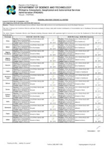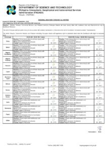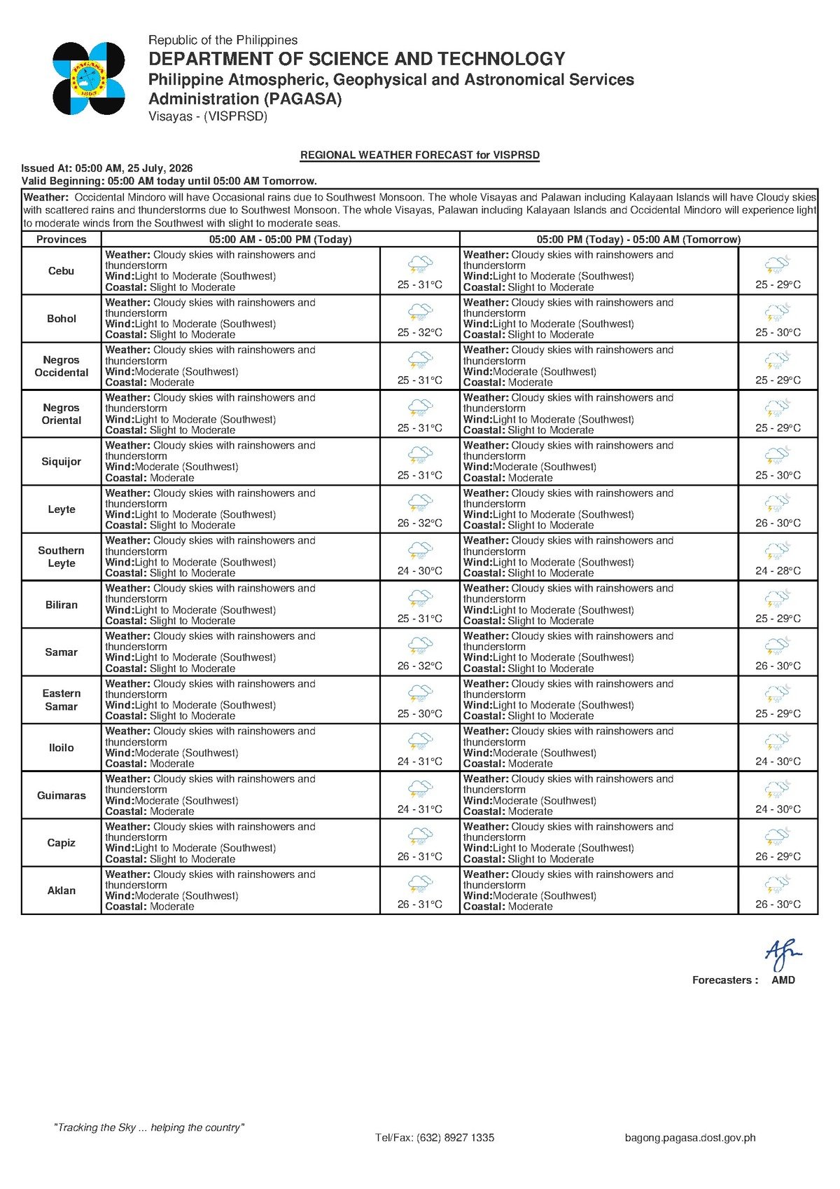
DUMAGUETE CITY — A wet and unsettled Saturday is in store for Negros Oriental and the rest of the Visayas as the southwest monsoon, locally known as habagat, continues to push moisture-laden weather systems across the region. PAGASA’s early morning regional forecast, issued at 5:00 AM, warns of cloudy skies, rainshowers, and thunderstorms throughout the day, with conditions expected to remain similarly unsettled into Sunday.
The Force Behind the Foul Weather
According to PAGASA, the dominant weather driver this weekend is the southwest monsoon — a seasonal wind pattern that funnels warm, humid air from the southwest across the Philippine archipelago during the mid-year months. Unlike a typhoon or a low-pressure area that concentrates its force in one location, the habagat spreads broadly across affected regions, producing persistently cloudy and rainy conditions that can linger for multiple days without a single defined storm center.
PAGASA explains that when the habagat is fully active, moisture builds rapidly in the atmosphere over the Visayas, causing clouds to thicken and triggering rainshowers and thunderstorms — particularly during the afternoon and evening hours when surface heating intensifies convective activity. For Negros Oriental, which lies along the eastern edge of the Visayan Sea with its western and northern coastlines exposed to prevailing southwest winds, this means weather systems are driven directly into the island before crossing inland toward Dumaguete and the mountainous interior.
Forecast Conditions for Saturday, July 25
The weather agency’s forecast for the Visayas region on Saturday, July 25, 2026 — covering Negros Oriental, Siquijor, Cebu, and surrounding island provinces — paints a consistently overcast picture throughout the day. Residents in Dumaguete City, Bais City, Bayawan, Guihulngan, and the island province of Siquijor should be prepared for intermittent rain and the possibility of thunderstorms at any point during the day, with chances climbing as the afternoon progresses.
While morning hours may bring brief breaks in the rain, PAGASA’s forecast makes clear that the overall pattern is one of instability. Thunderstorms, once they develop, can arrive quickly and bring brief but heavy downpours, sudden wind gusts, and lightning. Temperatures, though within a moderate range, will feel warmer than the figures suggest because of elevated humidity levels — residents are advised to stay hydrated and avoid prolonged sun exposure during the late morning and early afternoon, before storm activity picks up.
By the Numbers
- Forecast low temperature: 25°C
- Forecast high temperature: 31°C (Saturday); 32°C (weekend extended outlook)
- Sunday forecast low: 26°C
- Slight seas: wave heights of approximately 0.5 to 1.25 meters
- Moderate seas: wave heights of approximately 1.25 to 2.5 meters
- Extended outlook issued: 9:00 AM, July 24, 2026
Coastal Waters and Maritime Safety
PAGASA’s forecast classifies Saturday’s sea conditions along Negros Oriental’s coastlines as “slight to moderate” — a range that carries meaningful implications for maritime travel and fishing operations.
In practical terms, slight seas refer to wave heights of roughly 0.5 to 1.25 meters, conditions that most standard vessels can manage without major difficulty. Moderate seas, however, push wave heights to between 1.25 and 2.5 meters — noticeably choppy waters that make inter-island passages uncomfortable and potentially hazardous for smaller, open vessels. Because Saturday’s forecast spans this entire range, sea conditions may worsen during the afternoon as thunderstorms develop and temporarily intensify winds along coastal waters.
Ferry passengers planning to travel on routes such as the Dumaguete–Cebu crossing, the Dumaguete–Siquijor route, or the Bais inter-island passage are strongly advised to check directly with their shipping lines — including OceanJet, Montenegro Lines, and other operators serving Negros Oriental ports — for any schedule adjustments or vessel advisories before proceeding to the terminal. Conditions can shift throughout the day, and last-minute changes to departure schedules are possible.
Guidance for Fisherfolk and Small Boat Operators
For fishing communities along the coasts of Sibulan, Bacong, Zamboanguita, and coastal Bayawan, PAGASA’s slight to moderate coastal forecast translates to genuinely challenging conditions for small, open motorized bancas and fishing boats. The weather agency’s advisory effectively means that fisherfolk should exercise caution before putting out to sea and, if they do venture out, should return well ahead of the afternoon thunderstorm window. Crossing open water during an active thunderstorm presents serious risks, particularly for overloaded or underpowered small vessels. Moderate seas can deteriorate rapidly when storm squalls pass through, with little warning.
Guidance for Farmers and Agricultural Workers
In the agricultural areas of Negros Oriental — including the sugarcane corridors and vegetable-growing uplands around Valencia, La Libertad, and the barangays above Dumaguete — Saturday’s forecast presents a mixed picture. Natural rainfall from the southwest monsoon provides irrigation relief during what can be a demanding stretch for crops, but the accompanying thunderstorm risk brings the threat of strong wind gusts and localized flooding that can damage standing plants. PAGASA’s forecast advises agricultural workers to secure loose farm implements and materials, ensure adequate field drainage is in place, and avoid working in exposed open fields during lightning activity. Mature crops that could be compromised by heavy rain should be harvested before conditions worsen in the afternoon.
Guidance for Students, Commuters, and Outdoor Activities
While the weather agency has not issued a suspension-level warning specific to Negros Oriental under this forecast, the presence of thunderstorms in the outlook means conditions can deteriorate rapidly and with limited advance notice. Parents of students attending Saturday classes or activities should monitor conditions throughout the morning. Schools and organizations hosting outdoor events should have contingency plans ready to shift activities indoors if necessary.
For construction workers, outdoor vendors, and organizers of weekend events, PAGASA’s thunderstorm forecast demands careful preparation. Lightning poses a genuine hazard during convective storms. Safety protocols recommend moving indoors immediately upon hearing thunder and waiting at least 30 minutes after the final thunderclap before resuming outdoor work. Scaffolding, temporary structures, tarpaulins, and loose materials should be secured ahead of time to prevent hazards from sudden wind gusts that typically accompany thunderstorm cells.
Land travel across Negros Oriental may also be disrupted if afternoon thunderstorms trigger localized flooding on low-lying roads — particularly in northern municipalities such as Guihulngan — so commuters should factor possible delays into their travel schedules.
Weekend Outlook Through Sunday
According to PAGASA’s extended weather outlook issued at 9:00 AM on July 24, 2026, the unsettled pattern is not expected to ease significantly over the coming days. Sunday’s outlook closely mirrors Saturday’s: southwest winds, light to moderate in speed, cloud cover with rainshowers and thunderstorms, temperatures ranging from 26°C to 32°C, and the same slight to moderate coastal conditions.
Residents and travelers with weekend plans — whether a beach outing in Zamboanguita, a day trip to Siquijor, or an outdoor gathering anywhere across the province — should build flexibility into their itineraries and continue monitoring official PAGASA updates as conditions evolve through the weekend. The weather agency remains the authoritative source for any changes to the forecast.
Why This Matters
Southwest monsoon weather affecting the entire Visayas region simultaneously poses compounding risks across multiple sectors — maritime safety, agriculture, and public outdoor activity — making coordinated awareness essential. The forecast’s “slight to moderate” coastal classification directly affects the livelihoods of fishing communities and the travel plans of ferry-dependent island populations across Negros Oriental, Siquijor, and Cebu. With no meaningful improvement projected through Sunday, according to PAGASA, residents and local authorities have a narrow but important window to prepare and adjust plans before conditions potentially intensify.
Source: breakingnewsnegrosoriental.com (BNNO) / PAGASA regional forecast