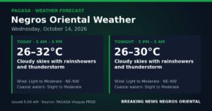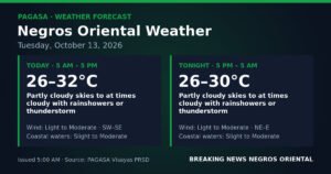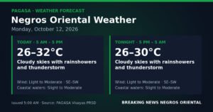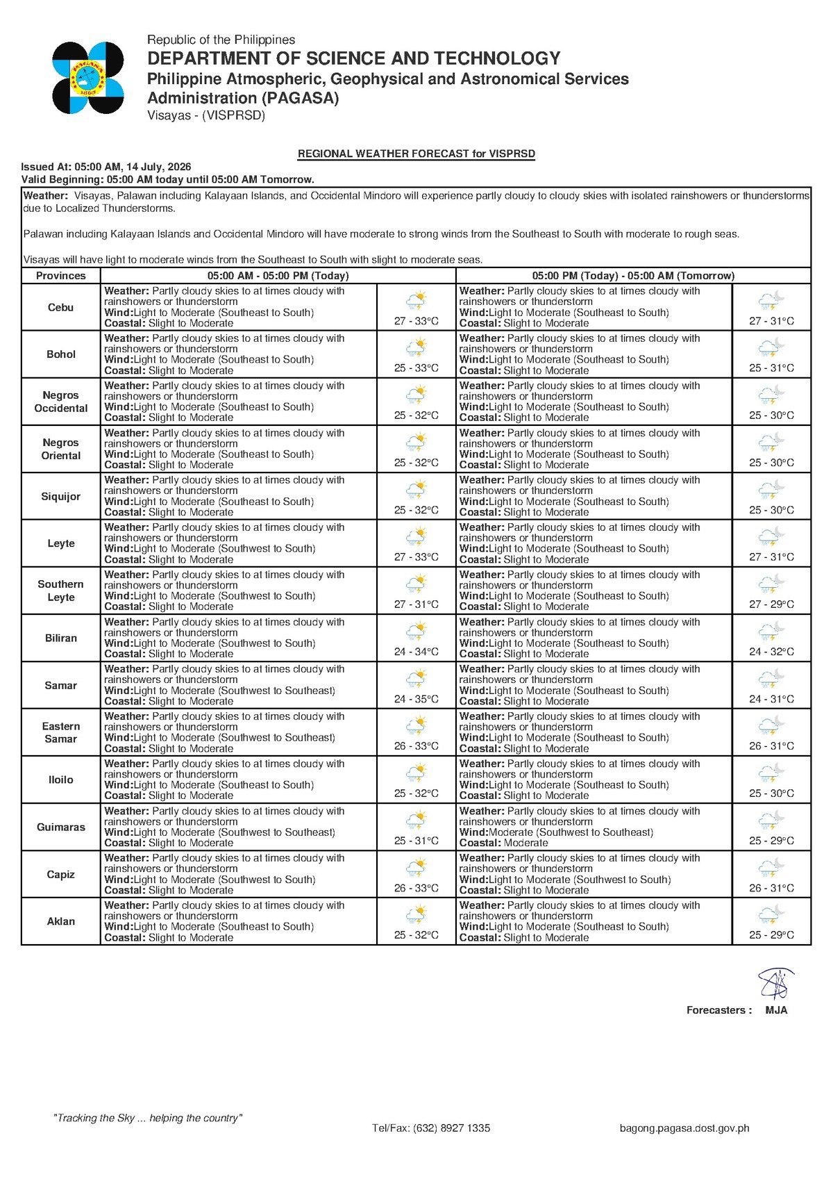
DUMAGUETE CITY, Negros Oriental — July 14, 2026 — A mix of partly cloudy to overcast skies, on-and-off rainshowers, and the threat of thunderstorms will define Tuesday’s weather across Negros Oriental and Siquijor, based on the 5:00 AM forecast bulletin released by the Philippine Atmospheric, Geophysical and Astronomical Services Administration (PAGASA). The advisory covers the broader Visayas region and calls for heightened awareness among residents, commuters, fisherfolk, and farmers throughout the day.
What PAGASA Is Forecasting
According to PAGASA’s Visayas regional weather bulletin issued at 5:00 AM on July 14, 2026, skies over Negros Oriental and Siquijor will be partly cloudy to at times cloudy, with scattered rainshowers and thunderstorms developing at various points during the day. The weather agency placed daytime temperatures between a low of 27°C and a high of 33°C, with winds blowing from the southeast to south at light to moderate velocities. Coastal waters along the province — including the Tañon Strait, the Bohol Sea, and the waters surrounding Siquijor — are classified as slight to moderate.
An earlier extended outlook published by PAGASA at 9:00 AM on July 13, 2026 projects the same general pattern carrying over into the next several days. That bulletin notes temperatures ranging from 26°C to 33°C, winds shifting slightly toward the southwest to south, and coastal conditions remaining in the slight-to-moderate range. PAGASA indicated no significant improvement is expected in the near term, meaning the current unsettled pattern is likely to persist across the Visayas.
Weather Driver: What PAGASA Says — and Does Not Say
The PAGASA forecast text for the Visayas region does not attribute Tuesday’s conditions to a specific named weather system such as the habagat (southwest monsoon), a low-pressure area, or an active tropical cyclone directly affecting Negros Oriental. Nevertheless, the agency’s data noted that the PAGASA website as of Tuesday morning carried an active Tropical Cyclone Warning for Shipping as well as a Severe Wind Impact Based Forecast — though neither bulletin was cited in the Visayas regional text as directly influencing local conditions at this time.
The southeasterly to southerly wind direction and the pattern of scattered showers described in PAGASA’s bulletin are consistent with what is typically observed across the Visayas during the middle of July. Residents are strongly encouraged by PAGASA to consult the latest tropical cyclone advisories directly at pagasa.dost.gov.ph to stay updated on any active systems that may develop or shift throughout the day.
By the Numbers
- Forecast low temperature: 27°C (Tuesday, July 14)
- Forecast high temperature: 33°C (Tuesday, July 14)
- Extended outlook low: 26°C
- Extended outlook high: 32–33°C
- PAGASA bulletin issued at: 5:00 AM, July 14, 2026
- Extended outlook issued at: 9:00 AM, July 13, 2026
Understanding “Slight to Moderate” Coastal Conditions
The slight-to-moderate coastal rating issued by PAGASA for Negros Oriental’s surrounding waters means wave heights are generally low but not entirely calm — conditions that can make travel uncomfortable or potentially hazardous for very small, low-powered watercraft. PAGASA’s bulletin notes that these conditions can deteriorate rapidly when thunderstorms develop, producing sudden wind gusts and choppy waves that pose a serious risk to small fishing bancas and similar vessels.
Small-boat operators and fisherfolk are advised by the weather agency to assess actual sea conditions at their departure point before setting out, and to keep watch on developing clouds throughout the day. If thunder is heard or dark clouds are observed building on the horizon, PAGASA recommends returning to shore immediately without waiting for conditions to worsen.
Guidance for Different Sectors
Fisherfolk and Coastal Communities
Coastal barangays in Dumaguete, Bacong, Dauin, Zamboanguita, and communities across Siquijor face a combination of moderate sea conditions and afternoon thunderstorm risk. According to PAGASA’s advisory, this combination creates a particularly hazardous environment for small vessels. Fisherfolk should coordinate with local coast guard stations and monitor PAGASA marine forecast updates before and during any sea activity. The threat of thunderstorms, which can rapidly generate strong winds and swells capable of swamping small craft, makes early departure and early return the safest approach for Tuesday’s operations.
Inter-Island Ferry Passengers
Those with plans to travel by ferry or fast craft on routes connecting Dumaguete to Cebu, Siquijor, or Dapitan — through operators such as OceanJet and similar lines — should verify departure schedules directly with their respective shipping companies before proceeding to the port. While PAGASA’s current coastal rating does not in itself indicate a suspension-level sea state, the weather agency’s bulletin flags the possibility of afternoon thunderstorms that could alter sea conditions with little notice. Shipping operators make final sailing decisions based on real-time conditions, so day-of confirmation is essential.
Road Commuters and Travelers
Motorists and commuters traveling along Negros Oriental’s road network — including routes through the mountain passes between Dumaguete and Bayawan, or northward toward Bais and Guihulngan — should exercise added caution. PAGASA’s forecast of rainshowers at any time of day means road surfaces in hilly and mountainous barangays can become slippery quickly. The weather agency’s guidance advises reduced speeds during rain and a strict avoidance of flooded road sections and swollen river crossings.
Farmers Across Negros Oriental’s Agricultural Zones
Agriculture workers — particularly those in the sugarcane-growing lowlands around Bayawan and the vegetable-producing highlands — should use any dry morning window to prioritize critical fieldwork. PAGASA’s extended forecast showing similar rainy conditions continuing beyond Tuesday suggests the current pattern is not a single-day disruption. Harvested crops and materials that must stay dry should be covered or stored early, and the coming week’s farm schedule should be planned with recurring afternoon rains in mind.
Students, Parents, and School Administrators
The PAGASA bulletin does not indicate any weather-related school suspension signal currently issued for Negros Oriental for Tuesday, July 14. However, parents are advised to equip children with rain gear given the likelihood of afternoon downpours. School officials and local government units, the forecast notes, retain the authority to issue suspension orders based on actual local conditions — so monitoring official announcements throughout the day remains important.
Outdoor Workers and Event Organizers
Workers in construction, market vending, and other outdoor occupations in Dumaguete, Canlaon, Santa Catalina, and throughout Negros Oriental should build weather contingencies into Tuesday’s schedule. PAGASA’s forecast makes clear that afternoon rainshowers are probable, and anyone organizing outdoor community events or sports activities is advised to have alternative shelter or a postponement plan ready. The weather agency’s guidance is consistent and direct: seek sturdy shelter at the first sign of lightning, and do not delay action while waiting for the storm to arrive overhead.
Looking Ahead: The Coming Days
The extended weather outlook issued by PAGASA at 9:00 AM on July 13, 2026 does not project any significant break in the pattern. Temperatures are expected to remain within the 26°C to 33°C range, winds will continue at light to moderate levels from the southwest to south, and coastal conditions will stay slight to moderate. The agency’s data makes clear that this is a multi-day weather pattern — not a one-time weather event — and that residents and businesses across Negros Oriental should plan their activities for the week with this in mind. Continuous monitoring of PAGASA’s official channels is the best way to stay informed as conditions evolve.
Why This Matters
The combination of on-and-off thunderstorms and moderate coastal conditions forecast by PAGASA for July 14, 2026 presents real risks across multiple sectors in Negros Oriental — particularly for fisherfolk operating small vessels, inter-island ferry passengers, and farmers managing time-sensitive field and harvest work. PAGASA’s simultaneous listing of an active Tropical Cyclone Warning for Shipping and a Severe Wind Impact Based Forecast on its website, even without a direct cyclone reference in the regional bulletin, underscores the importance of monitoring updated advisories throughout the day. With the extended outlook showing this unsettled weather persisting over several days, residents and local businesses face a sustained period of weather-related disruption rather than a brief, isolated event.
Source: breakingnewsnegrosoriental.com / PAGASA