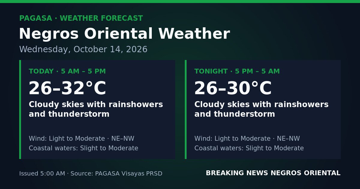
DUMAGUETE CITY, Negros Oriental — There will be no break in the clouds over Negros Oriental on Wednesday, October 14, 2026. The Philippine Atmospheric, Geophysical and Astronomical Services Administration (PAGASA) issued its 5:00 AM regional weather forecast warning of cloudy skies, rainshowers, and thunderstorms blanketing the province for the full 24-hour period — from early morning straight through to the overnight hours of October 15.
The unsettled conditions are expected to affect the length of the province, from Dumaguete in the south up to Guihulngan in the north, as well as the nearby island of Siquijor across the strait.
What Is Behind Today’s Weather
According to PAGASA’s forecast data, no specific weather system has been named as the driver of today’s conditions over Negros Oriental. What the bulletin makes clear is that cloud cover, rain, and thunderstorms are expected to remain continuous and sustained throughout the day and night — not intermittent isolated showers, but a full, uninterrupted wet-weather event with embedded thunderstorm activity that can intensify rapidly and without much advance warning.
October 14 Forecast Breakdown
Daytime Hours: 5:00 AM – 5:00 PM
PAGASA forecasts cloudy skies with rainshowers and thunderstorms across the province during daylight hours. Temperatures are expected to range between 26°C and 32°C. Winds will come from the northeast to northwest at light to moderate intensity. Coastal waters along Negros Oriental’s shores are described as slight to moderate.
Overnight: 5:00 PM – 5:00 AM (Thursday, October 15)
The wet pattern carries through after sunset. PAGASA’s overnight forecast again calls for cloudy skies with rainshowers and thunderstorms. Temperatures dip slightly to a range of 26°C to 30°C. Wind direction and intensity remain unchanged — light to moderate, northeast to northwest. Coastal sea state holds at slight to moderate.
By the Numbers
- Daytime temperature range: 26°C to 32°C
- Overnight temperature range: 26°C to 30°C
- Slight seas wave height: approximately 0.5 to 1.25 metres
- Moderate seas wave height: approximately 1.25 to 2.5 metres
- Forecast duration: full 24 hours (5:00 AM October 14 to 5:00 AM October 15)
Coastal Water Conditions Explained
PAGASA classifies today’s coastal waters for Negros Oriental as “slight to moderate.” Slight seas carry wave heights of roughly 0.5 to 1.25 metres — manageable for larger vessels but already uncomfortable and potentially hazardous for small fishing boats and bancas. Moderate seas bring wave heights of approximately 1.25 to 2.5 metres, making small-craft operations increasingly dangerous and causing significant rolling and pitching even for medium-sized vessels.
The state weather bureau’s data indicates these conditions can shift toward the more dangerous end of the range during thunderstorm bursts, when winds pick up suddenly with little notice.
Guidance by Sector
Fisherfolk and Small-Boat Operators
Fishing communities along the coasts of Bayawan, Bais, Tanjay, and the coastal barangays of Dumaguete should treat today as a high-caution day at sea. PAGASA’s bulletin makes clear that coastal waters are not calm, and embedded thunderstorms can generate sudden squalls that rapidly worsen conditions beyond the baseline forecast. Small bancas and fishing vessels are particularly exposed during these squall events. Fisherfolk are advised to carefully assess sea conditions before departure, postpone offshore trips where possible, and immediately seek shelter if a thunderstorm develops while at sea.
Ferry and Inter-Island Passengers
Travelers on the Dumaguete–Siquijor route and on connections toward Cebu should prepare for possible schedule adjustments by ferry operators such as OceanJet and similar services. While the PAGASA forecast does not automatically trigger route cancellations, slight to moderate seas combined with active thunderstorms are conditions under which operators may adjust departure windows. Passengers are advised to confirm schedules directly with their ferry line before proceeding to the terminal, carry waterproof protection for documents and electronics, and have a backup plan in case of delays.
Farmers and Agricultural Workers
For farmers working rice paddies, sugarcane fields, and vegetable plots across Negros Oriental’s upland barangays, sustained rain will make field operations difficult to impossible during heavy bursts. Workers using electrical or metal equipment outdoors must stop activity and move to covered shelter whenever active lightning is present. Those in low-lying or flood-prone areas in interior municipalities are advised to watch drainage conditions closely throughout the day, as continuous heavy rain raises the risk of surface runoff and soil saturation, particularly on slopes.
Commuters and Students
All-day rain means flooded roads and reduced visibility are real possibilities in Dumaguete City and across the province’s municipalities. Commuters should carry rain gear and allow extra travel time. Parents of students in Guihulngan, Bais, Bayawan, and other areas should monitor local government and school announcements throughout the day. PAGASA’s forecast alone does not trigger class suspensions — that authority rests with local government officials — but sustained thunderstorm activity during school hours can prompt local action.
Outdoor Workers and Event Organizers
Construction crews, utility workers, and organizers of outdoor events anywhere in Negros Oriental should operate on the assumption that no clear weather window will open today. According to PAGASA, lightning risk is present throughout both the daytime and overnight periods. Outdoor gatherings — market days, fiestas, sports competitions — should have covered contingency areas in place, and organizers must be ready to halt activities at the first sign of intensifying thunderstorms.
Siquijor
Residents and tourists on Siquijor can expect conditions similar to those forecast for the Negros Oriental mainland, given the island’s proximity and shared coastal exposure. The strait between Siquijor and Negros Oriental will experience the same slight to moderate sea state, and thunderstorm activity may develop over or near the island at any point during the day. Visitors planning beach or water activities are strongly advised to monitor conditions hourly and avoid coastal activities whenever thunderstorms are in the vicinity.
Why This Matters
PAGASA’s forecast identifies commuters, fisherfolk, farmers, students, and outdoor workers as groups directly affected by the all-day rain and thunderstorm event. The bureau’s data indicates there is no forecast window of clear skies across the entire 24-hour period, meaning disruptions to livelihoods, travel, and outdoor activity are expected to persist without interruption through the night of October 15.
Source: breakingnewsnegrosoriental.com / PAGASA 5:00 AM Regional Forecast, October 14, 2026